

On the evening of February 1st, Typhoon Kajiki entered the East Sea.
At 1 PM on February 1st, the center of Typhoon Kajiki was located in the northern Sulu Sea (Philippines). The strongest winds near the center of the typhoon were at level 8 (62 to 74 km per hour), with gusts reaching levels 9 and 10.
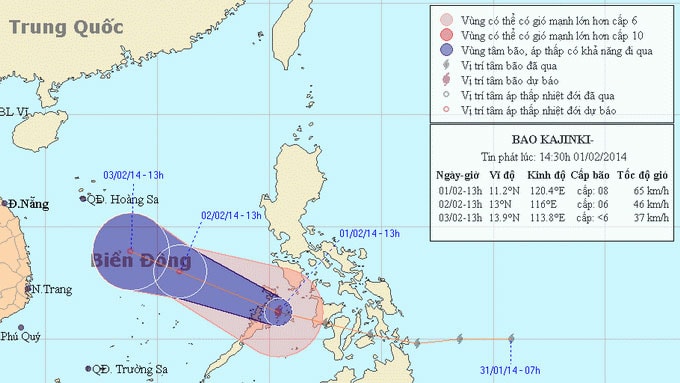 |
| Location and path of Typhoon Kajiki - Photo: National Center for Hydro-Meteorological Forecasting |
The forecast for the next 24 hours indicates the storm will move mainly in a west-northwest direction, traveling at approximately 20-25 km per hour. Therefore, by late this evening, the storm's center will enter the southeastern part of the South China Sea, then gradually weaken into a tropical depression.
Due to the influence of the storm, which has weakened into a tropical depression, the eastern part of the central South China Sea (including the northeastern sea area of the Spratly Islands) will experience strong winds of force 6 and 7, with winds near the storm's center reaching force 8, gusting to force 9 and 10. The sea will be rough.
Central Meteorological and Hydrological Forecasting Center