Weather June 10: Warning of tornadoes, hail and strong winds in thunderstorms
(Baonghean.vn) - According to forecasts, from today (June 10) to the night of June 11, due to the influence of low pressure causing showers and thunderstorms, the heat wave will end in the North and gradually decrease in the Central region.
Currently (June 10):The low pressure trough with its axis at about 21-23 degrees North latitude is being compressed by continental high pressure from the North combined with the wind convergence zone above 1,500 meters causing widespread showers and thunderstorms in the Northwest region.
Forecast:Due to the influence of the low pressure trough with its axis at about 21-23 degrees North latitude, which continues to be compressed by the continental high pressure from the North combined with the wind convergence zone above 1500 meters, from now (June 10) to the night of June 11, there will be showers and thunderstorms in the North and North Central regions. In particular, the mountainous provinces in the North will have moderate rain, heavy rain, and in some places very heavy rain and scattered thunderstorms. During the thunderstorms, there is a high possibility of tornadoes, hail and strong gusts of wind.Disaster risk level: level 1.
Due to the influence of low pressure causing showers and thunderstorms, the heat wave ends in the North and gradually decreases in the Central region.
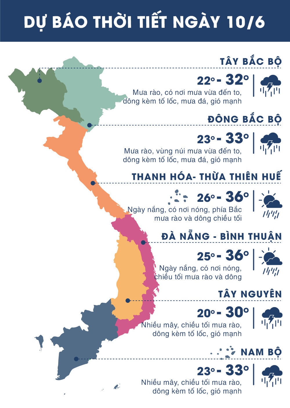 |
| Temperature on June 10, 2018 in regions across the country. Source: zing.vn |
WARNING FOR STRONG WINDS AND HIGH WAVES IN THE SOUTHERN COAST:
Due to the influence of the southern edge of the low pressure trough with an axis at about 21-23 degrees North latitude with a southwest wind zone of medium intensity, there will be showers and thunderstorms in the Central and Southern East Sea (including the Truong Sa archipelago), the Binh Thuan-Ca Mau sea area, the Ca Mau-Kien Giang sea area and the Gulf of Thailand.
Currently (June 10):The low pressure trough has a little changed position with the activity of the southwest wind zone of medium intensity.
Forecast:Due to the influence of the southwest monsoon with medium intensity, the Central and Southern East Sea area (including the Truong Sa archipelago) has strong southwest winds of level 5, waves 2-4m high. Rough sea. The Binh Thuan-Ca Mau sea area has strong southwest winds of level 5, sometimes level 6, gusts of level 8-9, waves 1.5-2.5m high. Rough sea.
The Central and Southern East Sea, the waters from Binh Thuan - Ca Mau, Ca Mau - Kien Giang and the Gulf of Thailand continue to have showers and strong thunderstorms. During thunderstorms, there is a possibility of tornadoes and strong gusts of wind.Disaster risk level: level 1./.