Super typhoon Yutu enters the East Sea, about 650km from the Paracel Islands
(Baonghean.vn) - According to the National Center for Hydro-Meteorological Forecasting, the dangerous area in the East Sea in the next 24 hours (strong wind level 6 or higher): North of latitude 14.0 degrees North; East of longitude 114.0 degrees East.
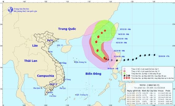
4:00 a.m. October 31, the storm center is located at about 17.2 degrees North latitude; 118.6 degrees East longitude, about 650km east of Hoang Sa archipelago.
The strongest wind near the storm center is level 11 (100-115km/h).level 13. The range of strong winds of level 6, gusting to level 8 or higher is about 260km from the center of the storm; The range of strong winds of level 10 or higher is about 70km from the center of the storm.
 |
| Location and path of the storm. Photo: National Center for Hydro-Meteorological Forecasting |
Forecast for the next 24 hours,The storm is moving northwest at a speed of 10-15km per hour. At 4:00 a.m. on November 1, the center of the storm was at approximately 18.9 degrees North latitude; 117.0 degrees East longitude, approximately 510km East Northeast of the Paracel Islands.
The strongest wind near the storm center is level 11 (100-115km/h).level 13. The range of strong winds of level 6, gusting to level 8 or higher is about 260km from the center of the storm; The range of strong winds of level 10 or higher is about 70km from the center of the storm.
Due to the influence of the storm, in the Northeast sea of the East Sea there will be stormy rain, strong winds of level 9-10, the area near the storm's eye will have level 11.level 13; rough seas.
Dangerous areas in the East Sea in the next 24 hours (strong wind level 6 or higher): North of latitude 14.0 degrees North; East of longitude 114.0 degrees East.
Over the next 24 to 48 hours,The storm is moving in a northwesterly direction, traveling 10-15km per hour. At 4:00 a.m. on November 2, the center of the storm was at about 20.9 degrees North latitude; 116.7 degrees East longitude, about 620km northeast of the Hoang Sa archipelago. The strongest wind near the center of the storm is level 10 (90-100km/hour).jerky12.
Over the next 48 to 72 hours,The storm is moving in a North-Northeast direction, traveling about 10km per hour. At 4:00 a.m. on November 3, the center of the storm was at about 22.1 degrees North latitude; 117.2 degrees East longitude, about 330km southwest of Taiwan. The strongest wind near the center of the storm is level 8 (60-75km/hour).level 10.Disaster risk levelliveNortheast East Sea area: Level 3.
BesidesDue to the influence of the cold air, in the Gulf of Tonkin there is strong northeast wind level 6, gusting to level 8; rough sea.
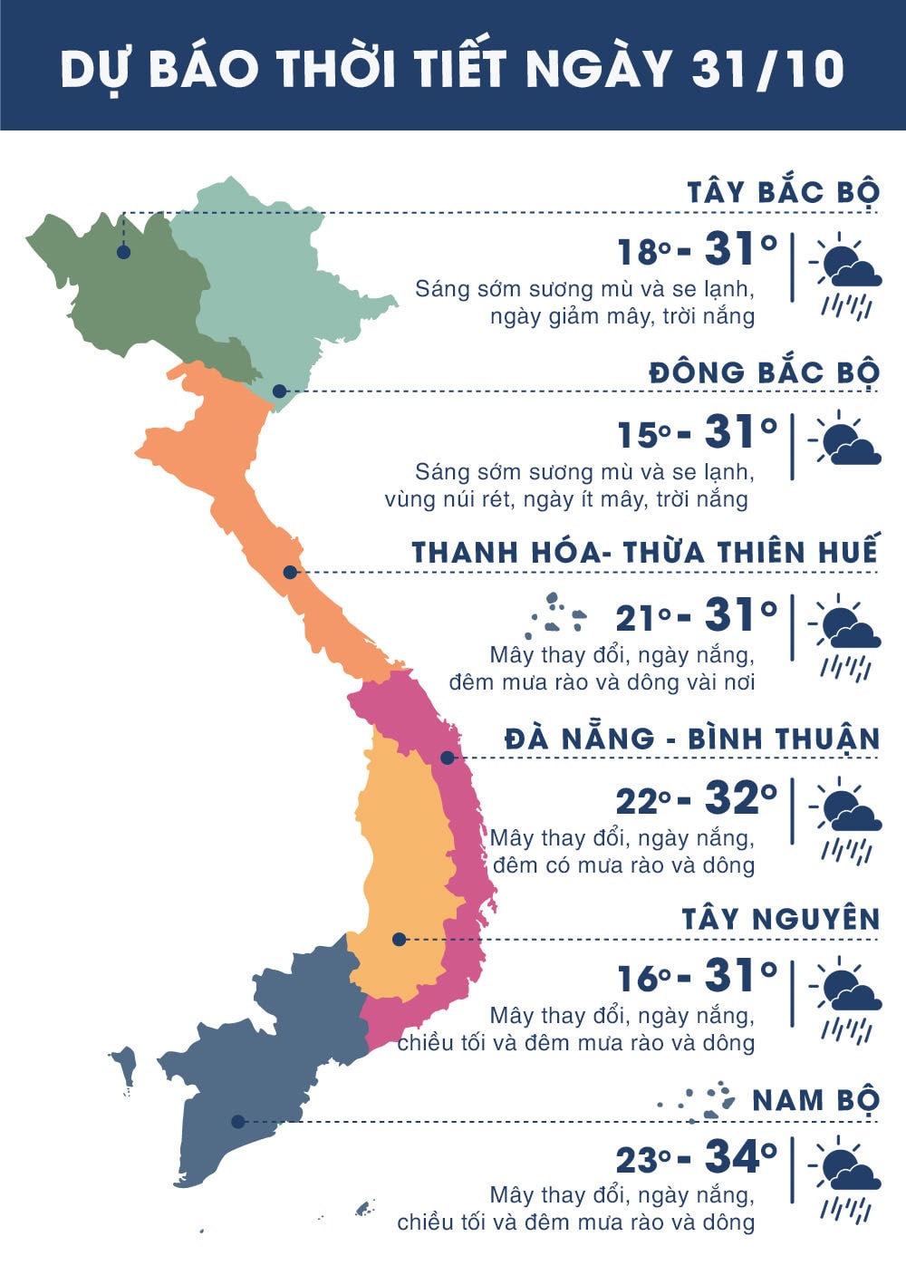 |
| Temperature on October 31 in regions across the country. Photo: news.zing.vn |