Yen Thanh 'rice district' will have 6 urban areas
(Baonghean) - According to the plan, Yen Thanh will have 6 urban areas, including 1 central urban area - type IV, 5 satellite urban areas - type V. This is an important orientation for the "rice homeland" to develop in the direction of sustainable urban - rural areas.
The new Yen Thanh district planning was approved by the People's Committee of Nghe An province at the regular meeting in September 2019, aiming to adjust and supplement the master plan for socio-economic development of Yen Thanh district until 2020 (approved by the Provincial People's Committee in Decision No. 1496/QD-UBND dated April 17, 2017).
The planning scope is the entire area within the administrative boundary of Yen Thanh district, Nghe An province.
According to the plan, by 2035, Yen Thanh district will have 6 urban areas, including 1 central urban area - type IV (upgrading Yen Thanh town to type IV urban area), 5 satellite urban areas - type V. The urbanization rate will reach 21.2%.
Specifically:Central urban development on the basis of upgrading Yen Thanh town. Function as an urban center of administration, services, industry, technology transfer of the district; Urban population size in 2025 is about 11,000 people, in 2015 is about 20,000 people.
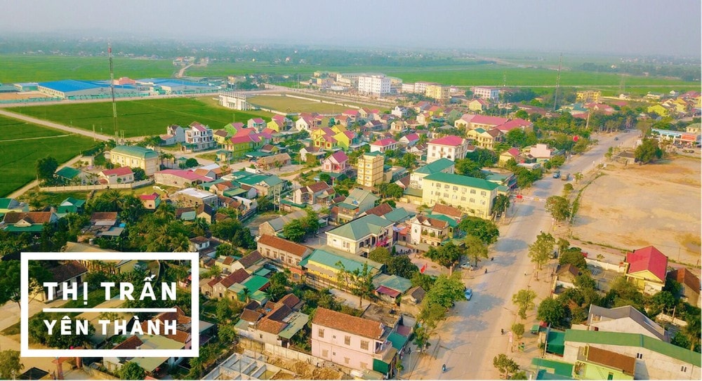 |
| A corner of Yen Thanh town. Photo: Document |
Van Tu New Urban AreaDeveloped on the basis of Cong Thanh commune center, part of Khanh Thanh and Lien Thanh communes. Function is a mixed urban area developing services, industry, agriculture, the southern sub-regional center of the district; Urban population size in 2025 is about 12,000 people; area 300 hectares.
Do Thanh New Urban AreaDeveloped on the basis of Do Thanh commune center, with the function of a commercial and service urban area, the center of the eastern economic sub-region of Yen Thanh district; Urban population size in 2025 is about 13,000 people, urban land size in 2025 is about 370 hectares.
Tan Thanh New Urban AreaDeveloped on the basis of Tan Thanh commune center, the function is a mixed-use urban development, processing forestry products, agricultural products, small-scale industry and developing eco-tourism. The urban population in 2035 is about 7,000 people, the urban land area in 2035 is about 210 hectares.
Lang Thanh New Urban AreaDeveloped on the basis of Lang Thanh commune center: Function is a mixed-use urban development, processing forestry products, agricultural products, small-scale industry and developing eco-tourism; Urban population size in 2035 is about 8,000 people.
Tay Thanh New Urban AreaDeveloped on the basis of Tay Thanh commune center (current population of about 2,100 people); Function is a mixed-use urban development, processing forestry products, agricultural products, small-scale industry and developing eco-tourism; Urban population size in 2035 is about 5,000 people; Urban land size in 2035 is about 150 hectares.
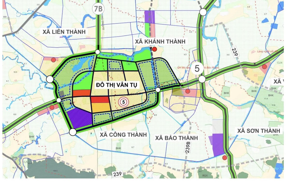 |
| Urban planning of Van Tu (Yen Thanh). Photo: Tran Chau |
Region 1:The central area includes the communes: Hoa Thanh, Hop Thanh, Van Thanh, Tang Thanh, Xuan Thanh, Nhan Thanh and Yen Thanh town. The total area is: 5,067 hectares, equal to 9.25% of the total natural area of the district. Function: Concentrated construction of urban, administrative, service, industrial, and technology transfer areas of the district.
Region 2:Southern zoning plan, including the entire administrative boundaries of the communes: Lien Thanh, Khanh Thanh, Cong Thanh, My Thanh, Bao Thanh, Son Thanh, Vien Thanh, Vinh Thanh, Long Thanh, Trung Thanh and Nam Thanh.
Total area is: 12,165 hectares, equal to 22.21% of the total natural area of the district. The function is a mixed development space for urban, industrial - handicraft, agriculture, service development, and agricultural commodity development. The center is Van Tu urban area with the function of a mixed urban area developing services, industry, and agriculture.
Region 3:Northern zoning plan, including Tan Thanh urban area, Lang Thanh urban area and the entire administrative boundaries of the communes: Tan Thanh, Ma Thanh, Tien Thanh, Lang Thanh, Hung Thanh, Phuc Thanh, Hau Thanh and Duc Thanh.
This is a mixed urban area, mainly developing high-quality agricultural and forestry production spaces, in the form of farm-garden economy. Developing agricultural and forestry processing industry, growing industrial crops, fruit trees, medicinal herbs, and developing livestock...
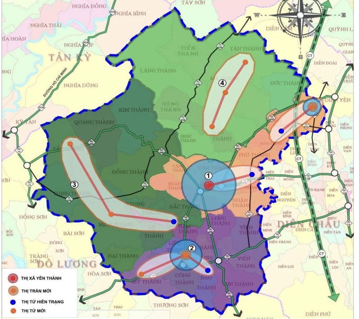 |
| Planning of Yen Thanh areas. Photo: Tran Chau |
Region 5:West and Northwest - Agricultural and forestry economy, eco-tourism, including the entire administrative boundaries of the communes: Kim Thanh, Quang Thanh, Tay Thanh, Dong Thanh, Thinh Thanh, Minh Thanh, Ly Thanh, Bac Thanh and Dai Thanh. Total area is: 17,615 hectares, equivalent to 32.16% of the total natural area of the district. This area has the function of protecting national forests, natural forests, special-use forests, planting protective forests, production forests; Mainly developing tourism service spaces, landscape spaces, natural ecology and revolutionary historical relic conservation areas.
The Provincial People's Committee's approval of the planning is very meaningful in the current period, the planning will be the foundation for Yen Thanh in socio-economic development starting from 2019. The planning also builds the Yen Thanh district area to promote the position and comprehensive strength of the district in socio-economic development associated with sustainable orientations, effectively exploiting internal and external relations. In particular, focusing on the strengths of agriculture, high-tech agriculture, clean agriculture and types of industry and services for the agricultural sector. Yen Thanh will be planned as a key agricultural district of Nghe An province, ensuring food security of the province, a district with advantages in developing eco-tourism services associated with the Ve Vung lake area, cultural and historical tourism, with a position to develop a sustainable urban-rural model associated with ecological urban orientations, smart cities, and eco-villages.