Map of Covid-19 epidemic areas in Nghe An
(Baonghean.vn) - Through the map, authorities, local governments and people can assess the risk of epidemics in the area and have appropriate epidemic prevention and control solutions.
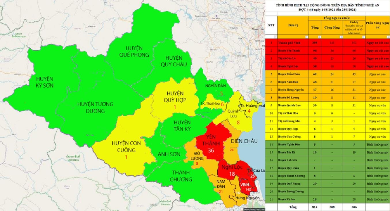
Nghe An Department of Health has just built a Map to identify Covid-19 epidemic areas. Accordingly, the epidemic situation inNghe Anis still in a very complicated stage. There are some very high risk areas in the area, first of allVinh city, second is Yen Thanh district, followed by Nghi Loc district, Cua Lo town,...
 |
| Map identifying Covid-19 epidemic areas in Nghe An province. Photo: Thanh Chung |
The epidemic area assessment map has information such as total infections from August 14, 2021 to August 28, 2021), the number of cases in the community, the number of cases detected from quarantine areas; can help authorities, local authorities and people assess the risk of the epidemic in the area and have appropriate epidemic prevention and control solutions.
According to the map,very high risk areasincluding: Vinh City; Yen Thanh District; Cua Lo Town and Nghi Loc District.
High-risk areasincluding: Dien Chau district; Nam Dan district; Hung Nguyen district and Do Luong district.
Medium risk areasincluding: Quynh Luu district; Thai Hoa town; Hoang Mai town; Quy Hop district and Con Cuong district.
New normal areaincluding: Nghia Dan district; Tan Ky district; Anh Son district; Quy Chau district; Thanh Chuong district; Que Phong district; Tuong Duong district and Ky Son district.