Searching for the source of the flood in Ky Son
(Baonghean.vn) - Going upstream of Huoi Loong stream, which is considered the source of the historic flood on the night of October 1 and early morning of October 2, sweeping through Ta Ca commune and Muong Xen town of Ky Son district, one can see a scene of devastation and erosion caused by landslides...
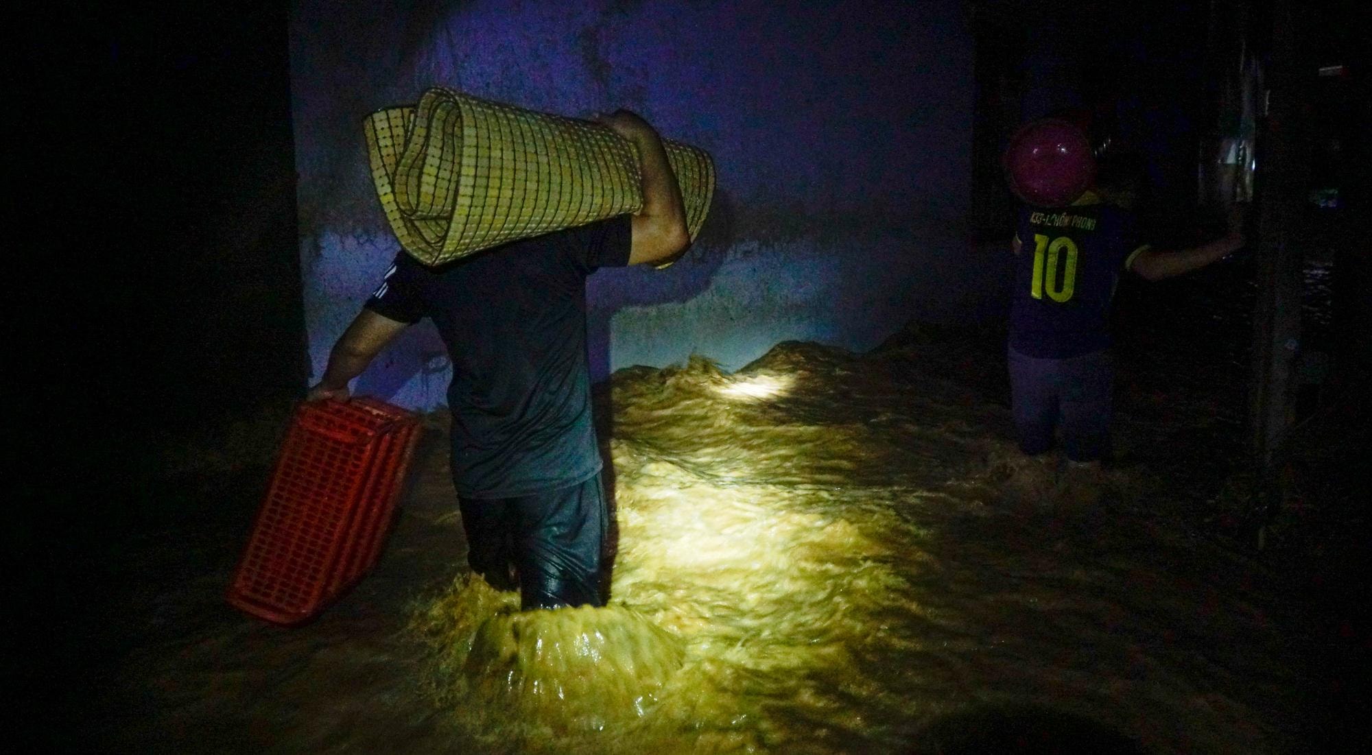 |
On the night of October 1 and early morning of October 2, a historic flash flood occurred in Ta Ca commune, Ky Son district. Floodwaters from upstream poured in, sweeping through Son Ha, Hoa Son, Binh Son 1, Binh Son 2 villages of Ta Ca commune and block 1, Muong Xen town, causing serious damage. Photo: Thanh Cuong |
 |
The flood came so suddenly that many people could only run away in time. Their houses, all their belongings and livestock were swept away by the floodwaters, leaving many families penniless. Photo: Thanh Cuong |
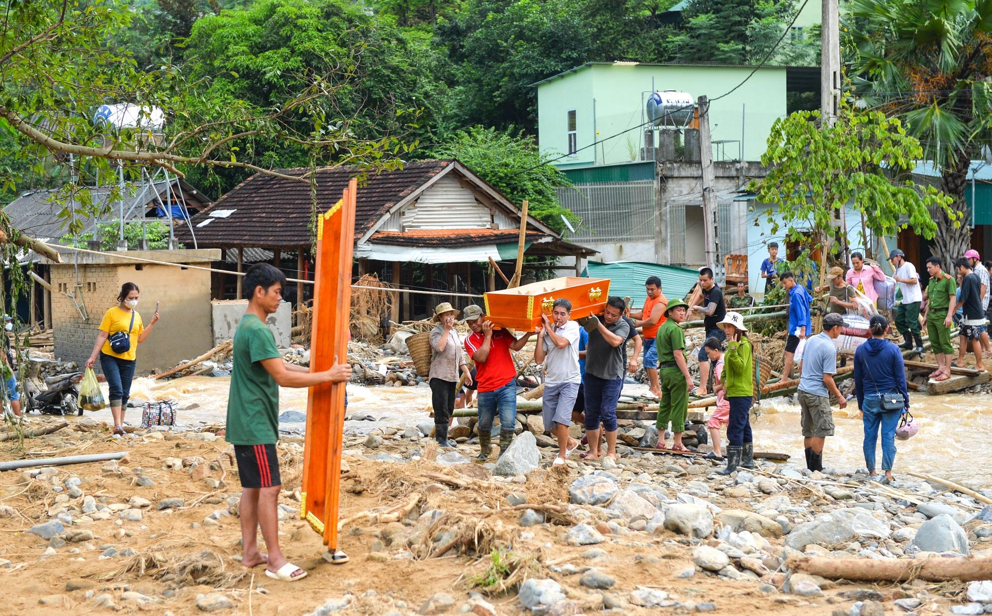 |
The flash flood killed a 4-month-old baby and damaged 233 houses of Ky Son residents and offices of many government agencies; 36 households had to be urgently evacuated. Hundreds of cars, motorbikes, bicycles and people's property and belongings were also swept away by the raging flood. Photo: Thanh Cuong |
 |
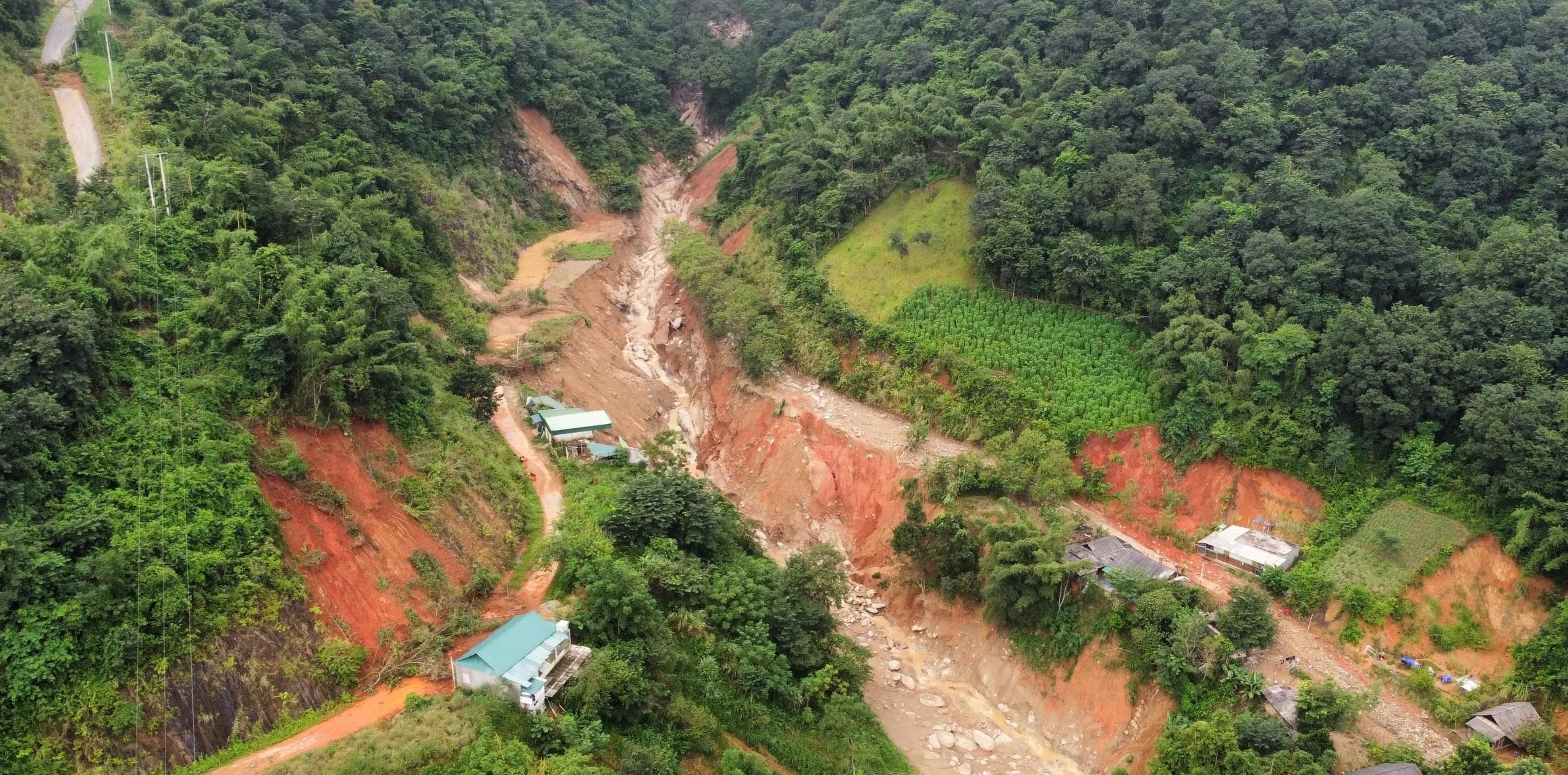
Many people believe that the origin of the flash flood started from the Huoi Loong stream. This stream flows from the top of Pu Lon, through Son Ha village, joins the Huoi Giang stream to the Nam Mo river. Previously, it was a dry stream. Photo: Thanh Cuong |
 |
| After many days of heavy rain, Huoi Loong stream became a raging stream, water pouring down in torrents, sweeping away everything that blocked the flow. Photo: Thanh Cuong |
 |
Floodwaters from Pu Lon peak, following the Huoi Loong stream, carried rocks and soil, cut through the Muong Xen - Tay Son road, and poured down to Son Ha village, causing serious damage to the road, even making it impossible for motorbikes to pass through in many places. Villages in Tay Son commune were cut off and isolated from the outside world. Photo: Thanh Cuong |
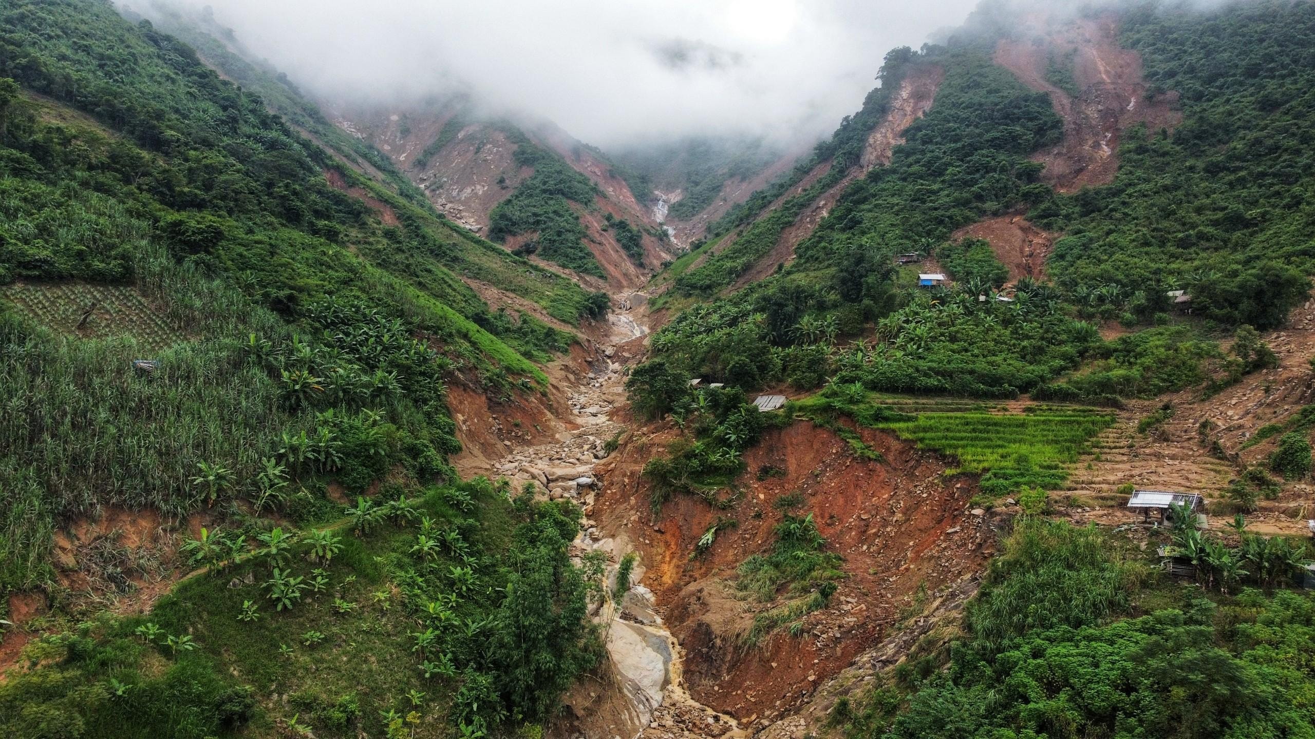 |
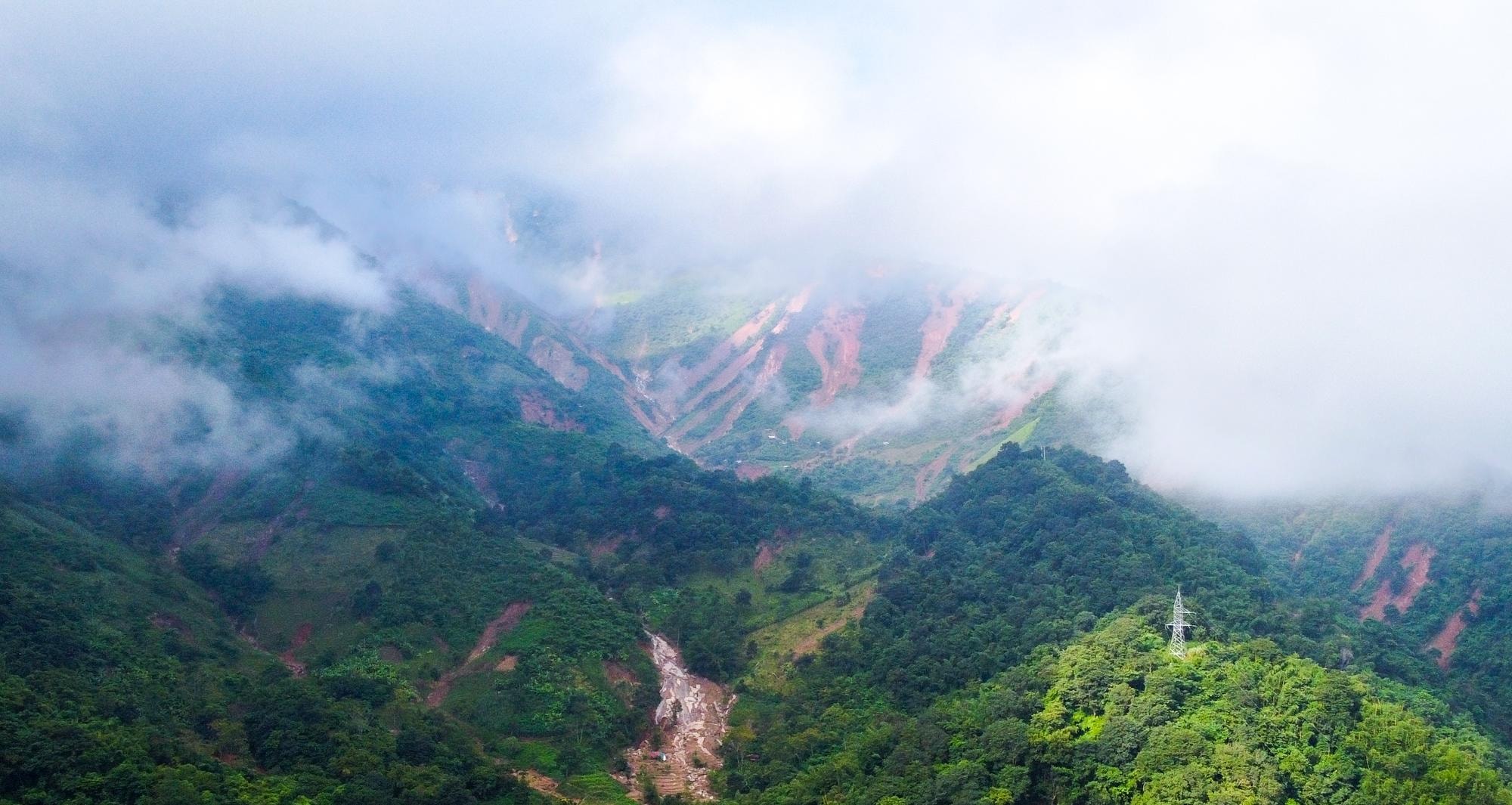
The upstream area of Huoi Loong is the production land of the people of Son Ha, Binh Son 1, Binh Son 2 villages and some households of Tay Son commune. Now, this area is jagged with large areas of landslides, bare, discolored, and bare soil and rocks because there are not many trees to cover it. Photo: Thanh Cuong |
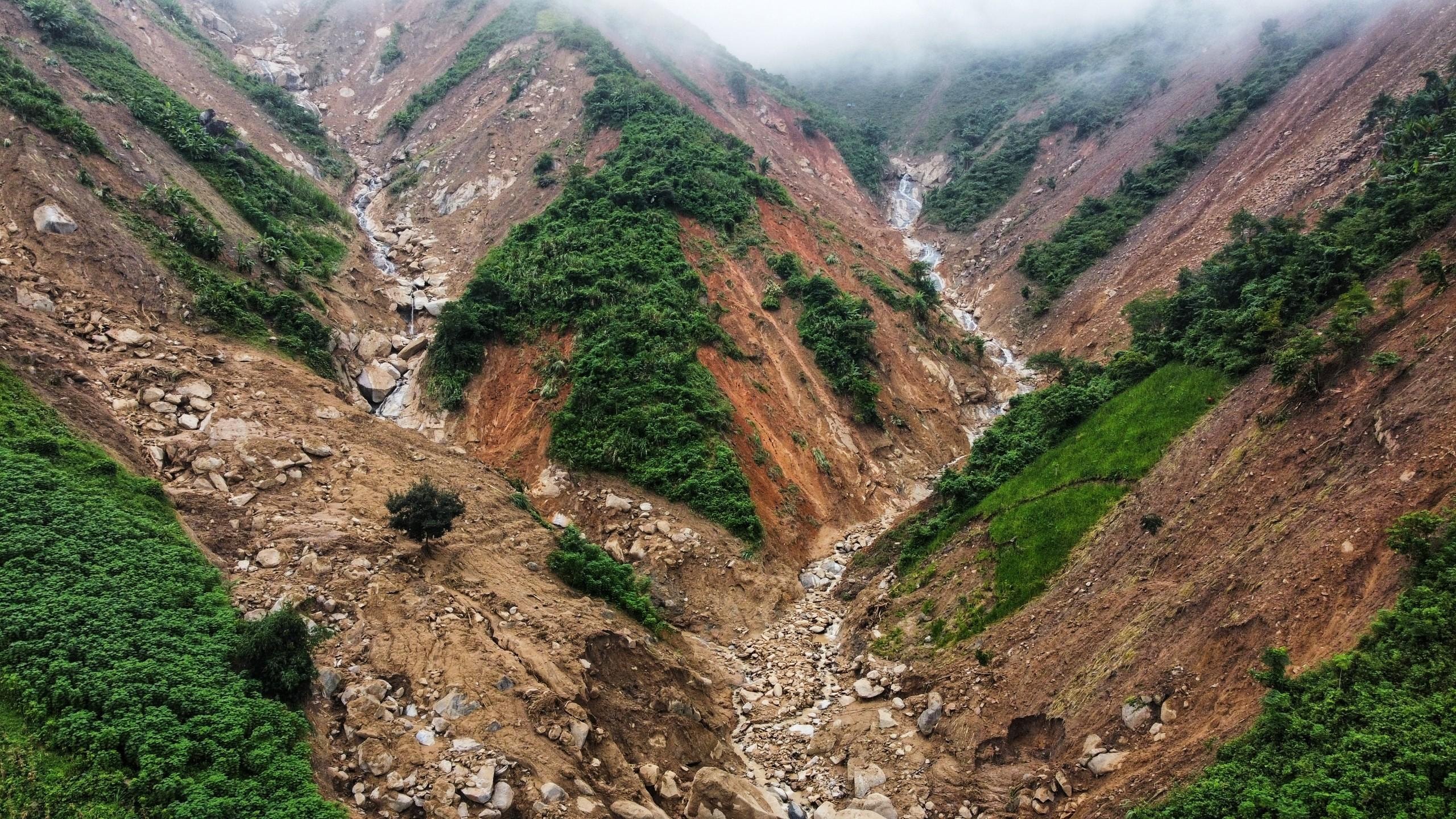 |
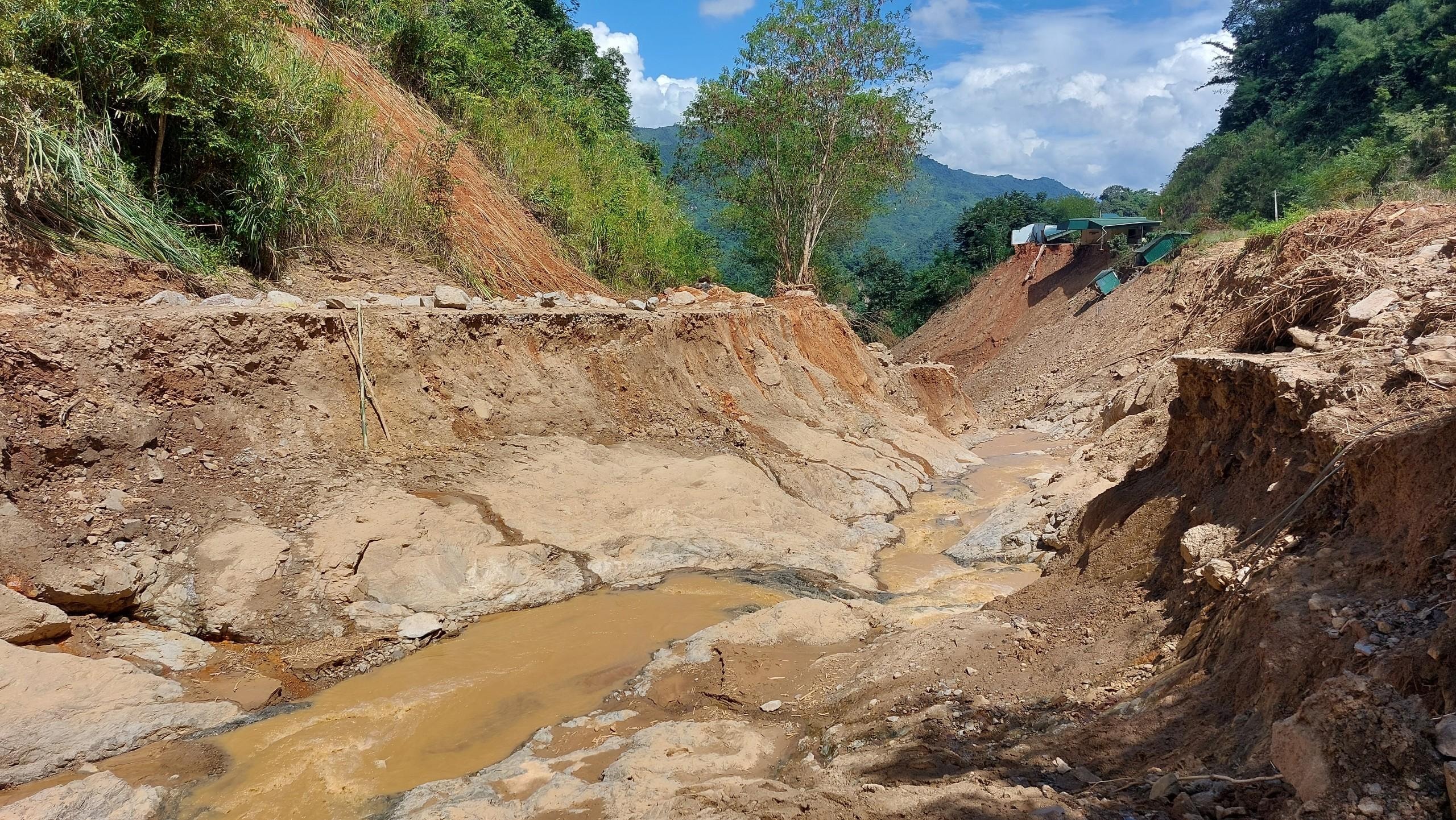
| When heavy rains continue, the cliffs along the streams here collapse, forming dams. The amount of water from upstream that accumulates in these dams will cause a series of dam breaks. All the rocks and soil are swept away by the water, pouring into the villages downstream, creating a flash flood that occurred in Ta Ca commune on October 2. Photo: Thanh Cuong |
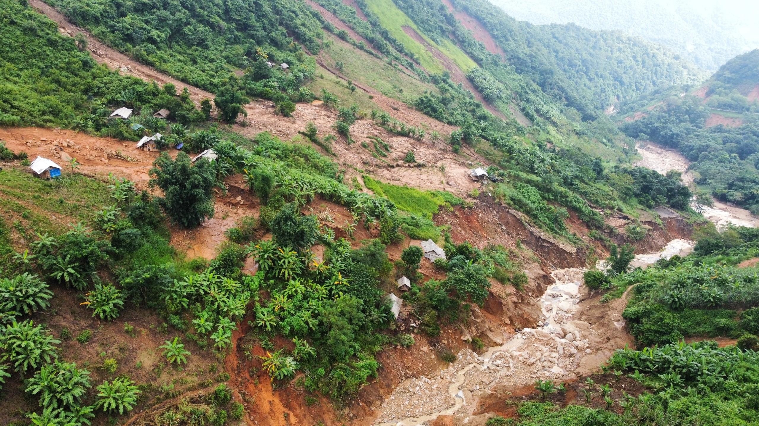 |
| Trees, crops, and barns were submerged and pulled down into the water by rocks and soil. Photo: Thanh Cuong |
 |
What remains of a camp set up by locals to look after crops in the production area. Photo: Thanh Cuong |
 |
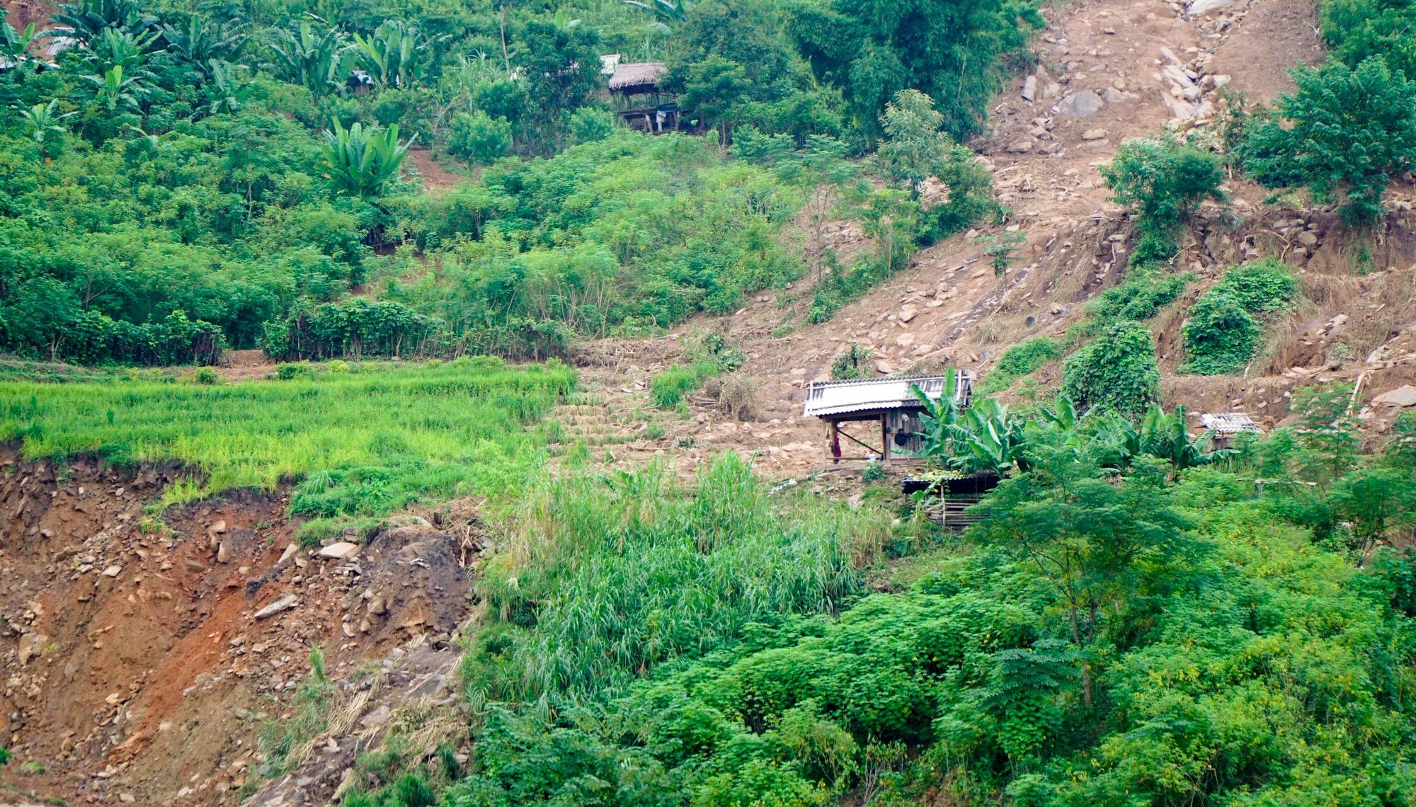
The Huoi Loong upstream area has long been a place for local people to cultivate and make fields. The process of cultivating fields according to custom and many other reasons has caused the upstream forest to be gradually cut down, or replaced by production forests and fields. Therefore, the protective capacity has decreased, leading to flash floods, an inevitable consequence of the laws of nature. Photo: Thanh Cuong |