Latest news on storm number 3 updated at 2:00 p.m. on September 7: Storm makes landfall in Quang Ninh - Hai Phong
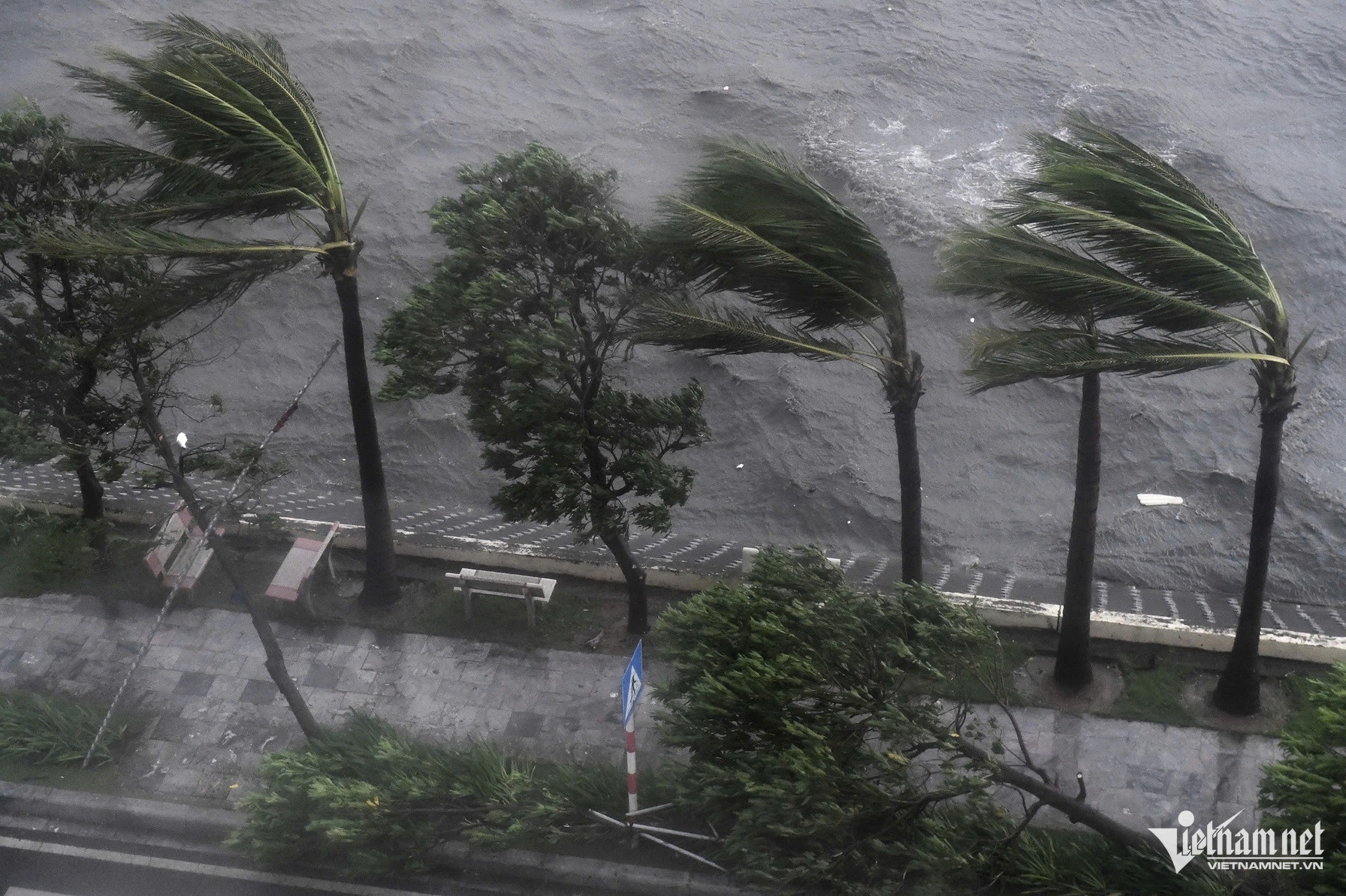
Storm No. 3 made landfall in Quang Ninh - Hai Phong with strong winds of level 13, causing many trees to fall and many houses to lose their roofs.
1.Storm status
Due to the influence of storm No. 3's circulation, Bach Long Vi Island has strong winds of level 13, gusts of level 14; Co To Island has strong winds of level 13, gusts of level 16; Tien Yen (Quang Ninh) strong winds of level 9, gusts of level 11; Dam Ha (Quang Ninh) strong winds of level 10, gusts of level 13; Cua Ong (Quang Ninh) strong winds of level 12, gusts of level 14; Bai Chay (Quang Ninh) strong winds of level 14, gusts of level 17; Phu Lien (Hai Phong) strong winds of level 8, gusts of level 10; Cat Hai (Hai Phong) strong winds of level 7, gusts of level 10; Dong Xuyen (Hai Phong) strong winds of level 9, gusts of level 10; Ba Lat (Thai Binh) strong winds of level 8, gusts of level 10,...
In the Northeast region, there was heavy rain, locally very heavy rain in some places such as: Cua Ong (Quang Ninh) 113mm, Cam Pha (Quang Ninh) 110mm, Cat Ba (Hai Phong) 86mm,...
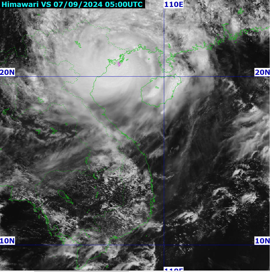
13:00 September 7th, the center of storm No. 3 is located at about 20.8 degrees North latitude; 107.1 degrees East longitude, on the coastal area of Quang Ninh-Hai Phong. The strongest wind near the center of the storm is level 12-13 (118-149km/h), gusting to level 16, moving in the West Northwest direction, speed 15-20km/h.
2. Storm forecast (in the next 12 to 24 hours)
| Forecast time | Direction, speed | Location | Intensity | Danger zone | Disaster Risk Level (Affected Area) |
| 01h/08/09 | West Northwest, 15-20km/h, going inland to the Northeast | 21.3N-105.4E; on the mainland in the Northeast | Level 8, level 10 | North of latitude 18.5N; West of longitude 110.0E | Level 4:Northern Gulf of Tonkin area, coastal waters and mainland of Quang Ninh, Hai Phong, Thai Binh Level 3:Southern Gulf of Tonkin area, coastal waters and mainland of Nam Dinh, Ninh Binh and Thanh Hoa |
| 13h/08/09 | West Northwest, 15-20km/h, moving inland, weakening and dissipating | 21.9N-103.3E; on land in the Northwestern provinces of the North | Level <6 | North of latitude 19.5N; West of longitude 108.5E | Level 3:Gulf of Tonkin, coastal waters and mainland of Quang Ninh, Hai Phong, Thai Binh, Nam Dinh, Ninh Binh and Thanh Hoa provinces |
3. Forecasting the impact of storms
| On the sea: - The Gulf of Tonkin (including Bach Long Vi and Co To island districts) has strong winds of level 8-10, near the storm's eye level 11-13, gusting to level 16; rough seas. On land: - Coastal areas from Quang Ninh to Thanh Hoa have strong winds of level 7-9, areas near the storm center have winds of level 10-12, gusts of level 14; inland areas in the Northeast have strong winds of level 6-8, gusts of level 9-11 (the strongest winds are from noon to evening on September 7). | |
| Rising water, big waves | |
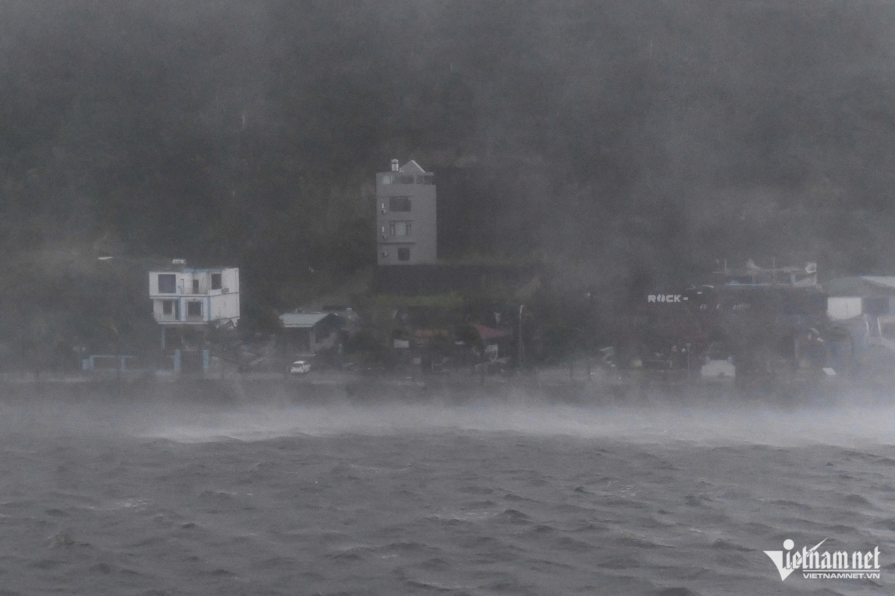
| Ocean Waves: - In the Gulf of Tonkin (including Bach Long Vy and Co To island districts), waves are 3.0-5.0m high, and in the area near the storm's eye, waves are 4.0-6.0m high. - Coastal waters from Quang Ninh-Hai Phong have waves 3.0-4.0m high, from Thai Binh-Ninh Binh 2.0-3.0m. Storm surge: Coastal areas from Ninh Binh to Quang Ninh need to guard against storm surges from 0.5m to 1.5m high. Boat mooring areas, aquaculture areas, dykes and seawalls in the above-mentioned dangerous areas are all likely to be affected by strong winds, large waves and storm surges/ebb. Low-lying coastal and estuary areas should be on guard against the risk of flooding due to rising water and large waves. | |
| Heavy rain | |
| - Northeast and Thanh Hoa: + From the afternoon of September 7 to the end of the night of September 7, there will be heavy to very heavy rain with common rainfall of 100-250mm, locally over 400mm. + Day and night of September 8: moderate rain, heavy rain and thunderstorms in some places with common rainfall of 20-60mm, in some places over 150mm; in mountainous areas there is heavy rain, in some places very heavy rain with common rainfall of 60-120mm, locally over 250mm. - Northwest: from the afternoon of September 7 to the morning of September 9, there will be heavy to very heavy rain with common rainfall of 100-300mm, locally over 450mm. Heavy rains can cause flooding in low-lying areas; flash floods in small rivers and streams, and landslides on steep slopes. | |
| Storms, hurricanes, tornadoes | |
| Due to the influence of the wide storm circulation, in the Northwest region, the area from Nghe An to Thua Thien Hue needs to be on guard against the risk of thunderstorms, tornadoes and strong gusts of wind. | |
According to the National Steering Committee for Natural Disaster Prevention and Control, as of 1 p.m., Typhoon Yagi had caused damage to Quang Ninh and Hai Phong. The storm caused 5 cement ships and 1 small wooden ship to sink at their anchorage (Quang Ninh); 146 trees to fall (Quang Ninh 100; Hai Phong 46); 2 low-voltage power poles and 1 transformer station to be damaged (Hai Phong); Cam Pha and Van Don districts (Quang Ninh) suffered widespread power outages. Thai Binh, Nam Dinh and Thai Binh provinces have not recorded any damage.
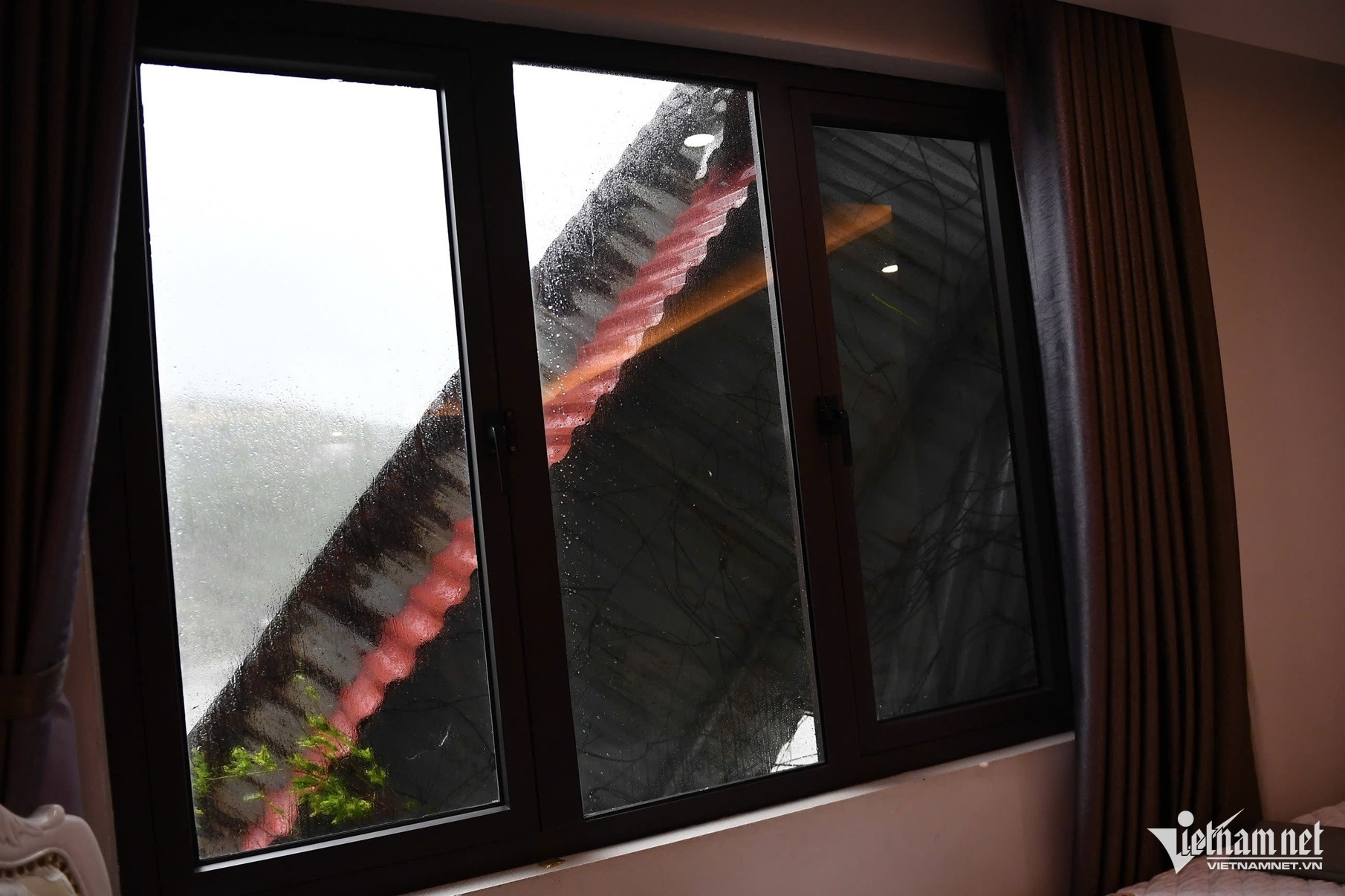
In Ha Long City (Quang Ninh), storm number 3 is currently raging.
In Ninh Binh, heavy rain caused a royal poinciana tree on Luong Van Tuy Street (Tan Thanh Ward, Ninh Binh City) to be uprooted and fall onto the street.

In Hai Duong, the wind blew away the heat-resistant roof of a two-story building with five classrooms at a kindergarten in Chi Lang Nam commune, Thanh Mien district. Authorities advised people to limit their travel on Provincial Road 396, which passes through the kindergarten.