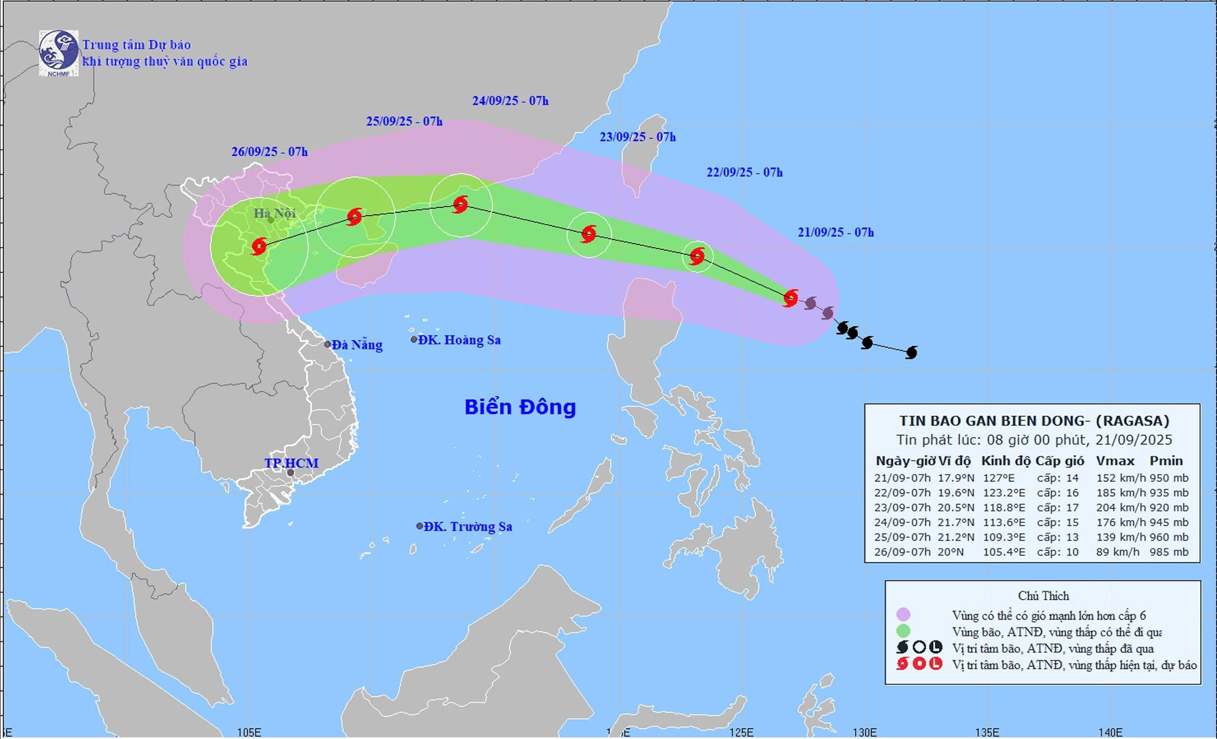
Storm news coming to the East Sea - storm RAGASA
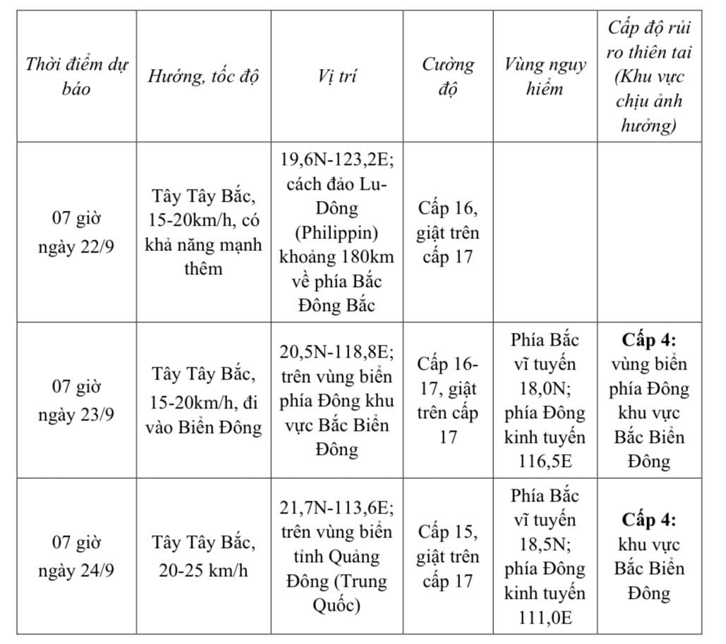
From the next 72 to 120 hours, the storm will move in the West Southwest direction, about 20km per hour, gradually weakening.

At 7:00 a.m. on September 21, the center of storm RAGASA was at about 17.9 degrees North latitude; 127.0 degrees East longitude, about 520 km east of Luzon Island (Philippines). The strongest wind near the center of the storm was level 14 (150-166 km/h), gusting to level 17. Moving in the West Northwest direction at a speed of about 15 km/h.
Storm forecast (in the next 24 to 72 hours):

Forecast of storm impact:
From the next 72 to 120 hours, the storm moved in the West Southwest direction, about 20km per hour, gradually weakening.
Strong winds and big waves.
At sea:
From September 22, the sea area in the East of the North East Sea will gradually increase to level 8-9, then increase to level 10-14, the area near the storm center will be level 15-17, gusting above level 17, waves over 10.0m high; the sea will be very rough.
Vessels operating in the above mentioned dangerous areas are susceptible to the impact of storms, whirlwinds, strong winds and large waves.
