Ragasa storm news at 12:00 today, September 24, 2025: Approaching Quang Ninh, level 4 natural disaster risk
Ragasa storm news at 12:00 today, September 24, 2025: Ragasa storm is 530 km from Quang Ninh, causing strong winds, high waves and heavy rain, warning of level 4 natural disaster risk in the East Sea.
Location and direction of storm Ragasa
According to the National Center for Hydro-Meteorological Forecasting, at 12:00 on September 24, the center of storm Ragasa was located at about 21.4 degrees North latitude; 112.8 degrees East longitude, about 530km east of Mong Cai (Quang Ninh). The strongest wind near the center of the storm reached level 14-15, gusting to level 17, moving west at a speed of 20km/hour.
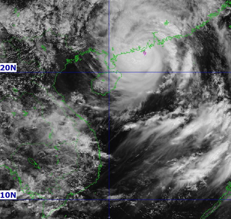
It is forecasted that by the morning of September 25, the storm will approach the coast of Quang Ninh - Hai Phong, decreasing to level 10, gusting to level 12. In the next 48 hours, the storm will continue to weaken into a tropical depression and gradually dissipate in the Northwest region.
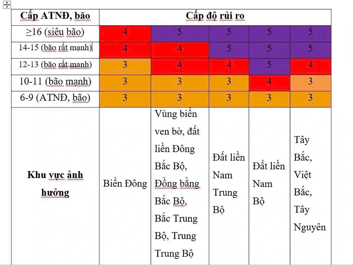
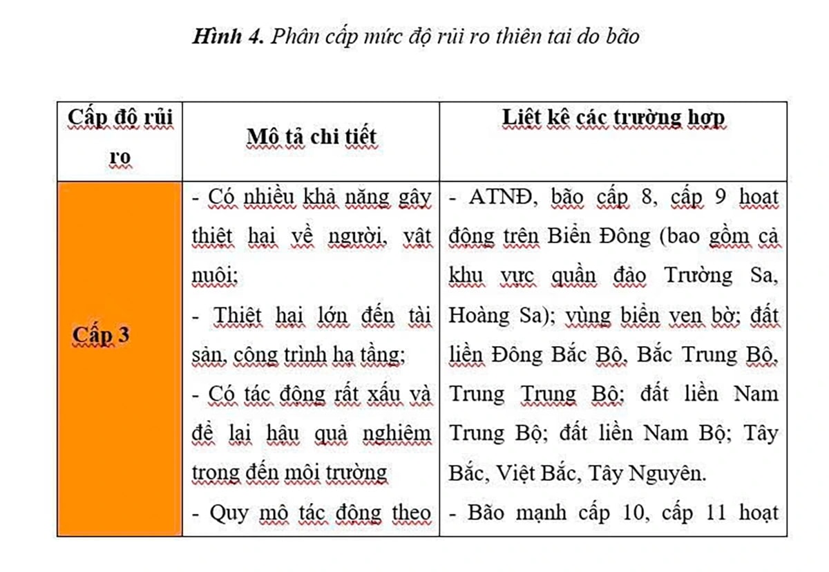
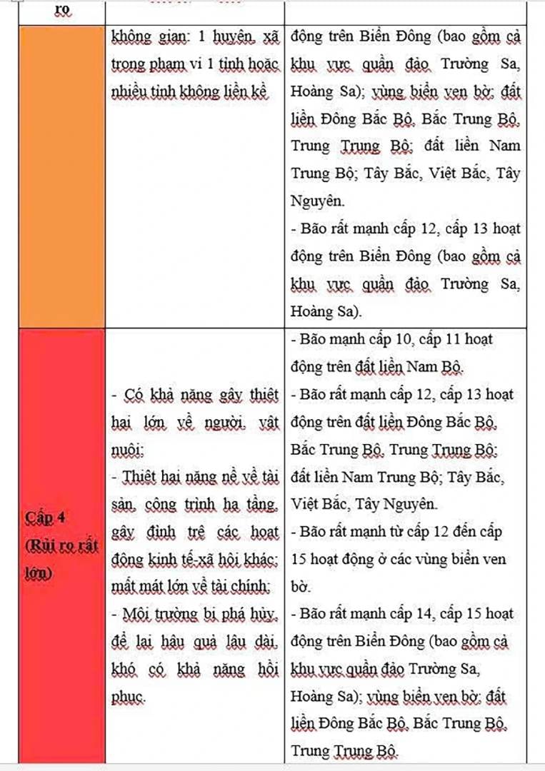
Level 4 disaster risk in the North East Sea
Although the storm intensity has gradually decreased, the risk of natural disasters at sea remains at level 4 for the northwestern part of the East Sea. The northern Gulf of Tonkin and the northeastern coast are warned at level 3. The natural disaster risk hierarchy helps local authorities prepare appropriate response plans to limit damage.
In the East Sea area, near the center of storm Ragasa, winds of level 13-15, gusts above level 17, waves higher than 10 meters, and rough seas appear.
In the eastern part of the Gulf of Tonkin, including Bach Long Vi Island, strong winds will be at level 6-7, gusting to level 9. By the night of September 24, winds in the Van Don, Co To, Cat Hai and Hon Dau areas will increase to level 9-11, gusting to level 13, with waves 3-5 m high.
Quang Ninh coastal area is forecast to rise 0.4 - 0.6 m, strongly affecting aquaculture areas and moored boats.
Impact on the Northern mainland
From the early morning of September 25, coastal areas from Quang Ninh to Hung Yen have gradually stronger winds of level 6-7, near the storm center of level 8-9, gusting to level 11. Deep inland in the Northeast, some places have winds of level 6, gusting to level 8.
Storm Ragasa also caused heavy rain from the night of September 24 to the end of September 26 in the North, Thanh Hoa and Nghe An. Rainfall was generally 100 - 250 mm, in many places over 400 mm, with a high risk of flooding in low-lying areas, flash floods on small rivers and streams and landslides in mountainous areas.
With a wide storm circulation, the risk of thunderstorms and strong winds may occur both before and during the storm's landfall. People, especially in coastal areas, should closely monitor forecasts and take preventive measures to minimize damage.