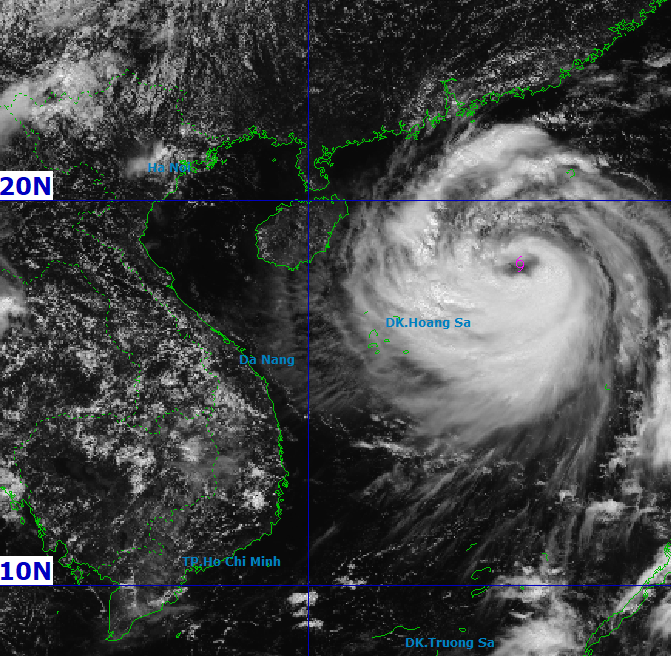
FLASH NEWS ON STORM NO. 11 (at 12 noon on October 4): The center of the storm is about 370km East Northeast of Hoang Sa special zone.
The center of the storm is located at about 18.3 degrees North latitude; 115.5 degrees East longitude, about 370km East Northeast of Hoang Sa special zone. Strongest wind: Level 11 (103-117km/h), gusting to level 14. Forecast: In the next 3 hours, the storm will move in the West Northwest direction, at a speed of about 25km/h.
Storm impact forecast: Strong winds, large waves, rising water.
In the North East Sea, there are strong winds of level 8-10, near the storm center level 11-13, gusts of level 16, waves 4.0-6.0m high, near the storm center 6.0-8.0m, very rough seas (extremely destructive, extremely strong waves. Sinking large tonnage ships).
From the night of October 5, in the sea area of Nghe An province (including Hon Ngu island), the wind gradually increased to level 4-5, then increased to level 6-7, gusting to level 8; waves from 1.5-2.5m high, rough sea.
From October 6 to the night of October 7, Nghe An province will have moderate to heavy rain, some places will have very heavy rain and thunderstorms. The general forecast rainfall is 70 - 150mm, especially in the Northwest of the province, some places will have over 250mm such as the communes of Quy Chau, Chau Tien, Thong Thu, Tien Phong....