
TYPHOON WARNING FOR THE SOUTH CHINA SEA (Typhoon No. 03)
At 13:00 on August 5th, the typhoon's center was located at approximately 17.4 degrees North latitude and 119.3 degrees East longitude, in the southeastern part of the North East Sea. The strongest winds near the center of the typhoon were at level 8 (62-74 km/h), with gusts up to level 10. It was moving in an east-northeast direction at a speed of about 5 km/h.
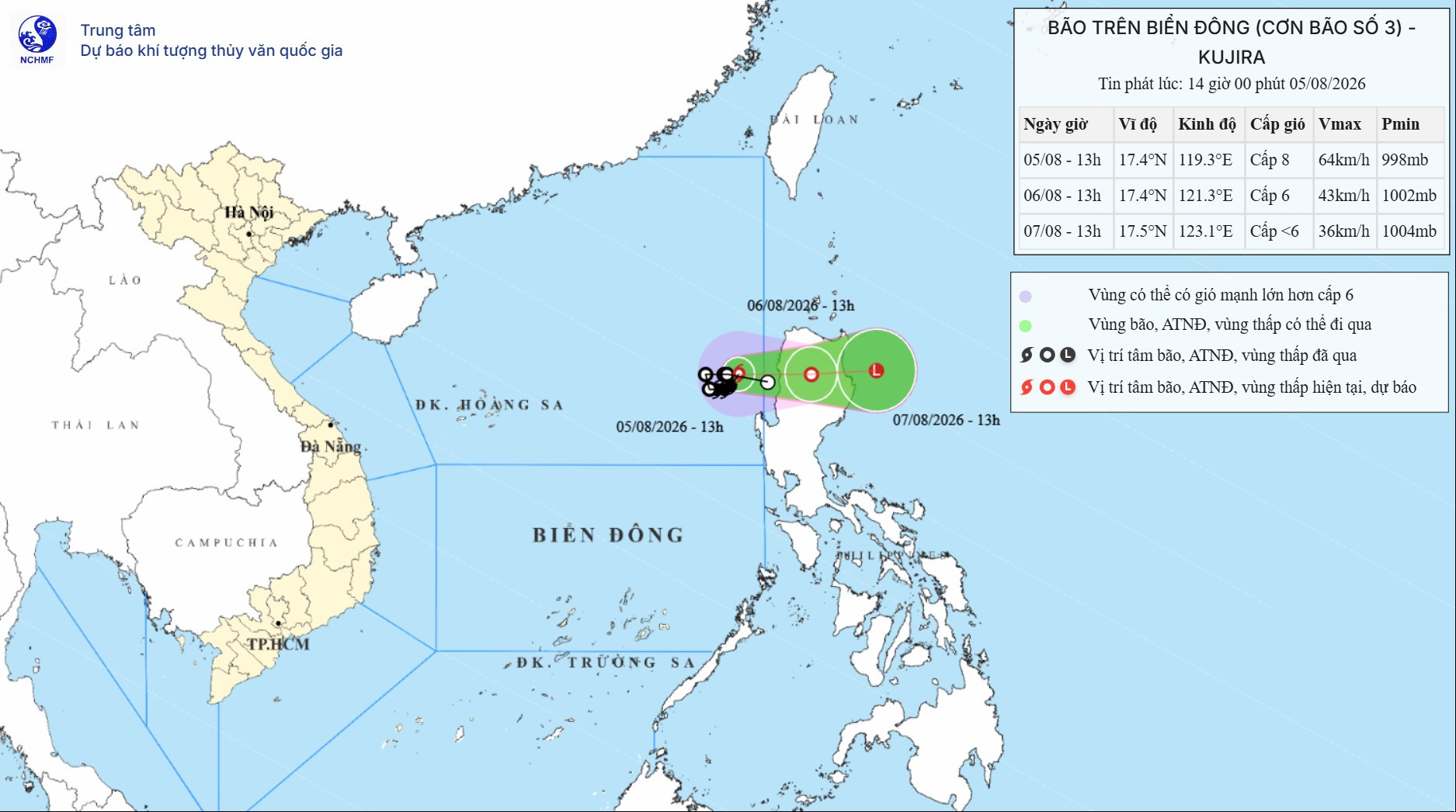
Forecast of storm developments (over the next 24 to 48 hours):
| Forecast time | Direction, speed | Location | Intensity | Hazardous area | Level of natural disaster risk (Affected area) |
| 13 hours August 6th | East, 5-10 km/h | 17.4N-121.3E; over the northern part of Luzon Island (Philippines) | Gradually weakening into a tropical depression. Level 6, gusts up to level 8. | 16.0-18.5N; east of longitude 117.5E | Level 3: the southeastern sea area of the North East Sea region. |
| 13 hours August 7th | East, 5-10 km/h | 17.5N-123.1E; in the sea east of Luzon Island (Philippines) | It gradually weakened into a low-pressure area. < level 6 |
Forecast of storm impact: Strong winds, high waves
| At sea: The southeastern part of the North East Sea region is experiencing stormy weather, with strong winds of force 6-7, gusting to force 9, and winds near the storm's center reaching force 8, gusting to force 10; waves are 2.0-4.0m high, and the sea is rough. The forecast indicates that Typhoon No. 3 will not affect the coastal and inland areas of Vietnam. Vessels operating in the aforementioned hazardous areas are susceptible to the effects of thunderstorms, tornadoes, strong winds, and high waves. | |
PV