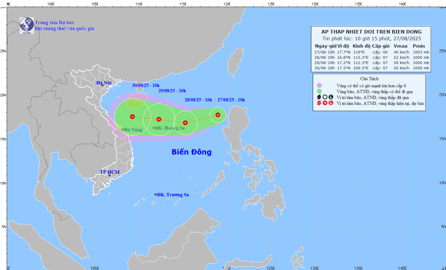
NEWS ON TROPICAL LOW PRESSURE IN THE EAST SEA
This morning (August 27), the low pressure area in the eastern sea of the North East Sea strengthened into a tropical depression.
At 10:00, the center of the tropical depression was at about 17.7 degrees North latitude; 119.0 degrees East longitude. The strongest wind near the center of the tropical depression was level 6 (39-49 km/h), gusting to level 8. Moving in the West Southwest direction at a speed of 10-15 km/h.

Forecast of tropical depression development (in the next 24 to 48 hours)
| Forecast time | Direction, speed | Location | Intensity | Danger zone | Disaster Risk Level (Affected Area) |
| 10 hours August 28 | West Southwest, 15-20km/h, likely to strengthen | 16.8N-115.3E; about 410km east of Hoang Sa special zone | Level 6-7, level 9 jerk | 15.0-18.5N; East of longitude 114.0E | Level 3: Eastern sea area of the North East Sea |
| 10 hours August 29 | West, about 15km/h | 17.2N-112.3E; in the Hoang Sa special economic zone | Level 7, level 9 jerk | 15.0-19.0N; 111.0-116.5E | Level 3: North East Sea area (including Hoang Sa special zone) |
Warning of tropical depression developments (from the next 48 to 72 hours):
From the next 48 to 72 hours, the tropical depression will continue to move mainly in the West direction, traveling 10 - 15km per hour.
Forecast of impact of tropical depression: Strong winds, big waves:
The eastern sea area of the North East Sea has strong winds of level 6-7, gusts of level 9; waves 2.0-4.0m high, rough seas.
Vessels operating in the above mentioned dangerous areas are susceptible to the impact of storms, whirlwinds, strong winds and large waves.
