NEWS ON TROPICAL DEPRESSION IN THE SOUTH CHINA SEA
This morning (August 27), the low-pressure area over the eastern part of the North East Sea has strengthened into a tropical depression.
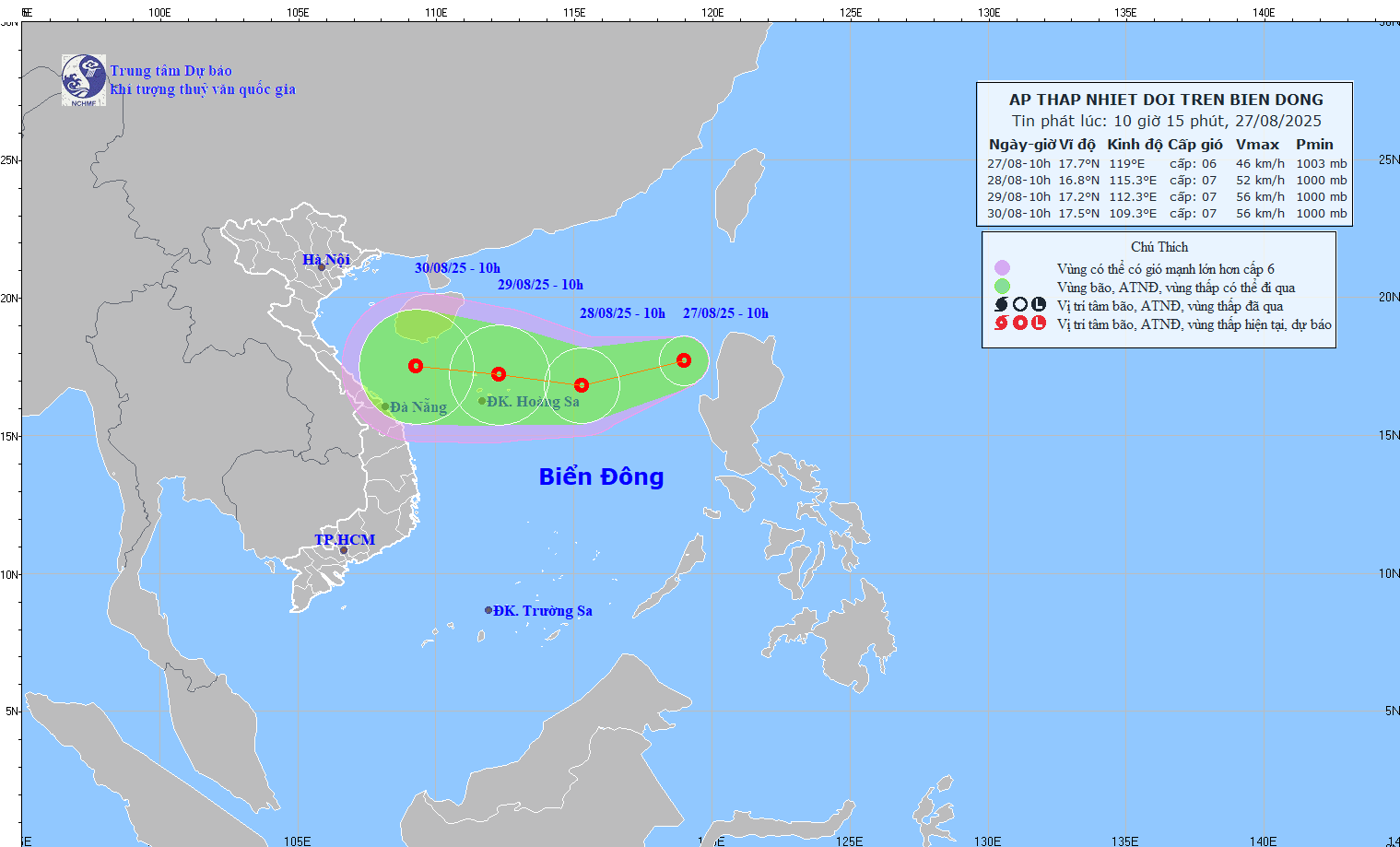
At 10:00 AM, the center of the tropical depression was located at approximately 17.7 degrees North latitude and 119.0 degrees East longitude. The strongest winds near the center of the tropical depression were at level 6 (39-49 km/h), with gusts up to level 8. It was moving in a west-southwest direction at a speed of 10-15 km/h.
Forecast of the development of the tropical depression (within the next 24 to 48 hours
| Forecast time | Direction, speed | Location | Intensity | Hazardous area | Level of natural disaster risk (Affected area) |
| 10 o'clock August 28th | West-southwest, 15-20 km/h, likely to intensify. | 16.8N-115.3E; approximately 410km east of the Hoang Sa Special Economic Zone. | Level 6-7, gusts up to level 9. | 15.0-18.5N; east of longitude 114.0E | Level 3: East Sea area of the North South China Sea |
| 10 o'clock August 29th | West, approximately 15 km/h | 17.2N-112.3E; in the Hoang Sa Special Economic Zone | Level 7, bursts up to level 9. | 15.0-19.0N; 111.0-116.5E | Level 3: Northern South China Sea region (including the Paracel Islands Special Administrative Region) |
Warning about the development of the tropical depression.(within the next 48 to 72 hours)
Over the next 48 to 72 hours, the tropical depression will continue to move mainly westward, at a speed of 10-15 km per hour.
Tropical depression impact forecast: Strong winds, high waves:
In the eastern part of the North East Sea, winds are strong, reaching force 6-7, with gusts up to force 9; waves are 2.0-4.0m high, and the sea is rough.
Vessels operating in the aforementioned hazardous areas are susceptible to the effects of thunderstorms, tornadoes, strong winds, and high waves.

