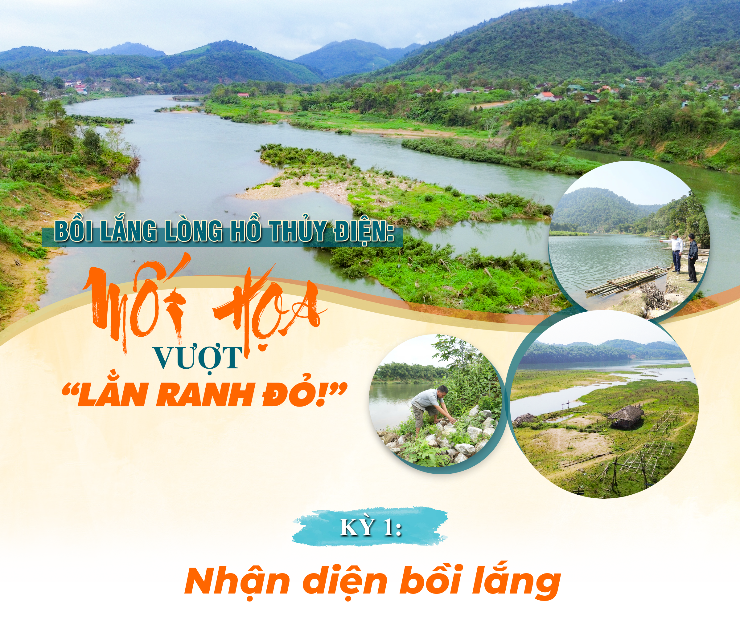
Sedimentation in hydroelectric reservoirs: A threat crossing the "red line!" - Part 1: Identifying sedimentation
After more than a decade of developing a cascade hydroelectric system, the Lam River, divided into reservoirs, is facing a "silent enemy"—the sedimentation of submerged waste, soil, and rocks. No longer hidden at the bottom of the river, the sedimentation is now clearly visible, rising up to form divides in the river's flow, creating sandbars that bury the livelihoods of the local people…
Content:Reporter TeamDesign: Huu Quan | 26/03/2026
After more than a decade of developing a cascade hydroelectric system, the Lam River, divided into reservoirs, is facing a "silent enemy"—the sedimentation of submerged waste, soil, and rocks. No longer hidden at the bottom of the river, the sedimentation is now clearly visible, rising up to form divides in the river's flow, creating sandbars that bury the livelihoods of the local people…
.png)
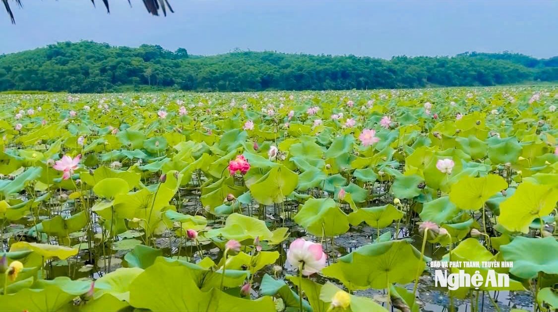
During our multi-day field surveys of the large hydroelectric reservoirs on the Lam River, our first stop was the Bai Gao area in Chau Khe commune. This was because Bai Gao was famous for its picturesque lotus ponds, an attractive ecotourism destination in the former Con Cuong district, but these were completely wiped out after the flood on the morning of July 23, 2025.
.jpg)
The Bai Gao lotus pond area was formerly agricultural land belonging to the people of Chau Khe commune. During the Chi Khe Hydropower Project, the land within the planning area was compensated and reclaimed to become part of the reservoir. Since 2018, when the Chi Khe hydropower plant began impounding water, the entire area has been flooded by 1.5 - 2 meters. From then on, the people of Bai Gao village began raising fish in cages and experimenting with lotus cultivation. Because Bai Gao village has many beautiful natural landscapes, the government of Con Cuong district (formerly) encouraged the people to expand lotus cultivation, linking it with tourism services. As a result, by 2022, the Bai Gao lotus pond, with an area of approximately 5 hectares, had become one of the tourist destinations of Con Cuong district (formerly), known to many tourists from within and outside the province.
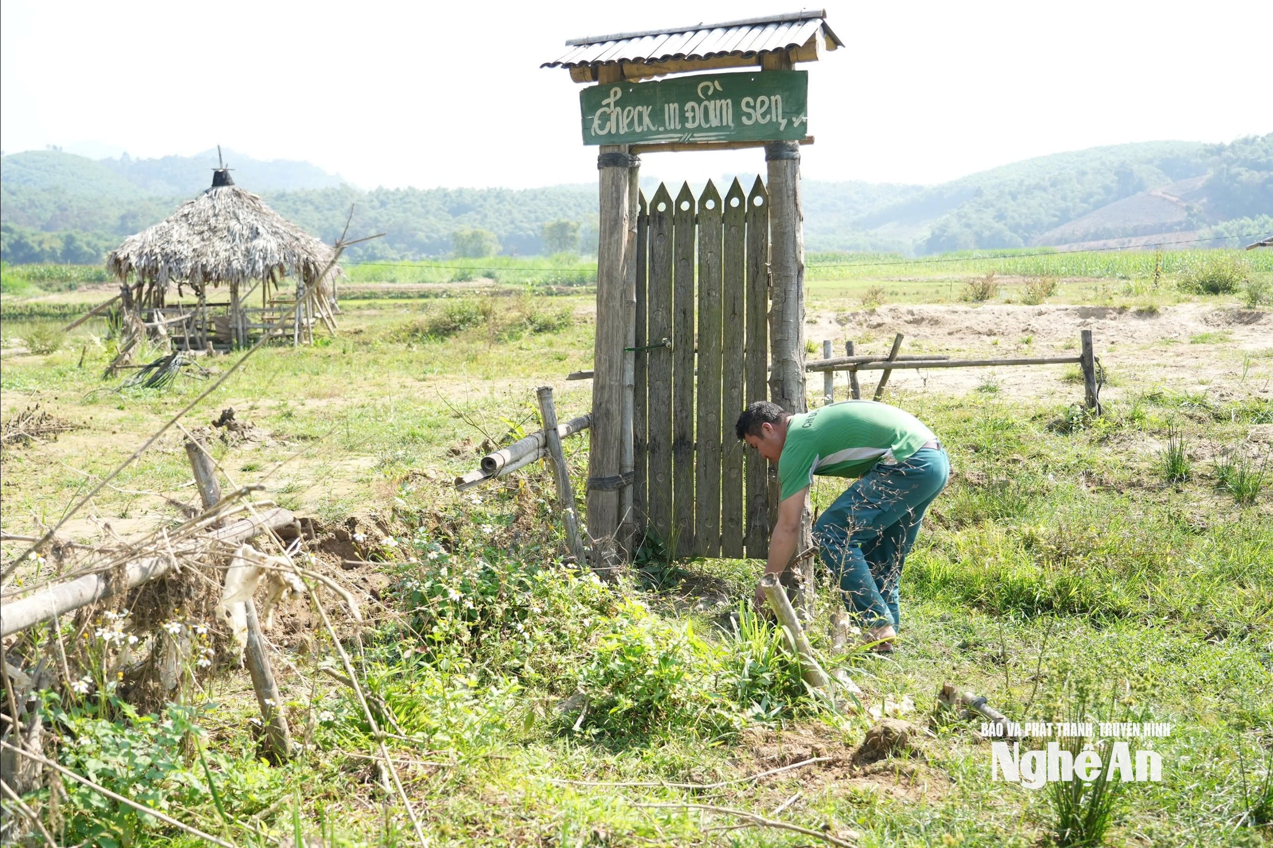
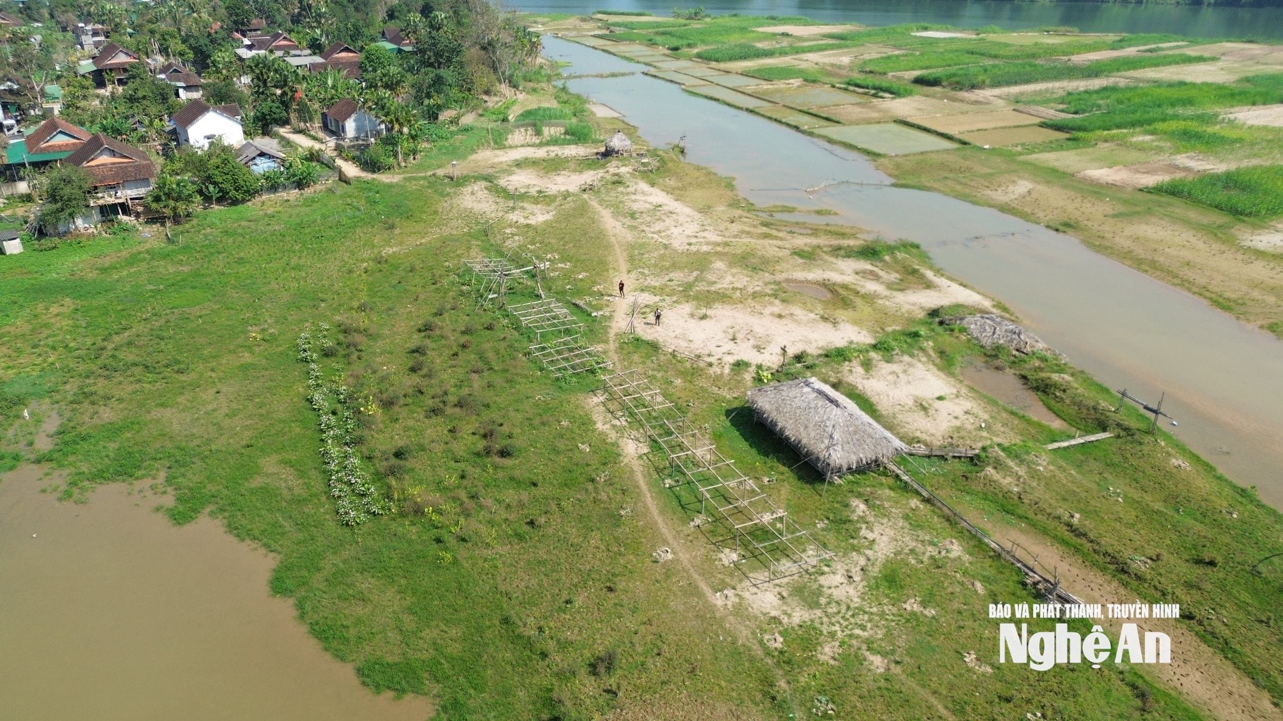
However, on the day we arrived, this tourist spot was a huge sandbank scarred by the remnants of storms and floods. The wooden gate with the sign "Experience the Bai Gao Lotus Pond" was still there, but the long bamboo bridges spanning the lotus pond, and the bamboo houses built on the lake to serve as resting places for tourists, had been buried under mud. The only remaining traces were broken bamboo stalks, rotten wooden posts, and collapsed roofs... mixed in with the soil, sand, and weeds.
.jpg)
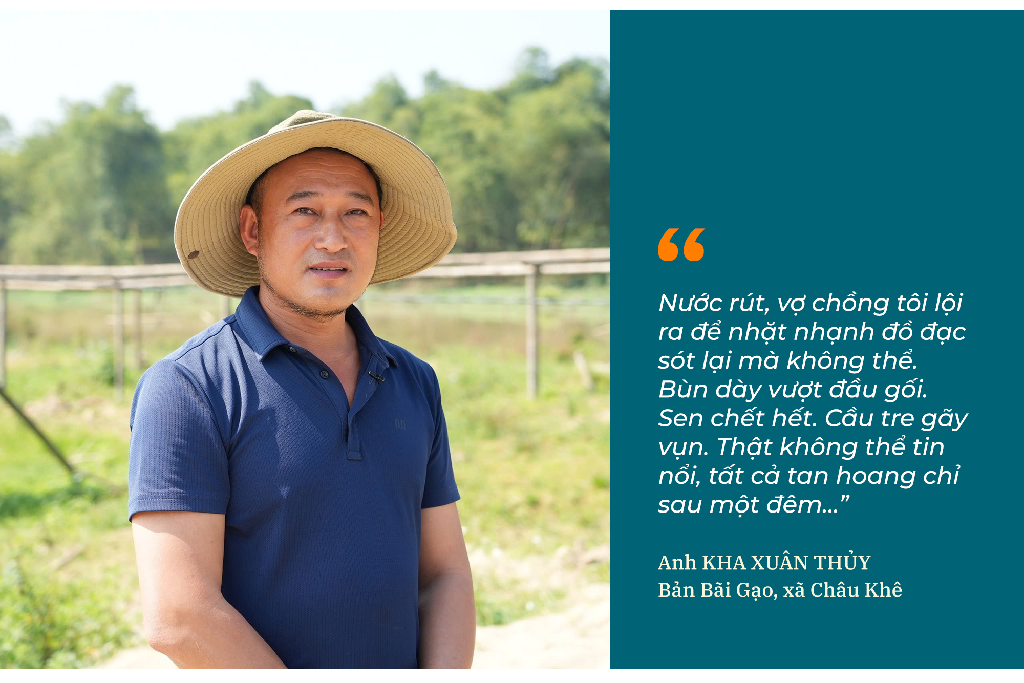
In Bai Gao village, Mr. Kha Xuan Thuy initiated the lotus cultivation project and later invested in tourism services. Leading us down to the alluvial plain, he lamented, "Who could have imagined that just a few years ago, this place was a vast lotus pond, with lotuses blooming profusely, filling the air with their fragrant scent, attracting a constant stream of visitors? But now it has become a desolate wasteland."
According to Mr. Thuy, when the reservoir was formed, his family expressed their desire to utilize the water surface area to develop a livelihood model to the local authorities and the hydropower unit. After receiving approval, he traveled to many places to find traditional lotus varieties with a distinctive fragrance. In the beginning, everything was done by the family themselves. After seeing the lotus plants thrive, he invested funds and mobilized the villagers to support the improvement and expansion of the planting area, building small structures to serve visitors. The initial idea was to plant lotus for its flowers and seeds, but as the lotus pond developed, he realized its potential for ecotourism. From there, he organized the construction of tourist facilities such as bamboo bridges, rest pavilions, and pathways through the pond. Due to a lack of resources, the constructions were completed gradually over time. But eventually, his aspirations became a reality with bamboo bridges spanning the water and connecting rest pavilions in the middle of the more than 4-hectare lotus pond, becoming a highlight of the tourist area. During the lotus blooming season, the entire lake area glows with a vibrant pink color. The Bai Gao lotus pond therefore attracts many tourists who come to take photos and visit, creating jobs and income for many local people.
"Visitors come not only to admire the lotus flowers but also to enjoy local specialties and learn about the local culture. The villagers participate in harvesting lotus flowers, processing lotus products, and providing essential services, which helps them earn extra income," Thuy shared.
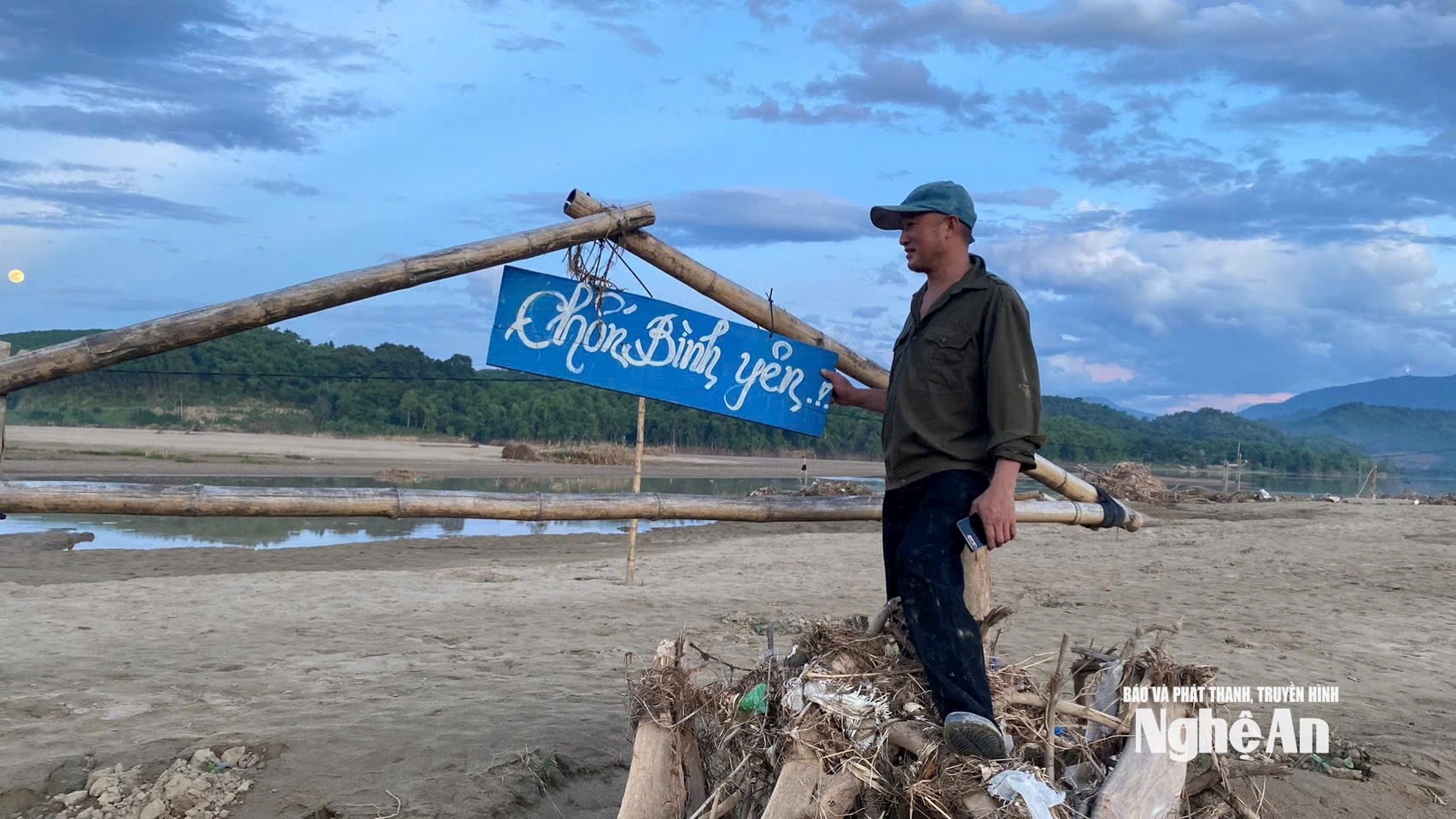
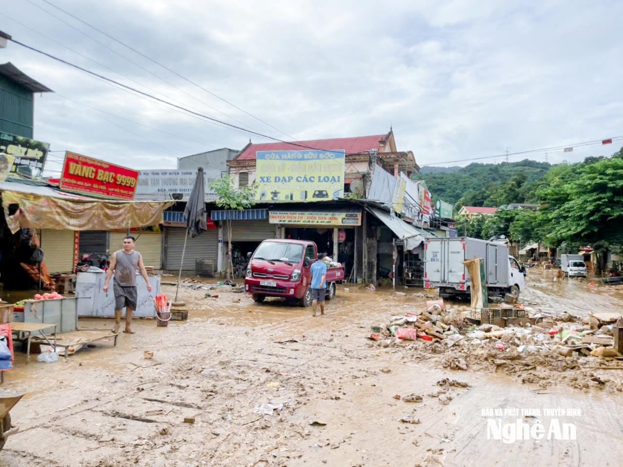
But everything changed overnight with a flood. On the night of July 22nd to 23rd, 2025, water from the upstream of the Lam River suddenly rose at an unprecedented rate. Initially, the water level rose only slightly, but after a few hours, it had risen by several meters. By dawn, the entire lotus pond was submerged. In Bai Gao village, with over 100 households, three-quarters of the houses were flooded. By morning, the water from upstream rushed down like a whirlwind, carrying trees, soil, rocks, mud, and sand. The bamboo bridges and rest shelters in the pond, built from natural materials, could not withstand the fierce force of the water and were successively swept away. Of the five rest shelters in the pond, two were swept away by the flood, and the remaining three were buried under mud and sand, losing their shape. When the water receded, the lotus pond, covering more than 4 hectares, became a muddy swamp. “When the water receded, my wife and I waded out to salvage our belongings, but we couldn’t. The mud was knee-deep. All the lotus plants were dead. The bamboo bridge was broken into pieces. It’s unbelievable, everything was destroyed overnight…,” Mr. Thuy lamented.

In Chau Khe commune, after the major floods of 2025, not only the Bai Gao lotus pond area but also many other areas were affected by silt and sand accumulation. The Choang stream section passing through Bung village recorded a massive accumulation of silt and sand flowing from upstream. Previously, the Choang stream was 9-10 meters deep, where Bung village residents invested in dozens of fish cages. However, after the floods, the Choang stream's depth was reduced to nearly 2 meters, with thick silt and sand clogging the bottom of the cages. Due to the sedimentation, residents were forced to move their cages to other locations.
According to Mr. Kha Van Thuong, Vice Chairman of the People's Committee of Chau Khe commune, sedimentation in the Chi Khe hydropower reservoir has been quite evident in recent years, especially after each rainy season. Monitoring by the commune authorities shows that the amount of mud and sand accumulating in the reservoir is increasing, significantly altering the natural flow of the river and leading to many negative consequences for the lives of the people. “After each rainy season, another layer of mud and sand accumulates. Over time, this distorts the flow, causing erosion in many sections of the riverbanks, and shrinking the agricultural land of the people along both sides of the river,” Mr. Kha Van Thuong explained. Regarding the impacts of sedimentation in the reservoir, Mr. Thuong said that when the reservoir is heavily silted, its flood drainage capacity decreases, causing water levels during floods to rise higher than before, leading to localized flooding and directly affecting the lives of people living along the river. In addition, the appearance of new sandbars has made boat travel on the lake more difficult and poses a potential safety risk.
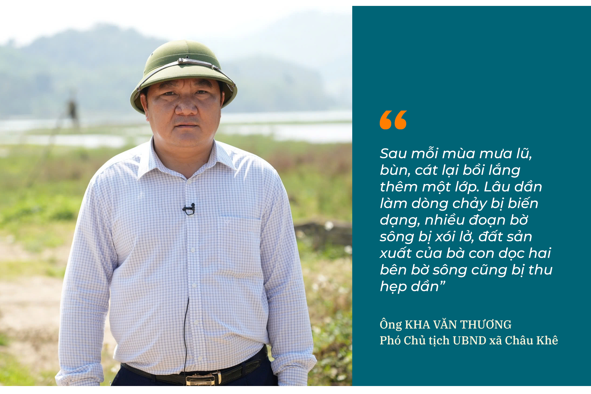
“Given this situation, the commune government has repeatedly made recommendations during meetings with voters and in discussions with relevant units, proposing the need for a comprehensive survey and appropriate technical solutions. We hope that the relevant authorities and the hydropower plants will soon conduct an assessment and develop a plan to dredge and clear the waterway to reduce sedimentation and ensure the safety of production and the lives of the people,” emphasized Kha Van Thuong, Vice Chairman of the Chau Khe Commune People's Committee.
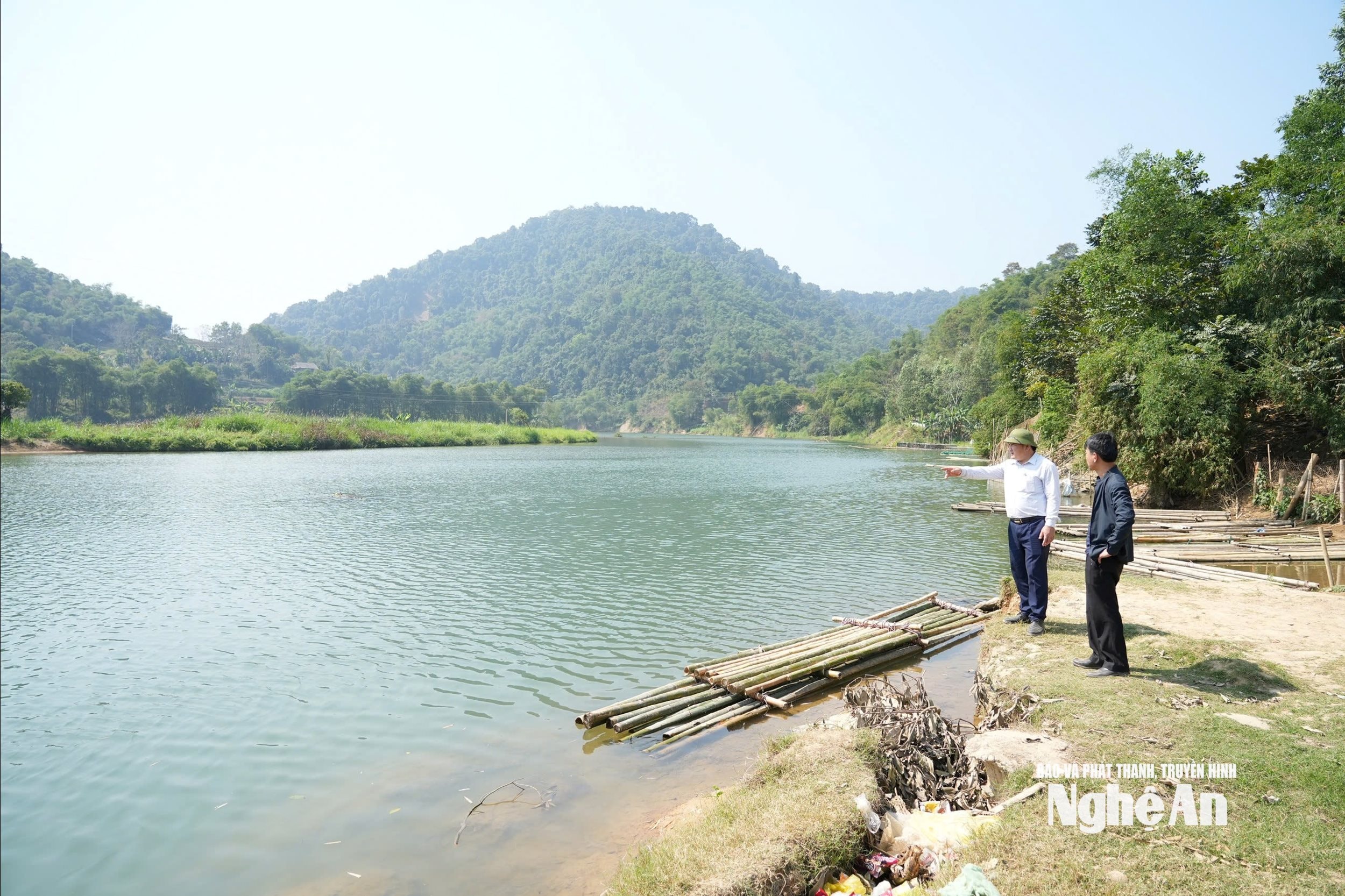
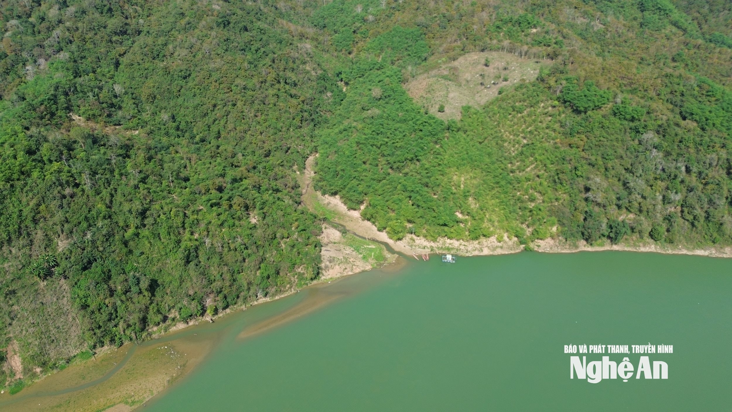
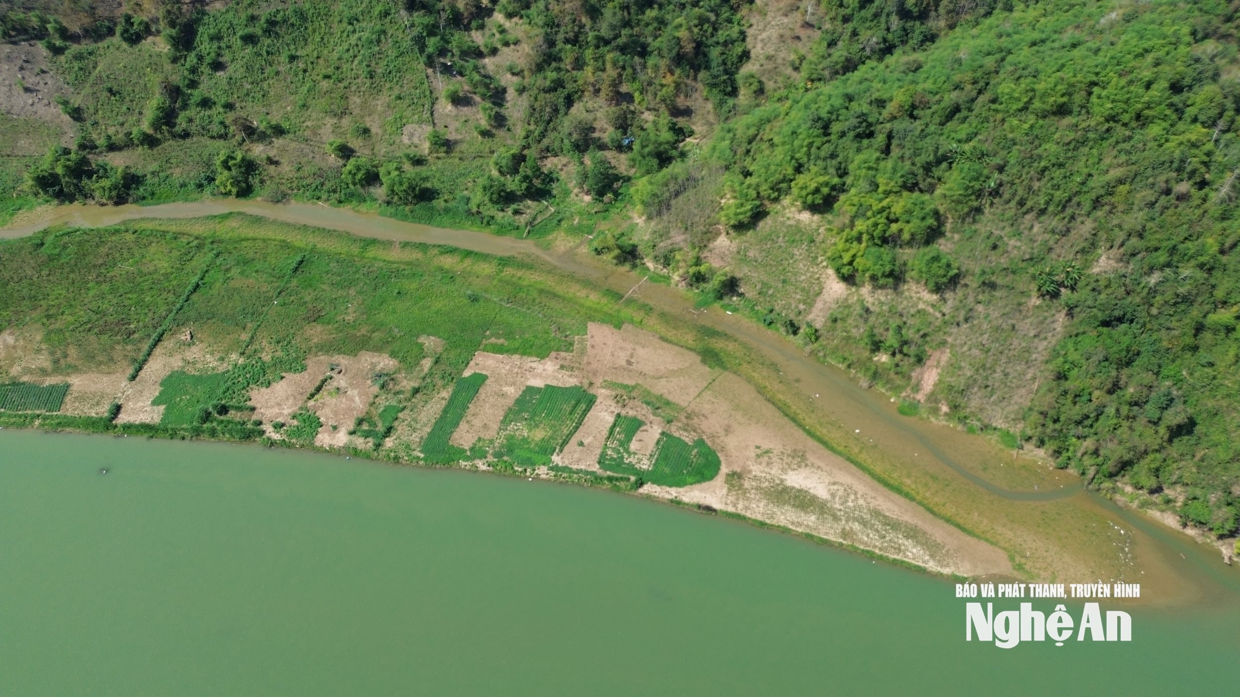
Leaving Chau Khe commune, we continued upstream towards Tam Quang, Tam Thai, Tuong Duong, Luong Minh communes… These areas are connected to the reservoirs of the Ban Ang, Nam Non, and Khe Bo hydroelectric power plants. And in any area, it is easy to see sandbars rising in the middle of the Lam River. Using a drone, we observed very large sandbars, stretching for hundreds of meters, either splitting the river flow or narrowing many sections of the river.
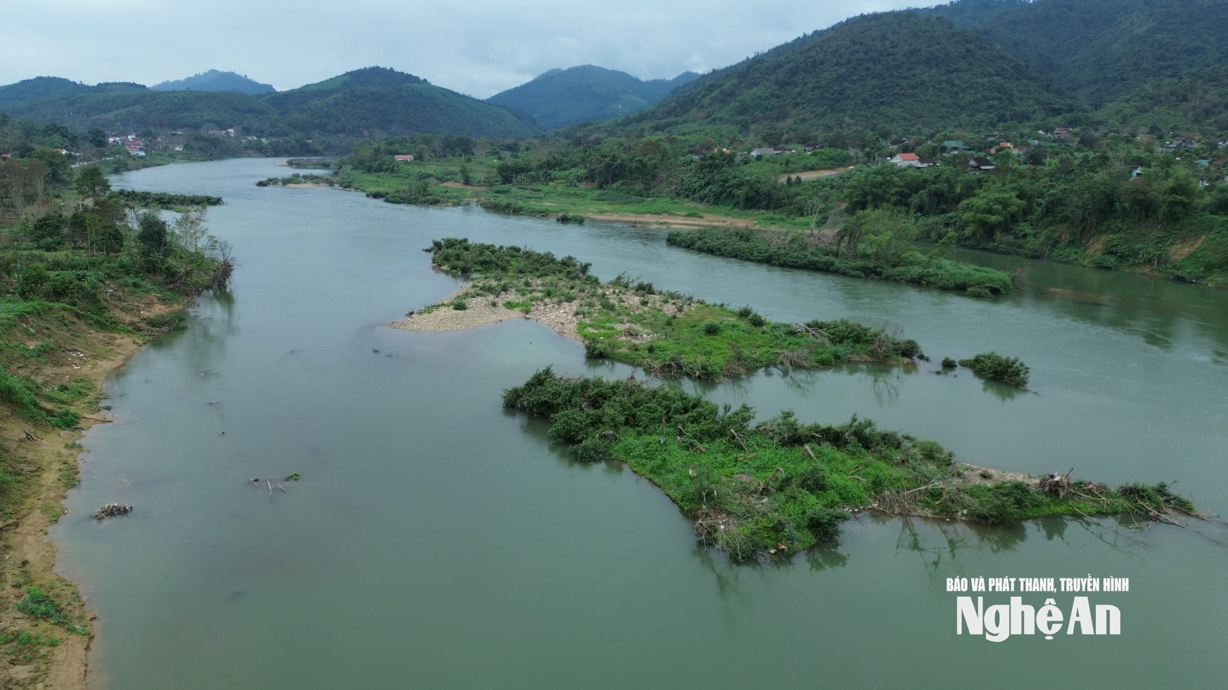
According to local residents like Mr. Luong The Vinh from Nhung village, Tam Quang commune, who has lived by the Lam River for nearly 60 years, he has never seen the river change as rapidly as it has in recent years. "In the past, the riverbed was very wide and deep. But now, sandbanks have sprung up everywhere," Mr. Vinh said.
.jpg)
Similar to Chau Khe commune, the appearance of alluvial deposits has not only altered the river's flow but has also directly impacted the livelihoods of the people. Tam Thai commune, with its advantage of a wide and deep riverbed, has seen the development of cage fish farming. At its peak, there were nearly 100 fish cages in Tam Thai commune. However, the sedimentation of the riverbed has seriously affected cage fish farming. Most concerning were the historic floods of 2025, which damaged dozens of fish cages belonging to local residents.
Mr. Lo Van Thanh, Vice Chairman of the People's Committee of Tam Thai commune, said: "Along with natural disasters, changes in the riverbed topography are also making cage fish farming increasingly risky. When sand accumulates, the riverbed depth decreases, causing fish cages to run aground or become covered in mud, leading to fish deaths."
When we visited Tuong Duong commune, the local authorities were rebuilding the entire drainage system for the residential areas. The reason was that the reservoir area in Tuong Duong commune had suffered severe siltation. The entire system of large drainage pipes along the river was clogged with soil and mud, making drainage impossible.
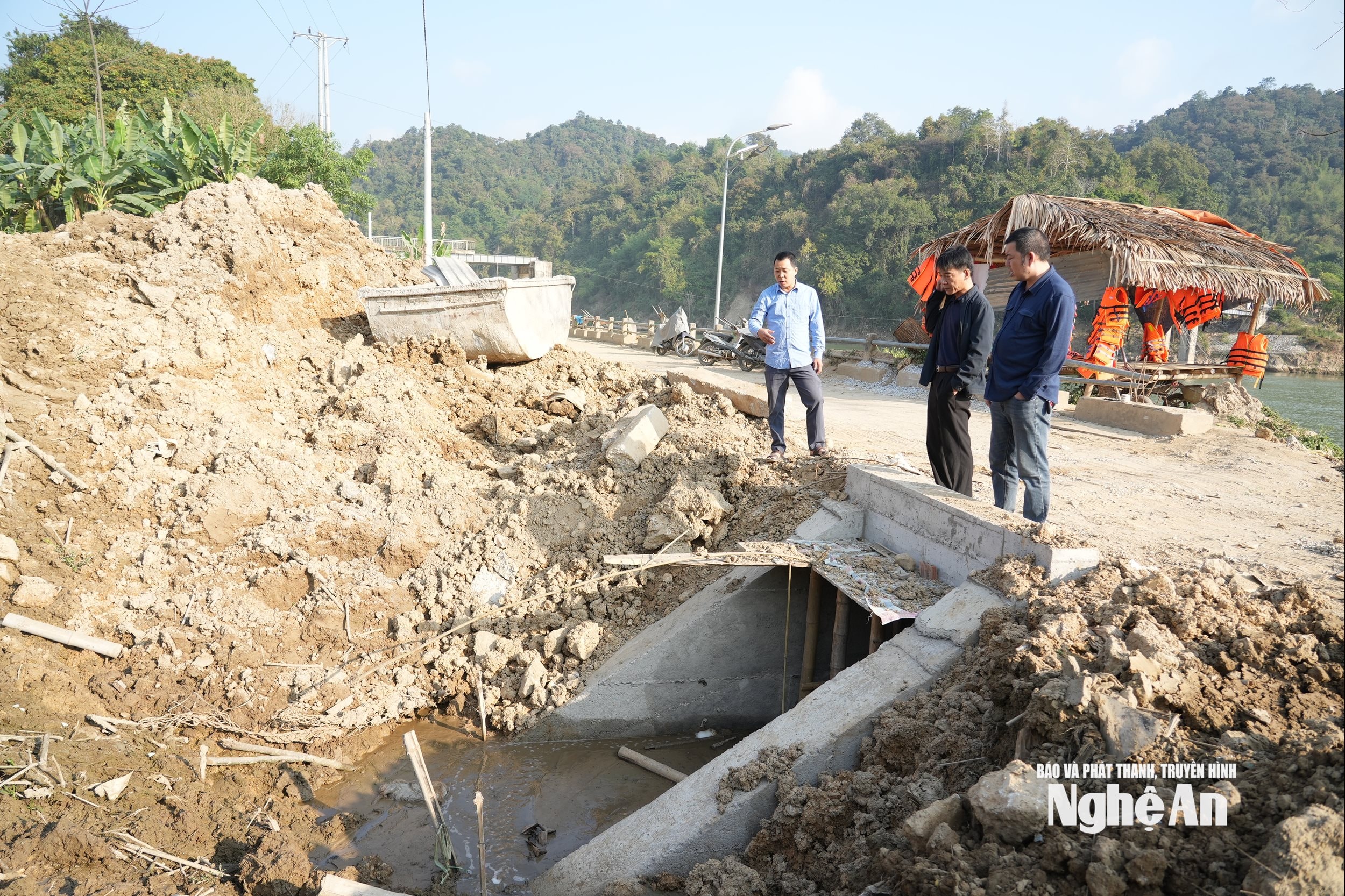
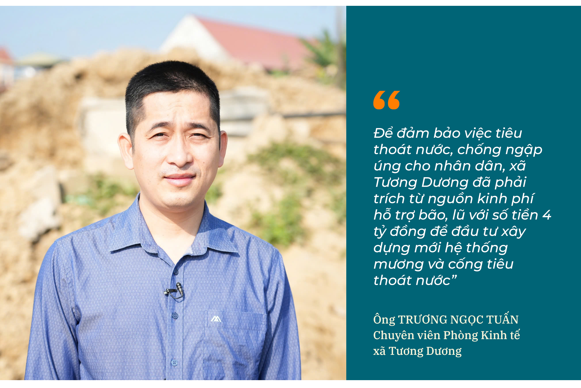
According to Mr. Truong Ngoc Tuan, a specialist from the Economic Department of Tuong Duong commune, the residential areas have a total of four drainage culverts leading to the Lam River. After the floods in 2025, the river water rose, carrying soil, mud, and waste that filled the drainage system, causing blockages. Even a light rain immediately caused localized flooding in the residential areas. Due to the enormous volume of mud and soil, and the fact that many culvert openings are located underwater, machinery is difficult to access, making clearing the blockage impossible. Therefore, to ensure proper drainage and prevent flooding for the people, Tuong Duong commune had to allocate 4 billion VND from its flood relief fund to invest in the construction of a new drainage system.
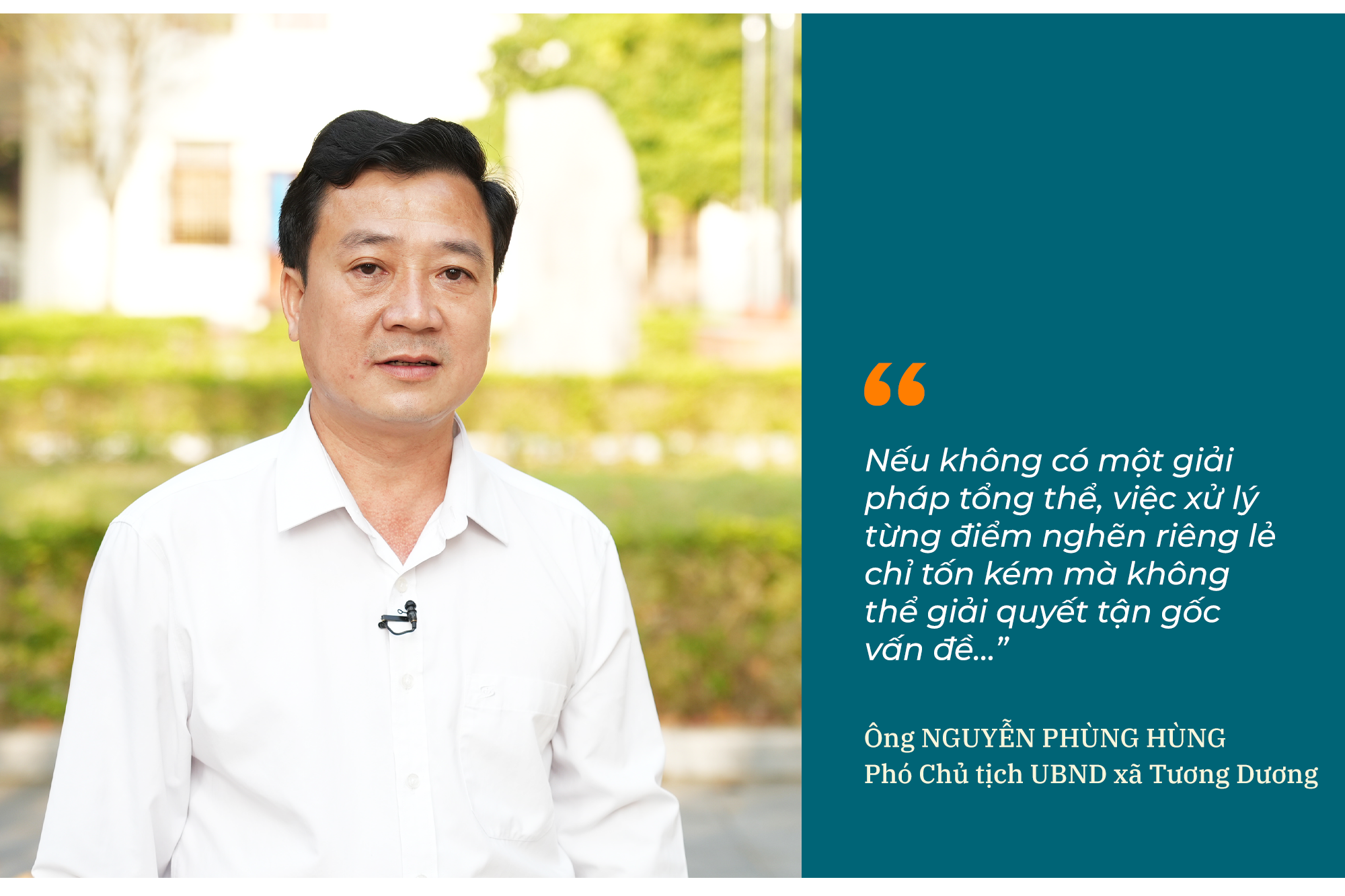
Regarding the issue of sedimentation in the hydropower reservoir, Mr. Nguyen Phung Hung, Vice Chairman of the People's Committee of Tuong Duong commune, stated that this is a worrying situation. “Sedimentation in the hydropower reservoir was clearly evident during the major flood of 2025. The riverbed topography has changed, the flow has narrowed, while the reservoir capacity has gradually decreased over time. As a result, the water level is rising faster than before, especially at the confluence points where streams and creeks flow into the Lam River. During the 2025 flood, many central areas of the commune, especially the former Hoa Binh town, were flooded very quickly. The authorities and people were almost caught off guard,” Mr. Hung said.
According to Mr. Nguyen Phung Hung, Vice Chairman of the People's Committee of Tuong Duong commune, since 2022, the local government has repeatedly requested hydropower units to reassess the sedimentation situation in the reservoir to develop appropriate solutions. However, to date, no comprehensive survey has been carried out. “The locality earnestly hopes for decisive direction from the provincial level to reassess the entire sedimentation situation in the reservoir. Without a comprehensive solution, addressing each bottleneck individually will only be costly and will not solve the root of the problem…,” Mr. Hung emphasized.
(To be continued)

