Hanoi warned of continued heavy rain during rush hour.
From approximately 5 PM to 7 PM today, Hanoi will continue to experience moderate to heavy rain, with total accumulated rainfall generally ranging from 40-80mm, and even higher in some areas.
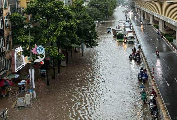
This rainfall is likely to cause localized flooding on many streets. Floodwaters will commonly reach 20 to 60 cm, with some areas experiencing deeper water, and flooding will last for 2 to 4 hours, or even longer in low-lying suburban areas. Residents are advised to take precautions against severe flooding in vulnerable areas.
According to the National Center for Meteorological and Hydrological Forecasting, heavy rain in Hanoi may continue until this afternoon and evening, then gradually decrease.
Forecasts indicate that from October 1st, Hanoi will only experience scattered showers and thunderstorms. However, the meteorological agency is currently warning of a level 1 natural disaster risk due to heavy rain. During thunderstorms, people should be wary of tornadoes, lightning, and strong gusts of wind that could cause trees to fall, damaging houses, transportation infrastructure, and other facilities.
Heavy rainfall over a short period also puts significant pressure on urban drainage systems, leading to flooding in many residential areas, urban centers, and roads. This can cause traffic congestion, reduce visibility for drivers, and increase the risk of slips and accidents.
Not only Hanoi, but many other localities in Northern Vietnam and Thanh Hoa also continue to experience rain due to the remnants of typhoon No. 10. Rainfall amounts here are generally between 20 and 60 mm, with some areas possibly exceeding 100 mm.
In the provinces of Tuyen Quang, Phu Tho, and Thai Nguyen, rainfall was recorded from 40 to 80 mm, with many areas exceeding 200 mm.

