
Proactive response to landslides during the rainy season and floods.
The prolonged heavy rains and floods in recent times have caused landslides and rockfalls in many areas of the province, posing a potential threat to people's lives and property. Local authorities are urgently reviewing vulnerable areas, monitoring weather developments, and proactively preparing evacuation plans for residents when necessary.
Many serious landslides have occurred.
.jpeg)
In Yen Na commune, serious landslides are occurring in residential areas and along transportation routes, posing a significant safety risk. On the evening of September 18th, a large section of mountain unexpectedly collapsed in the Cha Ha ravine, Huoi Pai village. Thousands of cubic meters of soil and rocks buried Provincial Road 543C for dozens of meters. The landslide area is located approximately 200 meters from the homes of many residents. In response, the Yen Na commune authorities urgently mobilized forces to relocate 54 households from Huoi Pai village away from the dangerous area.
Right next to the Xop Pu village residential area, a hillside collapsed after heavy rains. Mr. Lu Van Toan, a resident of Xop Pu village, said that since the beginning of August, the prolonged rain has caused serious landslides on the embankment behind his house, with soil, rocks, and bamboo bushes falling close to his living area. Facing the safety risk, his family received assistance from the local authorities to relocate people and property to a safe place.
According to observations at the scene, on Provincial Road 543C, the section passing through Xop Pu village, there are 3 landslide points, of which 2 points have caused soil and rocks to spill onto the road surface.
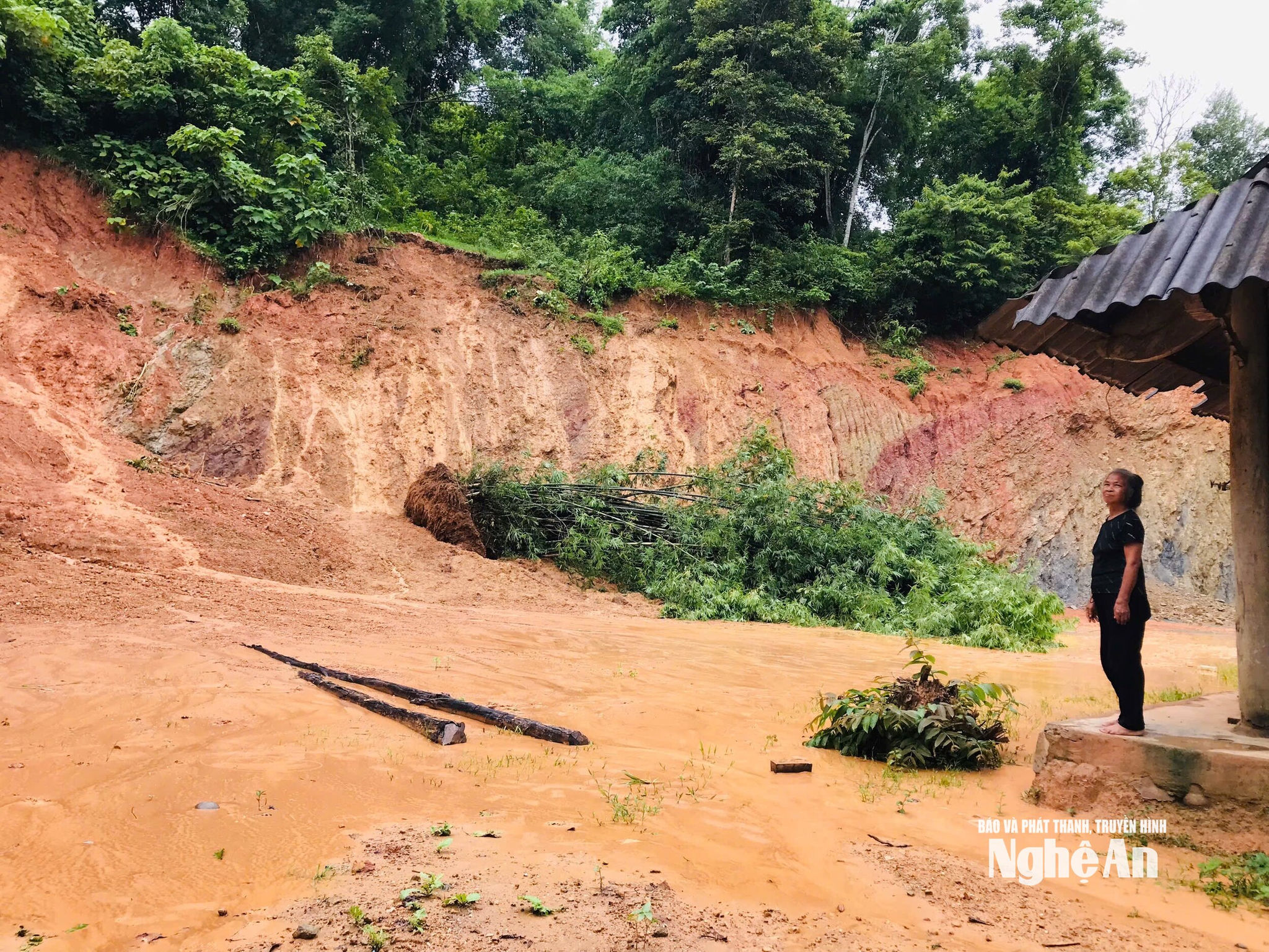
Mr. Vi Thanh Tung, Vice Chairman of the People's Committee of Yen Na commune, said: Due to the impact of floods, more than 15 landslides have occurred in the commune. During the heavy rain and floods on August 24th, Yen Na commune proactively evacuated all 45 households in Ve village, and on September 18th, evacuated 54 households in Huoi Pai village.
Similarly, in the border commune of Tri Le, prolonged heavy rains have caused serious landslides in the Lo Let stream area, in Kem Ai hamlet, Tan Thai village. At the scene, many wide cracks have appeared on the mountainside, along with deep erosion trenches, overhanging cliffs, and signs indicating that soil and rocks could continue to slide if the weather worsens. More dangerously, right at the foot of the slope is the Kem Ai residential area with dozens of households; in some locations, the landslides are only 3-5 meters from people's houses.
Mr. Ha Van Bay (60 years old), residing in Kem Ai hamlet, Tan Thai village, whose house is near the landslide site, added: When heavy rains caused the landslide, his family was evacuated to a safe place by the authorities. However, after returning, the worry remains constant whenever it rains.
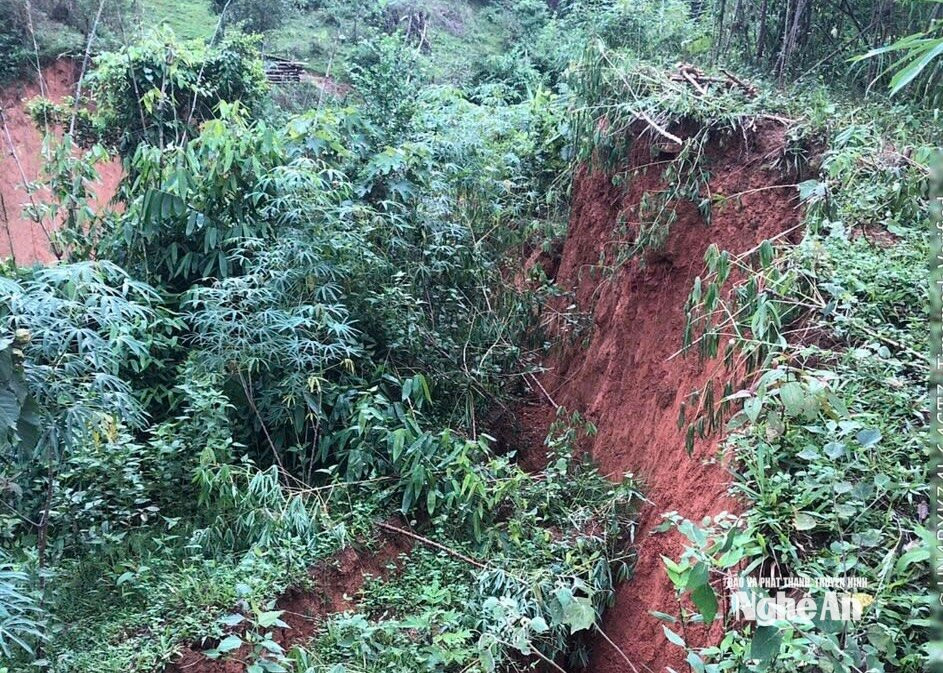
According to Mr. Lo Minh Diep, Chairman of the Tri Le Commune People's Committee, the landslide site in the Lo Let stream area is estimated to have a total volume of soil and rocks at risk of collapsing into the ground, reaching approximately 350,000 m³.
In response to this risk, the Provincial People's Committee has instructed relevant departments and agencies to coordinate with local authorities to urgently review and develop plans for the relocation and resettlement of affected households. Through surveys, Tri Le commune has identified 25 households that need to be relocated and integrated into Tan Thai village immediately.
The plan to support relocation and provide new housing is expected to be implemented according to Resolution No. 09/2024/NQ-HĐND dated June 7, 2024, of the Nghe An Provincial People's Council, with a support level of approximately 50 million VND per household. Local authorities will implement the relocation in September to help households quickly stabilize their lives and ensure long-term safety.
Landslides are also occurring in Tien Phong commune, and along National Highway 48, there are many locations where mountain landslides threaten the safety of residents.
Mr. Vi Van Nam, from Muong Hin village, said that the landslide is only about 5-7 meters from his house. Every time it rains, his family is worried. Since the beginning of August, his family has had to move to another place to ensure safety. At the scene, the landslide extends for more than 250 meters, with many new landslide marks appearing in several places. Trees have been uprooted, and bamboo and rocks hang precariously on the mountainside, posing a risk of further collapse at any time.
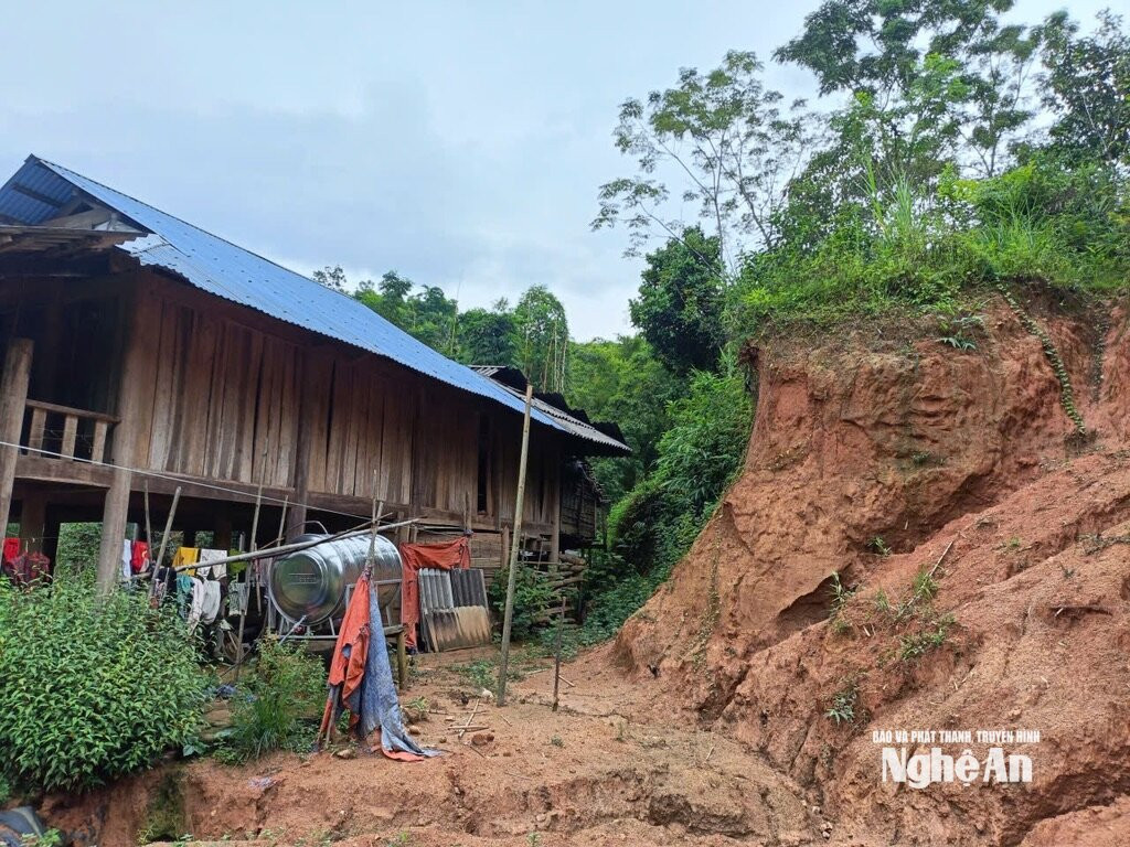
Ms. Lo Thi Nguyet, Chairwoman of the People's Committee of Tien Phong commune, said: The entire commune currently has 10 areas at high risk of landslides, directly affecting nearly 70 households in the villages of Muong Dan, Pieng Cu, Na Sanh, Muong Hin... The commune government has organized inspections and assessments of the current situation in the high-risk areas; at the same time, it has issued early warnings, encouraged people to proactively prevent and be ready to evacuate when required.
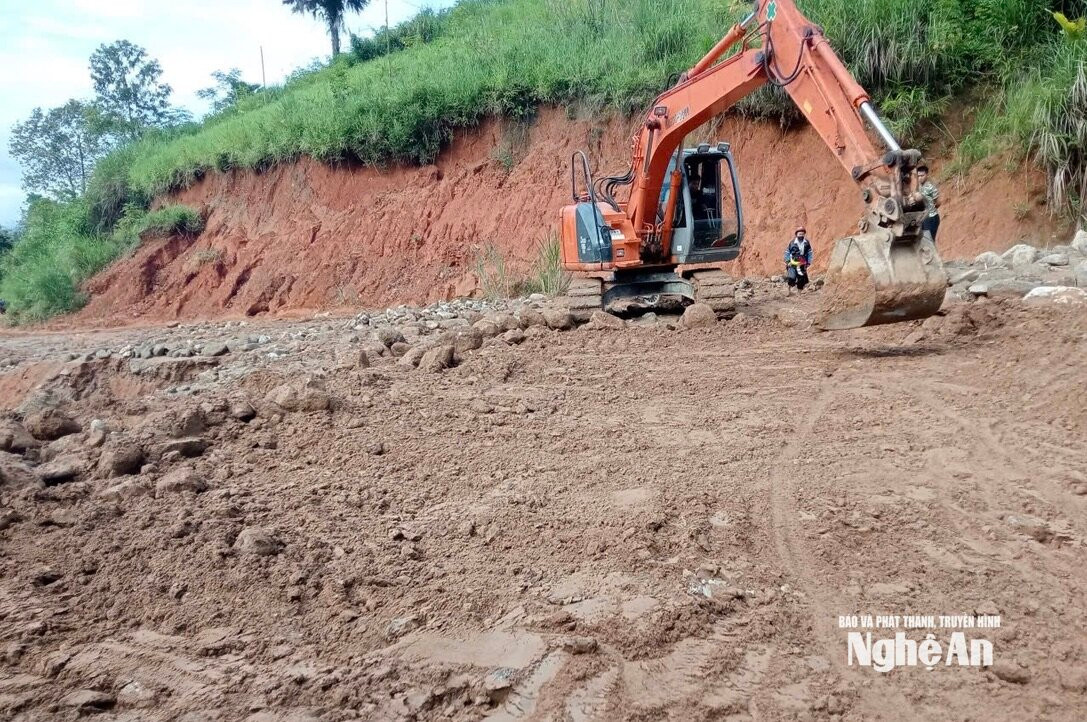
In Muong Long commune, the risk of landslides is also seriously affecting transportation. On August 31st, even though it wasn't raining, the road from Muong Long Sky Gate to the villages of Sa Lay, Tham Hang, and Tham Hoc was suddenly blocked by a torrent of soil and rocks cascading down from above. Hundreds of cubic meters of soil and rocks cut off traffic to the villages further inland. To ensure safety, Muong Long commune banned people and vehicles from passing through the dangerous area and opened a temporary road along the stream to facilitate travel.
Taking proactive measures early on minimizes damage.
According to a report by the Nghe An Provincial Department of Irrigation, the province currently has over 370 landslide sites, directly affecting nearly 4,000 households. The majority of these landslide sites are concentrated in the western communes of Nghe An, where the terrain is complex, economic conditions are difficult, and infrastructure and resources for disaster response are limited.
.jpeg)
Meanwhile, annual funding for disaster relief remains limited. In many areas, residents have to reinforce embankments, build stone retaining walls, or dig temporary drainage ditches to mitigate the risk of soil and rocks flooding their homes.
After prolonged periods of rain, the soil in mountainous areas is saturated with water, reducing the cohesion of soil and rocks and making the terrain unstable. If heavy rainfall continues, the accumulated water in the soil will increase pressure, keeping the risk of flash floods, landslides, and riverbank erosion high.
In light of this situation, local authorities are maintaining standby forces, closely monitoring weather developments, reviewing vulnerable areas, and preparing evacuation plans based on the "four on-the-spot" principle. The most important goal is to protect people's lives and prevent any passive or unexpected situations when natural disasters occur.
On August 6, 2026, the Provincial People's Committee issued Decision No. 3531/QD-UBND approving the 2026 disaster response plan, aiming to proactively minimize damage to people, property, and infrastructure in the face of unusual weather events. The focus of the plan is a system of eight emergency evacuation scenarios, designed in detail for each type of major disaster such as strong storms, tidal surges, flooding, flash floods, landslides, and dam and reservoir incidents.
For coastal areas, the province has prepared five evacuation scenarios (from scenario I to V) for 15 communes and wards, corresponding to storm levels from level 13 to super typhoon level 16 combined with high tides. In the most dangerous scenario, when a super typhoon of level 16 makes landfall causing water levels to rise to 7.7 meters, Nghe An province anticipates relocating more than 146,000 people, of which approximately 90,000 will be moved to centralized evacuation points. In addition, to respond to the risk of widespread flooding along the Ca River basin according to scenario VI, the locality has prepared a plan to evacuate more than 94,000 people when water levels reach the emergency alert threshold.
In mountainous and hilly areas, Scenario VII focuses on addressing flash flood and landslide risks in 66 communes and wards by requiring the urgent relocation of 2,811 households immediately upon warning of prolonged heavy rainfall. Scenario VIII prepares evacuation plans for over 11,000 people living around 16 reservoirs at risk of failure, along with over 41,000 people in downstream areas of large reservoirs such as Vuc Mau and Song Sao, in the event of emergency flood releases. Nghe An province requires all levels and sectors to review their forces, prepare sufficient equipment and supplies, and prioritize the protection of vulnerable groups to ensure that rescue and response efforts are safe, timely, and coordinated.
Given the inability to completely address all landslide-prone areas, the most immediate and effective solution remains proactive prevention. Authorities must regularly inspect, review, and update maps of dangerous areas, and develop specific evacuation plans for each residential area; at the same time, people need to increase vigilance and not become complacent by returning to live in areas that have been warned as dangerous.


