
List of flooded areas in Hanoi on the morning of October 7th.
The heavy rain on the morning of October 7th caused severe flooding in many areas of Hanoi, concentrated in the inner districts and riverside areas, disrupting traffic during rush hour.
According to the Hanoi City Technical Infrastructure Management Center, as of 10:00 AM on October 7th, dozens of flooded areas had been recorded in the To Lich, Nhue River, and Long Bien districts of the city. The average flood level was 20-25 cm, causing localized traffic congestion on many streets.
To Lich River Basin: Many streets are deeply and extensively flooded.
According to the Hanoi City Technical Infrastructure Management Center, as of 7:00 AM on October 7th, a series of flooded areas appeared in the To Lich basin, including:
Thuy Khue Street (section from Chu Van An School to La Pho slope)
Mac Thi Buoi Street
Minh Khai Street (at the foot of Vinh Tuy Bridge)
Bui Xuong Trach Street (from house number 49 to 93 Bui Xuong Trach Street)
Huynh Thuc Khang Street (intersection of Nguyen Hong and Alley 14 Huynh Thuc Khang)
Thanh Cong area (in front of the ward's People's Committee office)
Many sections were flooded to a depth of 20-25 cm, making it difficult for motorbikes and cars to move, especially in the Bui Xuong Trach and Huynh Thuc Khang areas where the water rose rapidly due to the low-lying terrain.
Nhuệ River Basin: the most flooded area in the capital.
The Nhuệ River basin area was most severely affected, with numerous localized flooding points recorded at:
My Dinh - Thien Hien intersection
Le Duc Tho Street (My Dinh Stadium Square)
Phu Xa Street (Phu Xa – Phuc Hoa intersection)
Duong Dinh Nghe Street – Nam Trung Yen (behind Keangnam Tower)
Vo Chi Cong Street (in front of the UDIC building)
Hoang Quoc Viet Street (near the University of Electrical Engineering)
Phan Van Truong Street (market gate – military barracks)
Hoa Bang Street (alley 99)
Tran Cung Street (A38 gas station)
Tran Binh Street (from Mai Dich Ward People's Committee to 19/8 Hospital)
Do Duc Duc Street (the road leading to Dam Temple)
Nguyen Trai Street (in front of the University of Social Sciences and Humanities – even-numbered bus lane)
Quan Nhan Street
Quang Trung Street (in front of Nguyen Hue High School and opposite La Khe train station)
Yen Nghia area (from Yen Nghia bus station to Ba La intersection)
Xom Street (the section opposite Hai Phat building)
Le Loi – Tran Hung Dao area (around Ha Dong market)
Victory Road
To Hieu Street (in front of the Tax Office and HUD3 building)
National Highway 6 (section in residential areas 1 and 4, Yen Nghia ward)
Area TT18, Phu La Ward
Van Quan urban area (at the end of Nguyen Khuyen street, intersecting with Nguyen Son Ha and Bach Thai Buoi streets)
Tay Mo Street (from the old Committee gate to Trien Bridge)
Xuan Phuong Street (house number 268)
This area has high traffic density and many low-lying roads, making drainage difficult.
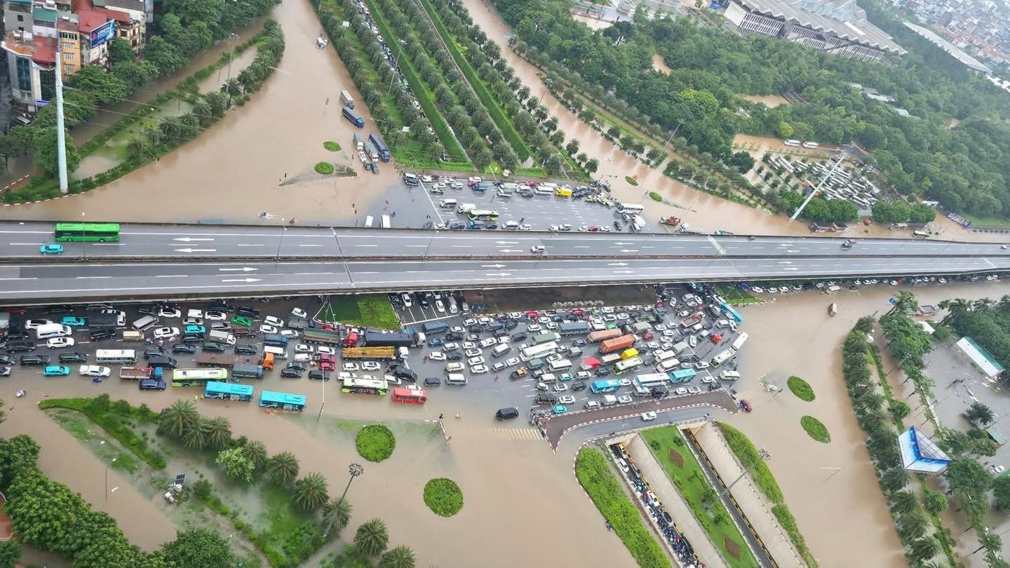
Long Bien Basin: flooding around Aeon Mall and residential areas.
In the Long Bien basin, many main streets were flooded, including:
Ngoc Lam Street (from Long Bien 1 intersection to Gia Lam Urban Environmental Enterprise)
Duc Giang Street (from Duc Hoa Market to Alley 97)
Dam Quang Trung Street (in front of and opposite Aeon Mall supermarket)
Co Linh Street (in front of and opposite Long Bien Secondary School)
Vu Xuan Thieu Street, Hoa Lam, Le Mat, Alley 80 Hoa Lam, Nam Duong, Phu Vien
The areas around Aeon Mall and Vinh Tuy Bridge were the most severely flooded due to heavy rain combined with rising water levels from a slow drainage system.
National and provincial roads also experienced localized flooding.
Some of Hanoi's main thoroughfares were also not immune to flooding:
Under the railway tunnel on Thien Duc Street
National Highway 3 (Huong Ninh village, Ma Street section, Go Soi Street section, Duoc Ha village gate, under Phu Lo bridge)
National Highway 32 (Hoai Duc welcome gate, opposite Ngoa Long street, near Phu Dien train station)
Van Tien Dung Street (section intersecting with National Highway 32)
Ngoc Truc Street
These areas were flooded to an average depth of 20–25 cm, causing traffic to slow down and many vehicles to break down.
Hanoi mobilizes all pumping stations to drain floodwater.
Hanoi Drainage Company Limited has operated the entire pumping station system, including Yen So, Dong Bong 2, Co Nhue, Dong Tru, Da Sy, Ha Tri, Mau Luong, DPS, Cau Chui, Dong Tru… to reduce water levels in the system.
At the same time, the city coordinated with the Department of Agriculture and Environment to operate the Yen Nghia, Khe Tang, and Dao Nguyen stations to help lower the water level of the Nhue River and drain water from urban areas in the west.
The standby forces continued to clear debris at the inlet, open the sluice gates, ensure the free flow of water, and provide continuous updates on weather developments.
People should avoid traveling through areas with deep flooding such as Nguyen Trai, Quang Trung (Ha Dong), Huynh Thuc Khang, Le Duc Tho, and the area around Aeon Mall Long Bien.
Private vehicles should stop or choose higher routes to ensure safety during the morning and midday of October 7th.
Rain is expected to continue throughout the morning, so localized flooding in Hanoi may persist until early afternoon.


