Vietnamese
Vietnamese
English
French
Русский
Listen to An News
Nghe An Daily
Nghe An Weekend
Log in
Nghe An Newspaper:
Nghe An Television:
Latest
Current Affairs
Forum
Human Resources
New policy
Party building
Protecting the ideological foundation
Putting the resolution into practice.
Economy
Industrial
Agriculture
Market
Real estate
Car
International
Comment
News
Society
Bridge of Compassion
Religion - Beliefs
Culture
National Defense
Tourism
Poetry - Stories
Education
Law
Security and Order
Advise
Case file
Sport
SLNA
Domestic
Nghe An Newspaper and Radio Cup
International
Business networking
Classified ads
Health
Advise
Medicine & Nutrition
Health & Beauty
News
Labor
Job
Entertainment
Showbiz
Short Video
Reflection
Digital transformation
Technology
Storm forecast
Latest news related to storm forecasts.
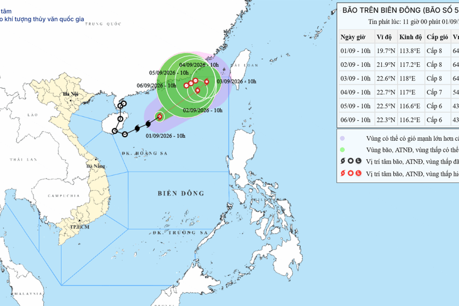
Forecast for Typhoon No. 5 in the Northern East Sea on September 1, 2026: Gusts of wind up to level 10, very rough seas.
At 10:00 AM on September 1, 2026, Typhoon No. 5 reached wind speeds of level 8, gusting to level 10 in the northern part of the East Sea, with waves reaching 4-6 meters in height, posing a level 3 natural disaster risk to ships and boats.
Economy
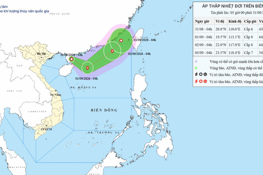
The tropical depression in the East Sea on August 31, 2026 has the potential to strengthen into a Category 8 typhoon with gusts up to Category 10.
On the morning of August 31, 2026, the tropical depression in the East Sea is forecast to strengthen into a typhoon with wind gusts of level 10, and the northern part of the East Sea will face large waves from 3 to 5 meters high.
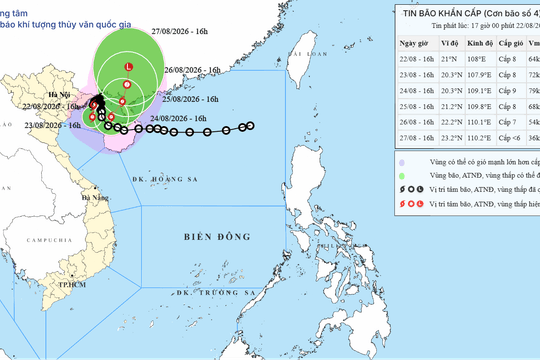
Urgent storm warning No. 4, August 22, 2026: Very heavy rain and gusts of wind up to level 10 in Quang Ninh and Hai Phong.
Typhoon No. 4 maintained wind gusts of level 10 in the sea area of Quang Ninh - Hai Phong, causing very heavy rain of over 400mm in the Northeast region from the evening of August 22nd to the end of August 24th, 2026.
Latest update on Typhoon No. 2 on July 25, 2026: Wind speed level 12, gusts level 15 in the Northern East Sea.
Typhoon No. 2 reached intensity level 12, with gusts up to level 15, in the northeastern part of the North East Sea, moving northwest towards Guangdong province.
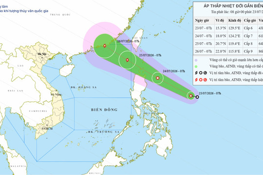
Tropical depression near the East Sea on July 23, 2026: Forecast to strengthen into a typhoon, with gusts up to level 10.
The tropical depression is moving rapidly towards the South China Sea, forecast to strengthen into a typhoon by July 25, 2026, causing strong winds of level 8 and high waves in the northern South China Sea.
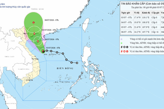
Emergency storm warning #1, July 3, 2026: Heading towards Quang Ninh, warning of very heavy rain.
Typhoon No. 1 is expected to make landfall on the coast of Quang Ninh province on the morning of July 5, 2026, with wind speeds of level 8. The Northeast region and Thanh Hoa province face the risk of localized heavy rainfall exceeding 350mm.
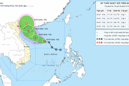
Tropical depression in the South China Sea on July 2nd, 2026: Potential to strengthen into a typhoon.
At 7:00 AM on July 2nd, 2026, the tropical depression was located 240km from Hoang Sa, with wind speeds of level 7, gusting to level 9. This weather system is forecast to strengthen into a typhoon within the next 24 hours.
Chairman of the Provincial People's Committee Le Hong Vinh inspects and gathers information on storm forecasts at the Vinh Weather Radar Station.
August 25, 2025 17:25
On the afternoon of August 25th, following a meeting at the Forward Command Post, Comrade Le Hong Vinh - Deputy Secretary of the Provincial Party Committee and Chairman of the Provincial People's Committee - personally inspected, gathered information, analyzed, and forecasted Typhoon No. 5 at...
Typhoon No. 5 is forecast to move quickly, intensifying by four levels today and tomorrow.
August 23, 2025 10:53
On the morning of August 23rd, the tropical depression intensified into Typhoon No. 5 (Kajiki). Forecasts indicate that the typhoon's intensity will continue to increase today and tomorrow, potentially reaching level 12 (118-133 km/h), with gusts up to level 15.
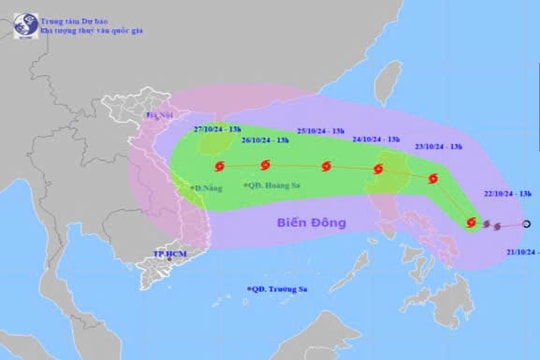
Storm warning near the South China Sea (Typhoon TRAMI)
October 22, 2024 15:04
Early in the morning of October 22nd, the tropical depression in the waters east of the Philippines strengthened into a typhoon and was given the international name TRAMI.
See more
POWERED BY
FREE
CMS
- A PRODUCT OF
NEKO
×
Log in
Log in with Google





.jpg "Bão số 5 dự báo đi nhanh, tăng liền 4 cấp trong hôm nay và ngày mai")