Vietnamese
Landslide in production area along Lam River in Long Xa Commune (Hung Nguyen). Clip: QA |
Present at the Lam River bank fields in Long Xa commune,Hung Nguyen district, about 2 km from the Ta Lam dike road, layers of soil and sand were eroded strongly, pieces of soil drifted along the Lam river, leaving the riverbank cracked and bare...
In the Lam River bank area in Long Xa commune, people often focus on growing crops such as corn, beans, peanuts, and vegetables, but at this time, although it is the main winter crop, no crops are cultivated in this area.
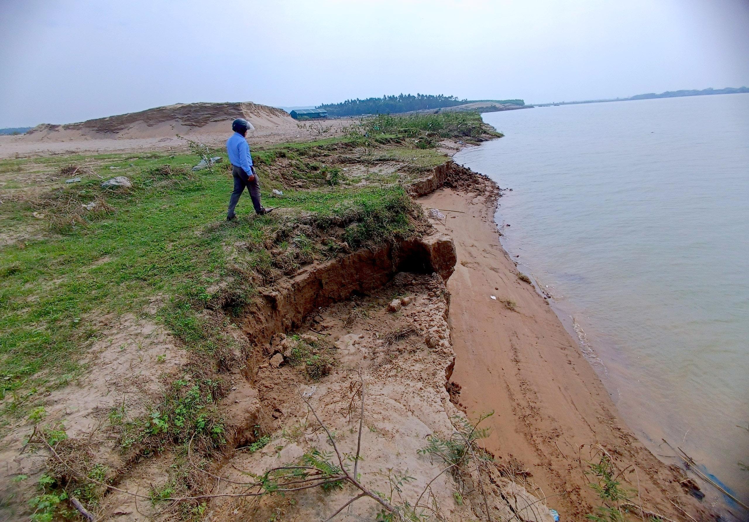 |
Landslides in Long Xa commune, Hung Nguyen district occurred seriously after the recent floods. Photo: QA |
Looking at the gradually shrinking crop fields, Mr. Nguyen Van Hung, a farmer in Long Xa commune, sighed: "Every year, we usually grow two crops in this area. However, due to the severe erosion of the riverbank, there were times after the rain and storms that the soil, sand, and seedlings were also washed away. We are all afraid, so since the beginning of the year we have not dared to cultivate here anymore...".
Some households that are still staying have also moved the planting area further to ensure safety, although this is only a temporary solution. Mr. Nguyen Hai Duong in Long Xa commune said: We produce high-tech burdock, in 2021, planted on an area of nearly 4 hectares, however, due to concerns about landslides, this year we only dare to plant 2 hectares in the beach area. The planting area is also about 50 meters back compared to last year. If there are no remedial measures, the loss of production land of the people will become more and more serious, the production land area is limited, it cannot be moved back forever...".
According to Long Xa commune, the landslide area along the Lam river bank is about 700 meters long, about 30 meters deep, with an area of about 2 hectares. This is 5% of the land managed by the commune and is the traditional vegetable growing land of the local people. However, people no longer dare to cultivate this area.
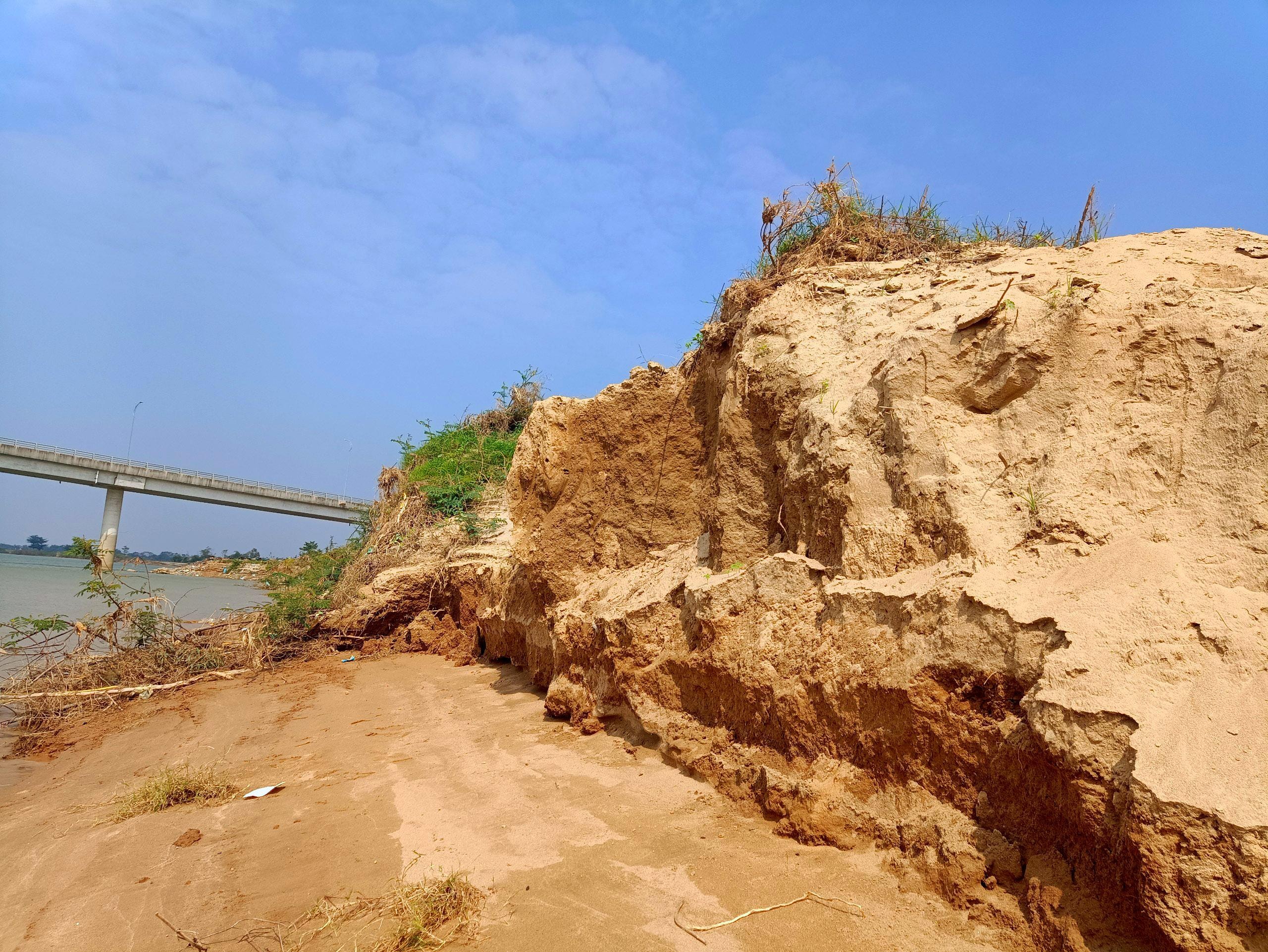 |
People's productive land is often washed away by the Lam River. Photo: QA |
Ms. Nguyen Thi Tuyet - Chairman of Long Xa Commune People's Committee said: The situation of landslides and loss of productive land along Lam River has been happening for many years, and after the flood in October, it became more serious. The locality has moved the safety distance signs twice. Currently, the most feasible solution is to carry out construction and rebuild the riverbank, however, the locality's capacity cannot do it, so the commune has sent a report to Hung Nguyen District People's Committee for solutions.
In Hung Linh commune, although the river bank has been embanked to minimize the risk of landslides and loss of productive land, in the recent flood, the embankment here was also damaged for about 150 meters, deeply eating into the productive land of the people. Mr. Hoang Nghia Quang - Chairman of Hung Linh Commune People's Committee said: Lam River embankment was built nearly 10 years ago, protecting the local beach area; after the recent flood, the embankment was also severely damaged, if there are no timely measures to handle it, the loss of productive land is also entirely possible.
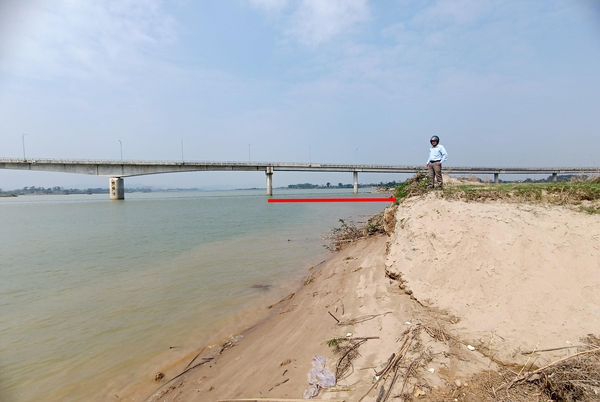 |
The Lam River bank location many years ago is now being eroded dozens of meters each year. Photo: QA |
Discussing this issue, Mr. Hoang Anh Tien - Vice Chairman of Hung Nguyen District People's Committee said: Landslides and embankments along the Lam River have been common in recent times. After receiving reports from localities, the district has established a working group to inspect and measure the area of landslides and damage. The most feasible option is to build a stone embankment in Long Xa commune and upgrade the embankment in Hung Linh commune. However, the estimated capital for implementation is very large (about over 100 billion VND), exceeding the district's conditions. Therefore, Hung Nguyen district has also reported to Nghe An Provincial People's Committee and the Ministry of Agriculture and Rural Development to have a plan to support the locality.
In the immediate future, the district has directed localities in landslide areas to put up safety warning signs for people, and at the same time, check and evaluate safe fertile land areas that can be cultivated for people to produce, not leaving land vacant. In addition, monitor the development of natural disasters to have timely preventive measures.

.jpg "Tiến sĩ, bác sĩ Nguyễn Khánh Toàn - người được bệnh nhân ung thư gửi gắm tin yêu")


")
Managing agency: Nghe An Provincial Party Committee
Editor-in-Chief: Tran Minh Ngoc
Electronic newspaper operating license number: 153/GP-BTTTT
Issued by the Ministry of Information and Communications on March 24, 2022


")

")
