Unlocking the potential of the mountains and forests.
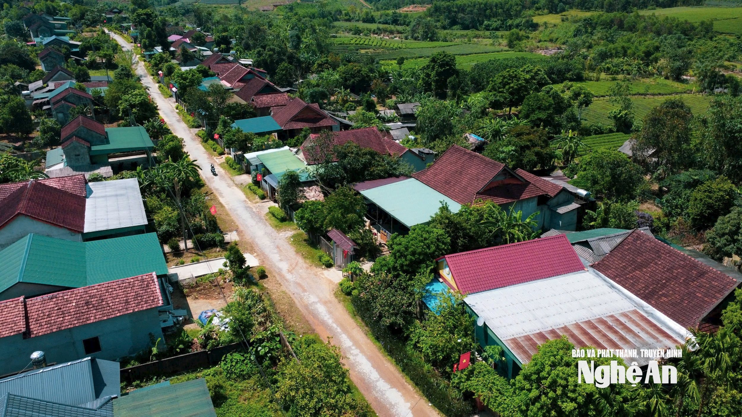
Son Lam, a name that is both strange and familiar. Strange because it is the new name for the two border communes of Ngoc Lam and Thanh Son (formerly Thanh Chuong district) after their merger, familiar because this resettlement area for the Ban Ve Hydropower Project still faces many difficulties, but for quite some time it has been known as a place blessed by nature with many beautiful landscapes…
- Notes -
JapanLan - Vinh Hoang•19/10/2025
Son Lam, a name that is both strange and familiar. Strange because it is the new name for the two border communes of Ngoc Lam and Thanh Son (formerly Thanh Chuong district) after their merger, familiar because this resettlement area for the Ban Ve Hydropower Project still faces many difficulties, but for quite some time it has been known as a place blessed by nature with many beautiful landscapes…
.png)
In Son Lam commune, after three months of the new administration's operation, one might expect that discussions would focus on the difficulties. But no. Right from the start, the Chairman of the People's Committee, Trinh Van Bang, boasted about Son Lam's untapped potential. He then affirmed: "One of the key tasks of the entire commune's political system in this term is socio-economic development. In reality, there is much room for Son Lam to develop…"
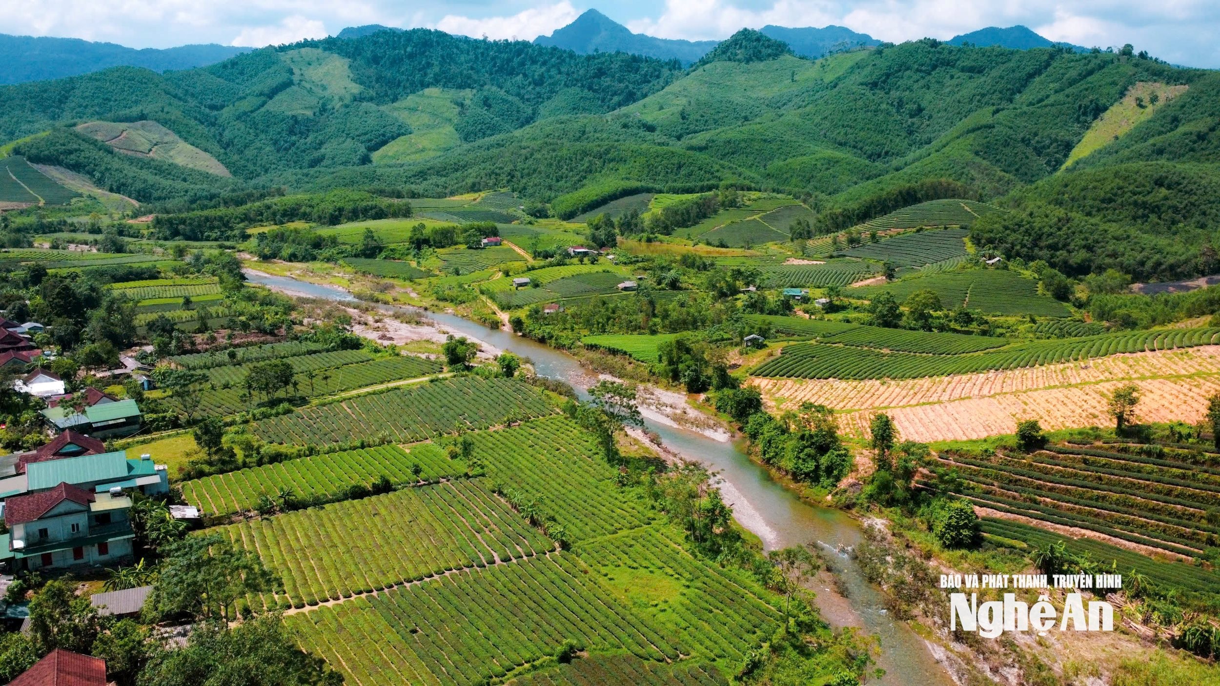
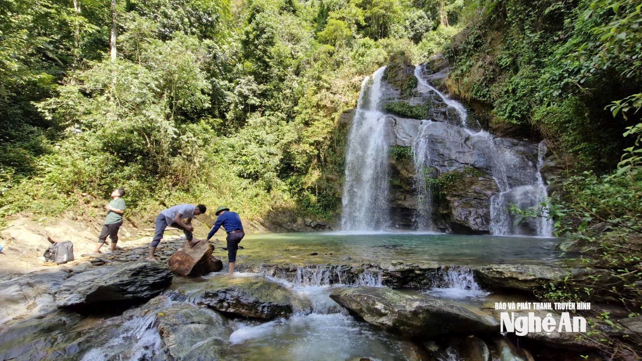
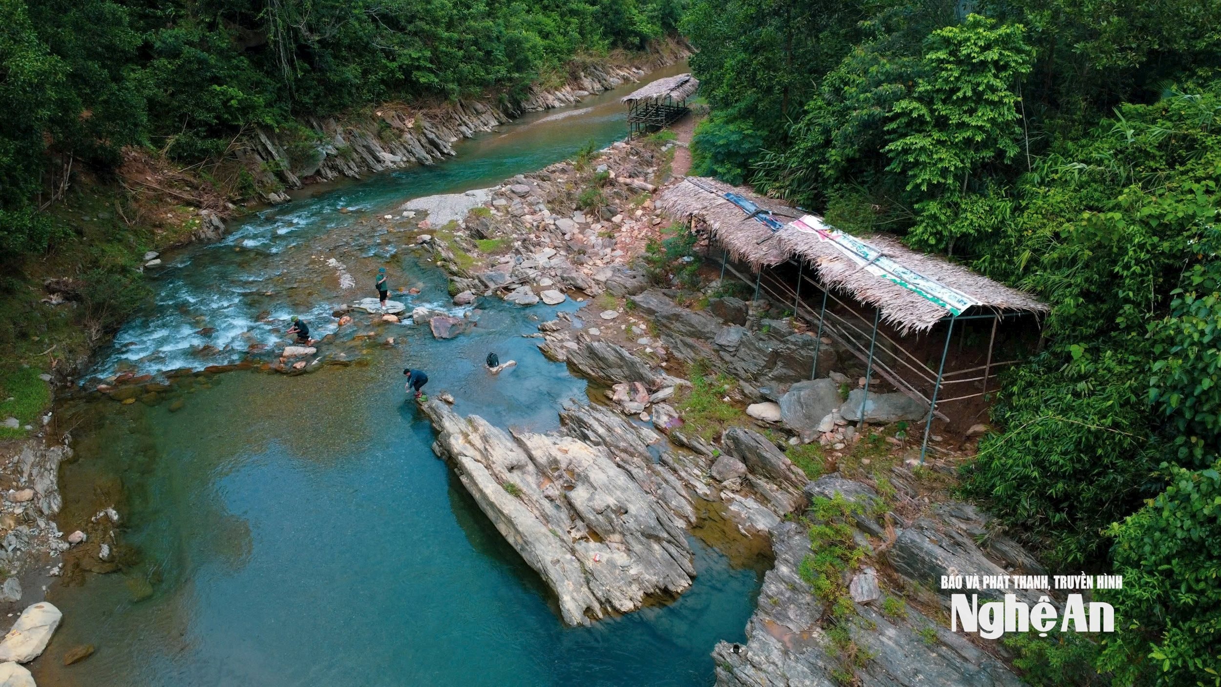
Among the potentials that Son Lam commune has identified as needing to be promoted and become a breakthrough in socio-economic development, as mentioned by the Chairman, are eco-tourism potential linked to the unique culture of ethnic minorities and scenic spots such as: Mua Waterfall, Lua Waterfall, Liep Waterfall, and Tan Sang stream beach. Of these, we visited Liep Waterfall. Liep Waterfall is located in the former Thanh Son commune, within a natural forest area managed by the Thanh Chuong Protective Forest Management Board, and has a fairly convenient concrete road leading to it.
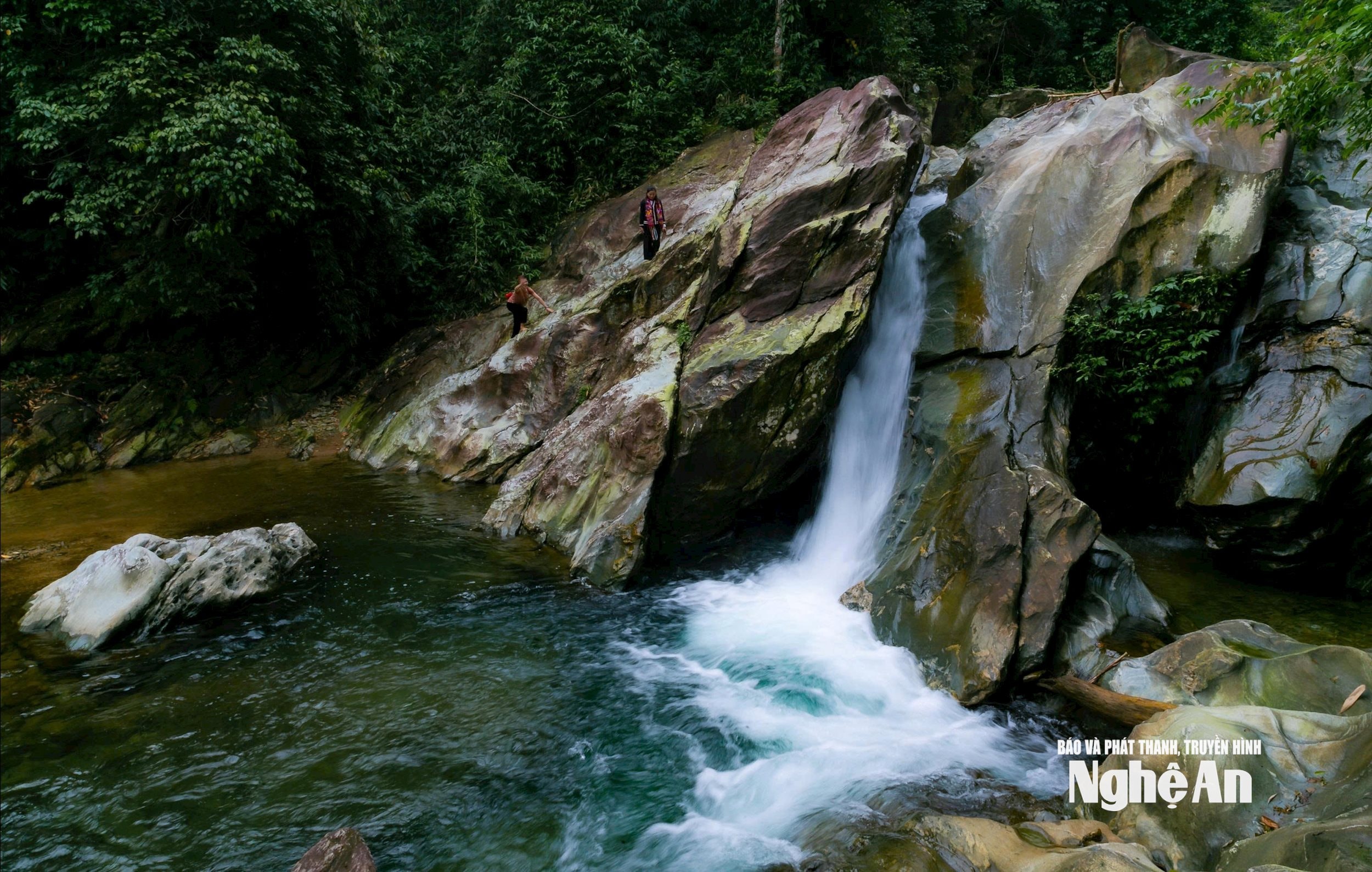
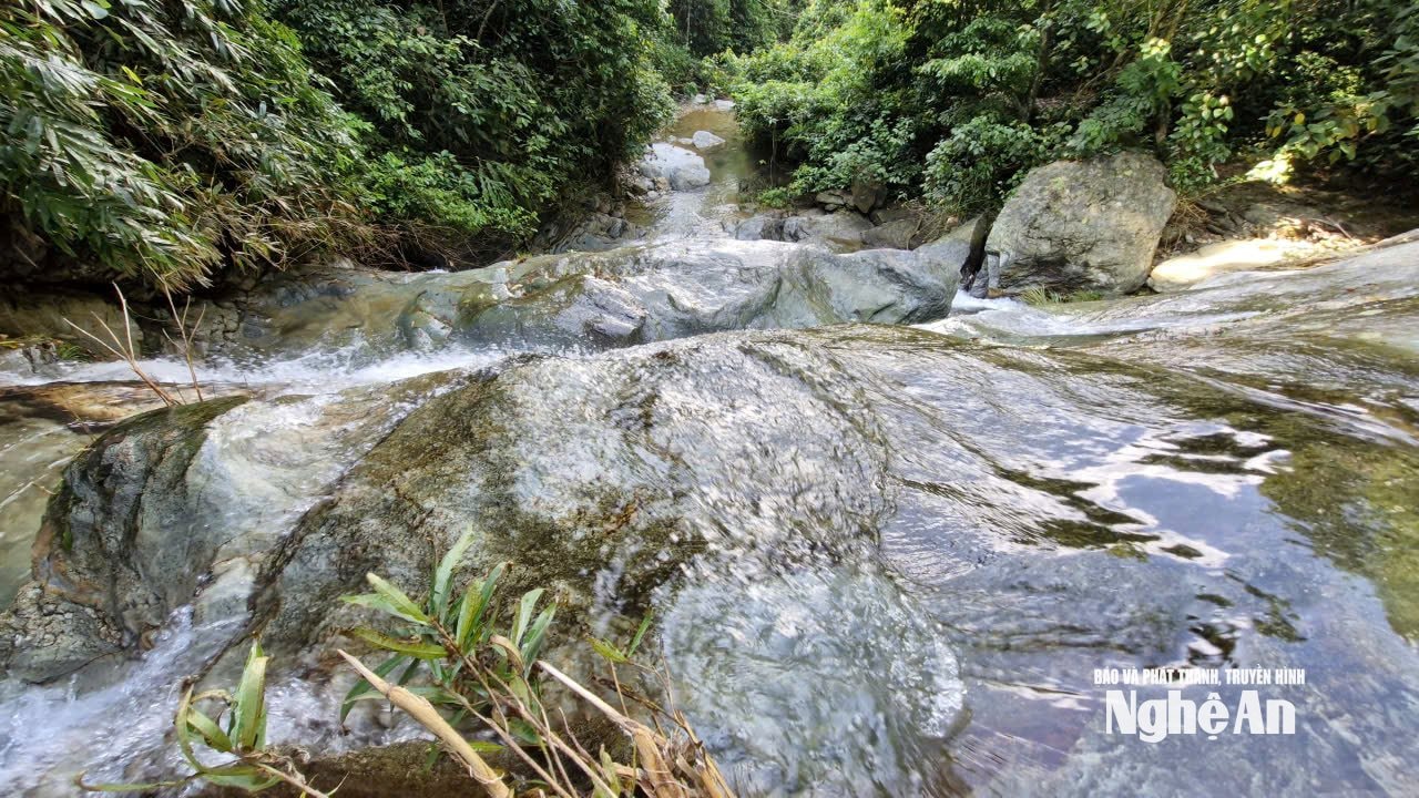
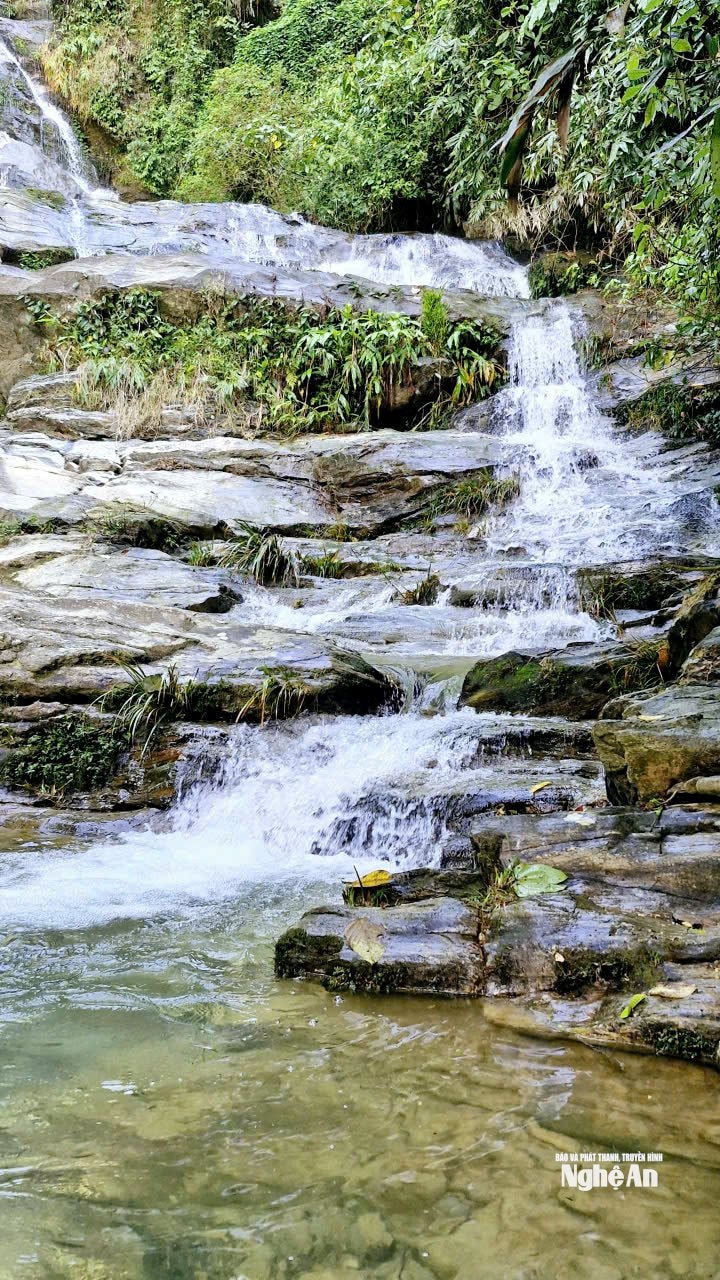
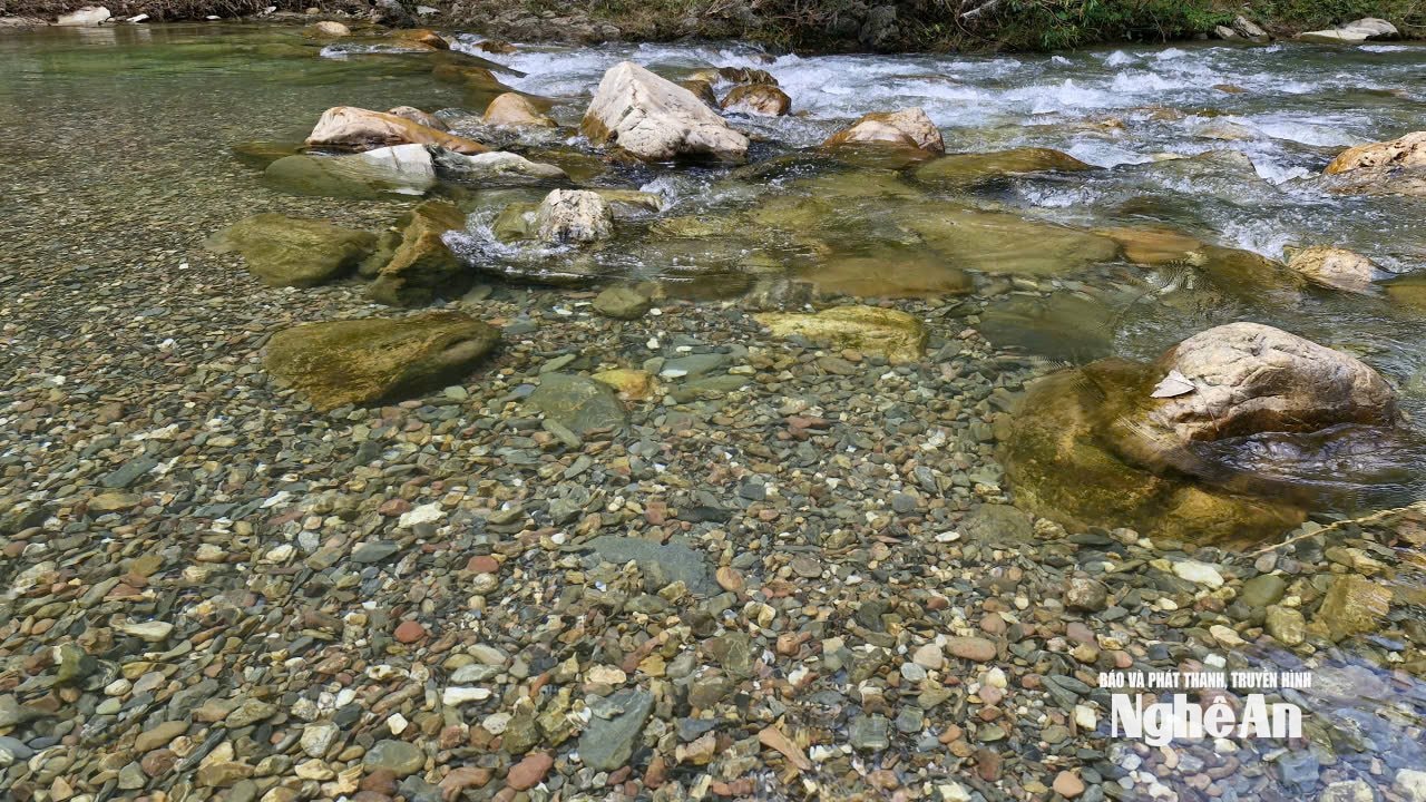
Despite its relatively low altitude, Liếp Waterfall possesses a pristine, unspoiled natural beauty. Part of the Lý stream, stretching over 100 meters, Liếp Waterfall stands out thanks to its striking, large, flat, swirling, liver-colored rock formations stacked upon each other, creating unique and beautiful shapes. Crystal-clear water flows from the deep forest, cascading over the rocks and forming waterfalls. Below the waterfalls, depressions form pools of clear water. Along the waterfall, forests stretch endlessly, with a variety of lush green trees, adding to the natural beauty and providing a consistently cool and refreshing atmosphere.
The Chairman of the People's Committee of Son Lam commune agreed with our impression of Liep waterfall, but said: "Since coming here for work, I've heard from colleagues and many locals that Mua waterfall, Lua waterfall, and Tan Sang stream bathing area are even more beautiful than Liep waterfall. The work of the new government has been too busy, I haven't been to Lua waterfall yet, but I have visited Liep waterfall, Mua waterfall, and Tan Sang stream bathing area. I also share that opinion…" Chairman Trinh Van Bang's comment prompted us to quickly end our conversation and embark on an interesting experience at Mua waterfall and Tan Sang stream bathing area.
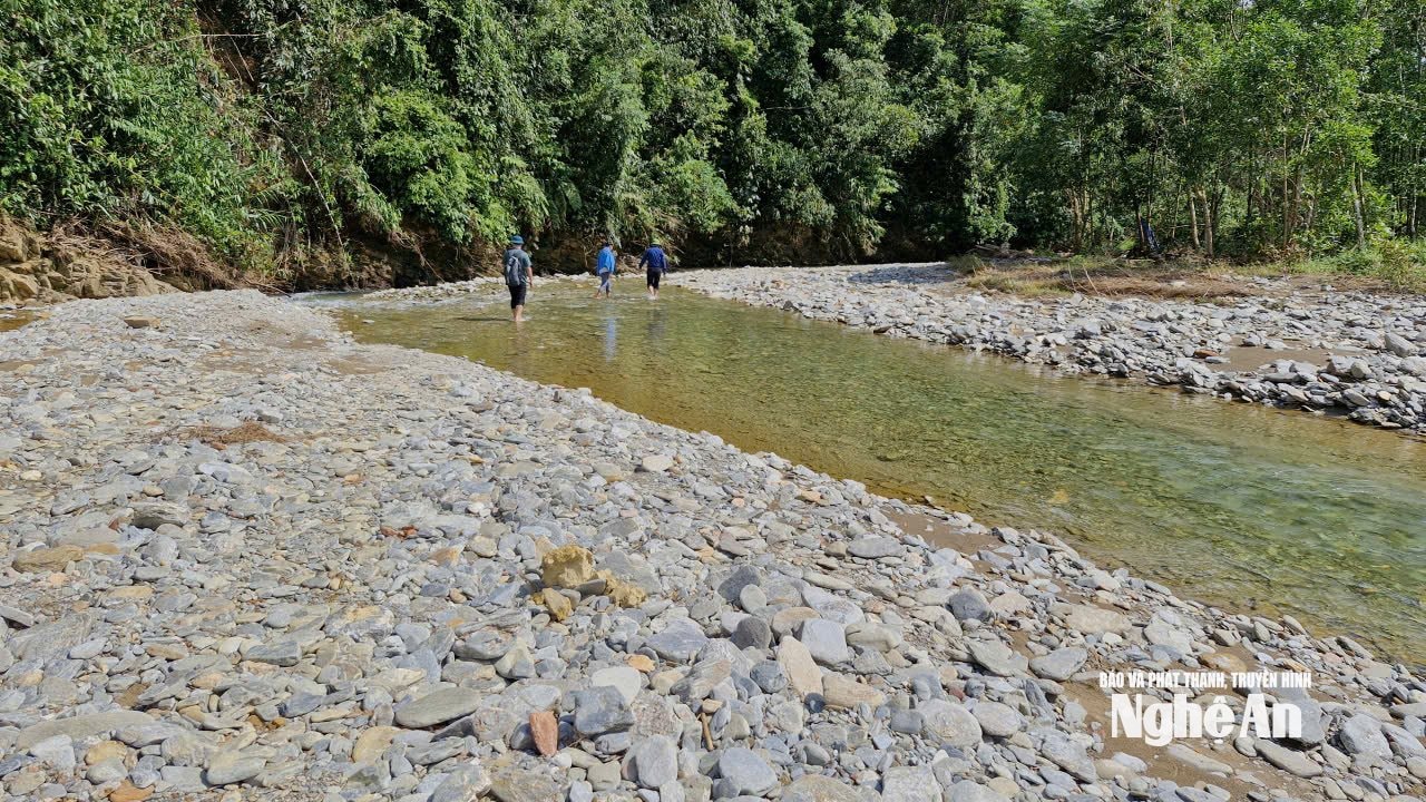
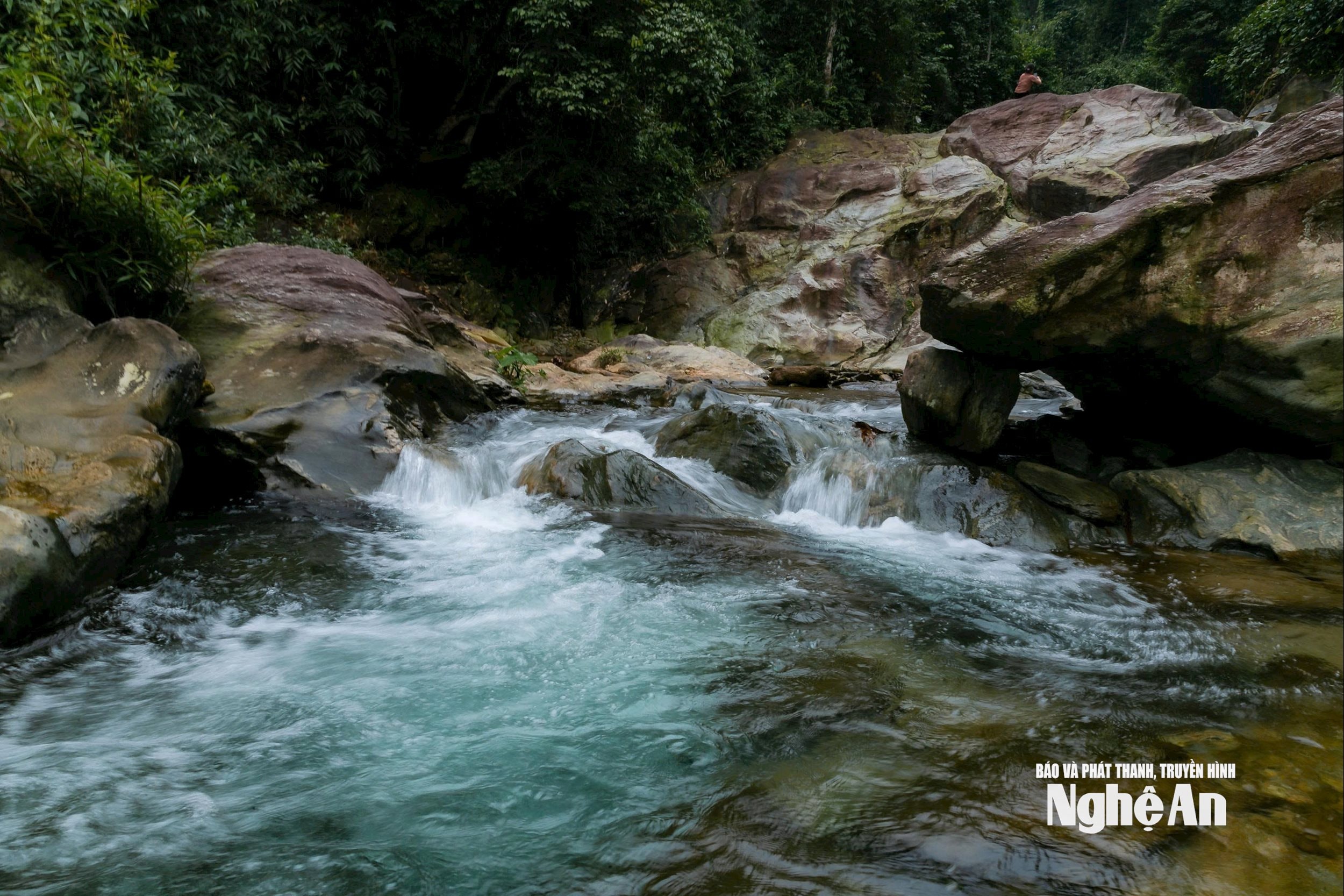
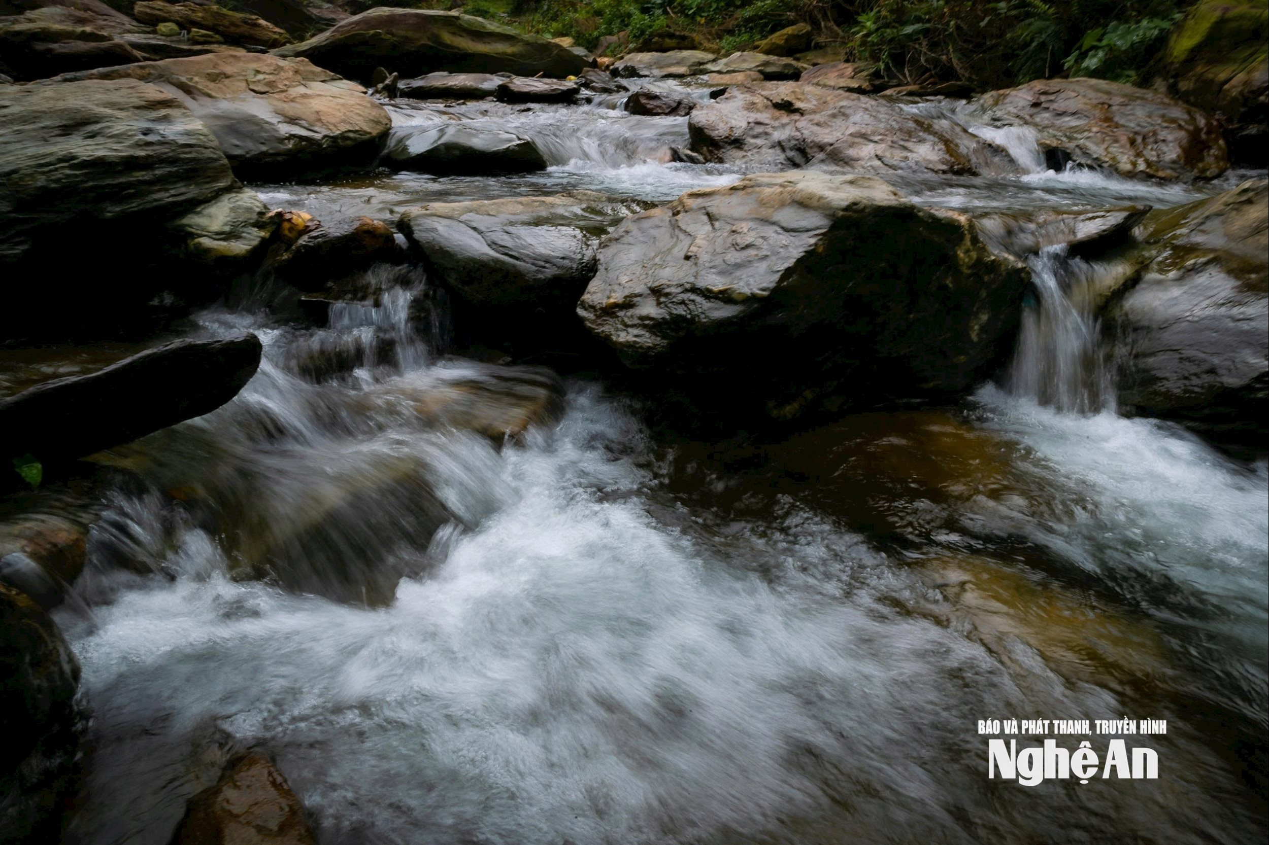
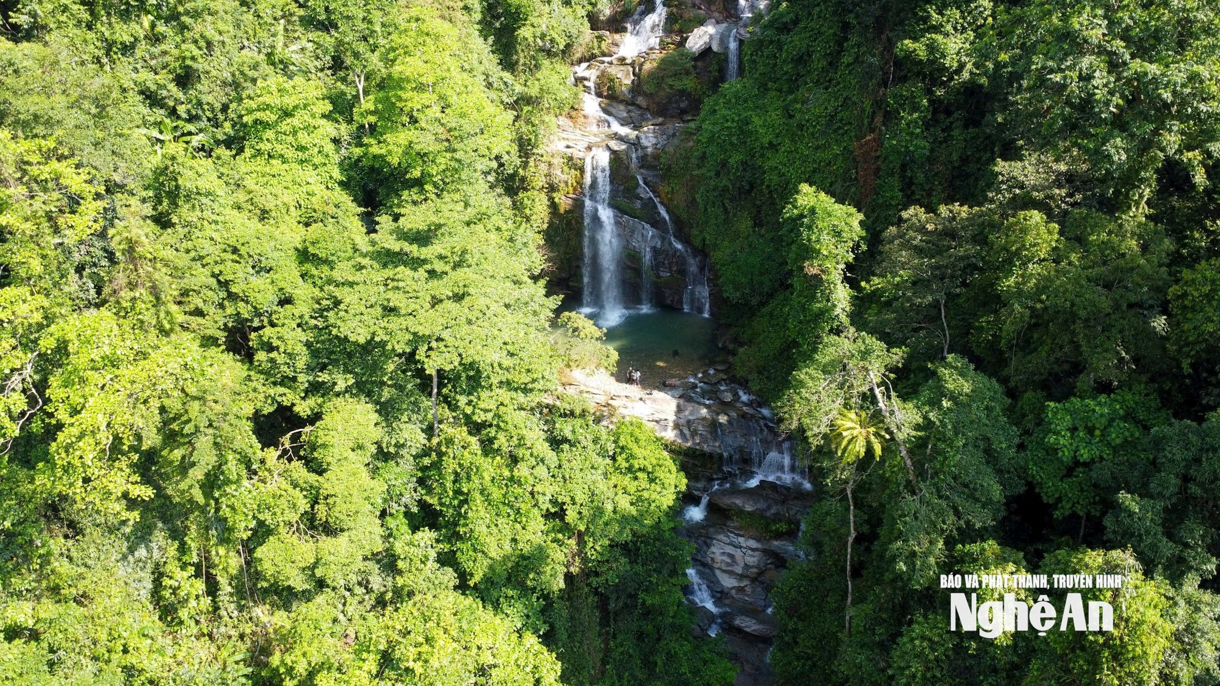
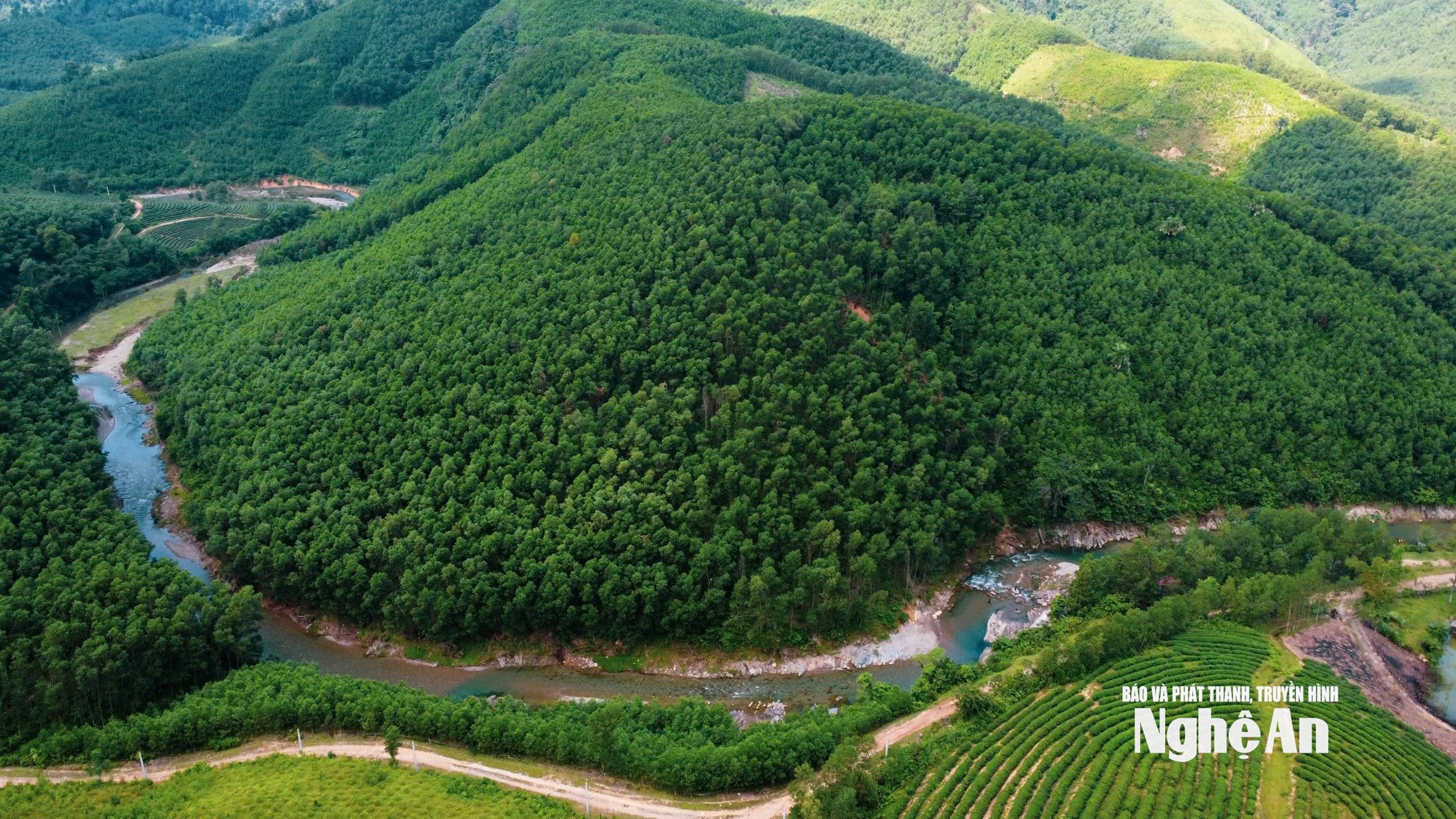
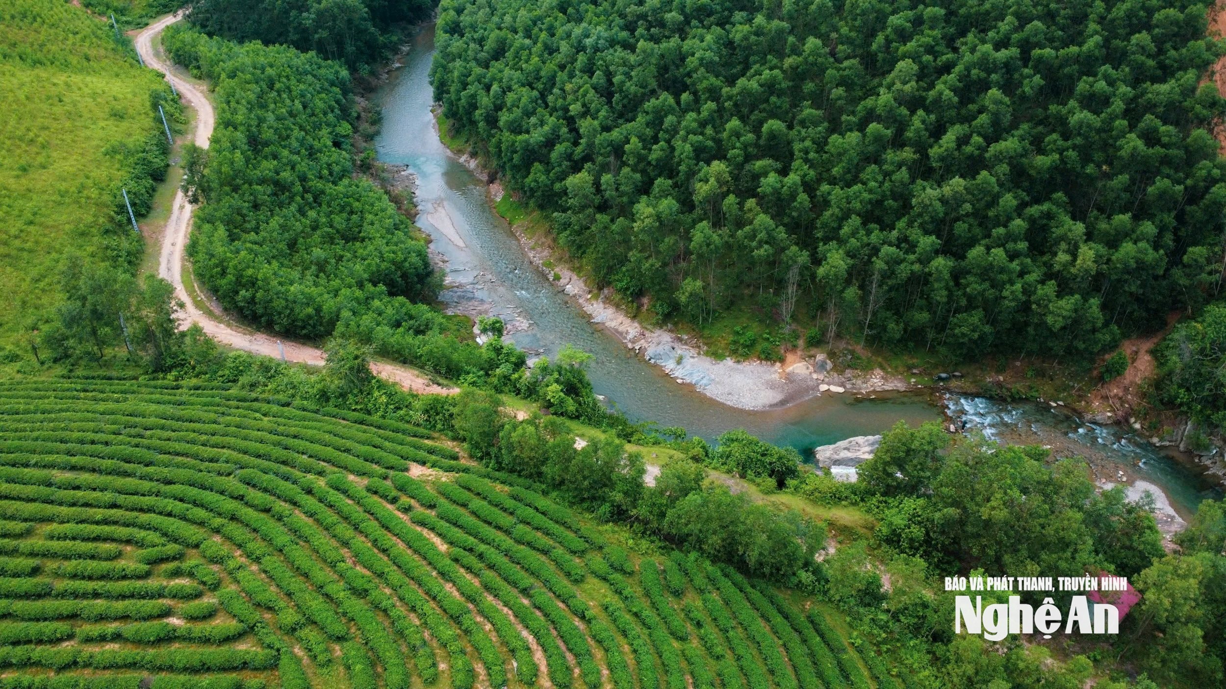
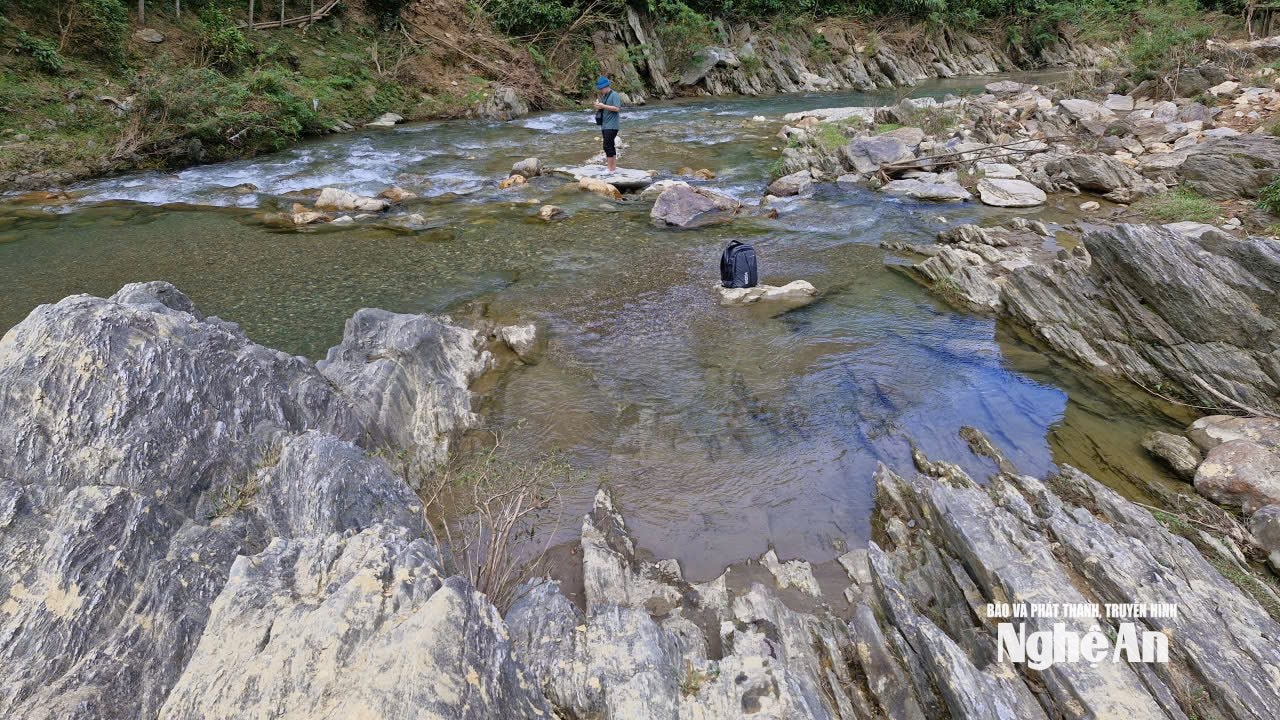
To reach Mưa Waterfall (located in Tân Lâm village), it's about a 6km motorbike ride from Sơn Lâm commune headquarters (formerly Ngọc Lâm commune headquarters), then a 20-minute walk along the stream. The experience was incredibly enjoyable. The enjoyment began during the walk along the stream, admiring and wading through the cool, clear water winding around flat, gray-white pebble beaches. Mưa Waterfall shares many similarities with Kèm Waterfall – a large and famous waterfall in Pù Mát National Park, one of the most beautiful in Nghệ An province.
The Rain Waterfall is about 40-50 meters high, like a giant white silk ribbon carrying very clean, clear spring water down to a natural rocky reservoir about several hundred square meters wide. Viewing the Rain Waterfall from a drone, you can also see many more tiers of waterfalls with seemingly indefinite lengths, gracefully winding through the mountains, forests, and lush green vegetation. Within the waterfall itself, there are also flat, eroded rock formations where visitors can stop to relax, admire the natural scenery, enjoy the cool air, take photos, or playfully interact with the waterwheels churning up white foam…
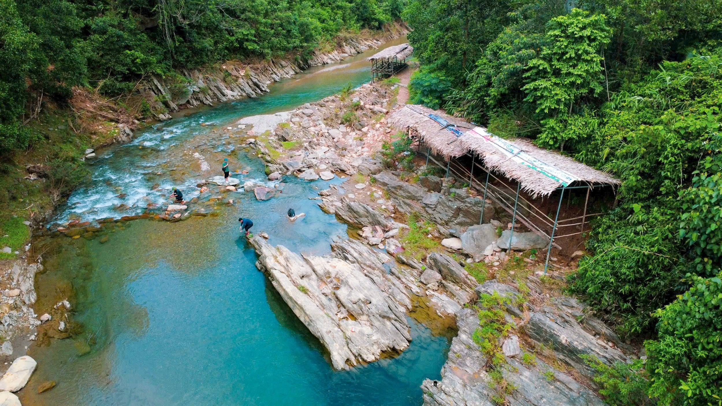
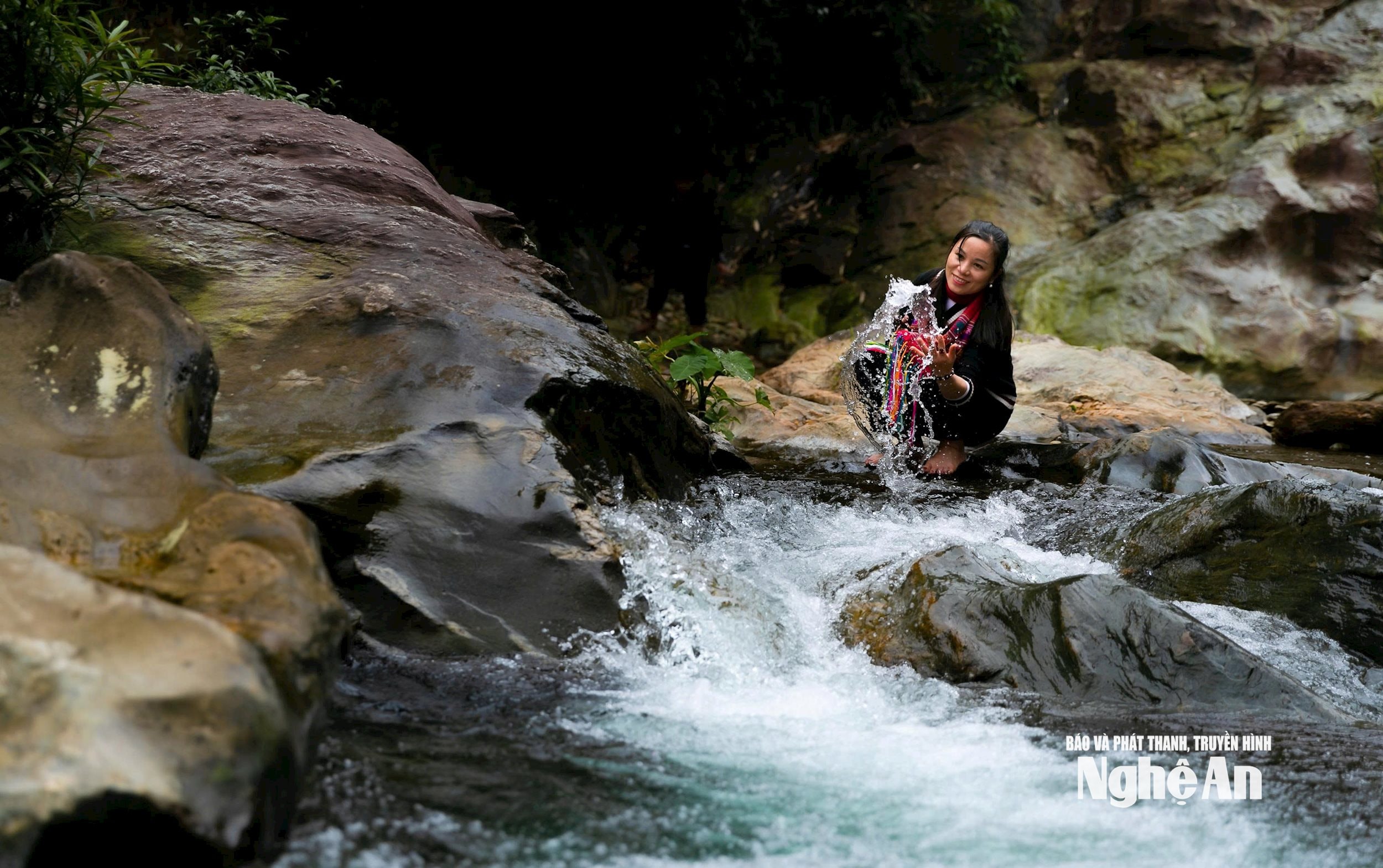
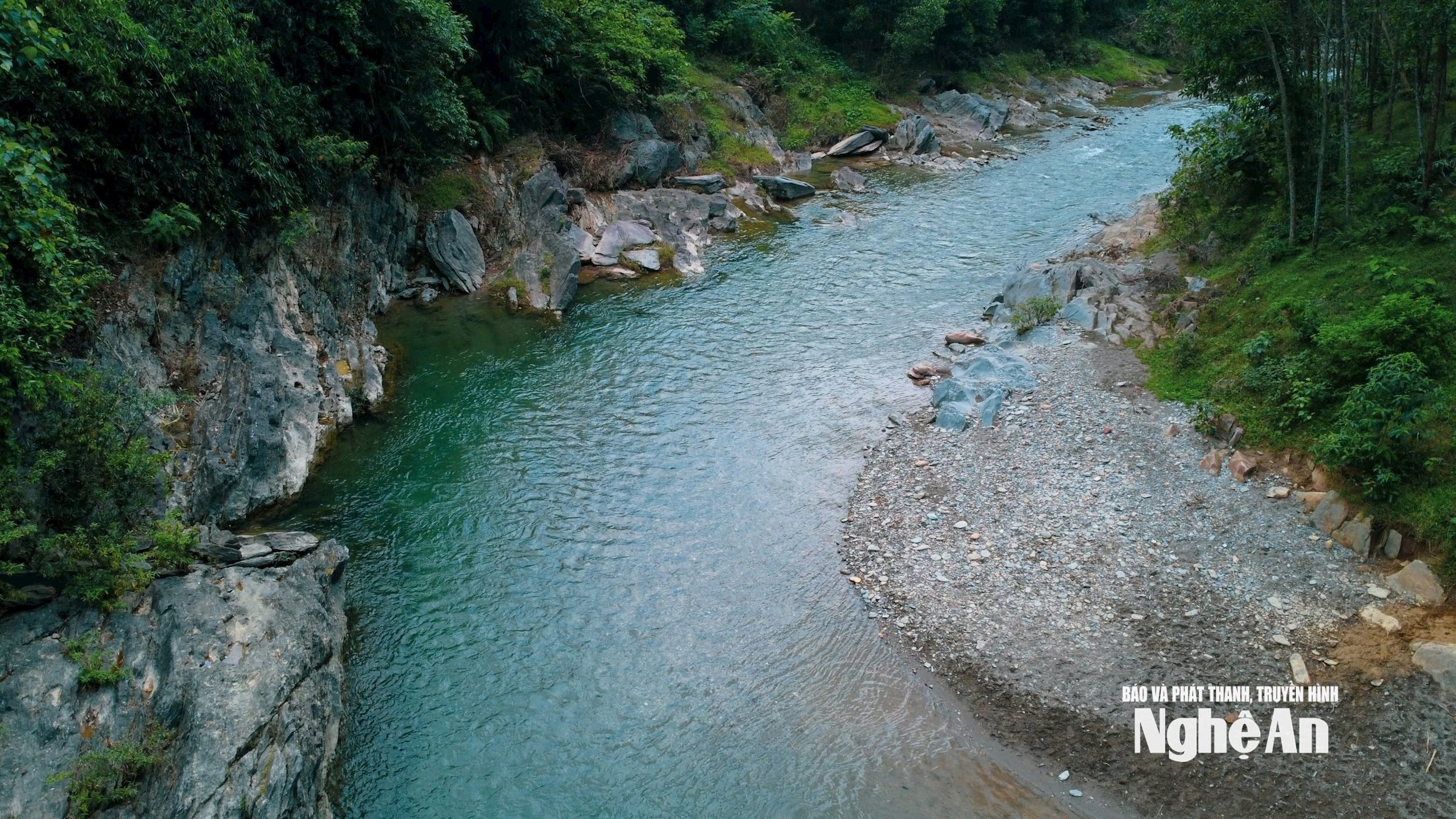
Regarding the Tan Sang stream bathing area (located in Tan Sang village), according to locals, it is the widest, deepest, and most rocky section of the Tron stream. The source of the Tron stream is the Lua Waterfall, which currently has no road access. To reach the Lua Waterfall, one must hike upstream along the Tron stream for several hours, but this is only recommended during the dry season. Upon arriving at the Tan Sang stream bathing area, the assessment of the Chairman of the Son Lam Commune People's Committee proved correct. The Tan Sang stream draws water from the border forest, embracing the hills and residential areas of Son Lam. The section designated as a bathing area is quite wide, about 50 meters. The stream water is crystal clear, revealing countless tiny pebbles sparkling at the bottom. But what is fascinating about the Tan Sang stream bathing area is the seemingly endless rocky outcrops on both sides. These rocks, millions of years old, have strange patterns on their surfaces and have been eroded and shaped by the stream water into unique and visually appealing forms…
.png)
Accompanying us to the Mưa Waterfall and Tân Sáng beach were Mr. Nguyễn Tài Diện - Vice Chairman of the People's Committee and Mr. Lương Sông Thương - specialist from the Party Building Committee of Sơn Lâm commune. Their stories along the way helped us understand that the former Thanh Chương district had previously developed a Thanh Chương District Tourism Development Project for the period 2021-2025 and beyond. During the project's development, it was determined that the resettlement areas of Thanh Sơn and Ngọc Lâm communes still retain many unique cultural features of ethnic minority communities and possess natural landscapes that could be exploited to become tourist destinations. Therefore, Thanh Chương district concretized the project by directing the People's Committees of Thanh Sơn and Ngọc Lâm communes to organize the construction of community cultural spaces and community tourism at Liếp Waterfall and Mưa Waterfall. Specifically for Thanh Son commune, Thanh Chuong district has assigned its subordinate units to review and plan the "Ethnic Minority Cultural Experience Tourism Route in the Thac Liep area of Thanh Son commune," and subsequently invested in a concrete road leading to it.
Formerly the Deputy Head of the Thanh Son Commune Police, Mr. Luong Song Thuong said that about five years ago, a group of dedicated part-time officials were very passionate about tourism activities at Liep Waterfall. They formed a chain of services to serve tourists and promoted the image of Liep Waterfall along with the unique cuisine of the Thai ethnic group. Thanks to this, Liep Waterfall became quite well-known to many tourists. Even some foreign tourists came to visit. Thanh Chuong District and Thanh Son Commune highly appreciated this and supported the group of part-time officials in establishing the Liep Waterfall Agricultural Tourism and Trade Cooperative, organizing training courses, and providing funding for the model… with the hope that this cooperative would be the nucleus for promoting tourism development. This served as a foundation for the establishment of Son Lam Commune, where the commune's Party Committee and government were even more determined to unlock the potential of scenic spots associated with the unique culture of ethnic minorities to promote tourism economic development.
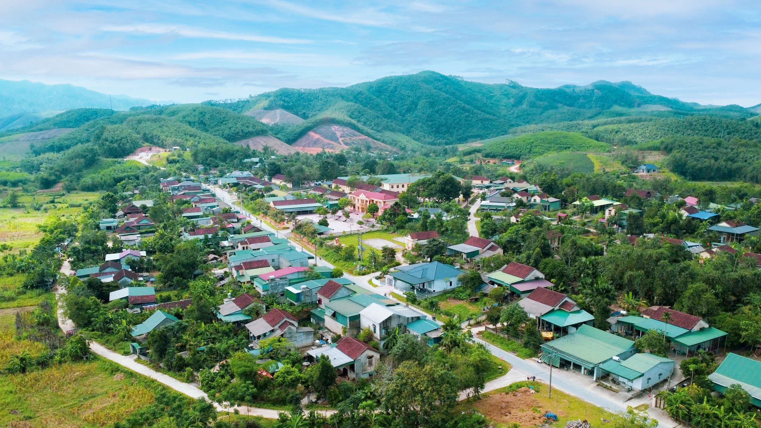
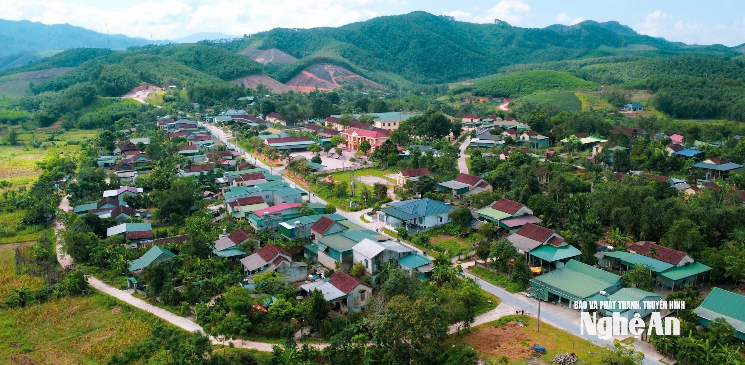
Mr. Nguyen Tai Dien stated that Son Lam commune was established by merging the existing areas of Thanh Son and Ngoc Lam communes, totaling 162.94 square kilometers.2The commune shares a 22,404km border with Xaychampon district, Bolykhamxay province, Laos. Currently, the commune has 12,331 inhabitants, of which 95.70% are ethnic minorities (Thai, Khmu, O Du, Tay, Mong, Muong, and Tho) distributed across 13 villages. The area is vast, villages are far apart, separated by high mountains and streams, and the level of education and economic development is still limited. Furthermore, some outdated customs persist, resulting in many difficulties, with 25.53% of households remaining poor. Therefore, improving the economic lives of the people is a major concern for the commune's Party committee and government. Consequently, in the political report of the Party Committee of the commune presented to the First Party Congress of the commune, term 2025-2030, the actual situation was frankly stated, without avoiding existing shortcomings, weaknesses, and mistakes; at the same time, it specifically analyzed the advantages and potential, and proposed many solutions for development.
According to Nguyen Tai Dien, Vice Chairman of the People's Committee of Son Lam commune, the Resolution of the Commune Party Congress has unanimously approved the programs, projects, action plans, and key projects to be implemented during the 2025-2030 term. These include a determination to implement four breakthrough socio-economic projects: the project to develop industrial tea cultivation linked to crop restructuring, improving product quality and value chain; the administrative reform plan linked to digital transformation in Son Lam commune for the 2025-2030 period; the project to renovate neglected gardens, develop fruit orchards and nutritional gardens linked to landscape beautification and environmental protection in residential areas; and the project to develop community tourism linked to the preservation and promotion of traditional cultural values of the ethnic minorities in Son Lam. Then Mr. Dien explained: “Identifying the successful implementation of the four projects is not simple, so the Party Committee of the commune has agreed on many solutions to remove the ‘bottlenecks’. In particular, to develop community tourism, it is necessary to focus on investing in the renovation, expansion, and upgrading of the main roads in the area connecting to the Ho Chi Minh Highway and eco-tourism destinations such as Mua Waterfall, Liep Waterfall, Lua Waterfall, Tan Sang beach…”
.png)
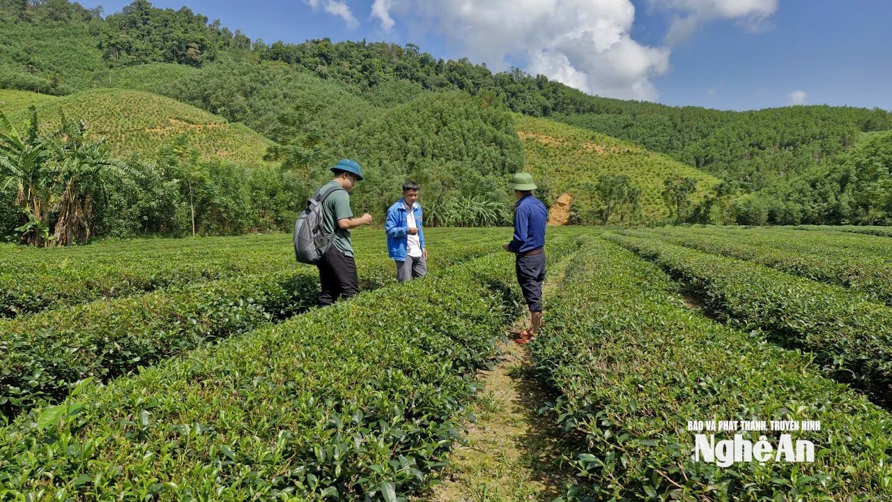
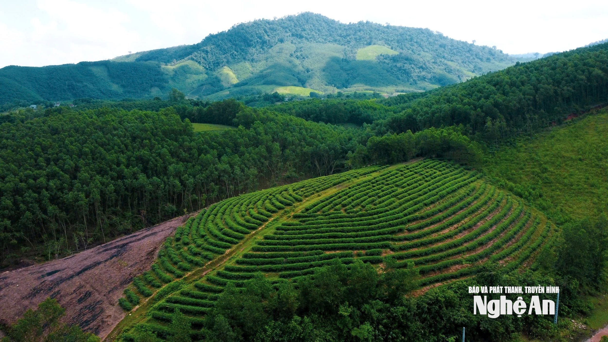
After our trip to the Mưa Waterfall and Tân Sáng Stream bathing area, Mr. Trình Văn Bằng discussed and clarified socio-economic development projects with us. According to him, the Party Committee of the commune had thoroughly researched the actual situation to determine these projects. For example, tea cultivation, although it was introduced to this border region late, is the crop that brings the highest economic value to the people. Currently, Sơn Lâm has about 400 hectares of tea, with 2-3 fairly high-quality varieties. But the commune will not stop here; it will continue to promote the transformation of the crop structure, improve quality, and is determined to build a product chain so that the people can earn even higher value.
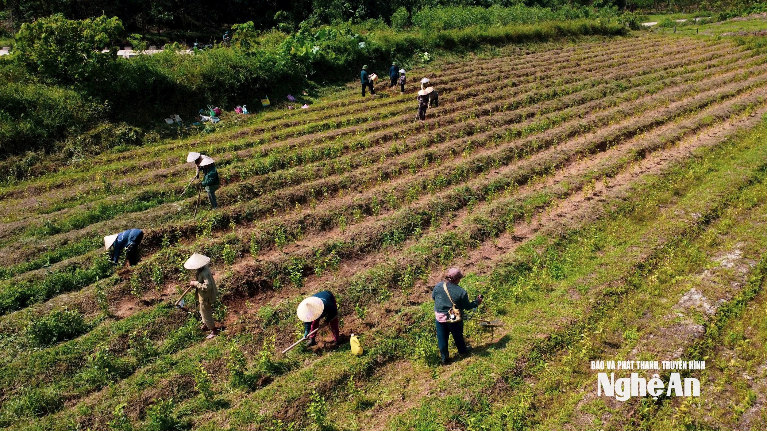
It was observed that although the people possessed a considerable amount of garden land, most of it was left fallow, with very few families having vegetable gardens or fruit orchards. This reality affected both the people's lives and significantly impacted the environmental landscape. Recognizing this as an old habit and custom of the highland people, a project was decided to be developed to transform and renovate neglected gardens, linked with the renovation of fruit orchards and the improvement of the environmental landscape. To achieve results in this area, the government cannot do it on their behalf; the households must directly participate. Therefore, it will begin with changing the awareness of local officials, and then spreading that awareness to encourage the people to follow suit.
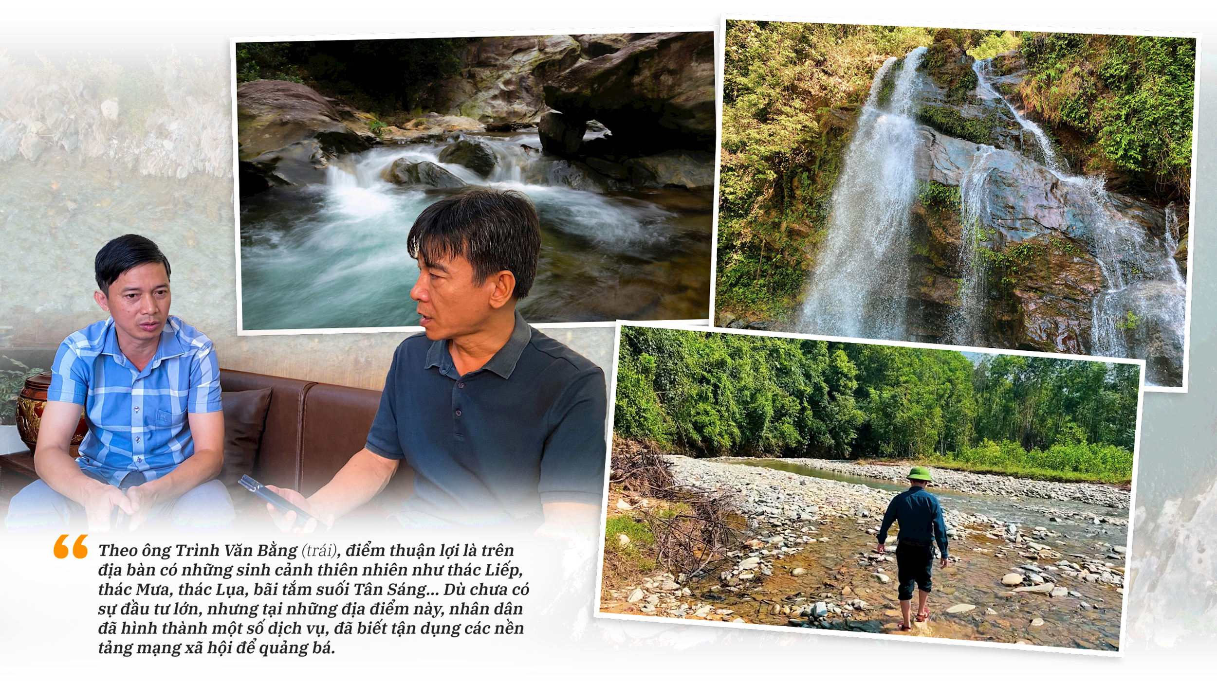
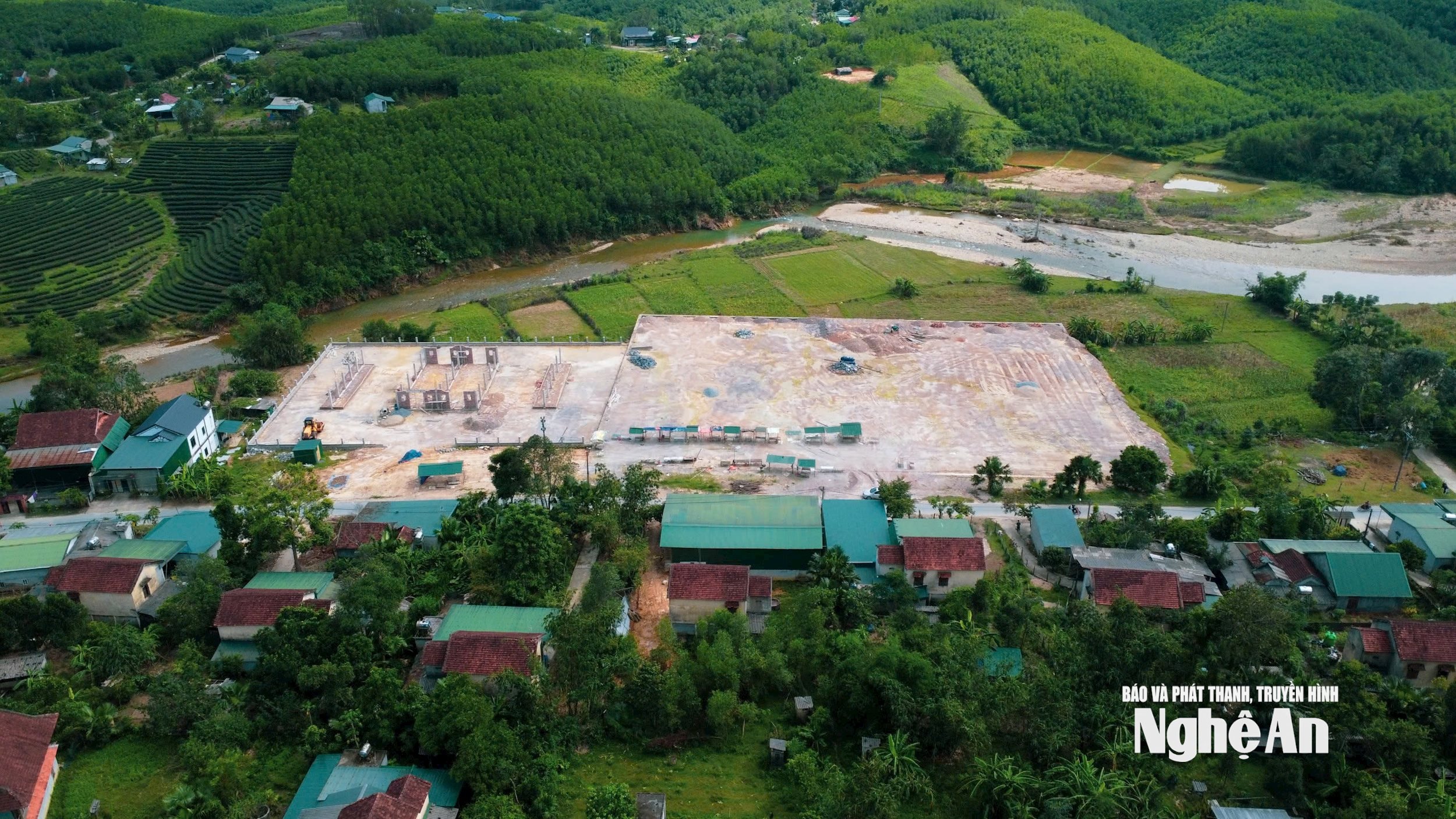
The Chairman of the People's Committee of Son Lam Commune, Trinh Van Bang, is particularly enthusiastic about the Community Tourism Development Project linked to the preservation and promotion of the cultural values of ethnic minorities. According to him, a favorable factor is the presence of natural landscapes in the area such as Liep Waterfall, Mua Waterfall, Lua Waterfall, and Tan Sang Stream bathing area… Although there hasn't been significant investment, the local people have already developed some services at these locations and have learned to utilize social media platforms for promotion. Furthermore, the former Thanh Chuong district has implemented a tourism development project, and this provides a foundation for Son Lam commune to inherit and build upon. “The projects to renovate neglected gardens, develop tea plantations, and integrate digital technology have contributed to the success of the community tourism development project. Son Lam also recognizes that transportation is a major limitation. Therefore, in this term, we are determined to implement two roads: a road connecting the Ho Chi Minh Highway to the center and linking to Mua Waterfall; and a road connecting the Ho Chi Minh Highway to the center of the former Thanh Son commune and leading to Liep Waterfall…” – said Mr. Trinh Van Bang.
Hearing the heartfelt words from the Chairman of the People's Committee of Son Lam commune, I felt happy and confident. Because Son Lam is connected to the legendary Ho Chi Minh Trail, adjacent to the scenic Cau Cau tea plantation area, with the Liep, Mua, and Lua waterfalls, Tan Sang stream beach, and many other undiscovered natural landscapes along the Vietnam-Laos border, and with a new, determined political system, change and development are entirely possible!