Nghe An province approves local adjustments to the Vinh - Cua Lo Boulevard planning.
The People's Committee of Nghe An province has just issued Decision No. 1500/QD-UBND approving the partial adjustment of the zoning plan for the Vinh - Cua Lo Boulevard and the area on both sides of the Vinh - Cua Lo Boulevard.
This adjustment aims to remove "bottlenecks" and obstacles in the implementation of the old plan from 2019, gradually expanding urban space towards the sea and creating room for long-term development.
Location of adjustment: In Vinh Loc ward and Dong Loc commune, Nghe An province. Specifically, the land plot has the following boundaries:
- To the North: Bordering the existing residential area and agricultural land of Dong Loc commune (formerly Nghi Thach commune).
- To the south, it borders the existing residential area and agricultural land of Vinh Loc ward (formerly Nghi Phong commune).
ButTo the east, it borders the existing residential area and agricultural land of Vinh Loc ward (formerly Nghi Xuan commune).
- To the west, it borders the existing residential area and agricultural land of Vinh Loc ward (formerly Nghi Phong commune).
The area of land subject to the planning adjustment is 220 hectares.
Changes in land use structure
According to the revised plan, the land use structure across the total area of 220 hectares has changed compared to the previous plan. Previously, this area included various land types such as green space and sports facilities (96.02 hectares), new residential land, existing residential land, commercial land, and mixed-use land. After the adjustment, the land fund has been reallocated to prioritize public purposes and future development reserves.
Specifically, the new land fund includes: State agency land accounting for 45.24 hectares; national defense and security land accounting for 33.75 hectares; and development reserve land accounting for 69.66 hectares. Mixed-use land (including commercial and service functions, old and new residential areas, social infrastructure, public services) accounts for 46.98 hectares, and transportation land accounts for 24.37 hectares. Strict planning and architectural standards are stipulated, with a maximum overall building density of 50%, a maximum building height of 20 floors, and a maximum of 2 basement levels.
Upgrading and synchronizing urban technical infrastructure systems.
In addition to changing the land use purpose, the technical infrastructure system is also locally adjusted to be compatible with the new function.
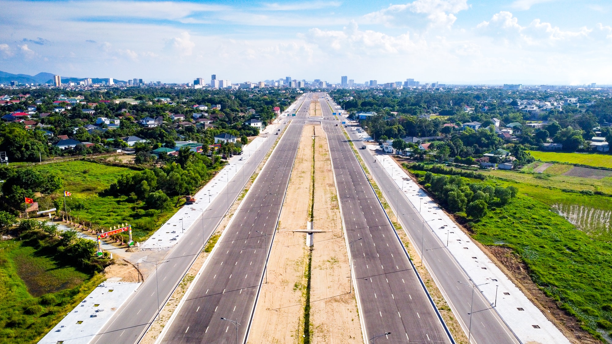
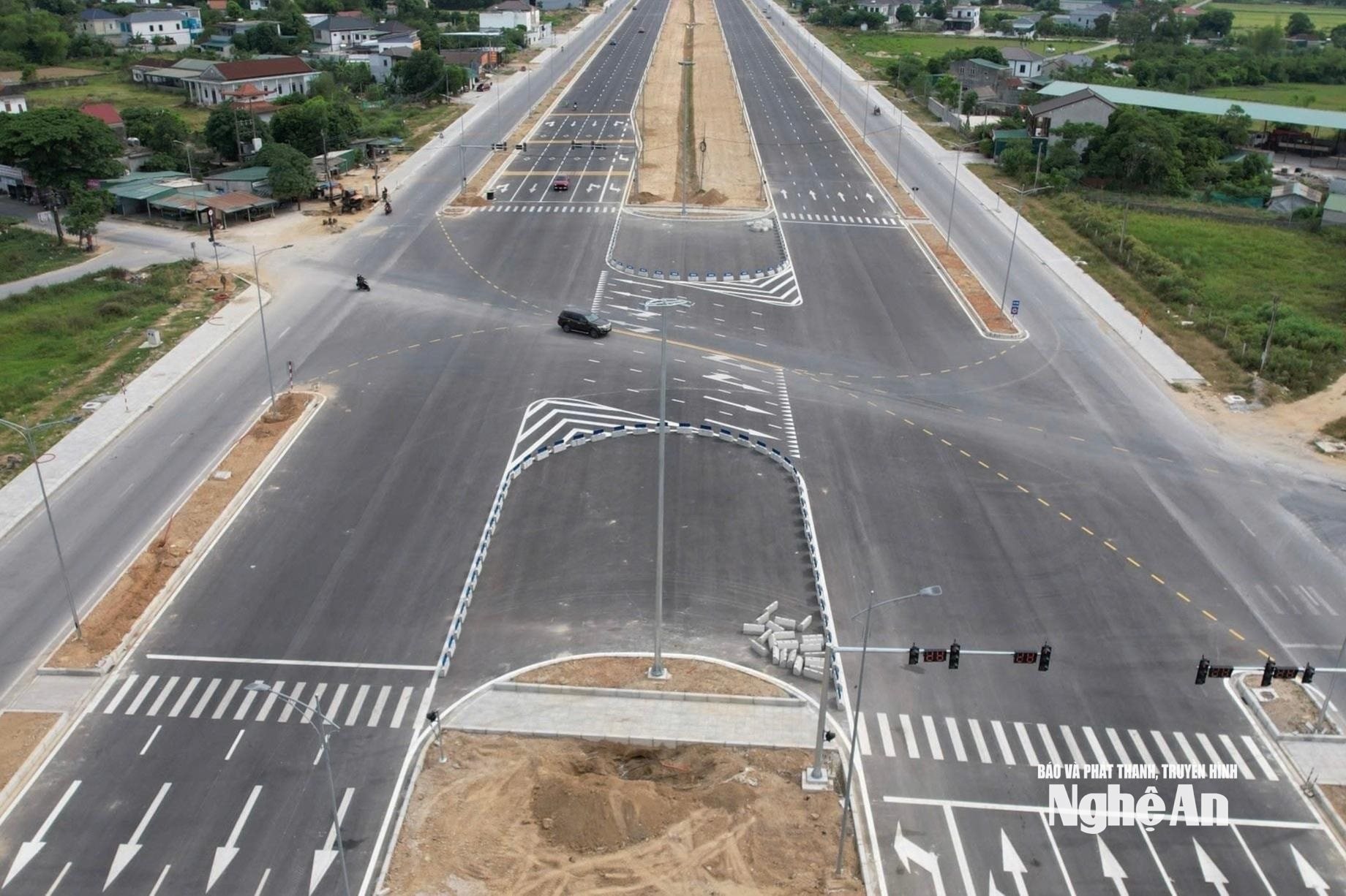
Regarding transportation, the province decided to remove the planned 24m, 18m, and 12m roads in the Northwest and the 30m and 18m roads in the Southeast of the planned area. The plan adds new 24m and 18m roads through the existing residential area in the Northwest, along with a planned 30m road to the Northeast connecting directly to the Vinh - Cua Lo Boulevard.
The technical preparation plan and water supply and drainage system have also undergone corresponding changes. The ground elevation remains the same as the old plan (highest +4.79 m, lowest +4.20 m), but additional B800 and B600 drainage ditches have been added along the planned 24 m and 18 m roads passing through the existing residential area in the Northwest and the 30 m road in the Northeast connecting directly to the Vinh - Cua Lo boulevard. The water supply system has been supplemented with D200 pipes and fire hydrants at standard intervals of 150 m. The wastewater drainage and lighting systems have also been redesigned to run along the newly added traffic axes.
The Provincial People's Committee has assigned the Department of Construction to update and incorporate the local adjustments to the planning into the zoning plan for the Vinh - Cua Lo Boulevard and the areas on both sides of the Vinh - Cua Lo Boulevard. Simultaneously, the Department is to organize the announcement and public disclosure of the adjusted plan in accordance with regulations, serving as a basis for management according to the approved plan.
The Provincial People's Committee assigns the People's Committees of Vinh Loc Ward and Dong Loc Commune, and relevant departments and agencies, to organize and implement the approved plan; manage the planning, manage land use, and resolve related administrative procedures in accordance with the law and consistent with the approved plan in the area until another plan replaces it.
According to the decision, the local adjustment of the Vinh - Cua Lo Boulevard zoning plan and the areas on both sides of Vinh - Cua Lo Boulevard aims to concretize the socio-economic development orientation of Nghe An province in the new period; at the same time, it meets the requirements for implementing the project in Nghe An province, contributing to improving the quality of service for people and businesses and promoting administrative reform in the province.
At the same time, this also promptly addresses some bottlenecks, difficulties, and obstacles in the implementation of the approved Vinh - Cua Lo Boulevard zoning plan; gradually expanding urban space towards the sea, reducing pressure on the existing urban technical infrastructure system, creating room for development and meeting the long-term development requirements of the province.

