
Nghe An province issues directive to respond to tropical depression.
(Baonghean.vn) - At 4 PM on October 21st, the Provincial Steering Committee for Disaster Prevention, Search and Rescue and Civil Defense issued Official Dispatch No. 12/CĐ-VPTT directing concentrated response to the tropical depression and minimizing damage.
According to the National Center for Hydro-Meteorological Forecasting: At 13:00 on October 21st, the center of the tropical depression was located at approximately 20.1 degrees North latitude; 123.0 degrees East longitude, about 230km north-northeast of Luzon Island (Philippines). The strongest winds near the center of the tropical depression were at level 6, gusting to level 8.
Forecast for the next 24 hours: The tropical depression will move westward at a speed of 20 km/h, with maximum wind speeds near the center reaching levels 6-7, gusting to level 9. The level of natural disaster risk is level 3 in the eastern part of the North East Sea.
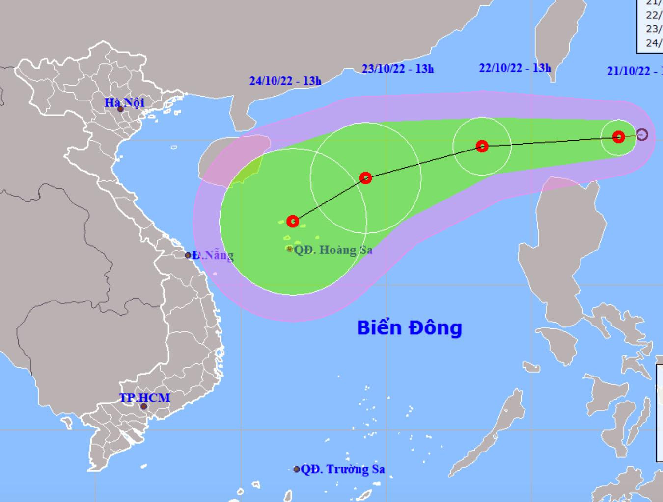 |
The path of the tropical depression. Photo: NCHMF |
To proactively respond to the tropical depression and minimize damage, the Standing Office of the Provincial Steering Committee for Disaster Prevention, Search and Rescue and Civil Defense requests: The Steering Committees for Disaster Prevention, Search and Rescue in the districts of Quynh Luu, Dien Chau, Nghi Loc; the towns of Cua Lo, Hoang Mai; the Provincial Border Guard Command; the North Central Region Meteorological and Hydrological Station; Nghe An Radio and Television Station, Nghe An Newspaper, Ben Thuy Coastal Information Station; the Fisheries Sub-Department and other agencies and units must closely monitor the development of the tropical depression, and inform owners of vessels and captains of ships and boats (including transport and tourist vessels) operating at sea about the location, direction of movement and development of the tropical depression so that they can proactively take precautions, evacuate, or avoid moving into the dangerous area.
Accordingly, the dangerous area in the South China Sea over the next 24 hours is defined from latitude 18.0 to 21.5 degrees North; east of longitude 116.0 degrees East (the dangerous area will be adjusted in subsequent forecast bulletins).
At the same time, the authorities will monitor and count ships and boats operating in the area affected by the tropical depression; strictly manage vessels going out to sea; maintain regular communication with vessel owners to promptly handle any adverse situations that may occur; and prepare measures to ensure the safety of people and property in aquaculture areas.
The regional meteorological and hydrological stations in North Central Vietnam are closely monitoring, forecasting, warning, and providing timely information on the development of the tropical depression in order to proactively implement response measures.
The Nghe An Radio and Television Station, Nghe An Newspaper, Ben Thuy Coastal Information Station, and other mass media agencies are strengthening measures to disseminate information about the developments of the tropical depression to all levels of government, owners of vessels operating at sea, and the public so that they can proactively prevent and respond to it.
In particular, forces and resources must be readily available for rescue and relief operations when required.
Maintain a strict duty roster and regularly report to the Standing Office of the Provincial Steering Committee for Disaster Prevention, Search and Rescue, and Civil Defense.


