
Concerns arise over dozens of landslides in Ky Son.
With the rainy and stormy season approaching, hundreds of households and local authorities in Ky Son district are apprehensive and worried as dozens of landslides and riverbank erosion threaten the lives and property of residents. Therefore, in addition to monitoring weather developments, the district is also developing proactive response plans.
Anxiety as the rainy season approaches.
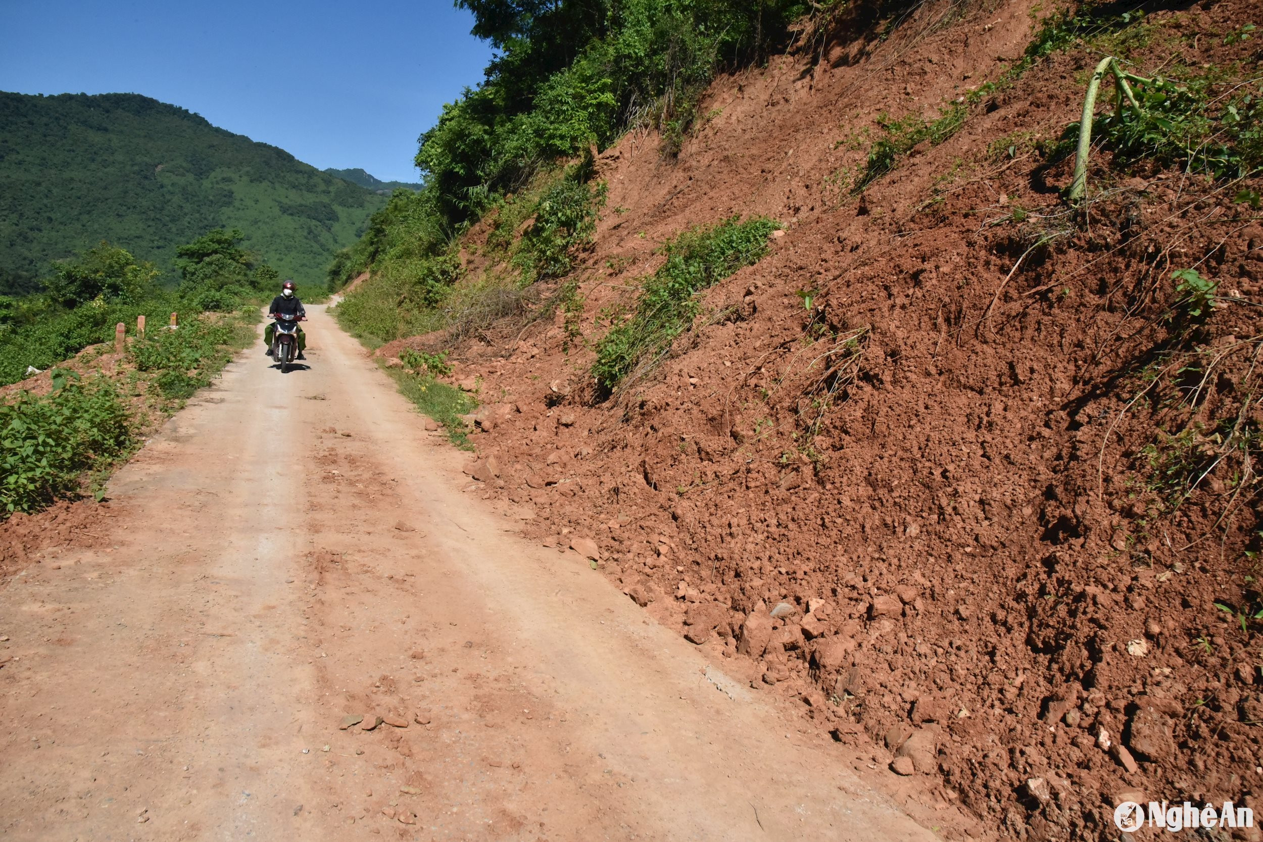
In early August 2024, the weather in the mountainous district of Kỳ Sơn was characterized by sunny mornings and rainy afternoons, with hot and stuffy air. Local residents said this marked the beginning of the rainy season. Traveling from Mường Xén town to Mường Típ commune, along the paved road to the commune center, in addition to the landslides from the 2023 rainy season that had been addressed, there were many new landslides. Many sections of irrigation ditches were buried by rocks and soil sliding down from the mountains, and many sections of the road were littered with loose rocks.
Meeting a man named Hoa Ba Nuu traveling from Vang Phao village, Muong Tip commune, to Muong Xen town, he said that at a fairly large landslide point in Xop Tip village, the villagers dare not pass through this section of road when it rains, for fear of rocks falling from the mountain. “Even on sunny days, small rocks occasionally fall from the mountaintop, it’s very scary. But besides the river route, this is the only land route to Muong Xen, so despite the fear, we still have to use it when necessary. The alternative route is too far, and there are many other landslide points,” Mr. Hoa Ba Nuu added.
Regarding the landslide situation, officials from the Ky Son District Project Management Board stated that the authorities always advise people traveling on this road to wear helmets to prevent injuries in case of falling rocks. They also recommend limiting travel during rainy weather, and if the rain persists for several days, some high-risk landslide areas will be closed to ensure public safety.
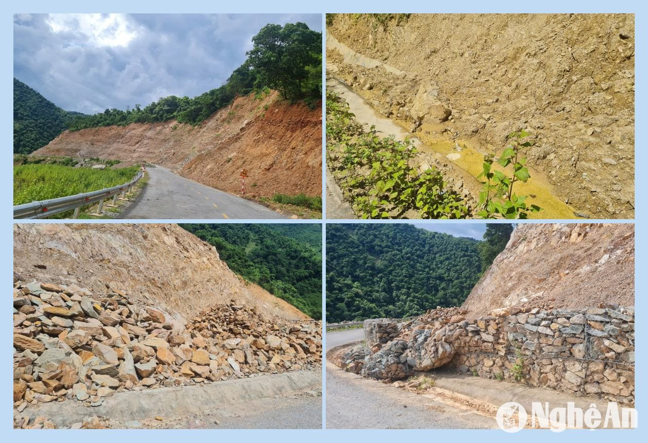
According to the leaders of Muong Tip commune People's Committee, along the road from Muong Xen town to Muong Tip, there are 8 landslide points in the villages of Huoi Khoi, Cha Lat, Xop Phe, Xop Tip, Vang Phao, Na My, Ta Do, and Pha Noi. In addition, there are 2 riverbank landslide points in Xop Tip and Na My villages. “All 8 landslide points on the Muong Xen - Ta Do road are located within Muong Tip commune, many of which occur frequently and pose a significant danger to travelers. We are very concerned and have assigned personnel to regularly monitor the situation and provide timely warnings to the people,” shared Mr. Moong Van Kham, Vice Chairman of the Muong Tip commune People's Committee.
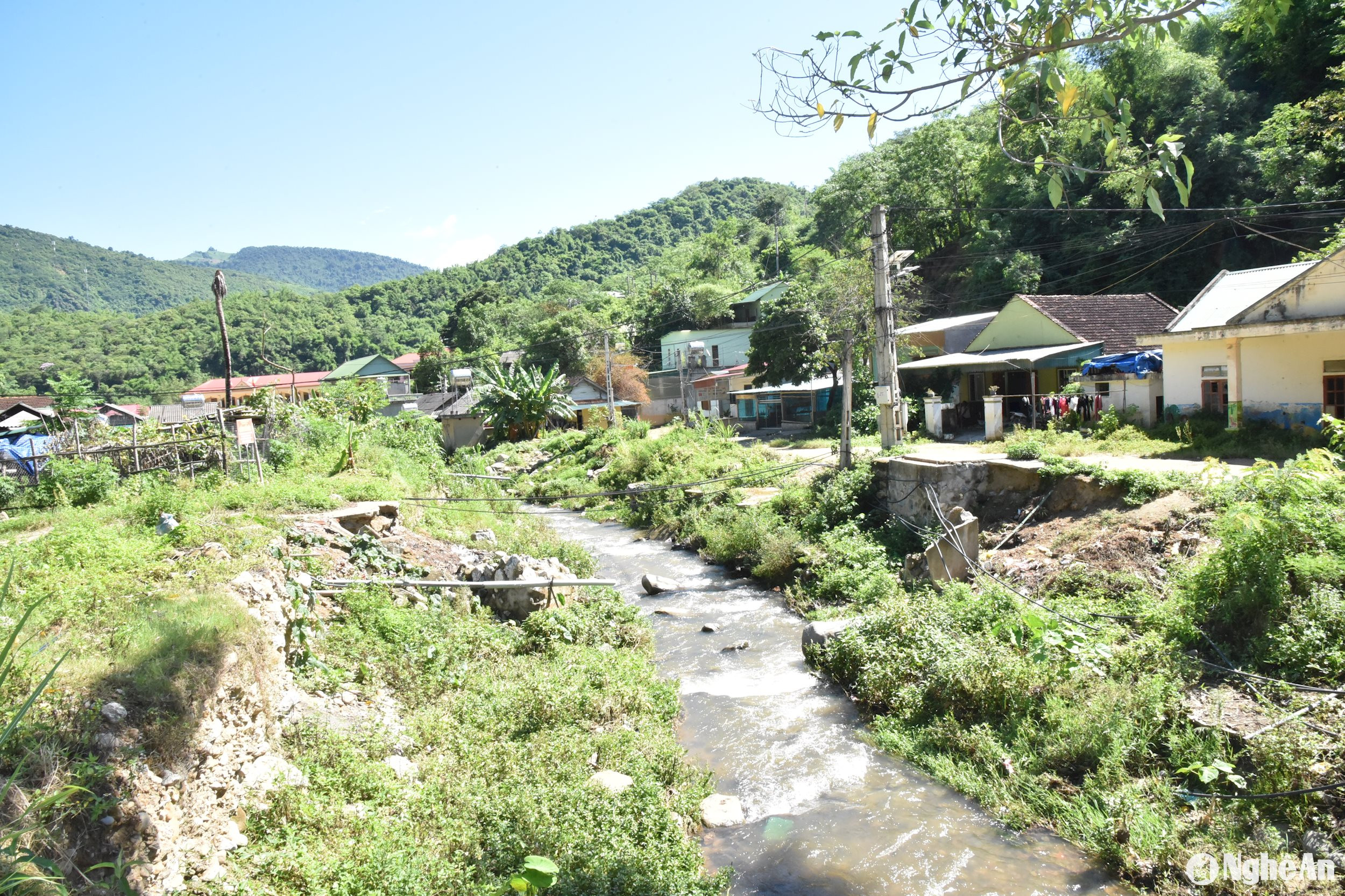
Besides Muong Tip, Ta Ca commune is also one of the high-risk areas affected by natural disasters when the rainy season arrives, especially Hoa Son village. In early August 2024, we returned to Hoa Son village, where a devastating flash flood occurred in October 2022, sweeping away dozens of houses and killing one person. Although the villagers have repaired their houses or built temporary shelters, the haunting traces of the flash flood still remain on many of the walls of the houses here.
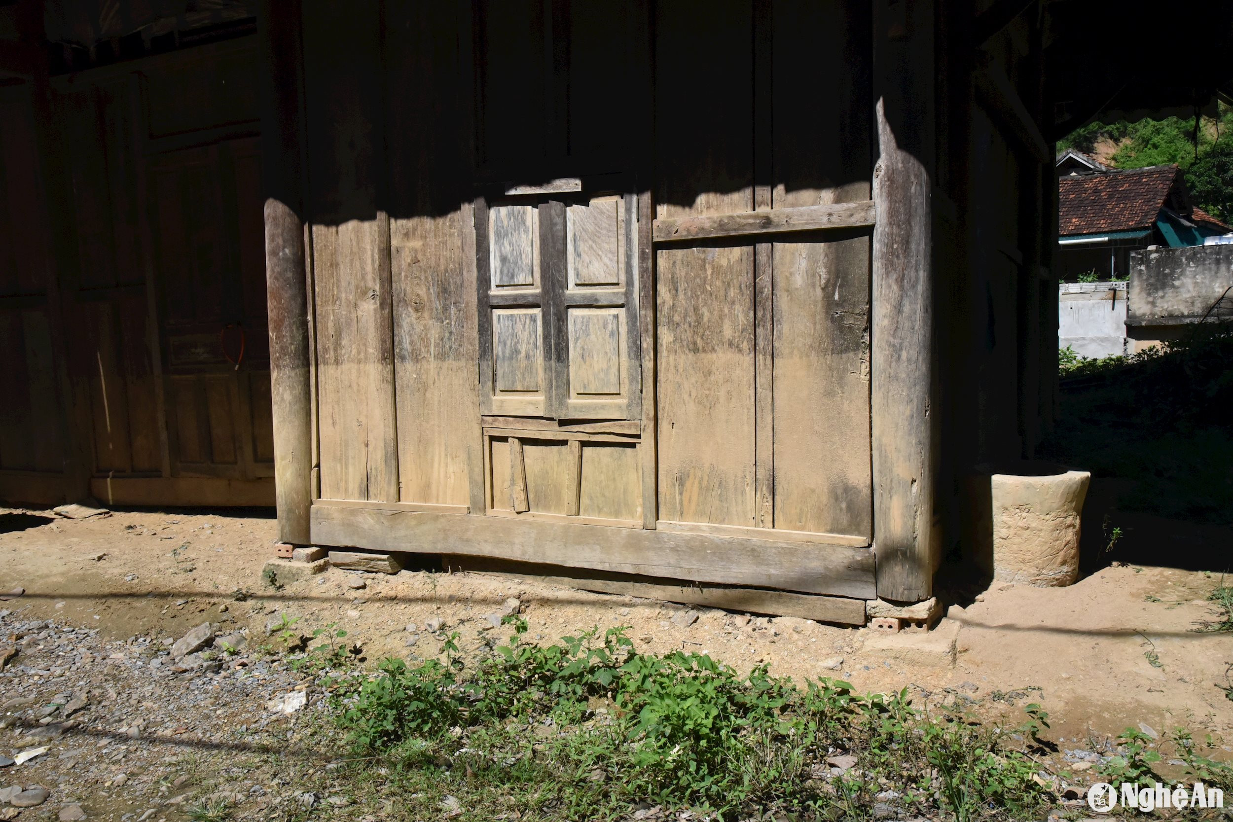
Ms. Vi Thi Huong, a resident whose house is located near the beginning of Hoa Son village, said, "I can't sleep when it rains because I'm so worried, especially at night. I always keep bags of essentials at home so that when the rain is too heavy and the water rises, I can move everything in time. Last year's flood swept away all my possessions." Pointing to the mud marks still visible on her walls, she added, "That year's flood rose so high, up to waist level. The water marks are still there, and every time I see them, I feel scared."
In Ta Ca commune, there are currently 4 locations experiencing ongoing landslides and 1 location threatened by landslides. For example, recently, a landslide occurred on the road from Binh Son 2 village in Ta Ca commune to Dong Duoi village in Tay Son commune, affecting 6 households with 25 people. Similarly, along the road from the Hoa Son village entrance gate to the Hoa Son village production area, the road and 12 houses have been damaged and cracked, requiring relocation to a safer location.
According to Dềnh Bá Lồng, Secretary of the Party Committee of Huồi Tụ commune, 12 households with 61 people are currently at risk of house collapse during the rainy season. Specifically, this is located on the road at the end of Trung Tâm village in Huồi Tụ commune leading to Mường Lống. A deep crack has appeared on the mountaintop. The houses of the 12 households are situated on the mountainside directly below the crack, and for several years now, the land has been eroding and sinking by several tens of centimeters each year. Currently, two households have relocated. The remaining households, unable to find land to live on, remain in their homes, but they are constantly worried. "In the long term, staying here will be very dangerous," Mr. Dềnh Bá Lồng stated.
Many other residential areas in Ky Son are also threatened as they are located along routes prone to landslides, such as: 17 households with 91 people in Son Ha village, Ta Ca commune and 94 households with 455 people in Huoi Giang 3 village on the Muong Xen - Tay Son road; 13 households with 62 people in Ba and Huoi Tho villages, Huu Kiem commune; 7 locations threatened by landslides on both positive and negative slopes in Na Loi commune…
Monitor the situation and proactively develop response plans.
According to statistics from the Ky Son District People's Committee, as of June 2024, the district had 20 locations where landslides had occurred and 13 other locations threatened by landslides; there were also 7 locations with riverbank erosion and 2 locations threatened by riverbank erosion. The Ky Son District People's Committee, together with the authorities of the communes and towns, has developed plans to monitor, respond to, and gradually mitigate the consequences.
For example, at landslide sites in Muong Tip commune, the District People's Committee has posted warning signs at locations without residential houses and instructed commune and village authorities to prepare evacuation plans in case of heavy rain and landslides. Simultaneously, they are continuing to clear debris and unblock drainage ditches at the landslide sites. Regarding the two riverbank landslides in Na My and Xop Tip villages, affecting 47 households and 185 people, they are currently constructing retaining walls to prevent further landslides and are preparing to evacuate residents in case of heavy rain.
Besides households, many public facilities such as commune offices and schools in Ky Son are also threatened when the rainy season arrives. Currently, the commune police station (Ta Ca) and the Tien Tieu Kindergarten and Primary School in Nam Can commune, with 7 classrooms (7 teachers and 59 students), need to be relocated. However, the district currently lacks an effective solution due to insufficient funding and land.
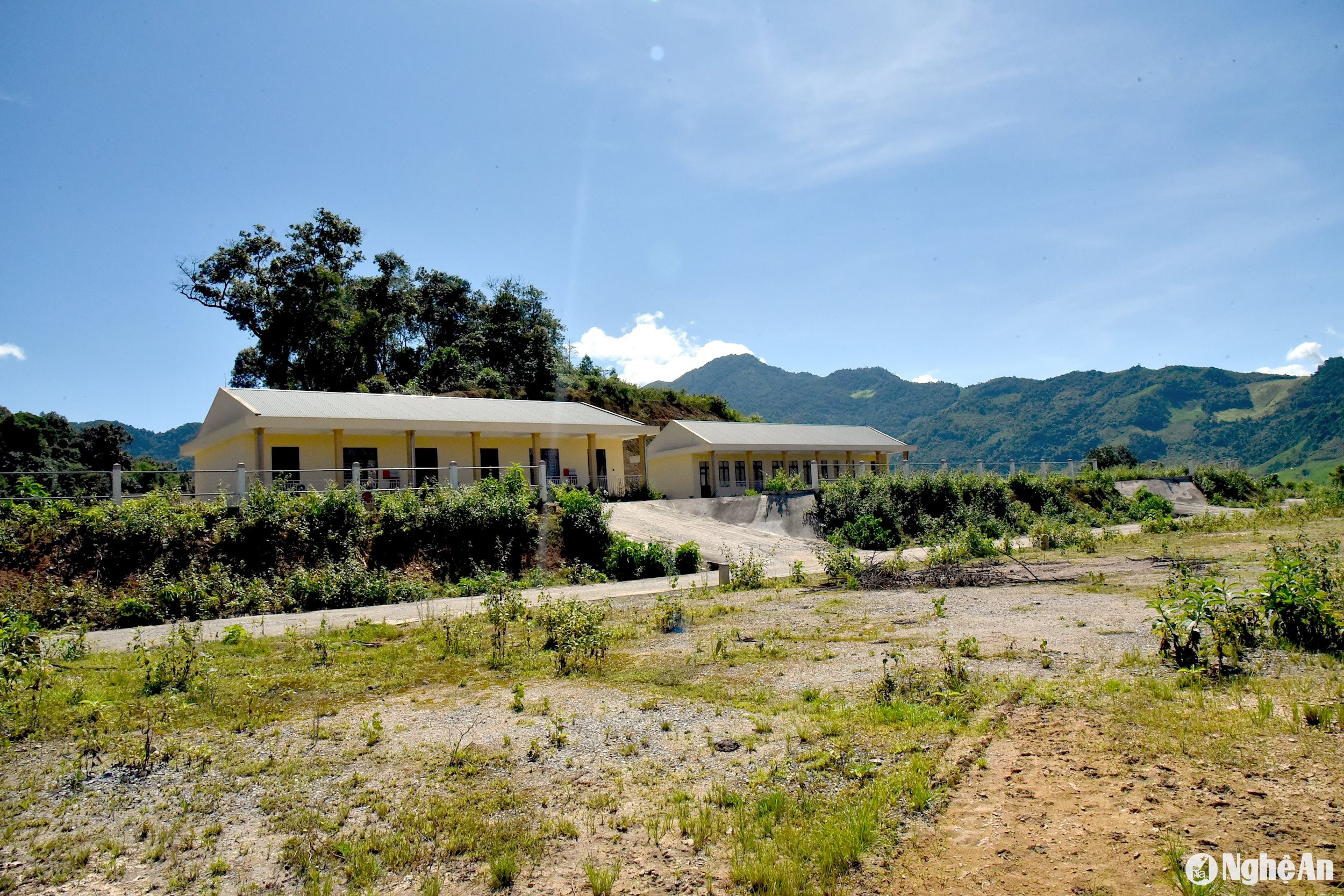
Mr. Tho Ba Re, Vice Chairman of the Ky Son District People's Committee, said that not only in Muong Tip commune, but also in dozens of landslide and landslide-threatened areas throughout the district, have been compiled and reported to higher authorities. He also directed regular monitoring and the development of response plans. Specifically, he requested that local authorities at the commune and village levels monitor weather information and track developments at vulnerable locations to report and address issues promptly. In addition, the district is utilizing funding from various programs and projects to gradually address landslide-affected areas, prioritizing vulnerable and potentially major landslide sites and accelerating construction progress before the rainy season arrives.
On August 8th, the People's Committee of Nghe An province issued Plan No. 635/KH-UBND to implement Decision No. 1262/QĐ-TTg dated October 27, 2023, of the Prime Minister approving the early warning system for landslides and flash floods in mountainous and midland areas of Vietnam, specifically in Nghe An province. The purpose is to provide information on landslides and flash floods in the province based on effective coordination among research agencies, management bodies, local authorities, the people, and socio-political organizations. The goal is to proactively enhance the capacity for managing and preventing flash floods and landslides, and to provide early warning information to communities in high-risk areas so they can take timely response measures. Early warning systems for landslides and flash floods in Nghe An province serve disaster prevention and control, ensuring the safety of people's lives and property, infrastructure, creating conditions for stable socio-economic development, and contributing to national defense and security.


