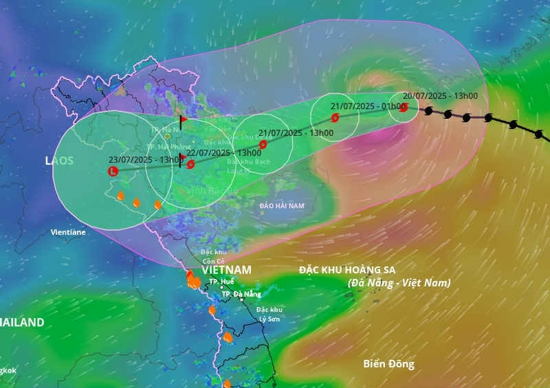
9:00 AM, July 21st: Typhoon Wipha (Typhoon No. 3) has entered the Gulf of Tonkin and is beginning to strengthen again.
The National Center for Hydrometeorology announced that after partially weakening, Typhoon No. 3 has begun to strengthen again.
At 7:00 AM on July 21st, the typhoon's center was located at approximately 21.3 degrees North latitude and 109.9 degrees East longitude, over the northern part of the Leizhou Peninsula (China), about 220km east of Quang Ninh - Hai Phong. The strongest winds near the center of the typhoon were at level 9 (75-88 km/h), with gusts up to level 11; it was moving in a west-southwest direction at a speed of 15-20 km/h.
In the northwestern part of the North East Sea, winds will be strong, reaching force 7-8, and near the storm's center, reaching force 9 with gusts up to force 11; sea waves will be 4.0-6.0m high, with very rough seas.
The northern part of the Gulf of Tonkin (including the special zones of Bach Long Vi, Co To, Cat Hai, and Hon Dau Island) will experience strong winds of force 6-7, later increasing to force 8-9, reaching force 10-11 near the storm's center, with gusts up to force 14. Sea waves will be 2.0-4.0m high, and 3.0-5.0m near the storm's center, with extremely rough seas. The southern part of the Gulf of Tonkin (including Hon Ngu Island) will experience gradually increasing winds of force 6-7, reaching force 8-9 near the storm's center, with gusts up to force 11. Sea waves will be 2.0-4.0m high, with very rough seas.
According to the National Center for Hydrometeorology's forecast: At 9:00 AM on July 21st, Typhoon No. 3 had entered the Gulf of Tonkin, beginning to strengthen again thanks to abundant energy from the ocean. Currently, dark clouds are gathering in the sky over Quang Ninh.
Given the complex developments of the storm, the Chairman of the People's Committee of Nghe An province has issued a directive requesting the Chairmen of the People's Committees of wards and communes to proactively prepare for and mitigate the effects of a major storm.
*Closely monitor developments related to storms, rain, and floods.Providing timely updates to the public; disseminating information and guiding people on skills to respond to natural disasters such as strong winds, flash floods, landslides, and flooding.
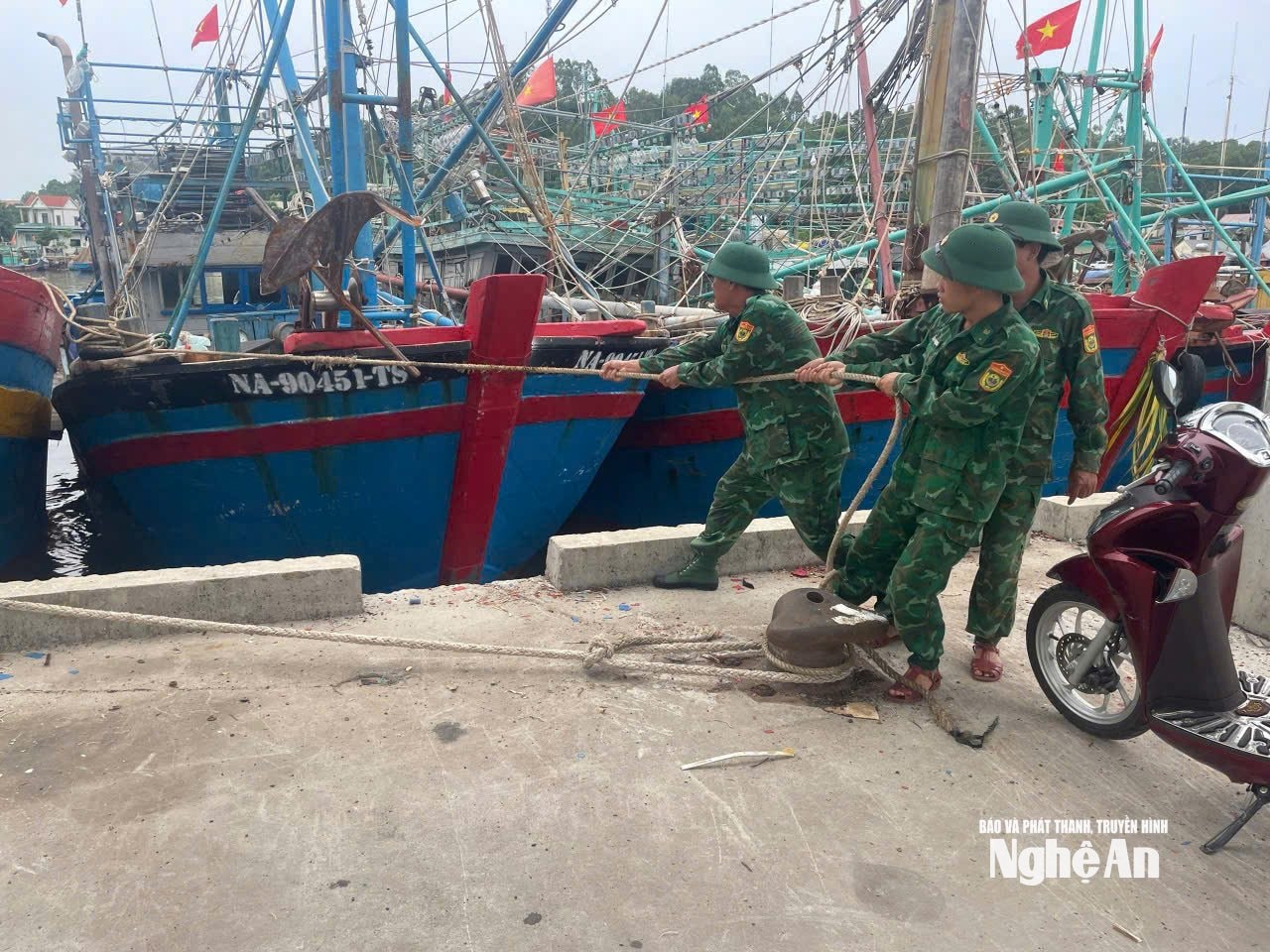
*Review and prepare for the evacuation of people from dangerous areas.Providing housing, food, and essential supplies to stabilize people's lives.
*Ensuring the safety of structures, infrastructure, power systems, and coastal tourism.They are ready with personnel, supplies, and on-call duty 24/7 to promptly handle emergency situations.
Emergency preventative measures during major storms in vulnerable areas:
- Follow the storm news.Listen to weather forecasts regularly via TV, radio, and official social media platforms.
- Reinforce your house.Reinforce the roof and doors; trim tree branches near the house.
- Stockpile essential supplies.Clean water, dried food, medicine, flashlight, rechargeable batteries.
- Charge your communication device fully.Phone, rechargeable lamp, power bank.
- Move to a safe place.If you live near the sea, a river, or a low-lying area, you should evacuate according to instructions.
- Do not leave your house when the storm hits.Avoid falling trees, electric shocks, and floods.
- Turn off the electricity, turn off the gas.To avoid fire and explosions.
- Protect important documents.Place in a sealed plastic bag and store in a dry place.

