Landslide warning on riverbank in Thanh Chuong
(Baonghean.vn) - Thanh Luong, Thanh Yen and Thanh Khai communes are considered flood-prone areas.Thanh Chuong district;Currently, people in the area are facing the risk of landslides on river banks.
As a fisherman living on the Lam River, for the past few years, Mr. Tran Van Son in Yen Binh hamlet, Thanh Yen commune has always been worried about the alarming level of riverbank erosion.
Mr. Son shared: "I have a solid house in the neighborhood but I mainly sleep on a boat. Since the beginning of the flood season, I have often heard the sound of landslides and feel anxious. There are days when the sound of landslides wakes me up..."
 |
| The entire beach area of Thanh Khai commune (Thanh Chuong) is eroding. Photo: Dinh Ha |
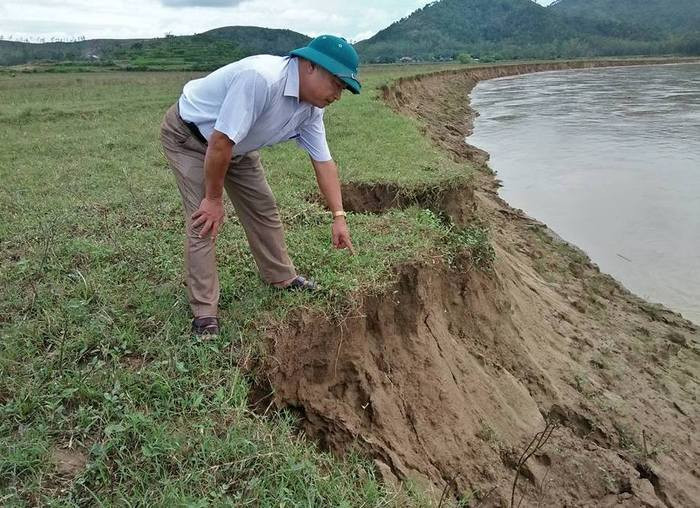
Currently, thousands of households in the three communes of Luong - Yen - Khai are facing and worrying about losing their land. According to statistics, these communes have about 500 hectares of alluvial land. Of which, riverside alluvial land is about 200 hectares. This is the main source of production materials for the people and is divided according to Decree 64. Previously, this area was relatively stable, so people were confident in investing in intensive farming.
In recent years, due to climate change and indiscriminate sand mining, the flow has changed and more ferocious floods have eroded many areas.
According to Mr. Le Hong Long - Chairman of Thanh Yen Commune People's Committee, in the past 3 years, the locality has lost an average of 8 - 10 hectares of land each year. In 2017 alone, after only 2 floods, about 12 hectares were lost. More than half of the alluvial land along the river has been lost and is still being eroded.
 |
| The ancient wave-breaking tree bank of Thanh Yen commune has just collapsed, dragging trees down the river. Photo: Dinh Ha |
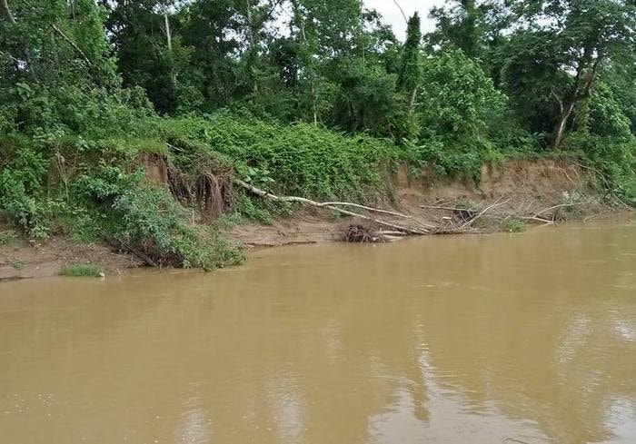
Landslides also occurred very seriously in Thanh Luong and Thanh Khai communes. Along the riverbank, about 7 km long, through 3 communes, only the section passing through Yen Thang village of Thanh Yen commune where Ru Dung pumping station is located is firmly stone-lined so it is not eroded. The entire beach area of Thanh Khai commune is eroded.
Luong - Yen - Khai communes are considered the flood-prone areas of Thanh Chuong district, so they have invested in building a flood-prevention dyke system with a budget of tens of billions of VND. However, due to many reasons, this dyke system is still unfinished.
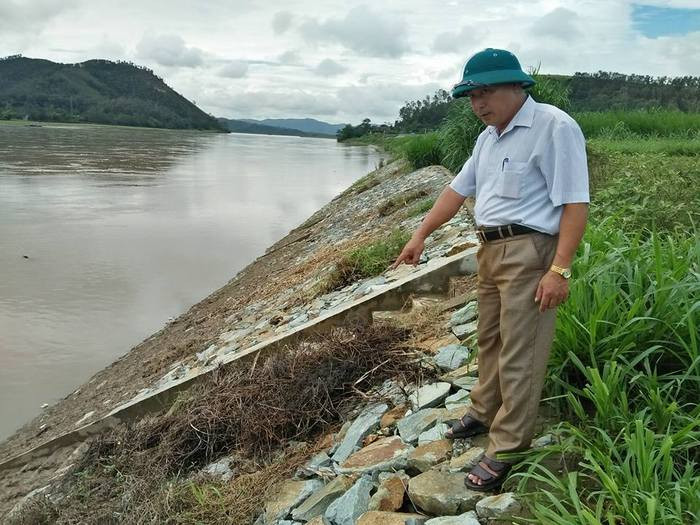 |
| The entire riverbank is about 7 km long, with only about 300 m passing through Yen Thang village, Thanh Yen commune, which is solidly embanked so it will not erode. Photo: Dinh Ha |
The landslide situation in the Luong - Yen - Khai area has reached an alarming level, but the solution seems extremely difficult.
Mr. Le Hong Long - Chairman of Thanh Yen commune, the most worried is where to get land to compensate for the people, especially Yen Binh hamlet where the majority of people's lives mainly depend on the area of alluvial land. If this speed continues, in the coming years the land will slide down to the goat's feet, threatening the residential areas because the unfinished dike line is unknown when it will be completed.
"Based on the actual situation, only embankment can prevent this situation, but embankment requires a huge amount of funding. Only about 300 meters in the most vulnerable section through Yen Thang village has required an investment of over 10 billion VND. We have also requested the district and province many times to support the embankment. In the meantime, the locality hopes to receive financial support, seedlings and techniques to plant wave-blocking trees, otherwise the entire embankment area will be lost" - Mr. Vo Trong Hoe, Chairman of Thanh Khai Commune People's Committee said.
Ha Temple
| RELATED NEWS |
|---|
