Landslide alert issued in mountainous districts of Nghe An province.
Since the beginning of June 2024, heavy rains have frequently occurred in the mountainous districts of Nghe An province, causing landslides and threatening the lives and property of the people.
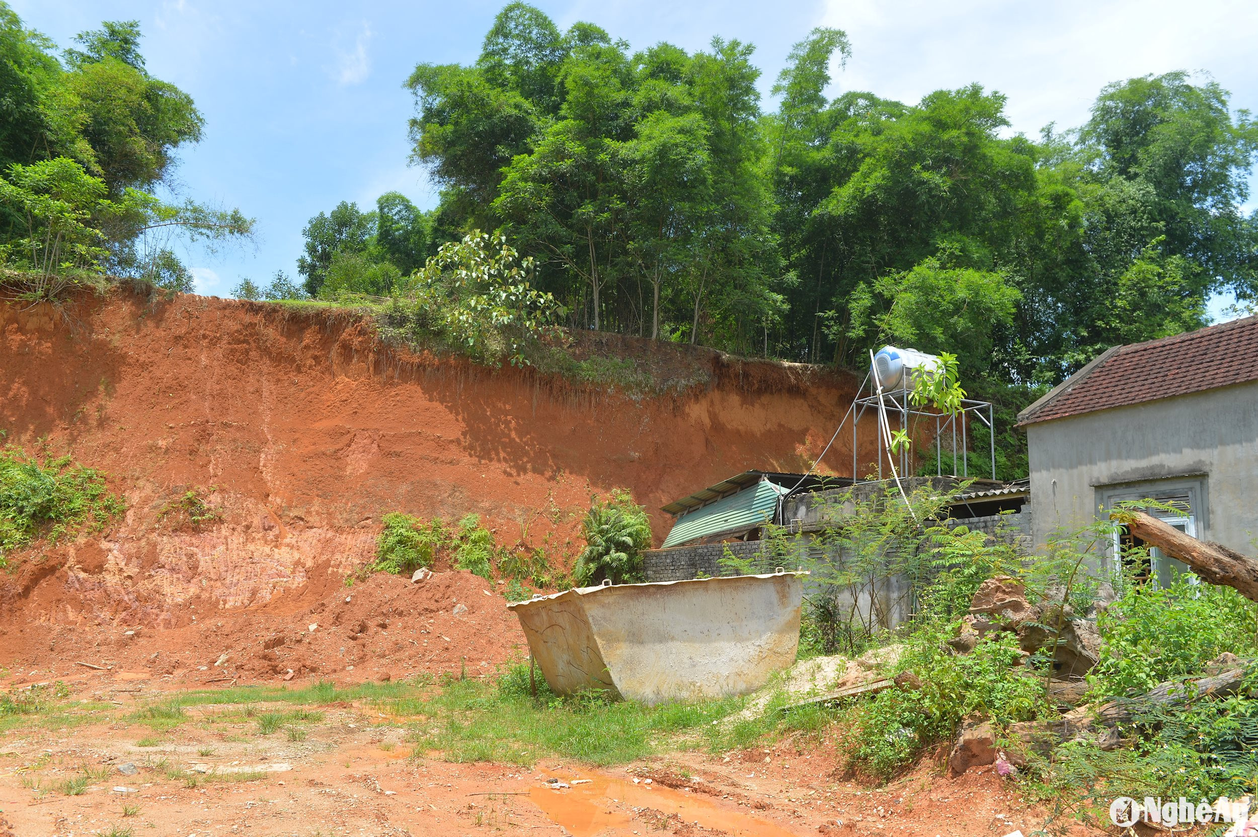
Since the beginning of June 2024, Que Phong district has experienced frequent thunderstorms, resulting in landslides in several locations. Ms. Vi Thi Binh from Muong Hin village, Tien Phong commune, Que Phong district, shared: "Just a few rainstorms and a landslide has already occurred, bringing down soil, rocks, and tree stumps near our house, leaving all family members feeling anxious and worried."
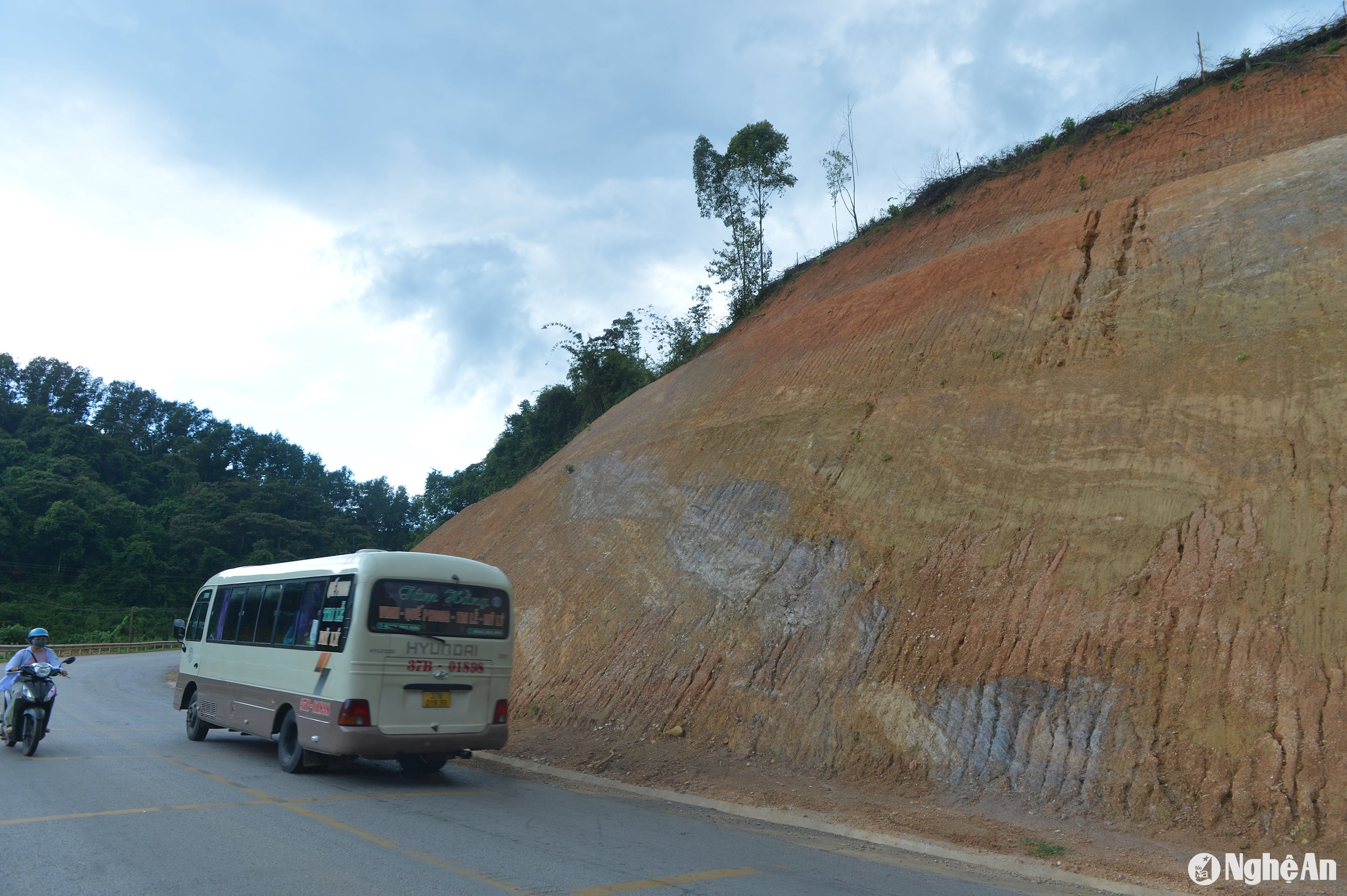
According to the reporter's observations, the hillside in the Muong Hin hamlet area has collapsed for nearly 200 meters, about 8-10 meters from Ms. Binh's family home. If heavy rain occurs, the soil and rocks will slide down, threatening the lives of the family and potentially burying the house at any time.
Mr. Vo Khanh Toan, Secretary of the Party Committee and Chairman of the People's Committee of Tien Phong commune, said: Tien Phong commune currently has 8 landslide points, concentrated in the villages of Huong Muong, Na Sanh, Muong Hin, Dan, etc., directly affecting nearly 40 households. After the rains from the beginning of June 2024 until now, the commune has organized forces to inspect and survey the landslide points, warning households of the risk of landslides so that people can proactively take precautions.
During the rainy season, the commune effectively implemented the "four on-the-spot" principle, mobilizing militia and other organizations to be on standby, and relocating 35 households when necessary to ensure the safety of people's lives and property.
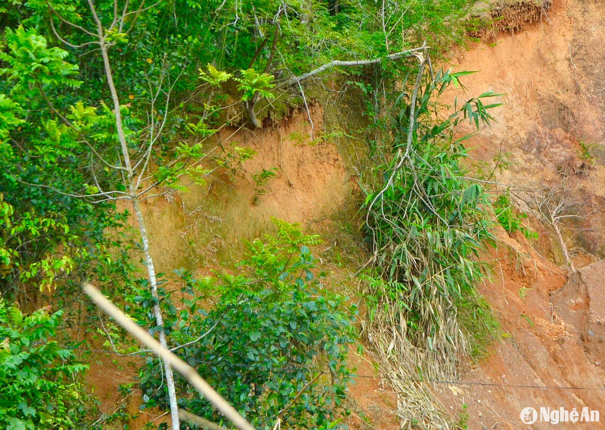
According to the Department of Agriculture's report, Que Phong is a large locality located in the northwest of the province, covering an area of over 1,888 square kilometers.2The district is divided into 13 communes and towns. The terrain is heavily fragmented by numerous ravines and streams, and the mountainous landscape frequently causes landslides, significantly impacting infrastructure, production, and the daily lives of the people. Currently, the district has over 40 landslide sites of varying sizes, affecting over 450 households, mainly concentrated in the communes of Dong Van, Thong Thu, Tien Phong, Chau Kim, Muong Ngoc, and Nam Giai…
Anticipating the complexities of natural disasters, the local authorities at all levels in Que Phong district annually organize effective preparedness and response measures based on the "four on-the-spot" principle, aiming to minimize damage caused by natural disasters, especially to people, property, and key infrastructure. This is particularly important for resettlement areas near the Hua Na hydropower plant and residential areas close to hills. The district proposes that the State continue to provide financial support for the relocation of households from areas at risk of flooding, flash floods, landslides, and mudslides.
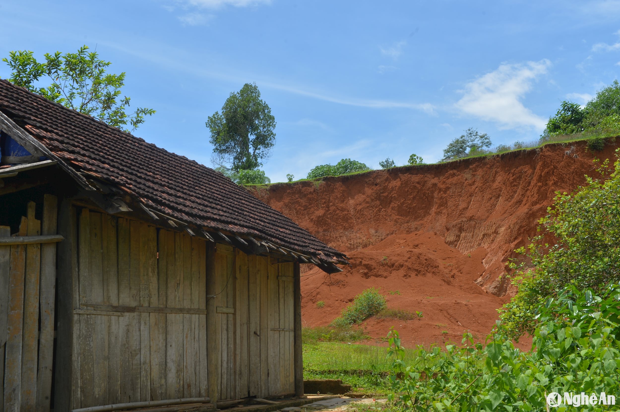
Sharing the same concern, in the Ta Lanh hamlet, Chau Hanh commune, Quy Chau district, several small landslides have occurred after each early-season rain. Currently, in that area, the landslides are minor, and nearby are the houses of local residents. A worried local resident said: "Every time there's heavy, prolonged rain, my whole family has to evacuate, taking our belongings, buffaloes, and cows to a neighbor's house for safety."
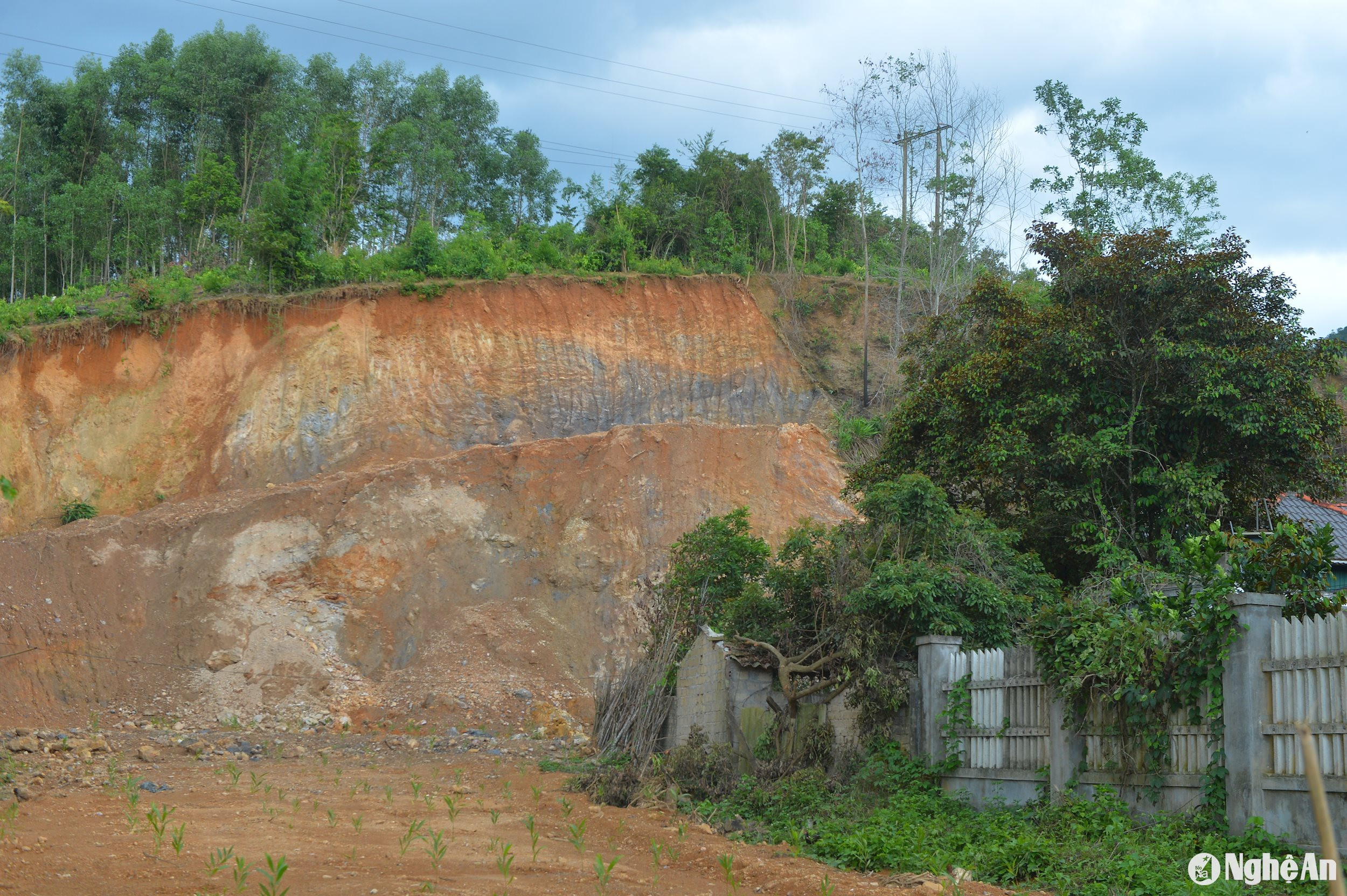
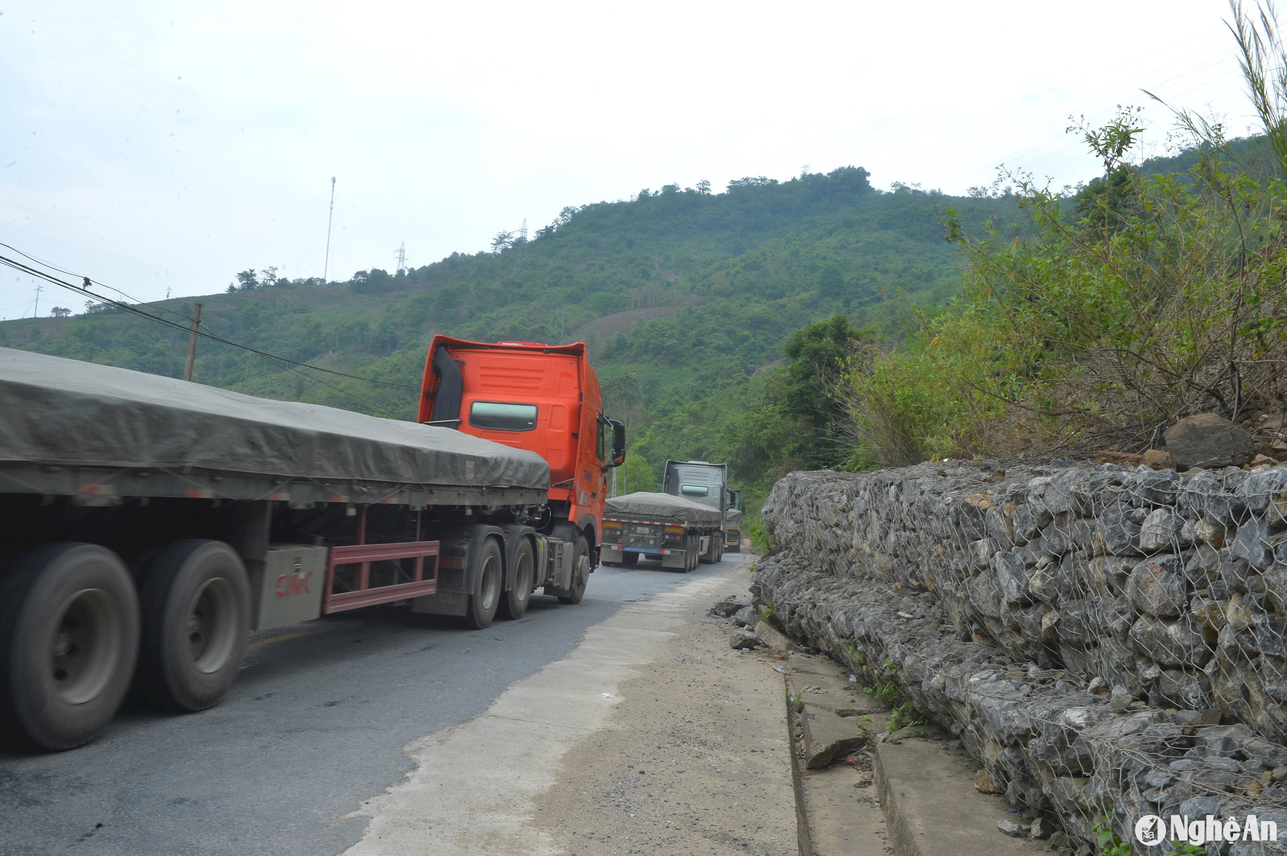
Mr. Nguyen Tien Hung, Head of the Economic and Infrastructure Department of Quy Chau District, said: "The terrain of Quy Chau District is quite rugged, with deep ravines on one side and high mountains on the other. During the rainy season, there are more than 50 landslides of varying sizes, concentrated in the communes of Chau Thang, Chau Tien, Chau Hanh, Chau Phong, Chau Nga, and along National Highway 48. From the beginning of 2024 until now, by integrating various funding sources, the district has temporarily repaired more than 20 landslides of varying sizes, mainly clearing and reopening roads."
In 2023, two serious landslides occurred on National Highway 48 in Chau Thang and Chau Hoi communes. The traffic management unit, in coordination with local authorities, has just completed the remediation of the landslides. Specifically, at Km 85+680 in the Ke Le slope area, along National Highway 48 in Chau Hoi commune, Quy Chau district.It has been severely affected by landslides since October 2023.
Rocks and soil collapsed from the mountain, blocking the road for over 200 meters. To date, the transportation unit has leveled the mountain, lowering the elevation by over 30 meters over a length of more than 200 meters in this area, clearing over 20,000 cubic meters of earth and rock.3.
At Km99+200 (National Highway 48), the section passing through Bu Bai village, Chau Thang commune, Quy Chau district, in November 2023, subsidence and deep cracks appeared, crisscrossing the road surface over a length of more than 150m. The transportation unit has now leveled the mountain, straightened the road, and removed over 14,000 m³ of landslide debris.3rocks and soil.
To minimize the risk of landslides, the district regularly reviews areas at risk of landslides, warns residents, and promptly evacuates people during heavy rains. The district has taken decisive action, raising awareness and preventing people from arbitrarily leveling hillsides and building houses under slopes.
Similarly, along National Highway 7, passing through the districts of Anh Son, Con Cuong, Tuong Duong, and Ky Son, there are numerous landslide-prone areas. Specifically, at the Cho Slope in Lang Khe commune, Con Cuong district, despite annual government funding for leveling the mountain to reduce its height, the weak soil conditions frequently cause serious landslides during the rainy season.
In some landslide-prone areas of Ky Son district, despite being reinforced with gabion retaining walls, heavy rains in recent days have pushed soil and rocks onto the road, threatening traffic.
According to a report from the Department of Irrigation, as of now, Nghe An province has nearly 274 landslide sites, affecting over 3,500 households. These landslide sites are mainly concentrated in the districts of Que Phong, Quy Chau, Ky Son, Tuong Duong, Con Cuong, Anh Son, and Quy Hop…
Mr. Nguyen Quang Dong, Head of the Disaster Prevention and Control Department of the Provincial Irrigation Sub-Department, said: To minimize the risk of landslides, households have mainly mobilized their own resources to temporarily address and mitigate landslides, such as hiring machines to remove slope damage or building small stone embankments.
The Department of Irrigation requested that localities erect warning signs about the risk of landslides so that people are aware and can take precautions. Localities at the commune level and above should develop disaster prevention plans, proactively implementing the "four on-the-spot" approach to handle landslide incidents, such as mobilizing forces to mitigate the consequences and relocating people to safe areas.

