Storm NALGAE hits the East Sea at level 12
According to the National Center for Hydro-Meteorological Forecasting, early this morning (October 30), storm NALGAE crossed the southern area of Luzon Island (Philippines) and entered the East Sea, becoming storm number 7 in 2022.
The news said, at 4 o'clock, the epicenter positionStorm NALGAEat about 15.9 degrees North latitude; 119.6 degrees East longitude, in the sea area east of the North and central East Sea. The strongest wind near the storm center is level 10 (89-102km/h), gusting to level 12.
It is forecasted that in the next 24 to 48 hours, storm number 7 will tend to strengthen.
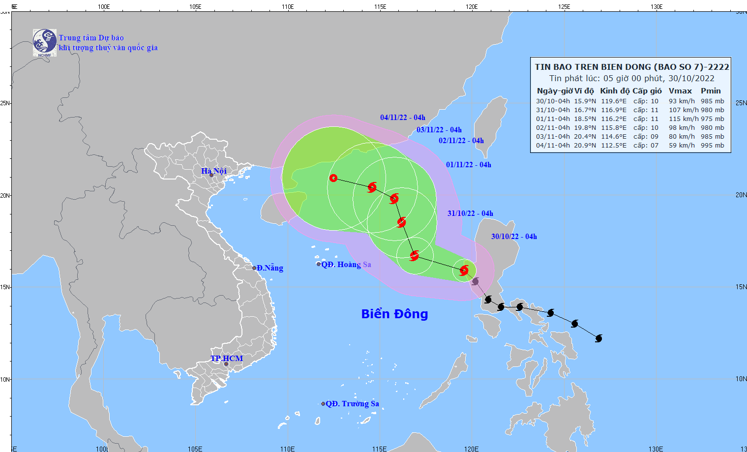 |
Forecast of the movement of storm NALGAE in the coming days. |
From the next 48 to 72 hours, the storm will move mainly in the North direction, traveling 5-10km per hour, with a strong intensity of level 10-11, gusting to level 13. From the next 72 to 120 hours, the storm is likely to change direction to move in the West Northwest direction, traveling 5-10km per hour, with a strong intensity of level 8-9, gusting to level 11.
Due to the influence of the storm, the eastern sea of the North and Central East Sea has strong winds of level 7-8, then increasing to level 8-9, the area near the storm center has strong winds of level 10-11, gusting to level 13; the sea is very rough. The western sea of the northern and central East Sea (including the sea area of Hoang Sa archipelago) has strong northeast to north winds of level 6-7; the sea is very rough.
In the eastern sea area of the North and Central East Sea, waves are 5-7m high, and near the storm center, they are 7-9m high.
