
Typhoon SAOLA is approaching the South China Sea.
(Baonghean.vn) - At 1:00 AM on August 30th, the center of Typhoon SAOLA was located at approximately 19.9 degrees North latitude and 121.9 degrees East longitude, in the sea north of Luzon Island (Philippines). The strongest winds near the center of the typhoon reached level 15, with gusts exceeding level 17.
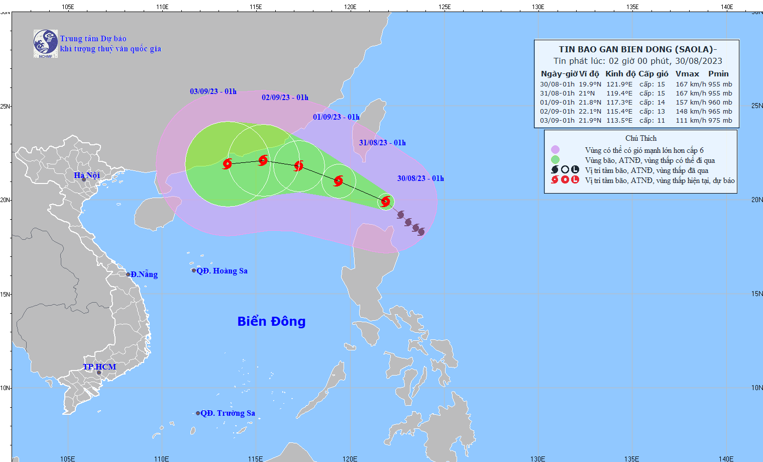
According to the National Center for Meteorological and Hydrological Forecasting, at 1:00 AM on August 30th, the center of the storm was located at...Typhoon SAOLALocated at approximately 19.9 degrees North latitude and 121.9 degrees East longitude, over the sea north of Luzon Island (Philippines). The strongest winds near the center of the typhoon are at level 15 (167-183 km/h), with gusts exceeding level 17, moving northwest at a speed of 10-15 km/h.
Forecasts indicate that by 1:00 AM on August 31st, the storm will move in a northwest direction, with an intensity of level 15, gusts of level 17, and a speed of 10-15 km per hour.
Over the next 72 to 120 hours, the storm will move mainly westward at a speed of about 10 km per hour, and its intensity is likely to gradually weaken.
Due to the impact of the storm, the northeastern part of the North East Sea region will experience strong winds of level 6, increasing to levels 7-8 from the afternoon and night of August 30th, with winds near the storm's center reaching levels 10-12, then increasing to levels 13-15, with gusts exceeding level 17; the sea will be extremely rough.
In the eastern part of the North East Sea region, the waves are 3.0-5.0m high.


