Flash flood and landslide warning in Nghe An and Thanh Hoa
(Baonghean.vn) - According to the National Center for Hydro-Meteorological Forecasting, a flood will appear in the North Central region, with flood levels rising to 3-6m on the river systems in Thanh Hoa and Nghe An.
From tonight (August 14) to August 15, there will be scattered rain in the Northeast. From the night of August 15 to August 17, there will be heavy to very heavy rain in the Northern and North Central provinces (rainfall 250-350mm/period).
Warning: From August 16-18, in the North and North Central regions, there will be a flood, the flood amplitude on the Red-Thai Binh river system, Hoang Long river will be from 2-4m, rivers in Thanh Hoa and Nghe An will be from 3-6m.
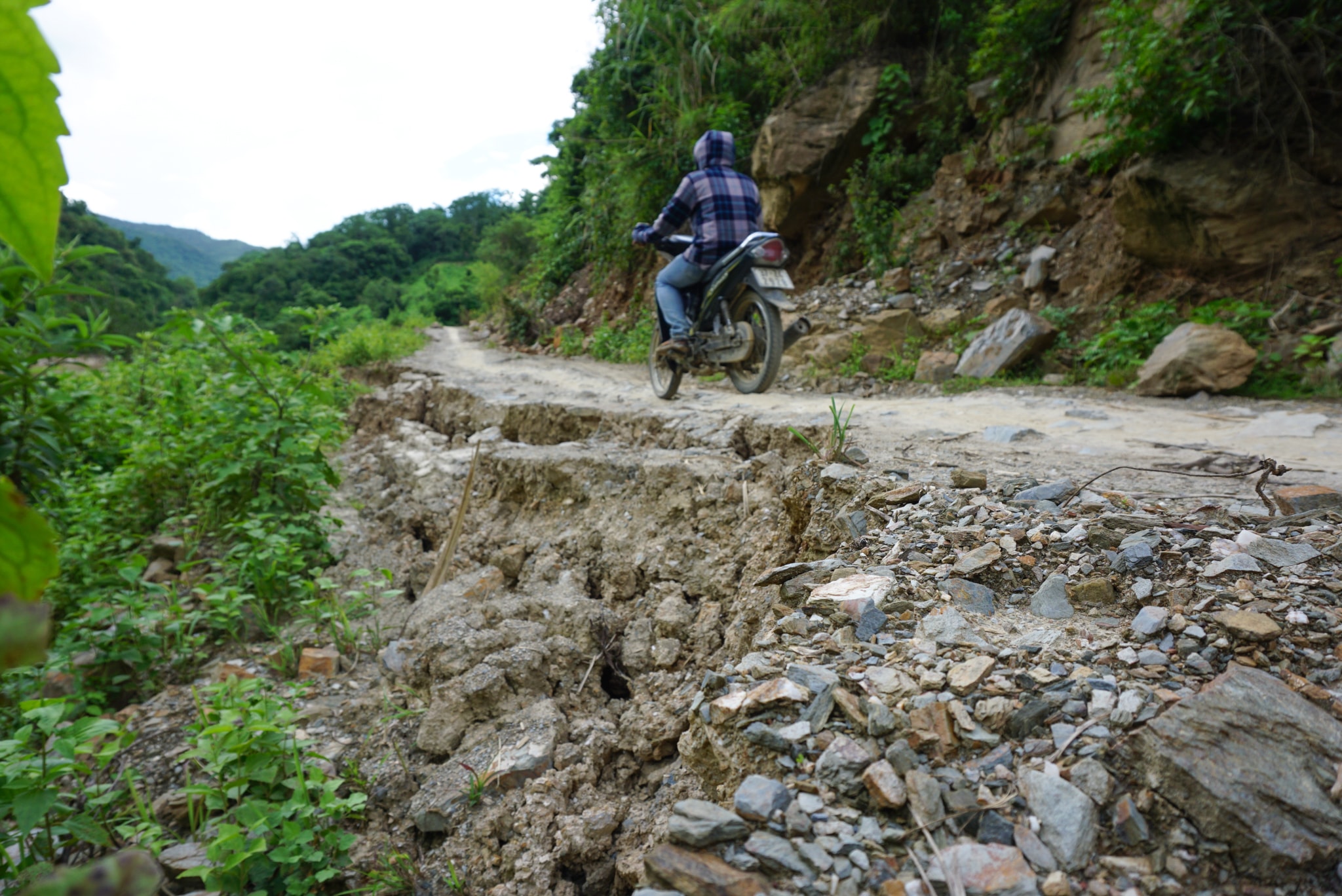 |
| Storm No. 3 at the end of July 2018 caused landslides and isolation of the border belt traffic route connecting Muong Xen town through Ta Ca, Muong Tip, and Muong Ai communes (Ky Son, Nghe An). Photo courtesy |
During this flood season, the flood peak on the Da River, Thao River, Hoang Long River, Bui River, and Buoi River (Thanh Hoa) is likely to reach level 2-3; the upstream of the Thai Binh River is at level 1, the upstream of the Ma River (Thanh Hoa) is at level 1-2, and the downstream of the Ma River is below level 1.
There is a high risk of landslides and flash floods in the mountainous areas of the North and North Central regions, especially in provinces such as Lai Chau, Son La, Hoa Binh, Yen Bai, Phu Tho, Quang Ninh, Lang Son, Cao Bang, Thanh Hoa, and Nghe An.
Flooding in low-lying areas is likely to occur, especially in the Northern Delta region. Warning level of natural disaster risk due to floods, flash floods, and landslides in the mountainous areas of the North and North Central regions: level 1.
FLOOD NEWS AT THE UPPER SOURCE OF THE MEKONG RIVER
According to the bulletin released at 9:30 today by the National Center for Hydro-Meteorological Forecasting, the water level at the headwaters of the Mekong River is rising. The highest water level on August 13 on the Tien River at Tan Chau station: 3.7m, 0.2m above the alarm level (BĐ)1; on the Hau River at Chau Doc: 3.17m, 0.17m above BĐ1.
It is forecasted that in the coming days, the water level of the Mekong River upstream will change slowly according to the tide. As of August 20, the highest water level on the Tien River at Tan Chau will be 3.85m, 0.15m below BĐ2; on the Hau River at Chau Doc will be 3.25m, 0.25m below BĐ2.
In the following days, the water level at the headwaters of the Mekong River will rise with the tide. On August 25, the highest water level at Tan Chau will be 4.0m, at level BĐ2; at Chau Doc it will be 3.4m, 0.1m below BĐ2.
High risk of flooding in low-lying areas, riverside areas, and areas outside the dikes of An Giang, Dong Thap, and Long An provinces.Disaster risk warning level: Level 1-2
")


