Heavy rain, rising river levels, and landslides are forecast in Nghe An from September 29-30.
According to information from Nghe An Hydrometeorological Station, many localities in the province are forecast to continue to be heavily affected by storm No. 10 and its circulation.
In the past 24 hours, on the mainland of Nghe An province, there was very heavy to extremely heavy rain and thunderstorms with commonly measured rainfall of 150 - 350mm, some places had more, such as Nong Truong 1/5 with heavy rain of 478mm, Yen Thuong 432mm...; especially in the western mountainous region, there was moderate to heavy rain with commonly measured rainfall of 30 - 60mm, some places had more, such as Cha Lum village with 93mm,...
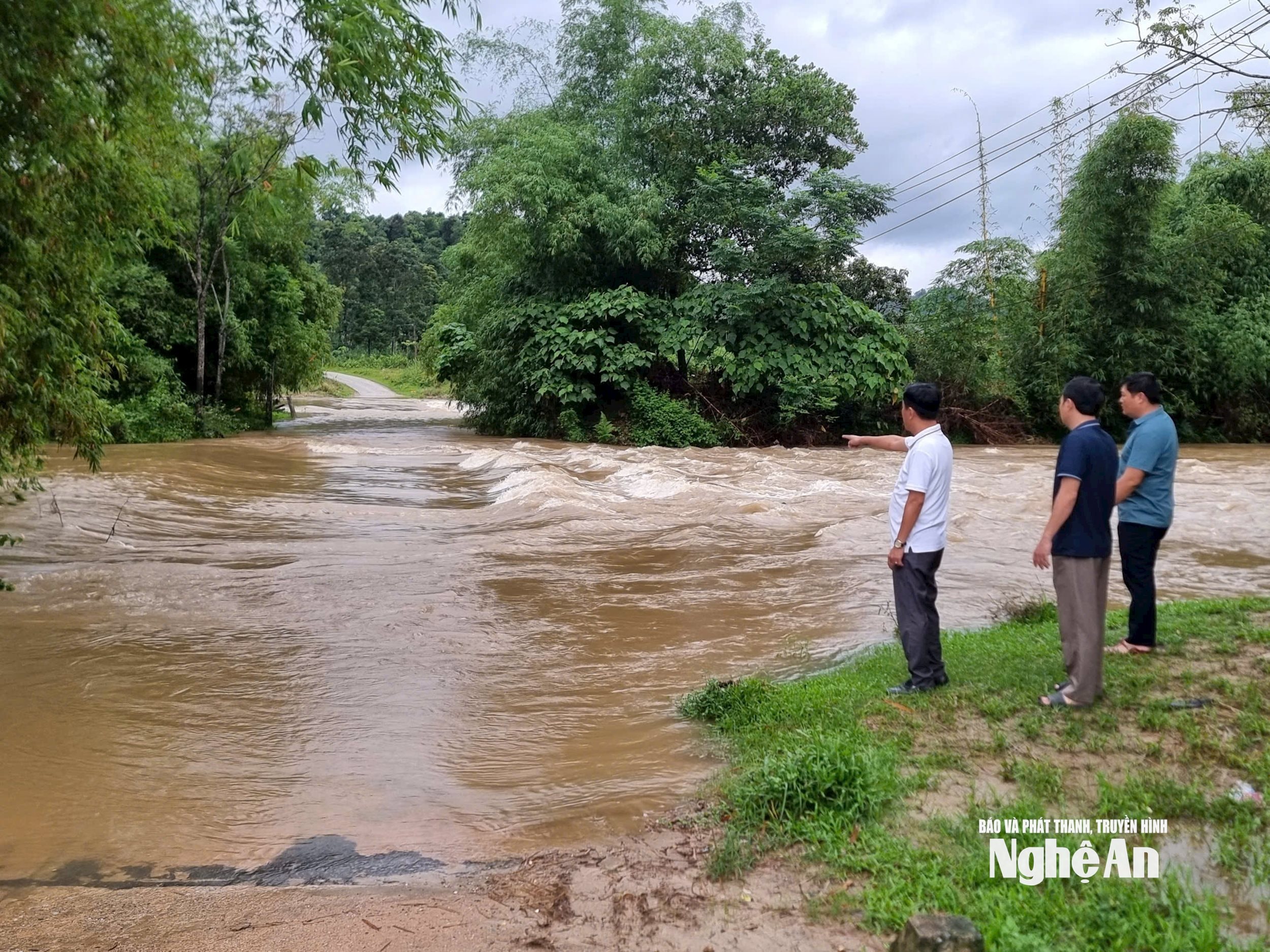
Forecast for the next 6-12 hours: Floods on Nghe An rivers continue to rise. Floods rising rapidly on Lam River are likely to reach alert level 2, alert level 3, and in some places above alert level 3. Water levels on Hieu River and the lower reaches of Lam River continue to rise rapidly.
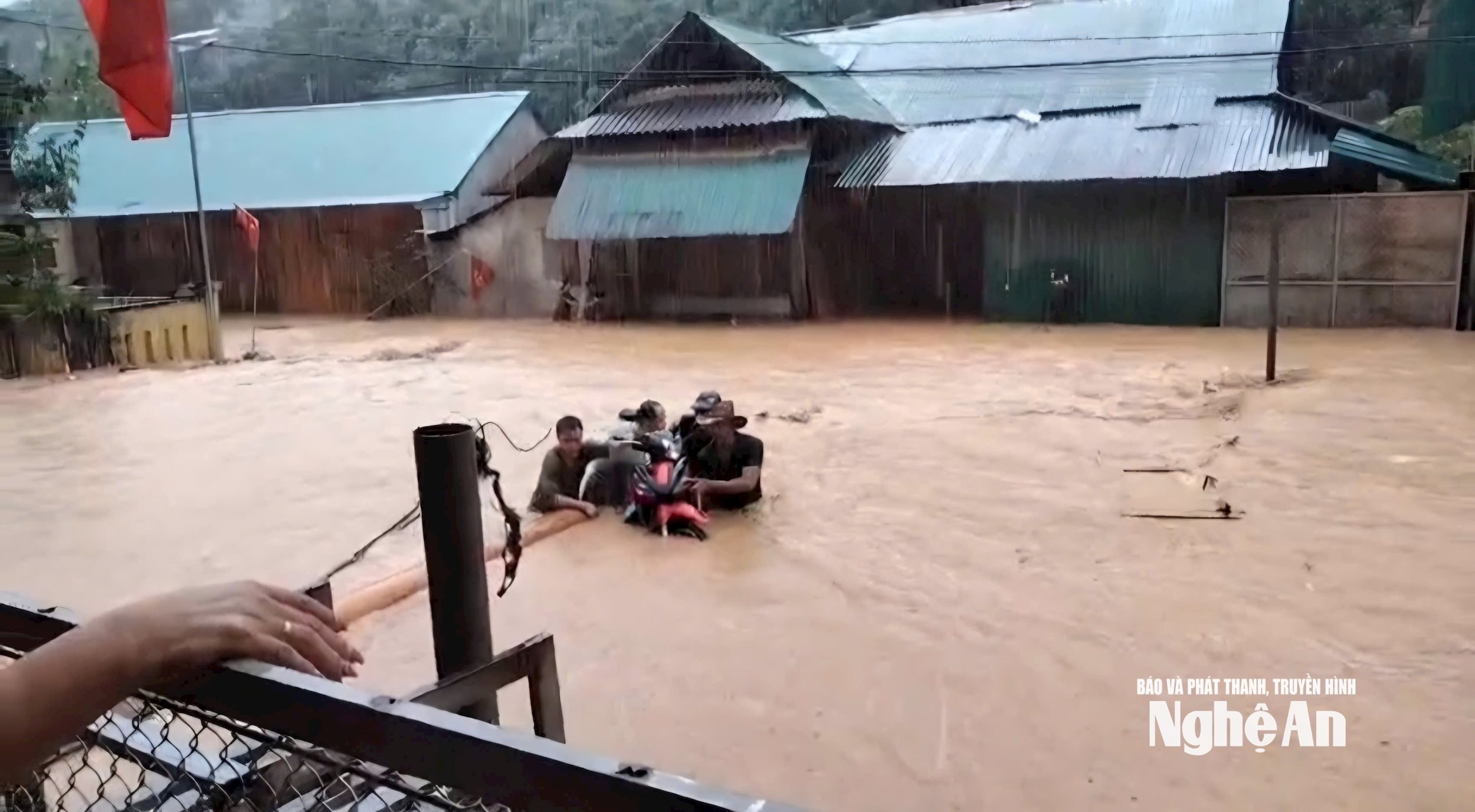
Therefore, localities need to continue monitoring and implementing response measures when the flood on Lam River continues to rise rapidly, causing widespread flooding in the entire Nghe An province. There is a high risk of flash floods and landslides in mountainous areas, midlands, along rivers, small streams and steep slopes in mountainous areas.
In particular, note the level 2 warning of natural disaster risks due to floods: River floods can cause flooding in low-lying areas, affecting waterway traffic, aquaculture, agricultural production, people's lives and socio-economic activities.
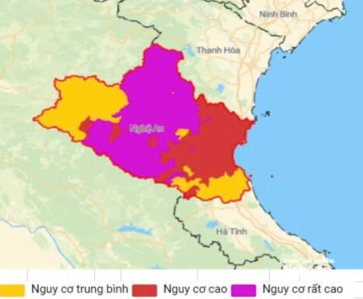
Forecast for the day and night of September 29, Nghe An province will have very heavy rain and thunderstorms. Forecasted rainfall: 60 - 120mm, some places over 150mm such as Muong Xen, Que Phong, Quy Chau, Quy Hop, Tuong Duong... Warning of risk of heavy rain (100mm/3h). During thunderstorms, there is a possibility of tornadoes, lightning, hail and strong gusts of wind.
In addition, it is forecasted that on the day and night of September 30, there will be scattered showers and thunderstorms in the area, with heavy rain in some places with rainfall ranging from 10mm to 30mm, and over 50mm in some places. Therefore, it is necessary to be on guard against heavy rain in a short period of time causing flooding in urban areas and low-lying areas. During thunderstorms, there is a possibility of tornadoes, lightning, hail and strong gusts of wind.
According to statistics, flood developments in the past 12 hours: floods on Nghe An rivers, water levels at 07:00 on September 29, 2025 at some locations are as follows: At Con Cuong station: 2,860cm above alarm level 1 (BĐ1): 60cm. Thach Giam: 6,667cm above BĐ1: 67cm. Dua: 2,110cm, above BĐ1: 60cm. Nam Dan: 554cm, above BĐ1: 14cm. Cho Trang: 362cm, above BĐ1: 62cm. Cua Hoi: 245cm, above BĐ3: 0.5m.
-
.jpg "Lực lượng cứu hộ khẩn trương giúp dân đường Nguyễn Tài thoát ngập")


