
The legendary Ho Chi Minh Trail - From Milestone No. 0
(Baonghean)We stood silently beside the sacred kilometer zero marker, where the first shovel strokes were made to open the strategic road that cut through the Truong Son mountain range to save the country - Tan Ky, Nghe An.
The Ho Chi Minh Trail stretched wide in the afternoon, the mountains along the road beginning to cast shadows. I imagined "squads of vehicles without windshields," the low hum of engines from camouflage-covered armored vehicles, the faint light emanating from small lamps beneath the chassis, groups of civilian laborers hastily repairing the road, the sounds of hoes and shovels leveling hills and mountains, the thundering footsteps marching to battle, the feet of soldiers "wearing down the blue stones"...
|
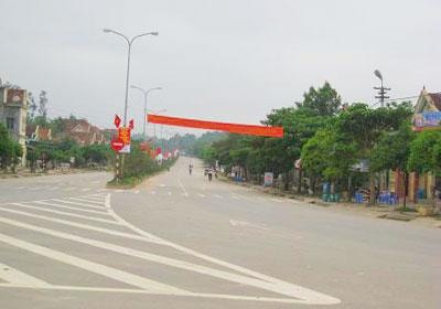
The old road...
This crucial point. The sound of vehicles and the road. The figures in white uniforms, living markers. The people, their dreams and expectations, the immense sacrifices that cannot be expressed in words today... The historic Truong Son Road has shed so much blood and bone from a time of burning hatred and passionate love, a time when "everything for the front lines, everything to defeat the American enemy."
Tan Ky was a key target of fierce enemy attacks aimed at completely cutting off the supply lines to the Southern battlefield, and was chosen as the first point to open the strategic road. The 559th Engineering Regiment – a strategic military engineering and transport unit responsible for transport along the Ho Chi Minh Trail – along with the army and people of Tan Ky, struck the first shovelfuls here, together with the entire route, creating a "battlefield of the jungle" that was crucial to the success or failure of the Ho Chi Minh Campaign.
The Ho Chi Minh Trail was not just a transportation route, but a fierce battlefield, an extraordinary effort by the Central Committee, the North, and our army and people to support our compatriots and soldiers in the South in defeating the American invaders. The American forces used every tactic and weapon to cripple this vital artery. From electronic equipment to chemical weapons, B52 bombers, weather weapons... Twenty thousand soldiers and militiamen fell along the trail, and thirty thousand were permanently injured, but the trail has become immortal.
Today, the Ho Chi Minh Trail stretches from Cao Bang to Ca Mau Cape, not only holding strategic significance in economic trade but also serving as a red thread preserving the heroic and indomitable traditions of the nation. It is the path back to the roots for future generations.
|
The car glided smoothly along the 37km stretch of the Ho Chi Minh Highway through Tan Ky. The spring sunshine shone brightly on the lush green hills on either side. Crimson wildflowers bloomed in the spring, cascading down the roadside embankments, and the spring rice paddies were a vibrant green.
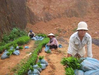
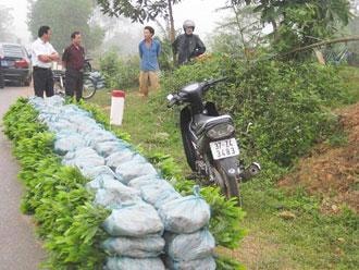
The village is prosperous, nestled amidst lush green forests and orchards. Stopping in Tan Huong, a commune now home to 70 households along the Ho Chi Minh Highway specializing in cultivating forest tree seedlings, eucalyptus, and acacia, has opened up a new business opportunity for the locals and become one of the most effective models in Tan Ky today. For the past three years, the people of Tan Huong have found a way out of poverty through cultivating forest tree seedlings, breeding fish, and creating effective models for crop and livestock conversion, earning tens of millions of dong in profit each year, leading to increasingly prosperous lives and a rise in wealth.
People from Nghia Hanh, Nghia Hop, and Nghia Binh districts, who used to migrate from Dien Chau and Quynh Luu, brought with them the tradition of growing vegetables and crops, but couldn't sell them. Now, with the development of major roads, they have boosted the cultivation of commercial vegetables and watermelons, selling not only locally but also to Anh Son and Do Luong districts, and even to Hanoi… Oranges from Tan Ky and paper-making raw materials are no longer subject to price manipulation because many traders come directly to the orchards to buy them.
Mr. Nguyen Duy Thuy, Chairman of the Tan Ky District People's Committee, happily stated: "Previously, Tan Ky was considered a 'dead end.' For the past three years, with the Ho Chi Minh Highway passing through six communes and one town, travel from Tan Ky to the South and North has become much easier. The district has also built a complete network of feeder roads along the route, effectively serving economic development and people's lives."
Previously, Tan Ky only produced 30,000 tons of food per year, but now it has increased to 60,000 tons annually thanks to good sales of rice and corn. Forestry has not developed significantly, but the strongest movement is the planting of raw material forests. The Thai and Tho ethnic minorities along both sides of the Ho Chi Minh Highway have abandoned their self-sufficient farming practices, and students are more diligent in attending school due to the shortened travel time. Thanks to the Ho Chi Minh Highway, Tan Ky town has seen strong development of commercial and service centers. Tan Ky has significantly shifted its crop structure, and the poverty rate has decreased rapidly.”
|
According to the plan for 2020, the Ho Chi Minh Highway, passing through Nghe An, Thanh Hoa, and Ha Tinh provinces, includes 20 urban areas, one Type III urban area, one central urban area in the western mountainous region of Nghe An equivalent to a Type III urban area (now Thai Hoa town), and the rest are Type 4 urban areas. The Ho Chi Minh Highway is being connected to the road network in a unified and interconnected manner, linking with National Highway 1 and other national highways.
The Ho Chi Minh Trail – from milestone number 0, is truly imbued with the deep affection of people and land. From the moment we stop to enjoy the sweet, juicy melons from the red soil along the roadside, to savoring the steamed fish of Tan Huong people. From the vibrant red blossoms of the vast forest, which have been, are, and will continue to bloom, honoring the legend of this vital artery leading to prosperity...
Text and photos: Chau Lan


