A different perspective of the center of 11 mountainous districts and towns in Nghe An province
(Baonghean.vn) - Many people may be familiar with the landmarks and landscapes in these lands, but not everyone has the opportunity to see the administrative center of 11 midland and mountainous districts of Nghe An from a different angle from above.
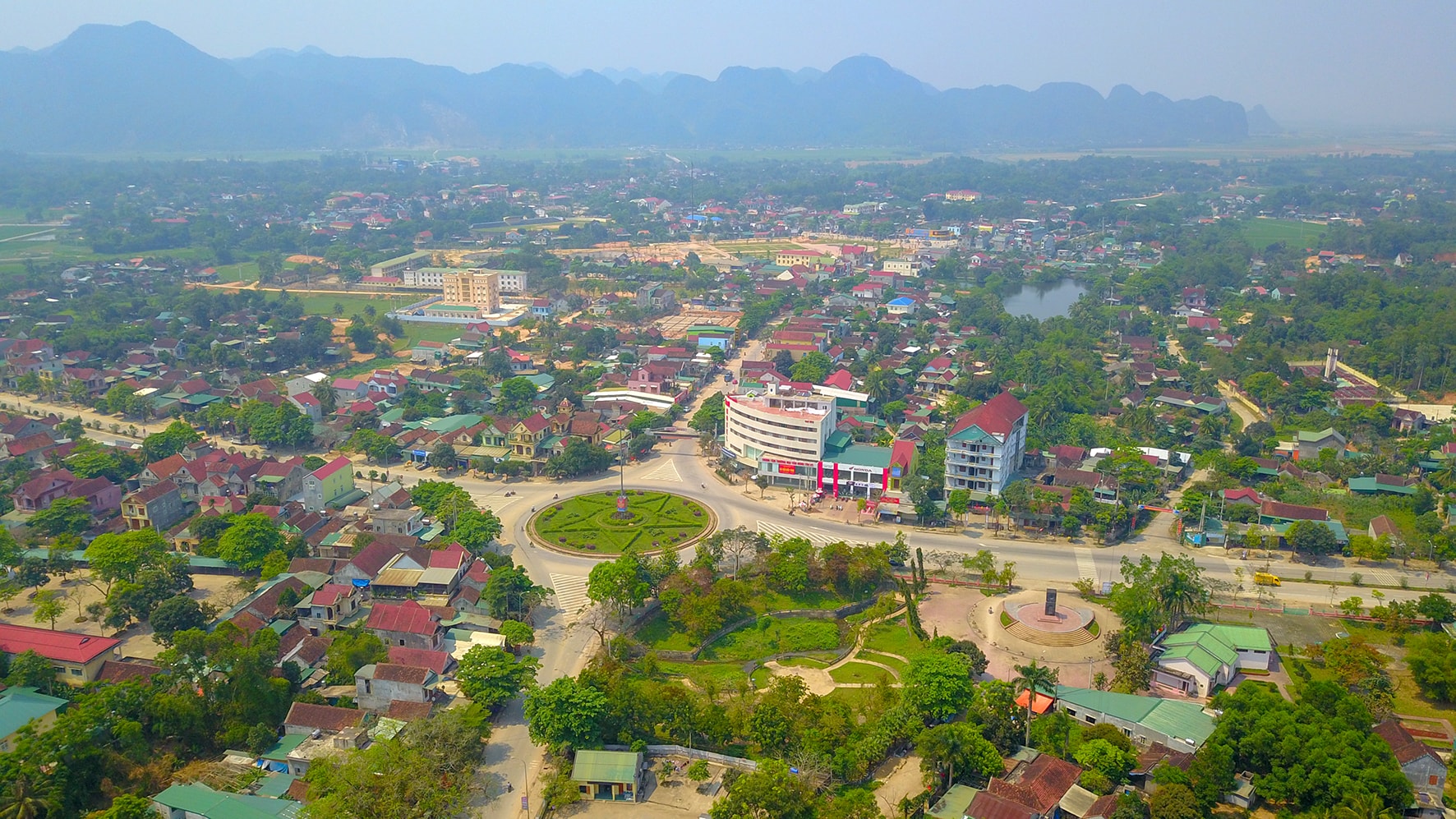 |
| The center of Tan Ky district stands out with a large star-shaped roundabout and milestone 0 of the Ho Chi Minh Trail. Tan Ky is a mountainous district in the West of Nghe An, 90 km from Vinh City, with Truong Son Road passing through. The district is included by UNESCO in the list of sites belonging to the Western Nghe An Biosphere Reserve. Photo: Sach Nguyen |
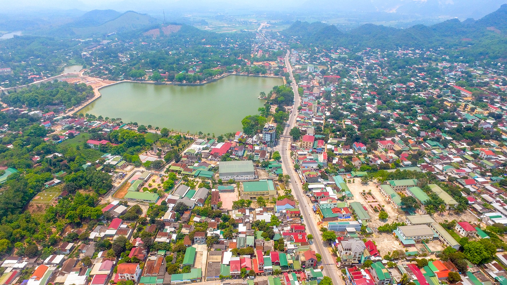 |
| The poetic Thung May Lake is located next to Thanh Nien Park in the center of Quy Hop District. The district has many beautiful landscapes such as Ke Ham Cave, Tham Poong Cave and the most famous is Ban Bia Waterfall. Quy Hop is also a place in the Western Nghe An Biosphere Reserve. Photo: Sach Nguyen |
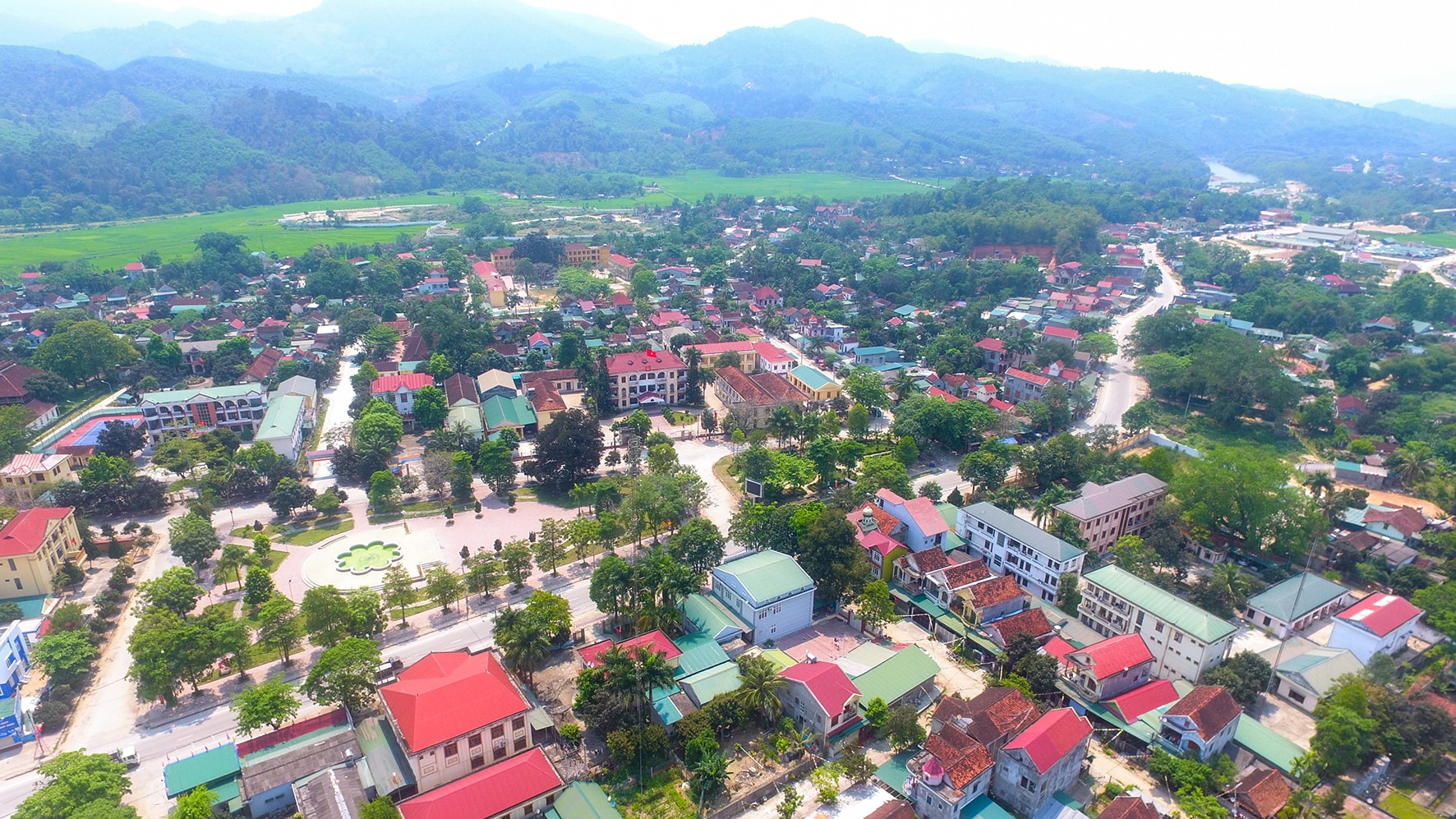 |
| Quy Chau town is located on National Highway 48A. Quy Chau's terrain is quite complex with more than 72% of the area at an altitude of over 200m above sea level and has a dense network of rivers and streams. This river system has created many beautiful waterfalls such as Dua waterfall, Tat Ngoi waterfall, and Nam Pong stream. This is the district's advantage for developing eco-tourism. Photo: Sach Nguyen |
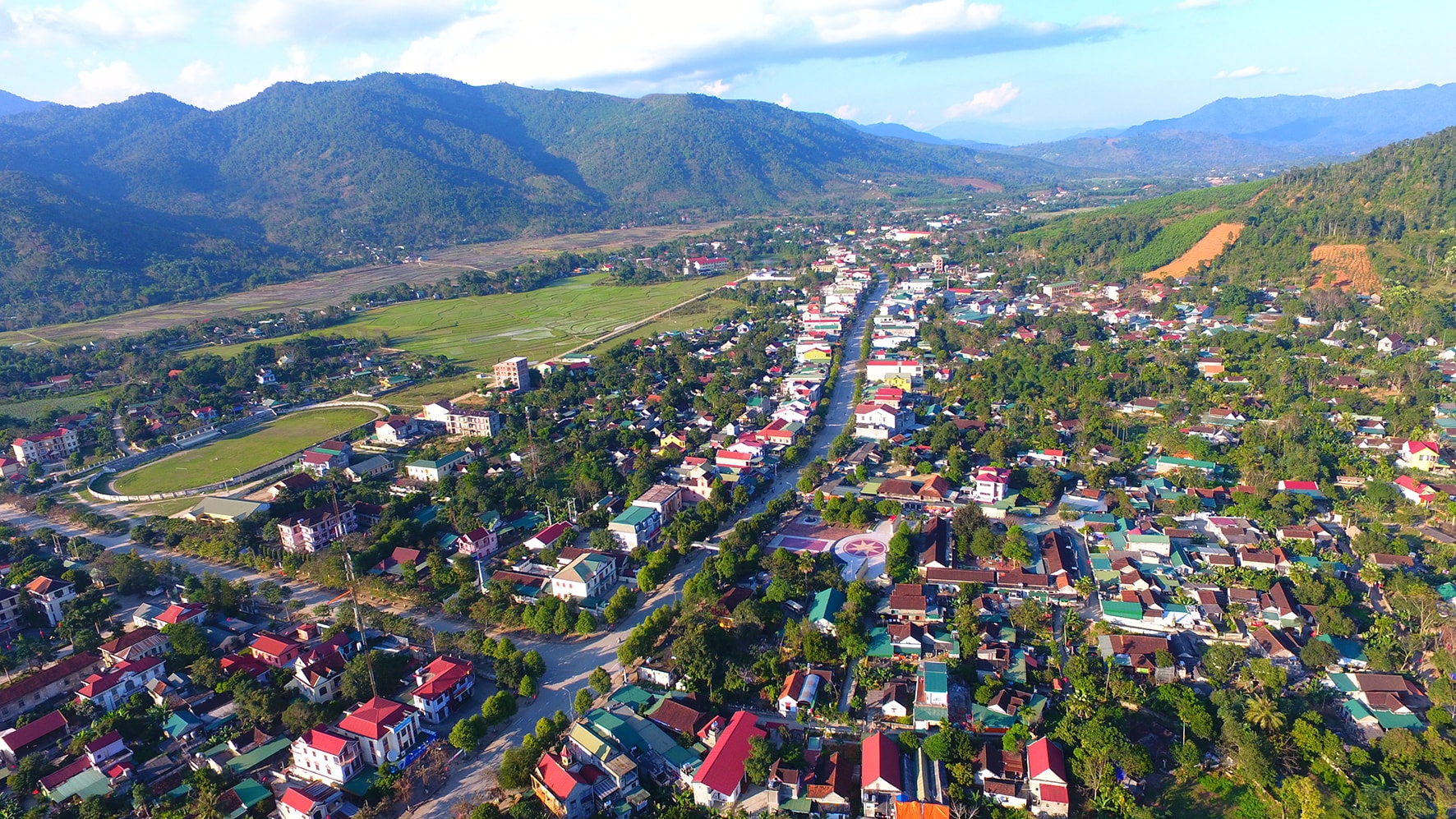 |
| The center of Que Phong district seen from above has a highlight of a spacious stadium covered with green grass. From the town, visitors can connect to many impressive tourist destinations of Que Phong such as Hua Na hydroelectric lake, Chin Gian temple, ancient Thai village, Sao Va waterfall, Bay Tang waterfall, Pu Hoat nature reserve,... Que Phong is one of the tourist destinations located on the route Cua Lo - Vinh - Nghia Dan - Quy Chau - Que Phong. This is a district bordering Vietnam - Laos. Photo: Sach Nguyen |
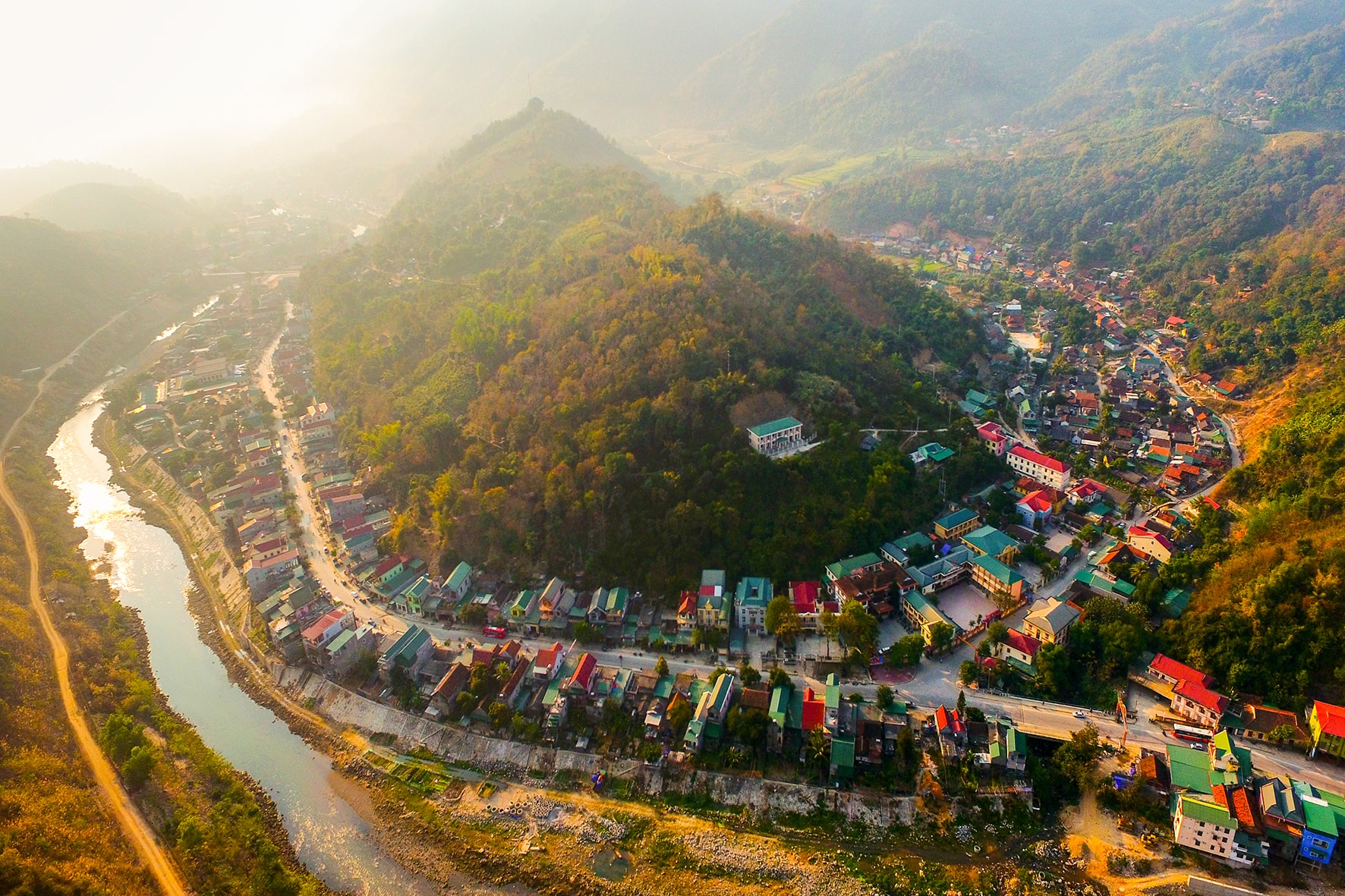 |
| Muong Xen town (Ky Son border district) is beautiful with undulating roofs leaning against the mountains and the clear Nam Mo stream flowing along National Highway 7A. Ky Son district is mainly mountainous, including many high, rugged mountain ranges on the Vietnam - Laos border. Puxailaileng mountain range in Na Ngoi commune has a peak of 2,711 m, the highest mountain in Nghe An and the entire Truong Son range, and is also an emerging tourist destination in recent years for those who love to explore, climb mountains and watch the snow fall in winter. Photo: Sach Nguyen |
 |
| The administrative center of Tuong Duong district - Hoa Binh town - lies between the green ranges of mountains and Lam Giang river. Tuong Duong is a mountainous district located in the southwest of Nghe An province, nearly 200 km from Vinh city and 90 km from Nam Can border gate, and is the district with the largest natural area among the districts in Vietnam. Photo: Sach Nguyen |
 |
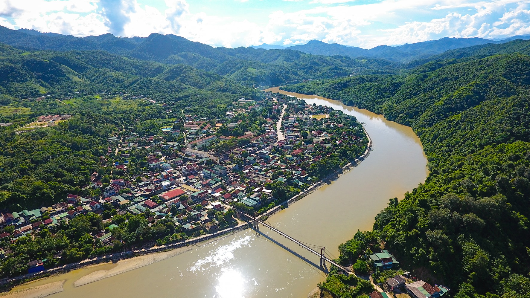
| Suspension bridge on Lam River, passing through Con Cuong town. Con Cuong district has a 55.5 km long Vietnam - Laos border in the southwest. Thanks to this location advantage, Con Cuong has many favorable conditions to develop agriculture - forestry, tourism and trade. Con Cuong is famous for Khe Kem waterfall, Bo Bo waterfall, Pu Mat National Park,... Photo: Sach Nguyen |
 |
| National Highway 7A cuts through the administrative center of Anh Son district. Anh Son district's area stretches along the banks of Lam River, Con River, Giang River and National Highway 7. The terrain has many limestone mountain ranges, connected together, with Kim Nhan peak over 1,340m high, creating many beautiful caves. The district also shares the Vietnam - Laos border. Photo: Quang Dung |
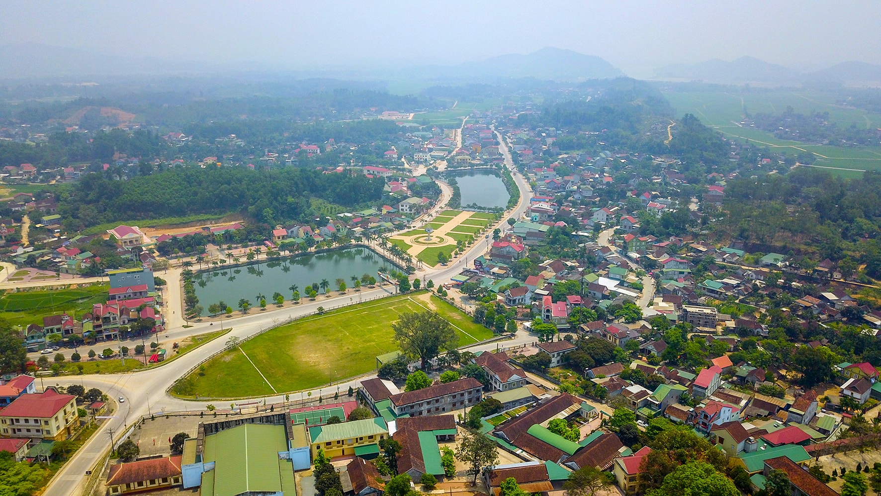 |
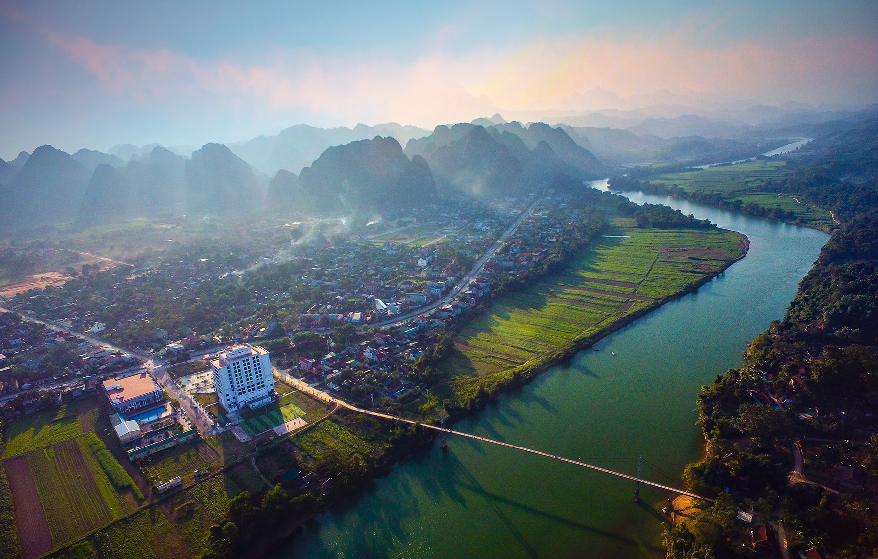
| Thanh Chuong district center is neatly planned with parks, lakes, and stadiums. Among the mountainous districts of Vietnam, Thanh Chuong is the most populous district (over 250,000 people). Thanh Chuong has the Vietnam - Laos border running through it, and there is the Thanh Thuy international border gate located on the Hanoi - Vientiane (Laos) highway under construction. Photo: Sach Nguyen |
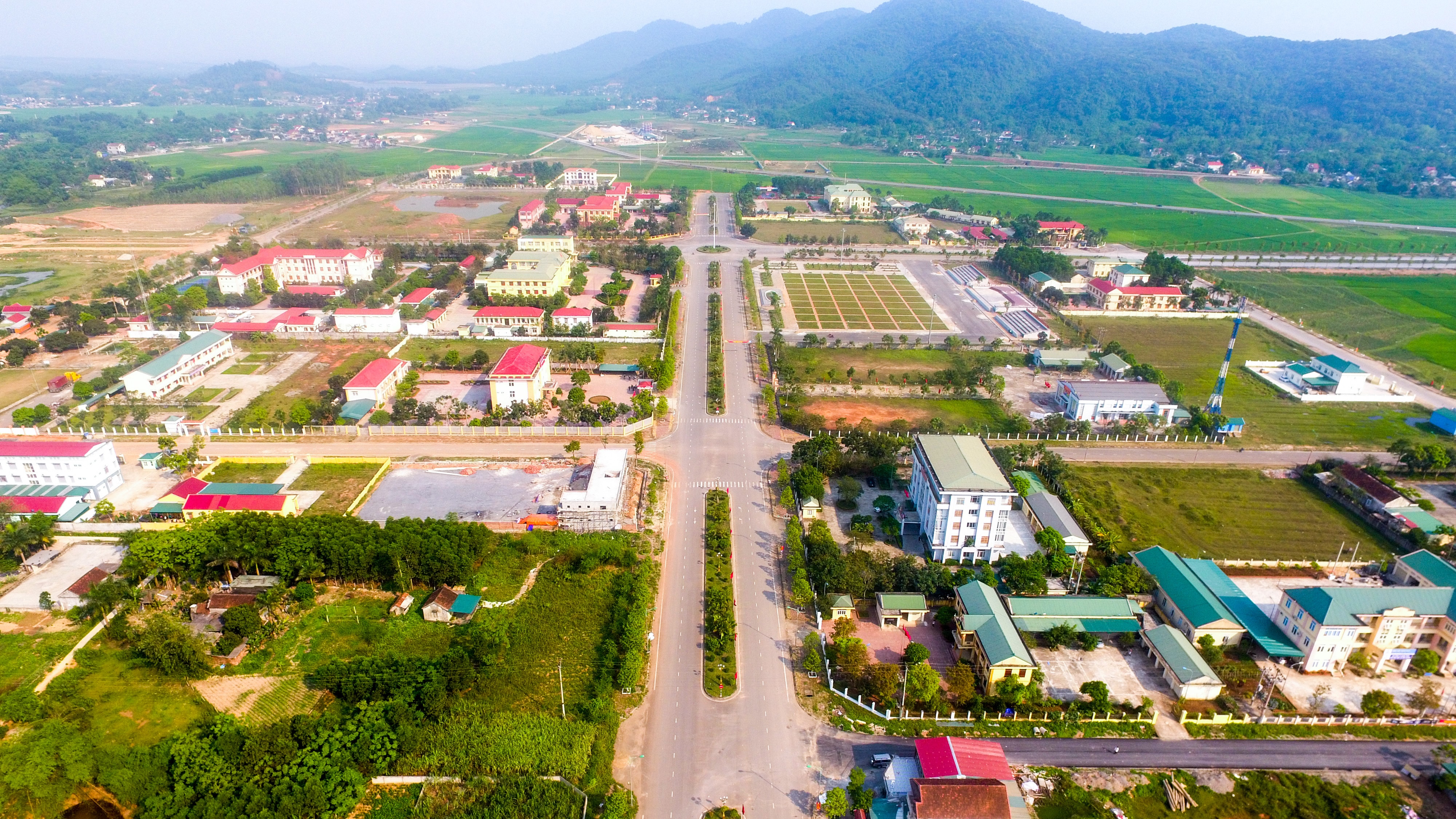 |
| The center of Nghia Dan district is planned and built spaciously. Nghia Dan district is a familiar destination for tourists inside and outside the province thanks to its beautiful sunflower fields and many attractive products. Photo: Sach Nguyen |
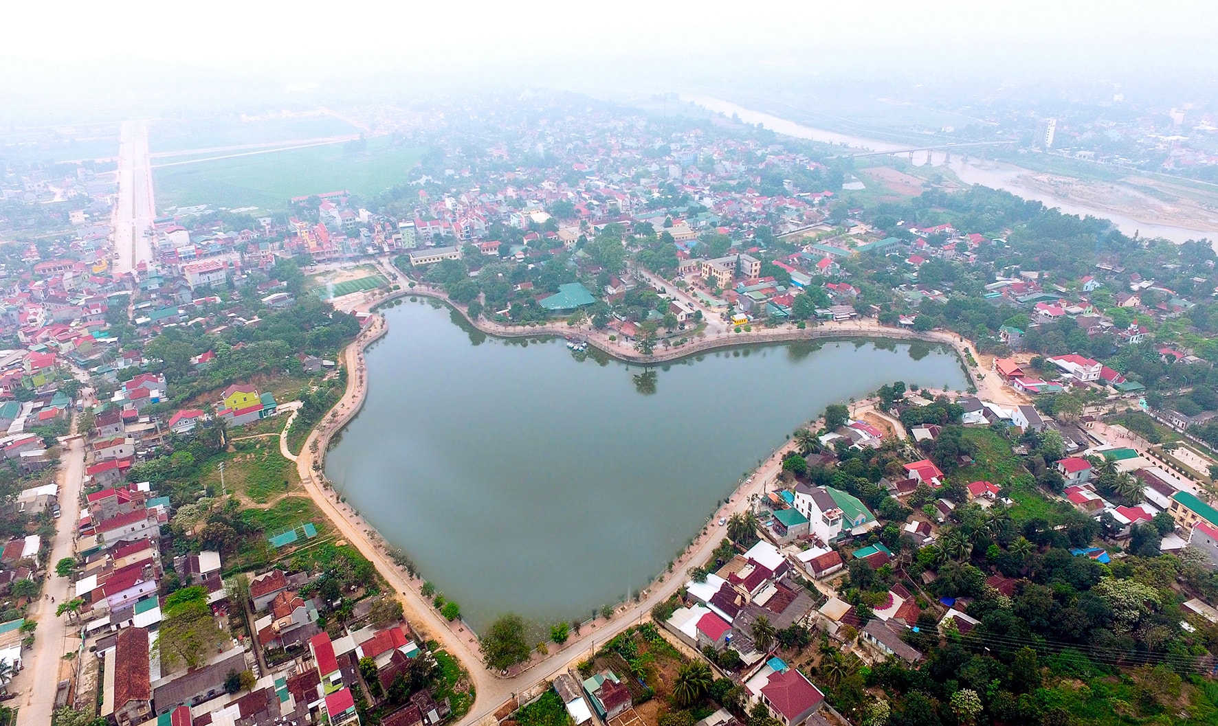 |
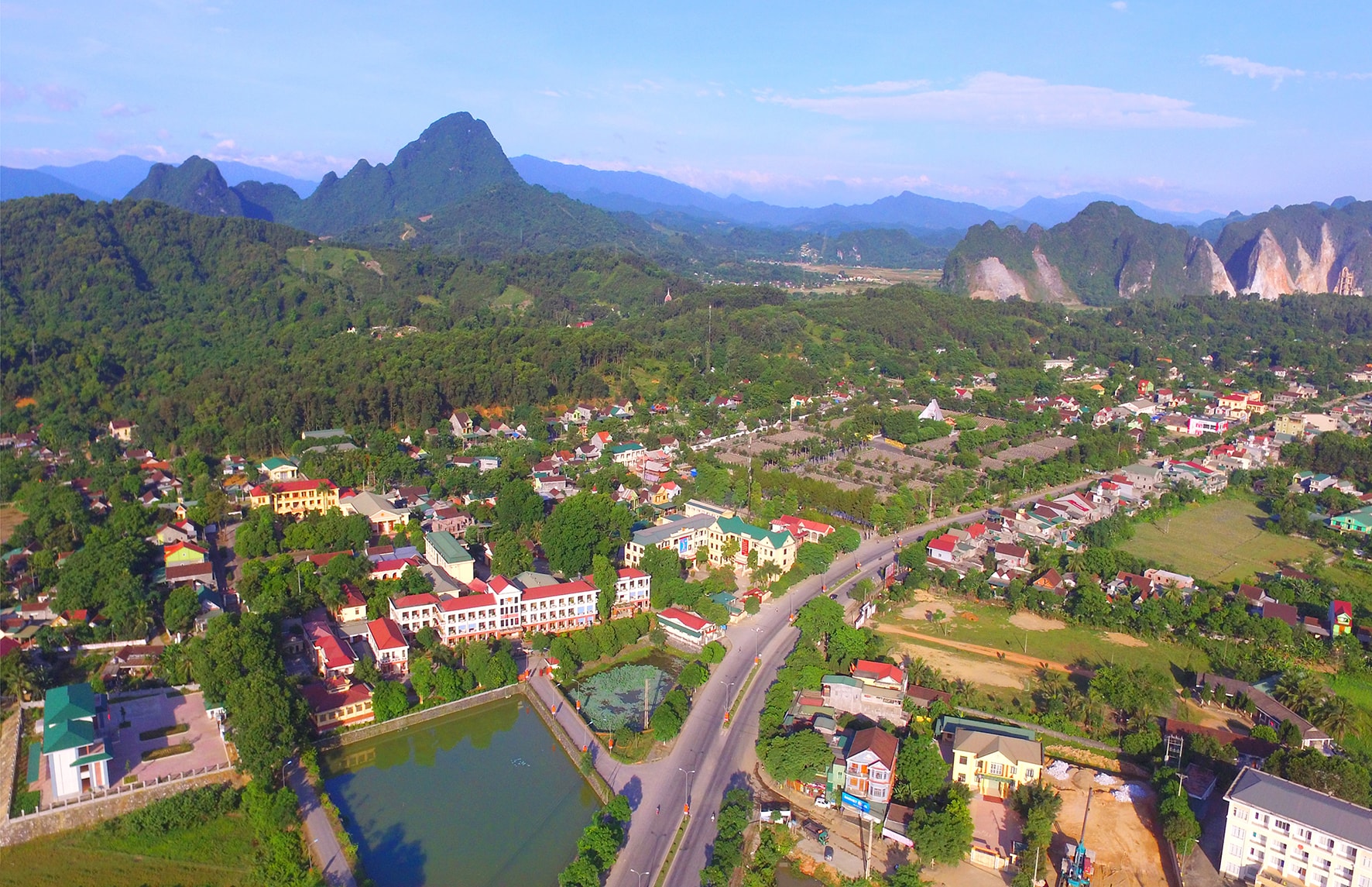
| Thai Hoa town is developed with spacious houses next to the famous Bau Sen lake. Thai Hoa was formerly the capital of Phu Quy, the economic, cultural and social center of the Northwest region of Nghe An. Thai Hoa is famous for its rich natural resources, with a large area of red basalt land that produces many industrial products such as tea, rubber, coffee and oranges. Photo: Sach Nguyen |
