Journey 'Discovering the Western Nghe An route'
(Baonghean.vn) - “Discovering the Western Nghe An route” is a caravan tour jointly surveyed and developed by the Nghe An Department of Tourism and the UNESCO Travel Club. This is a unique tourism product, creating conditions for visitors to explore and experience attractive destinations in Western Nghe An, a land that still retains its wild beauty, containing many mysteries and interesting things.
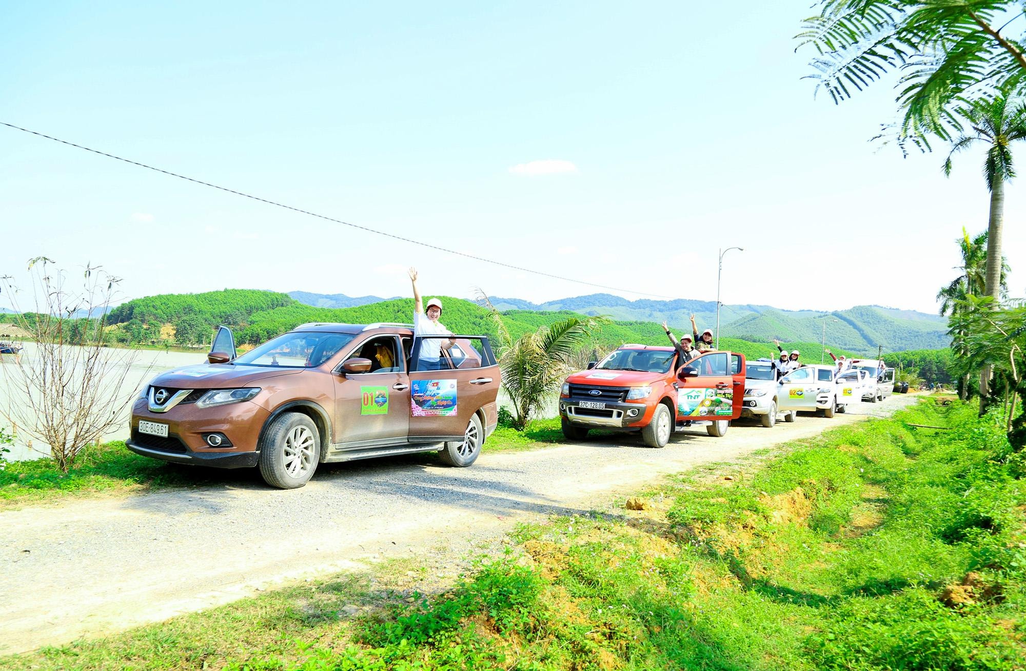 |
The journey "Discovering the Western Nghe An route" chose Hon Mat Eco-tourism Area in Nghia Loc Commune (Nghia Dan) as the starting point. Because this destination has convenient transportation, located next to Ho Chi Minh Road, near the intersection with National Highway 48. Visitors from the northern provinces, from Vinh up all choose Hon Mat as a meeting point, to rest and prepare for a long journey. Photo: Cong Kien |
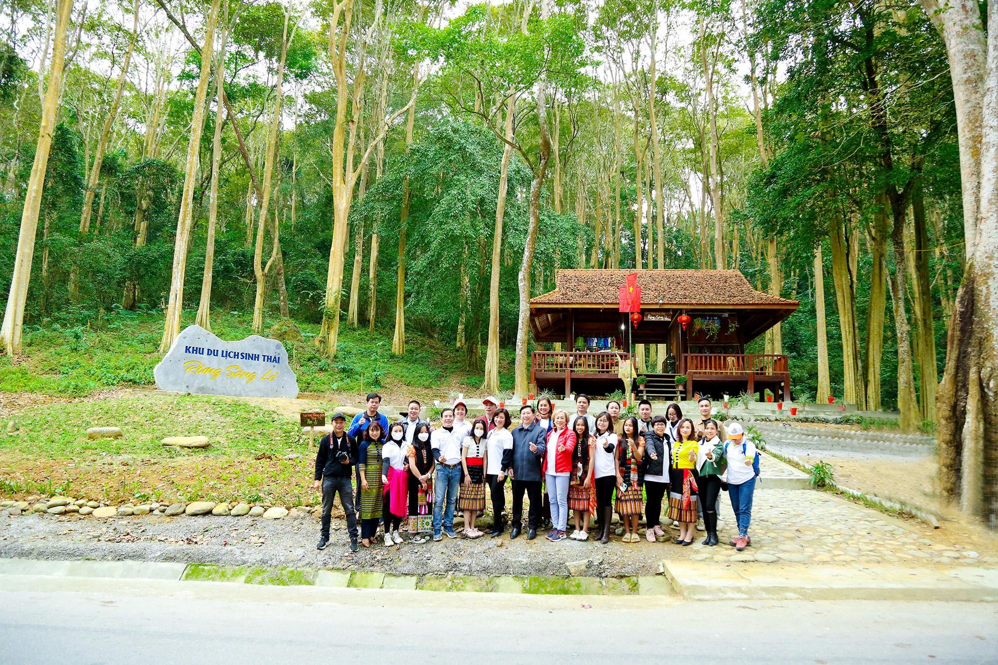 |
Stop to check in at the Sang Le forest in Tam Dinh commune (Tuong Duong), which is considered the most beautiful primeval forest in Indochina. This place was chosen to build a stopover so that on the journey up and down, visitors have the opportunity to rest, enjoy the flavor of the mountains and forests and experience the beauty of the landscape and life of the Thai ethnic people. Photo: Cong Kien |
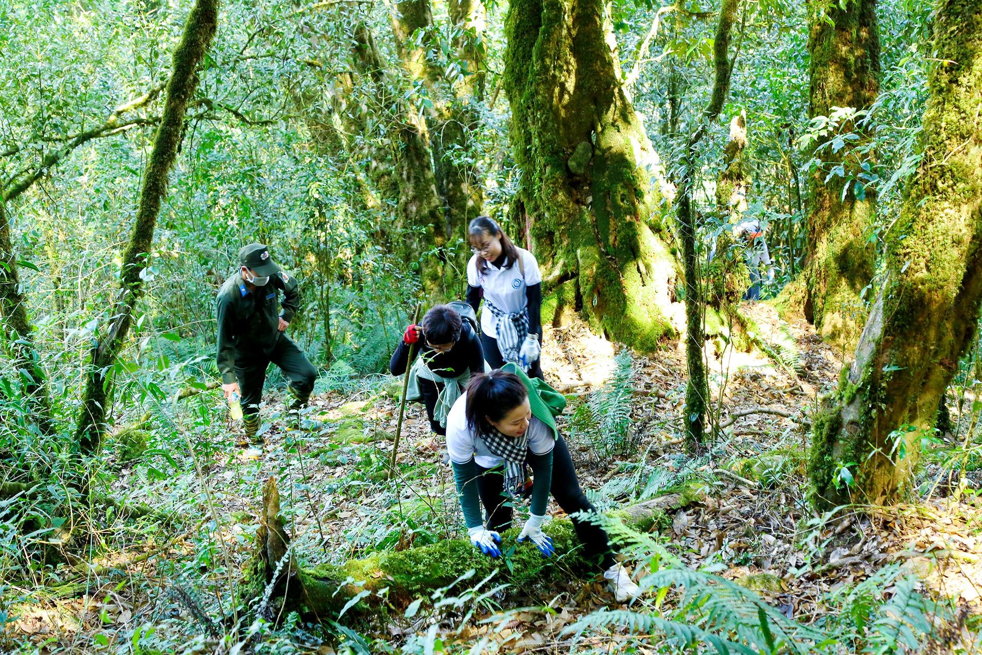 |
The journey to conquer Puxailaileng peak in Na Ngoi commune (Ky Son) is really interesting when passing through the primeval pơ mu forest, the hundreds of years old tree trunks covered with moss, adding to the deepness of the old forest. Photo: Dinh Tuyen |
 |
| And it is extremely interesting to be in the middle of a sea of floating clouds, feeling like the land is high and the sky is low, like being lost in a paradise, a fairyland... Photo: Dinh Tuyen |
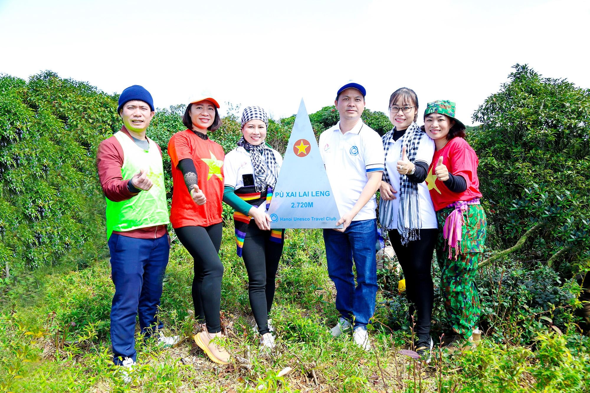 |
When setting foot on the peak of Puxailaileng at an altitude of 2,720 m, everyone was overwhelmed with emotions, joy and pride for conquering the "roof of the Northern Truong Son range". Photo: Dinh Tuyen |
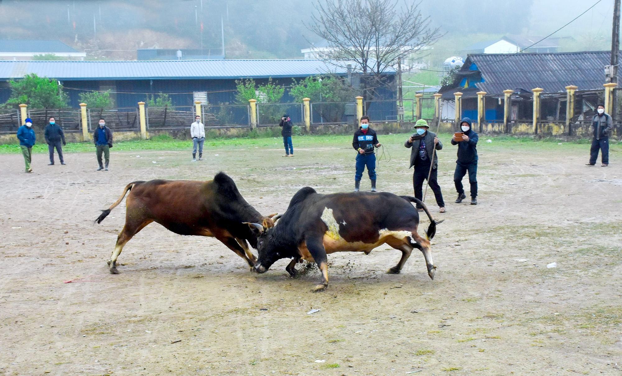 |
After conquering Puxailaileng peak, tourists go to Muong Long, which is considered as “Sa Pa of Nghe An”. Because, with an altitude of about 1,500m, Muong Long is cool this season, 6-8 degrees Celsius different from Muong Xen town. This is also the “capital” of the Mong people, who are preserving many traditional features in their production, living and customs. In particular, the bull fighting festival always attracts many tourists. Photo: Cong Kien |
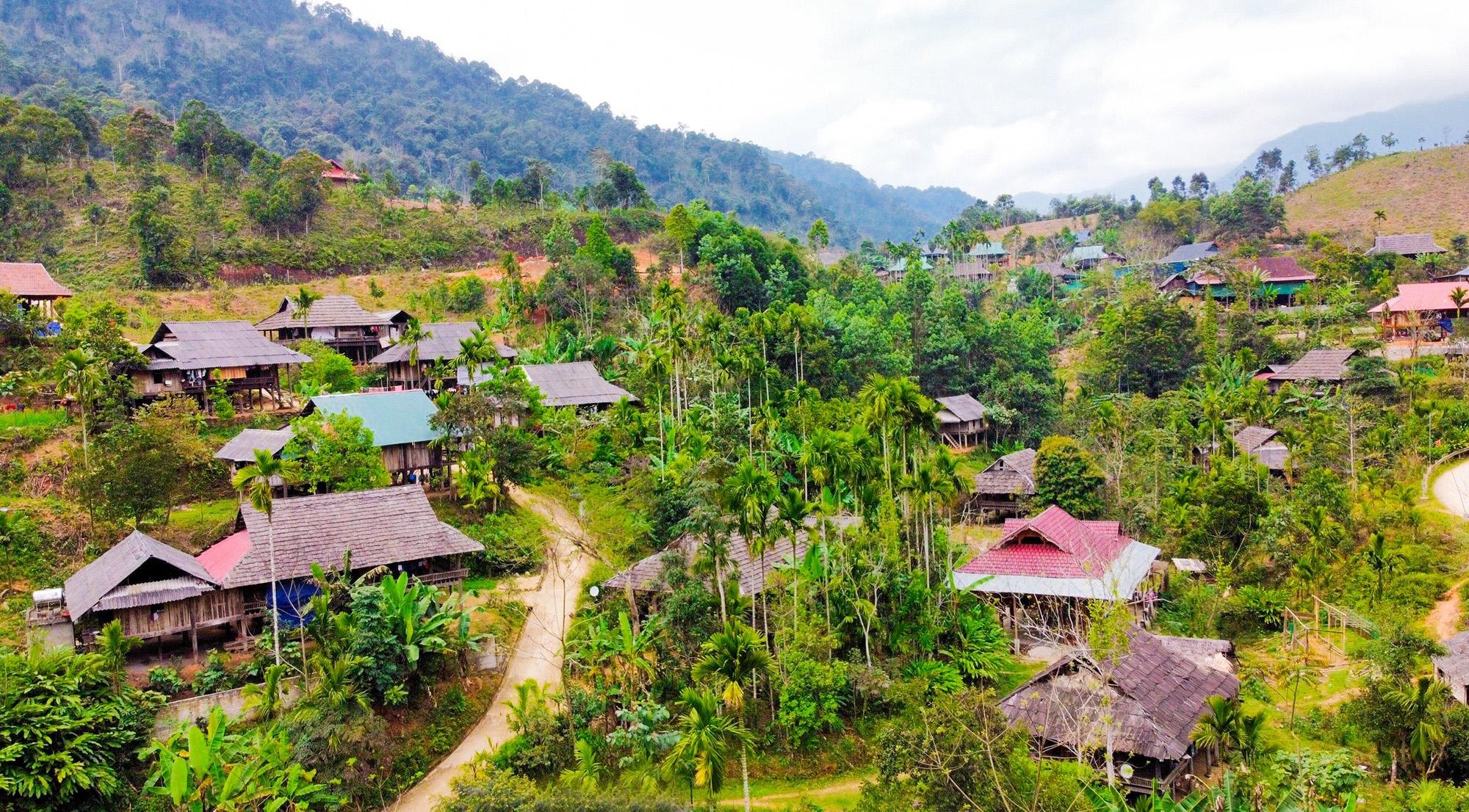 |
| Leaving Muong Long, the car continued to National Highway 16, passing through My Ly (Ky Son), Mai Son and Nhon Mai (Tuong Duong) to Que Phong, a border district in the Northwest region of Nghe An. This place has the community tourism spots of Co Muong village (Chau Kim commune) and the ancient village of Muong Dan (Hanh Dich) with the strong cultural features of the Thai people. In the photo: A corner of the ancient Thai village of Muong Dan. Photo: Dinh Tuyen |
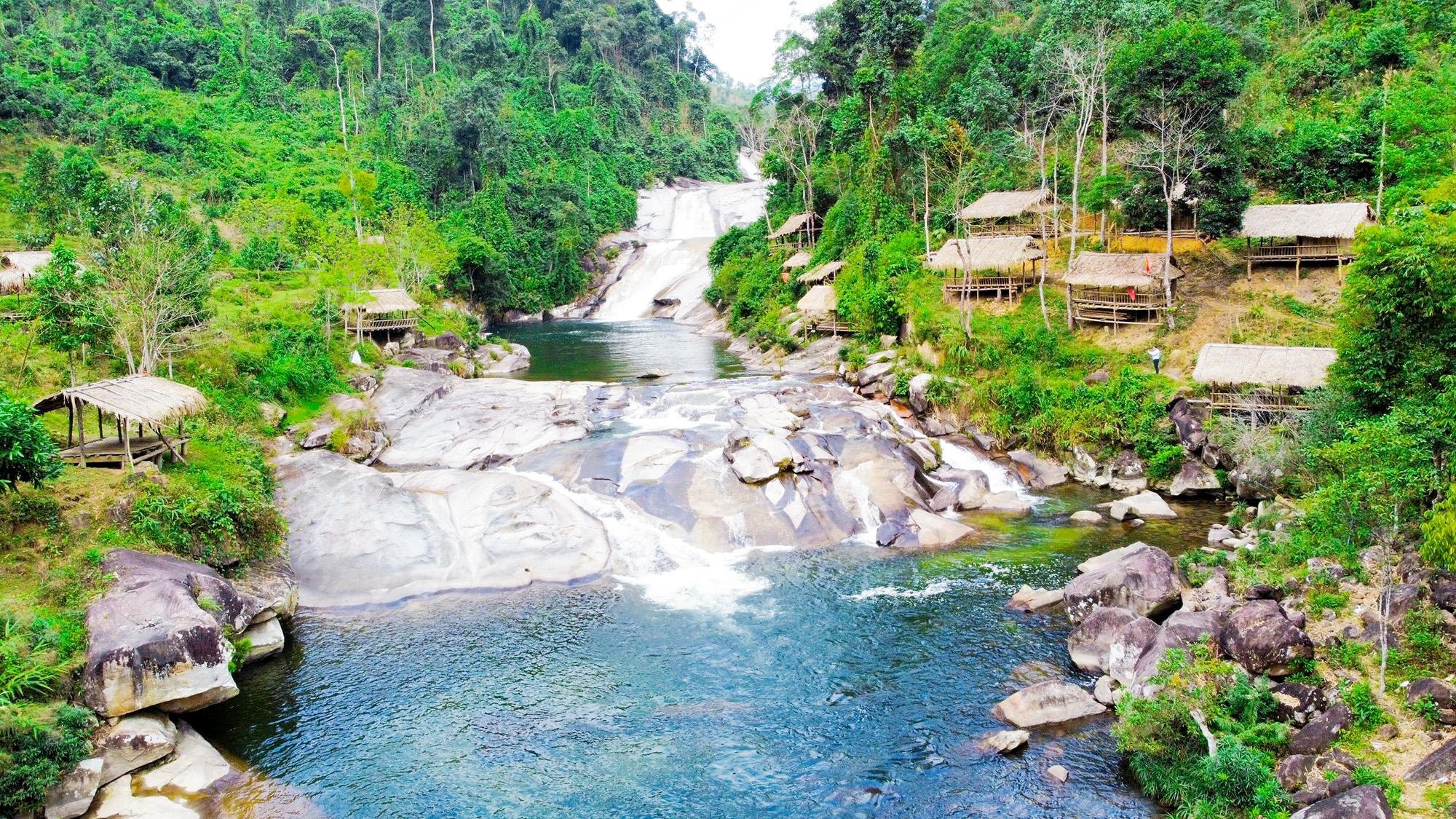 |
Coming to Que Phong, tourists always take time to experience the majestic beauty of the 7-storey waterfall complex on the Nam Viec River, located in Hanh Dich commune. Photo: Dinh Tuyen |
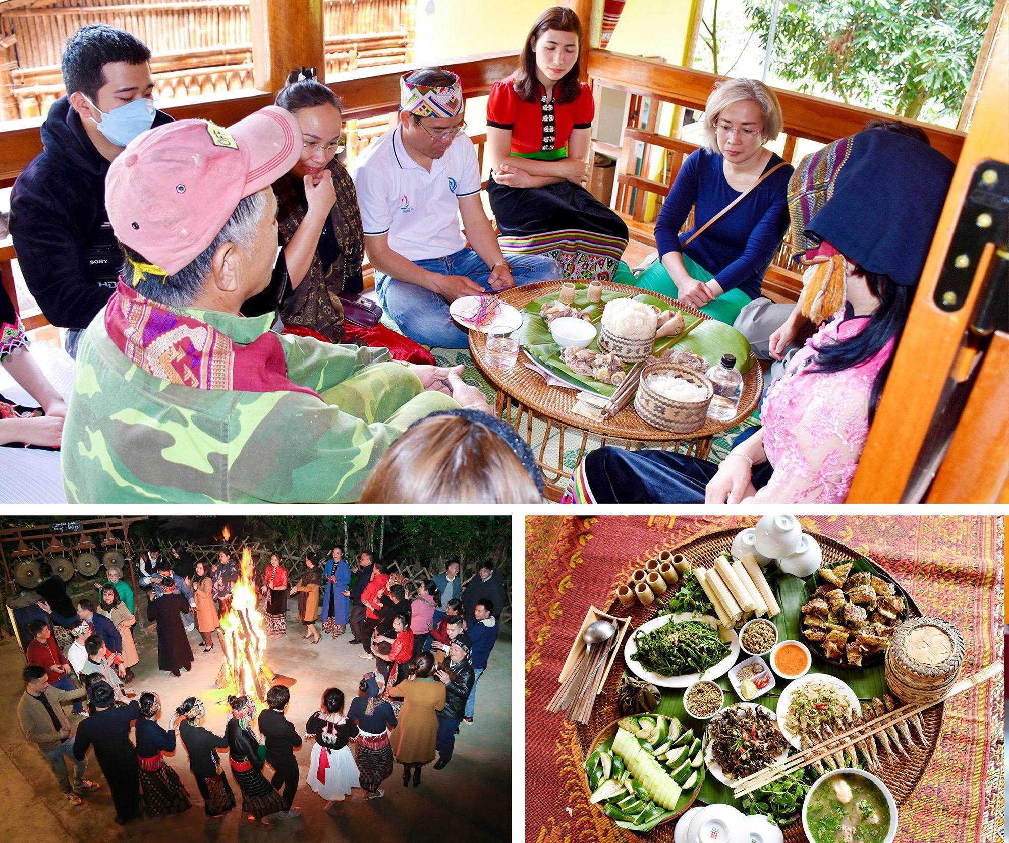 |
Experiencing community tourism spots in Que Phong, visitors have the opportunity to explore and experience cultural life, customs and enjoy special dishes, imbued with the flavor of the mountains and forests. Photo: Cong Kien |
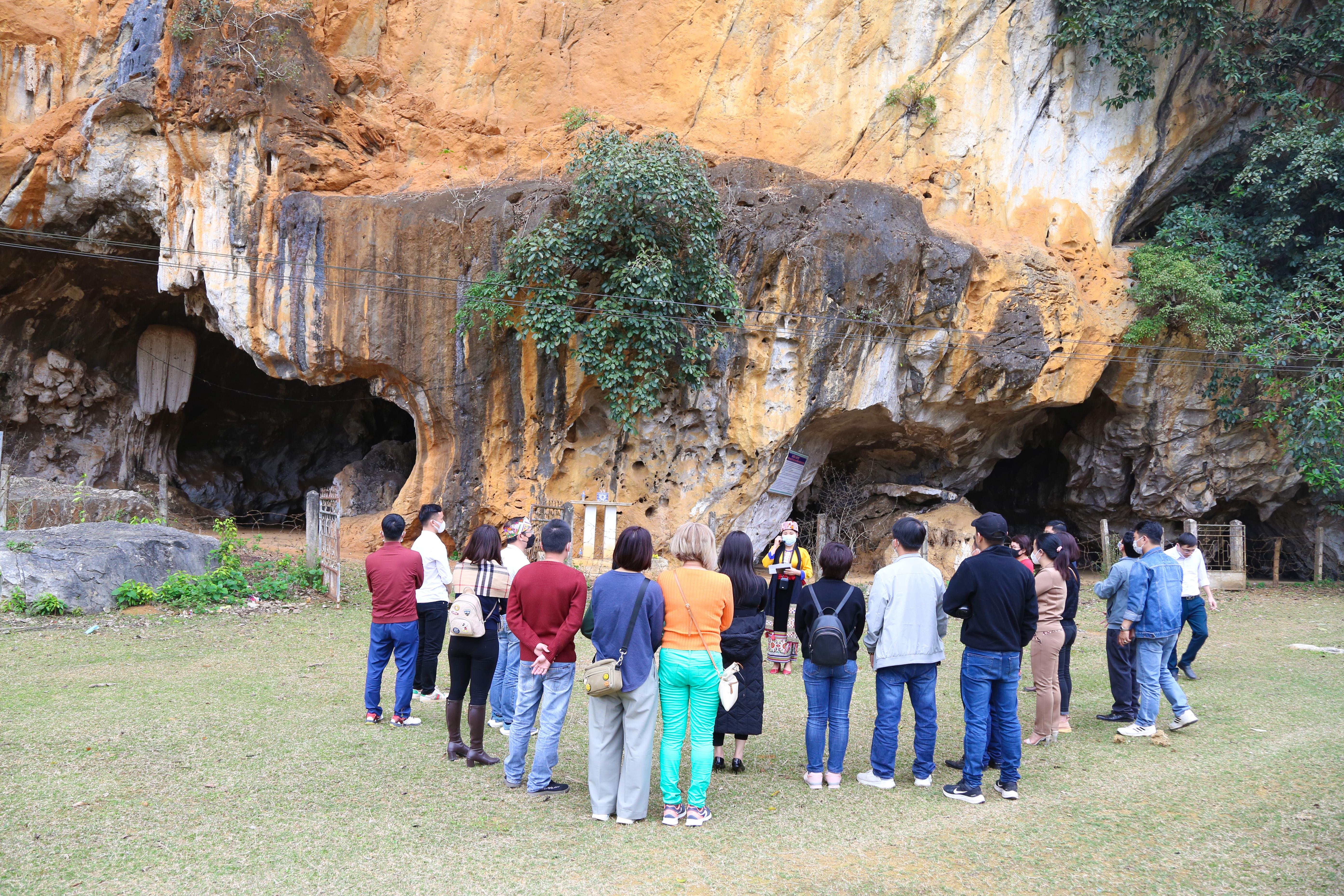 |
Saying goodbye to Que Phong, the group of tourists followed National Highway 48 to the Hoa Tien community tourism site (Quy Chau) to experience the scenery, working life, production and cultural activities of the Thai people. Mr. Luong Duy Doanh - Communications Director of the UNESCO Travel Club said: "The caravan tour "Discovering the Western Nghe An route" brings many interesting experiences about the land and people, tourists have the opportunity to broaden their horizons, gain more knowledge, thereby loving the natural scenery and their homeland and country more". In the photo: Tourists explore the beauty of Bua cave relic with a touching legendary story... Photo: Dinh Tuyen |


