Vietnamese
Vietnamese
English
French
Русский
Listen to An News
Nghe An Daily
Nghe An Weekend
Log in
Nghe An Newspaper:
Nghe An Television:
Latest
Current Affairs
Forum
Human Resources
New policy
Party building
Protecting the ideological foundation
Putting the resolution into practice.
Economy
Industrial
Agriculture
Market
Real estate
Car
International
Comment
News
Society
Bridge of Compassion
Religion - Beliefs
Culture
National Defense
Tourism
Poetry - Stories
Education
Law
Security and Order
Advise
Case file
Sport
SLNA
Domestic
Nghe An Newspaper and Radio Cup
International
Business networking
Classified ads
Health
Advise
Medicine & Nutrition
Health & Beauty
News
Labor
Job
Entertainment
Showbiz
Short Video
Reflection
Digital transformation
Technology
print newspaper
News updates related to newspaper printing.
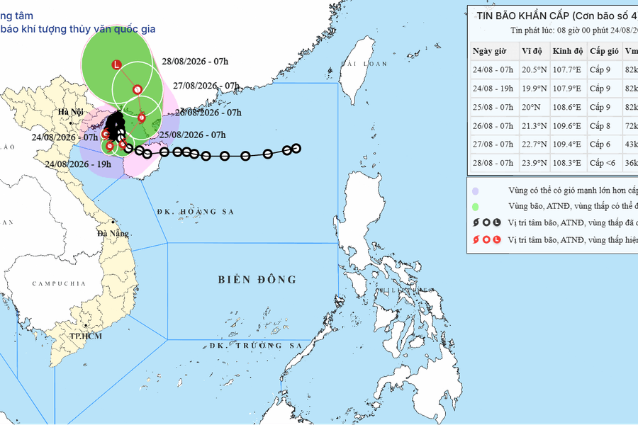
Emergency storm warning for Typhoon No. 4, August 24, 2026: Gusts of wind up to level 11, localized heavy rainfall exceeding 200mm.
Typhoon No. 4 was located 120km from Hai Phong with wind speeds of level 9 gusting to level 11, causing waves up to 5m high in the Gulf of Tonkin and heavy rain up to 200mm along the northern coast to Nghe An on August 24th.
Economy
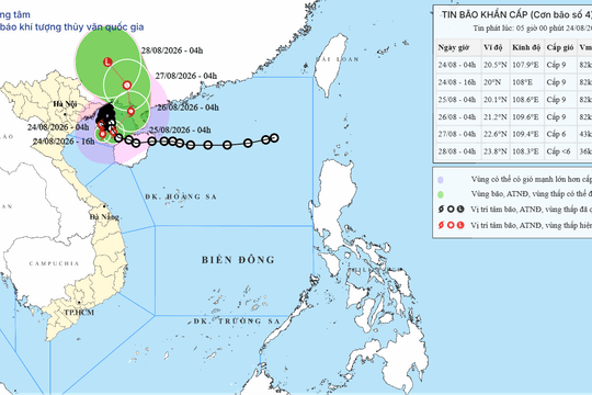
Emergency storm bulletin No. 4, August 24, 2026: Warning of very heavy rain and gusts of wind up to level 11 along the coast.
Typhoon No. 4 is approaching the Gulf of Tonkin on August 24, 2026, bringing strong winds of level 9 with gusts up to level 11, and localized heavy rainfall exceeding 200mm along the coast. Be prepared for urban flooding and landslides.
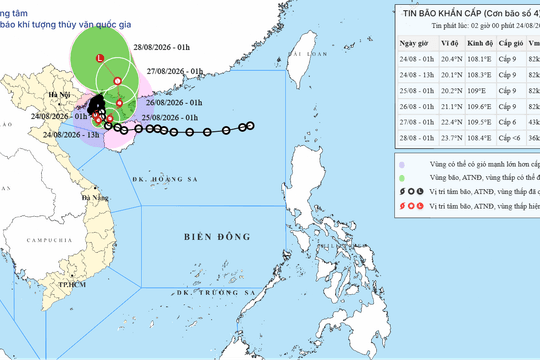
Emergency storm bulletin for Typhoon No. 4, August 24, 2026: Gulf of Tonkin with gusts of wind up to level 11 and very heavy rain.
Typhoon No. 4 maintained wind speeds of level 9 with gusts up to level 11 in the Gulf of Tonkin, causing strong winds along the coast of Quang Ninh and Hai Phong, and widespread heavy rain in Northern Vietnam and Thanh Hoa until August 25th.
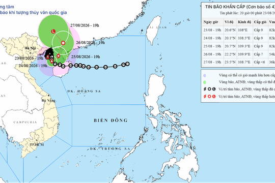
Emergency storm warning No. 4, August 23, 2026: Quang Ninh, Hai Phong and Northern Vietnam will experience localized heavy rainfall exceeding 250mm.
On the evening of August 23, 2026, Typhoon No. 4 approached the sea area of Quang Ninh - Hai Phong with wind speeds of level 9 gusting to level 11, causing widespread heavy rain and the risk of flooding and landslides in Northern Vietnam.
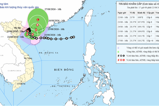
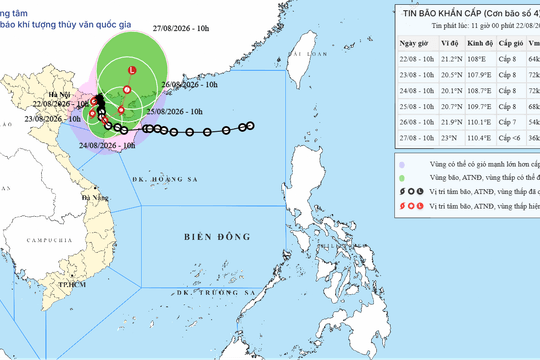
Urgent Typhoon No. 4 warning, August 22, 2026: Very heavy rain and gusts of wind up to level 10 in Quang Ninh and Hai Phong.
Typhoon No. 4 maintained wind gusts of level 10 in the sea area of Quang Ninh - Hai Phong, causing very heavy rain of over 400mm in the Northeast region from the evening of August 22nd to the end of August 24th, 2026.
Emergency storm warning No. 4, August 22, 2026: Heavy rain and strong gusts of wind in the sea area of Quang Ninh - Hai Phong.
Typhoon No. 4 in the Gulf of Tonkin on August 22, 2026, caused gusts of wind up to level 10, heavy rainfall from 100-350mm, with localized rainfall exceeding 600mm in the Northeast region, warning of the risk of flash floods and landslides.
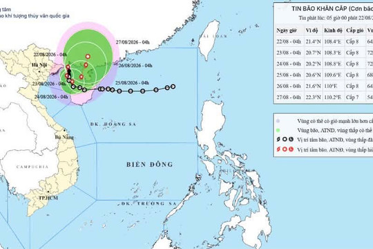
Latest storm update: Typhoon No. 4 is now over the sea area between Quang Ninh and Hai Phong.
At 4:00 AM on August 22nd, the typhoon's center was located at approximately 21.4 degrees North latitude and 108.4 degrees East longitude, over the sea off Quang Ninh-Hai Phong, about 150km northeast of Bach Long Vi Special Economic Zone...
Arsenal will face Borussia Dortmund at the Emirates Cup 2026: The Gunners are confident of defending their title.
August 8, 2026 08:51
The 2026 Emirates Cup final between Arsenal and Dortmund promises to be explosive as manager Arteta and his team are determined to redeem themselves after their defeat to Betis and defend their title.
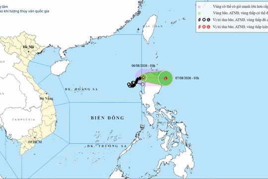
The latest news regarding Typhoon No. 3: It left the South China Sea on August 6, 2026, weakening into a low-pressure system.
August 6, 2026 14:49
Typhoon No. 3 moved out of the East Sea on the night of August 5th and is forecast to continue weakening into a low-pressure area, with no possibility of returning to the East Sea.
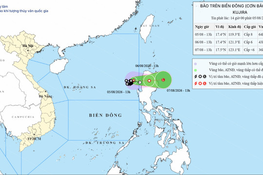
TYPHOON WARNING FOR THE SOUTH CHINA SEA (Typhoon No. 03)
August 5, 2026 14:25
At 13:00 on August 5th, the typhoon's center was located at approximately 17.4 degrees North latitude and 119.3 degrees East longitude, in the southeastern part of the North East Sea. The strongest winds near the center of the typhoon...
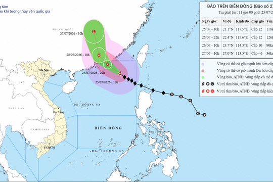
Latest update on Typhoon No. 2 on July 25, 2026: Wind speed level 12, gusts level 15 in the Northern East Sea.
July 25, 2026 14:05
Typhoon No. 2 reached intensity level 12, with gusts up to level 15, in the northeastern part of the North East Sea, moving northwest towards Guangdong province.
Forecast of Typhoon No. 2 in the East Sea on July 25, 2026: Gusts of wind up to level 15, waves up to 7m high.
July 25, 2026 11:35
Typhoon No. 2 is moving west-northwest with wind speeds of level 11-12, gusting to level 15. The northern part of the East Sea is under a level 3 natural disaster risk warning on July 25, 2026.
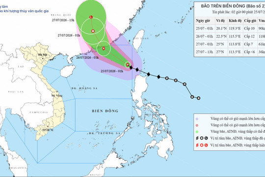
Typhoon No. 2, Typhoon NOUL, July 25, 2026: Moving towards Guangdong, the South China Sea is experiencing severe turbulence.
July 25, 2026 08:38
Typhoon No. 2 (NOUL) is moving in a west-northwest direction, likely reaching level 11-12, with gusts up to level 14, and is expected to make landfall in Guangdong province on July 25, 2026.
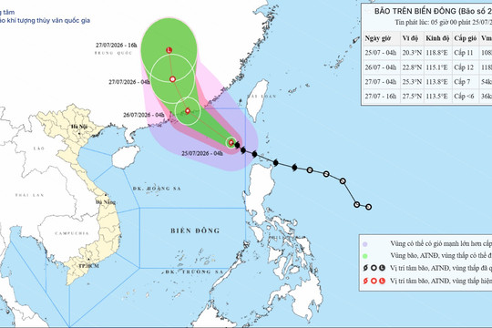
TYPHOON WARNING FOR THE SOUTH CHINA SEA (Typhoon No. 02)
July 25, 2026 06:14
At 04:00 on July 25th, the typhoon's center was located at approximately 20.3° North latitude; 118.8° East longitude, in the northeastern part of the South China Sea, about 580km southeast of Hong Kong (China).
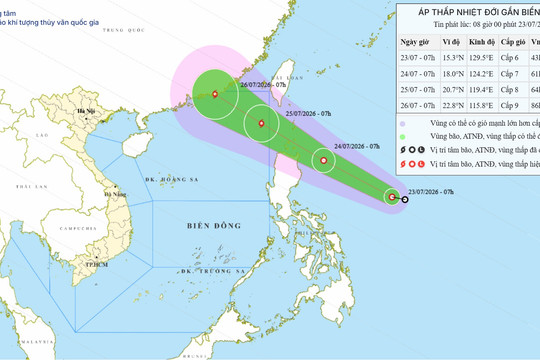
Tropical depression near the South China Sea on July 23, 2026: Forecast to strengthen into a typhoon, with gusts up to level 10.
July 23, 2026 08:10
The tropical depression is moving rapidly towards the South China Sea, forecast to strengthen into a typhoon by July 25, 2026, causing strong winds of level 8 and high waves in the northern South China Sea.
Latest news on Typhoon No. 1 on July 5, 2026: The typhoon has weakened into a tropical depression in China.
July 5, 2026 14:14
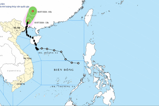
At noon on July 5, 2026, Typhoon No. 1 weakened into a tropical depression in Guangxi (China). The typhoon no longer directly affected Vietnam, but the sea remained rough.
Typhoon No. 01, July 5, 2026: Landfall in Guangxi, causing strong winds and heavy rain in Quang Ninh.
July 5, 2026 11:17
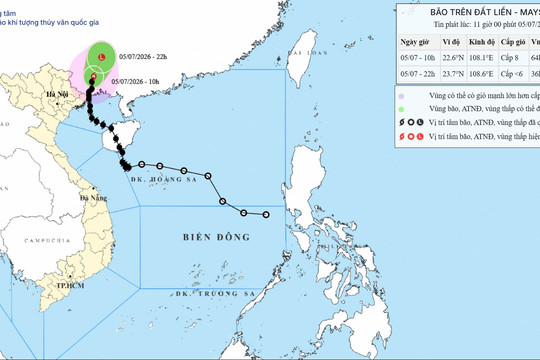
On the morning of July 5, 2026, the center of Typhoon No. 1 was located in the southern part of Guangxi Province (China). Coastal areas of Quang Ninh and the northern Gulf of Tonkin should be prepared for strong gusts of wind up to level 10.
Emergency storm warning #1, July 3, 2026: Heading towards Quang Ninh, warning of very heavy rain.
July 3, 2026 08:23
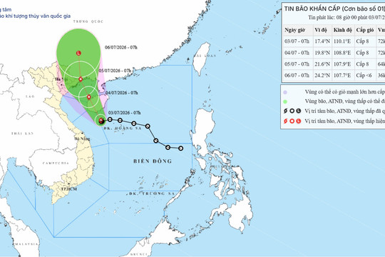
Typhoon No. 1 is expected to make landfall on the coast of Quang Ninh province on the morning of July 5, 2026, with wind speeds of level 8. The Northeast region and Thanh Hoa province face the risk of localized heavy rainfall exceeding 350mm.
Tropical depression warning for the South China Sea on July 2nd, 2026: Potential to strengthen into a typhoon.
July 2, 2026 12:53
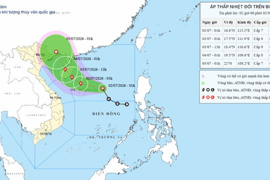
A tropical depression is approaching the Hoang Sa Special Administrative Region and is forecast to strengthen into a typhoon within the next 24 hours, causing gusts of wind up to level 12 and waves up to 5 meters high in the northern South China Sea.
Tropical depression in the East Sea on July 2nd, 2026: Forecast to strengthen into a typhoon, with gusts up to level 12.
July 2, 2026 04:22
At 1:00 AM on July 2nd, 2026, a tropical depression was located 400km from the Paracel Islands. It is forecast to strengthen into a typhoon within the next 24 hours with wind gusts reaching level 12, causing very rough seas.
Tropical depression in the East Sea on July 1, 2026: Forecast to strengthen into a typhoon, with gusts up to level 12.
July 1, 2026 20:23
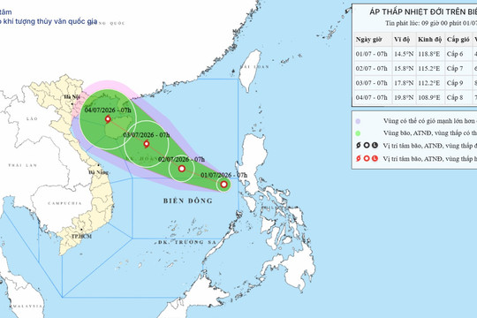
The tropical depression is currently located in the northern South China Sea with wind gusts reaching level 9. It is forecast to strengthen into a typhoon within the next 24 hours, threatening the Paracel Islands and Hainan Island.
Tropical depression in the South China Sea on July 1, 2026: Warning of strengthening into a typhoon.
July 1, 2026 09:20
On the morning of July 1st, 2026, the low-pressure area east of the central South China Sea strengthened into a tropical depression, with wind gusts reaching level 8 and the potential to intensify into a typhoon within the next 48 hours.
See more
POWERED BY
FREE
CMS
- A PRODUCT OF
NEKO
×
Log in
Log in with Google