Cold air will cause rain, thunderstorms, lightning; in some places the temperature will drop to 18 degrees Celsius.
(Baonghean.vn) - Early this morning (October 26), the cold air mass continued to move and push the low pressure trough with an axis at about 23-25 degrees North latitude to the South.
Forecast:This afternoon (October 26), this cold air mass will affect the northern mountainous provinces, then affect other places in the North; the wind will change to the northeast in the mainland of the Northeastern provinces at level 2-3.
 |
| From October 27, the weather in the Northern provinces will turn cold in the early morning and at night. Illustrative photo |
From October 27, in the Northern provinces, the weather will turn cold in the early morning and at night with the lowest temperature commonly ranging from 20-23 degrees Celsius. In the Northern mountainous areas, some places will have the lowest temperature of 18-20 degrees Celsius.
In the Gulf of Tonkin from tonight (October 26), the wind will change to the northeast and gradually increase to level 6, gusting to level 7; rough seas.
Warning of heavy rain, thunderstorms, tornadoes, lightning:Due to the influence of cold air compressing the low pressure trough, from this afternoon (October 26), there will be showers and thunderstorms in the mountainous areas of the North; in the evening and at night, thunderstorms will spread to the provinces of the North and Thanh Hoa, especially in the mountainous areas there will be moderate rain, heavy rain, and in some places very heavy rain and strong thunderstorms. During the thunderstorms, there is a possibility of tornadoes, lightning, hail and strong gusts of wind.
From tonight (October 26), in the provinces from Ha Tinh to Binh Dinh, there will be moderate rain, heavy rain in some places, and scattered thunderstorms.Disaster risk level due to tornado, lightning, hail: level 1.
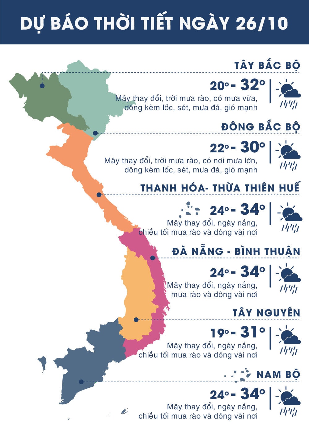 |
| Temperature on October 26 in regions across the country. Photo: news.zing.vn |


