Nghe An mountainous region proactively responds to heavy rain, landslides, and flash floods
Faced with forecasts of heavy rain and landslides due to the impact of storm No. 4, mountainous localities in Nghe An have proactively developed response plans and evacuated when necessary, prioritizing the protection of people's lives.
Keep a close eye on weather forecasts
According to the forecast of the National Center for Hydro-Meteorological Forecasting, the tropical depression has strengthened into storm No. 4 on the morning of September 19. According to the forecast of the storm's path, Nghe An is a locality in the affected area, with heavy and very heavy rain and strong winds. In particular, pay special attention to the mountainous area including 6 districts with high risk of landslides, beware of flash floods, including: Anh Son, Con Cuong, Tuong Duong, Ky Son, Quy Chau, Tan Ky, Thanh Chuong.
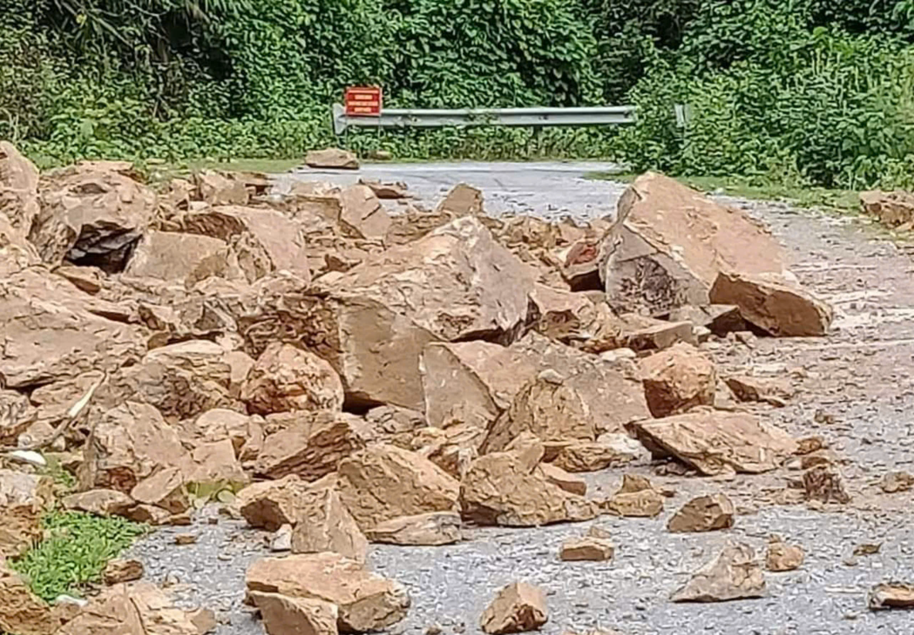
Information from the mountainous areas of Nghe An, from the night of September 18 to the morning of September 19, many places had heavy rain such as Tuong Duong, Quy Chau. Some places had light landslides such as the road from Bai Xa village to Tung Huong village in Tam Quang commune, making it impossible for cars to pass. In the districts of Con Cuong and Quy Chau, many communes had quite heavy and prolonged rain such as Chau Nga, Chau Hoi, and communes in the inner areas of Quy Chau; some communes in Con Cuong such as Chi Khe, Chau Khe, Bong Khe...
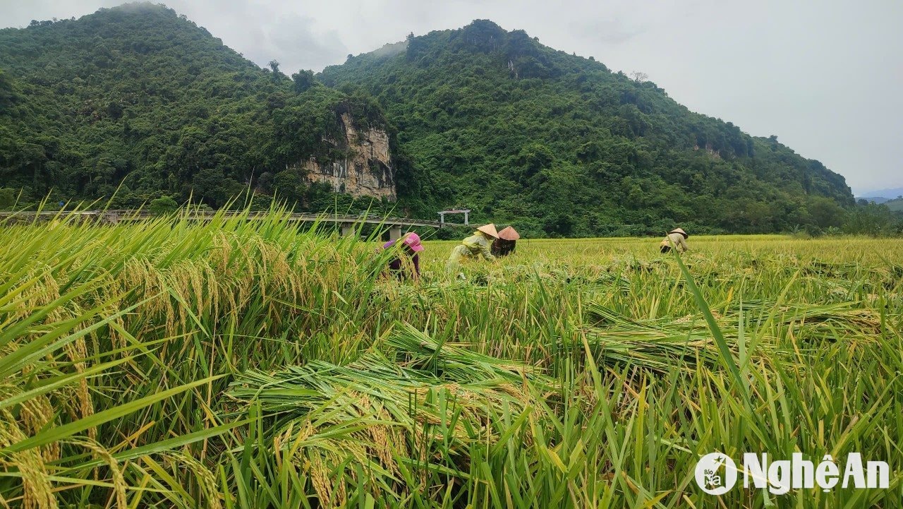
In Dong Van commune of Que Phong, the weather has also started to rain. Villagers are actively harvesting rice and crops "running away from the storm". Some rice fields were flooded due to the previous rain, although they have not ripened yet, people are still harvesting.
Provincial and national information pages continuously update forecasts on the path and developments of storm No. 4. From there, Facebook and Zalo groups of officials and people in localities in Nghe An also regularly update and share forecast information, advising people to proactively respond.
.png)
The National Center for Hydro-Meteorological Forecasting warned that at 4:00 a.m. on September 19, The center of storm No. 4 is located 210km northeast of Da Nang and about 260km east of Quang Tri. The strongest wind near the center of the storm is level 8 (62-74km/h), gusting to level 10; moving mainly west at a speed of about 20km/h.
From September 19 to the end of September 20, in Nghe An, there will be moderate rain, heavy rain, very heavy rain in some places and scattered thunderstorms. The forecasted rainfall is: Mountainous areas 50 - 100 mm, some places over 150 mm; Midland and coastal plains 70 - 150 mm, some places over 250 mm. Heavy rain leads to flooding in urban areas, densely populated areas because water cannot drain in time. Beware of strong thunderstorms ahead of the storm circulation. In the event of strong thunderstorms, the consequences include trees falling, metal roofs, and advertising signs being blown into the air.
Proactively "4 on-the-spot" with the motto of prevention is better than cure
Since the beginning of 2024, mountainous localities in Nghe An have experienced many rains, with many landslides and riverbank landslides occurring. However, the impact of storm No. 4 is forecast to be the heaviest and most widespread rain compared to the beginning of the year. Therefore, in order not to be complacent, local authorities have proactively developed response plans.
In Thanh Chuong district, Mr. Nguyen Khanh Hung - Head of the Department of Agriculture and Rural Development said that currently, the spring rice harvest in Thanh Chuong has been completed. The people have not yet produced crops to avoid the rainy season. The district People's Committee and departments have issued official dispatches directing communes to closely follow the forecast situation, proactively reinforce livestock barns and prevent flooding in aquaculture ponds, especially in communes that often experience flooding during heavy rains such as Thanh Long, Thanh Ha, Thanh Mai, Thanh Giang, Thanh Xuan, etc.
In the districts of Tuong Duong, Ky Son, Con Cuong, Quy Chau... after updating the map of locations at risk of flooding, landslides, and flash floods, the information was widely shared so that people in communes, villages, hamlets, and hamlets could grasp and proactively prevent it.
For example, in Tuong Duong, along with warnings of high-risk locations, the district has developed specific response plans such as: Deploying forces and means to protect key projects; bracing houses, schools, etc. Directing localities and people to protect crops and livestock such as: harvesting ripe rice, crops, protecting livestock and aquatic products.
When heavy rains last for many days, the water in streams begins to rise and the rain is forecast to continue, the People's Committees of communes and towns organize to check and evacuate households in areas at risk of flooding and landslides. The Chairman of the People's Committee of communes and towns directly command the evacuation. The evacuation sites are schools, village community houses or other areas that ensure safety.At the same time, absolutely do not let people operate on the river, on fish cages; tents, huts outside streams. Control traffic in flooded areas, ferry piers, underground, overflowing roads to guide people and vehicles to pass.
Nghe An Provincial People's Committee has also just issued Official Dispatch No. 37 requesting Directors of Departments; Heads of provincial-level sectors, branches and organizations; Chairmen of People's Committees of districts, cities and towns and relevant agencies and units, according to their assigned functions and tasks, to organize regular monitoring and updating of information on developments of tropical depressions, storms, floods and rains to proactively direct and deploy appropriate response work to developments of natural disasters that may affect the management scope of the sector and locality.
Request all levels and sectors to focus on immediately implementing measures to ensure safety for ships, boats, vehicles and activities at sea and along the coast. Review and complete plans and scenarios to respond to tropical depressions, storms, floods, landslides, flash floods, focusing on ensuring safety of people's lives and limiting property damage; operate reservoirs, hydroelectric dams and irrigation works scientifically and safely. Proactively arrange forces, materials and vehicles, especially in key areas to be ready to respond to tropical depressions, storms, floods and rains; rescue when required.
Telegram No. 37/CD-UBND dated September 18, 2024.

")

")
")
