Vietnamese
According to Nghe An Newspaper reporters, due to the influence of storm No. 4, there was heavy rain in Con Cuong district, dozens of cubic meters of rock and soil slid down National Highway 7, causing traffic congestion for many hours.
 |
| Con Cuong district leaders inspect the actual damage caused by floods in the localities. Photo: Ba Hau |
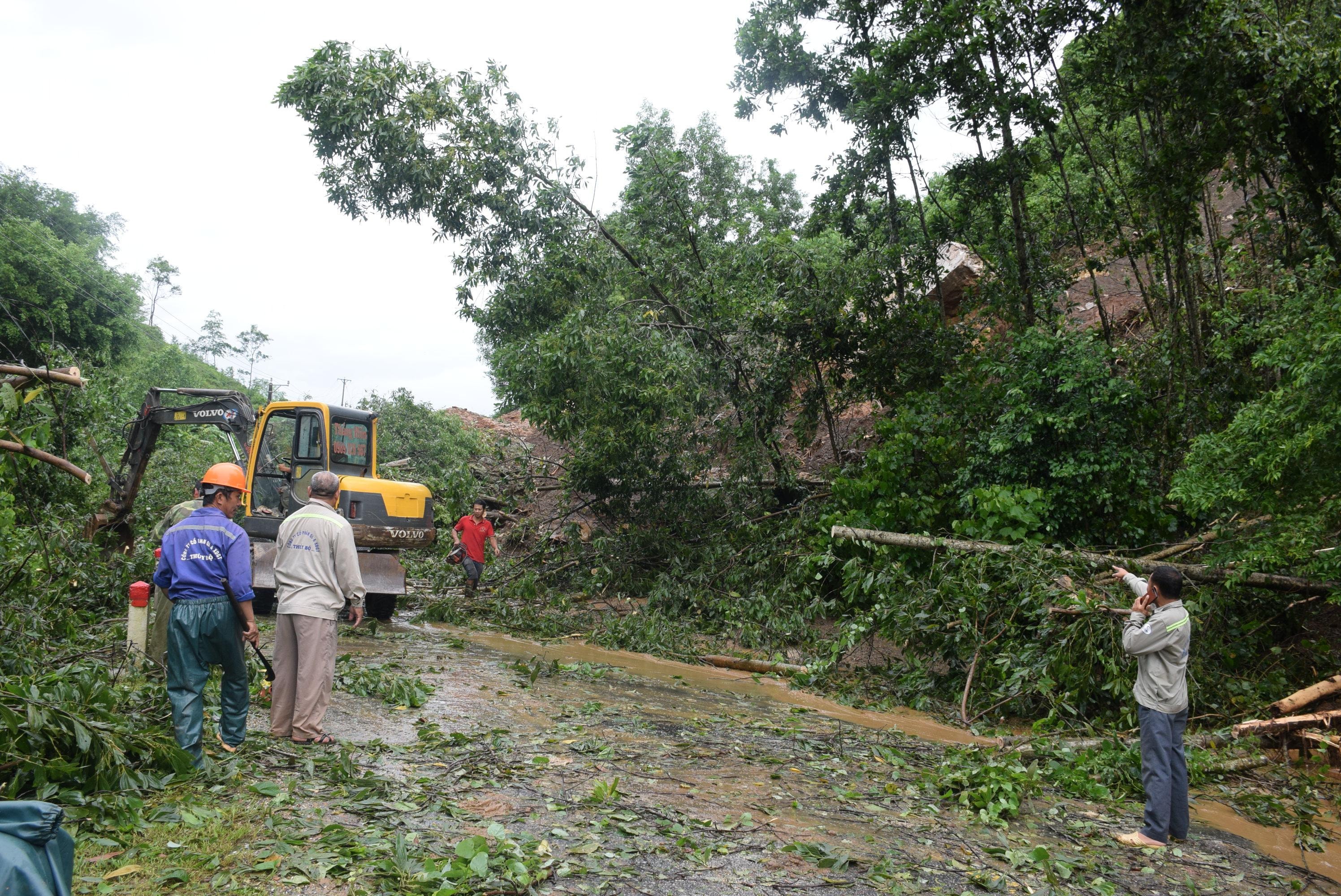
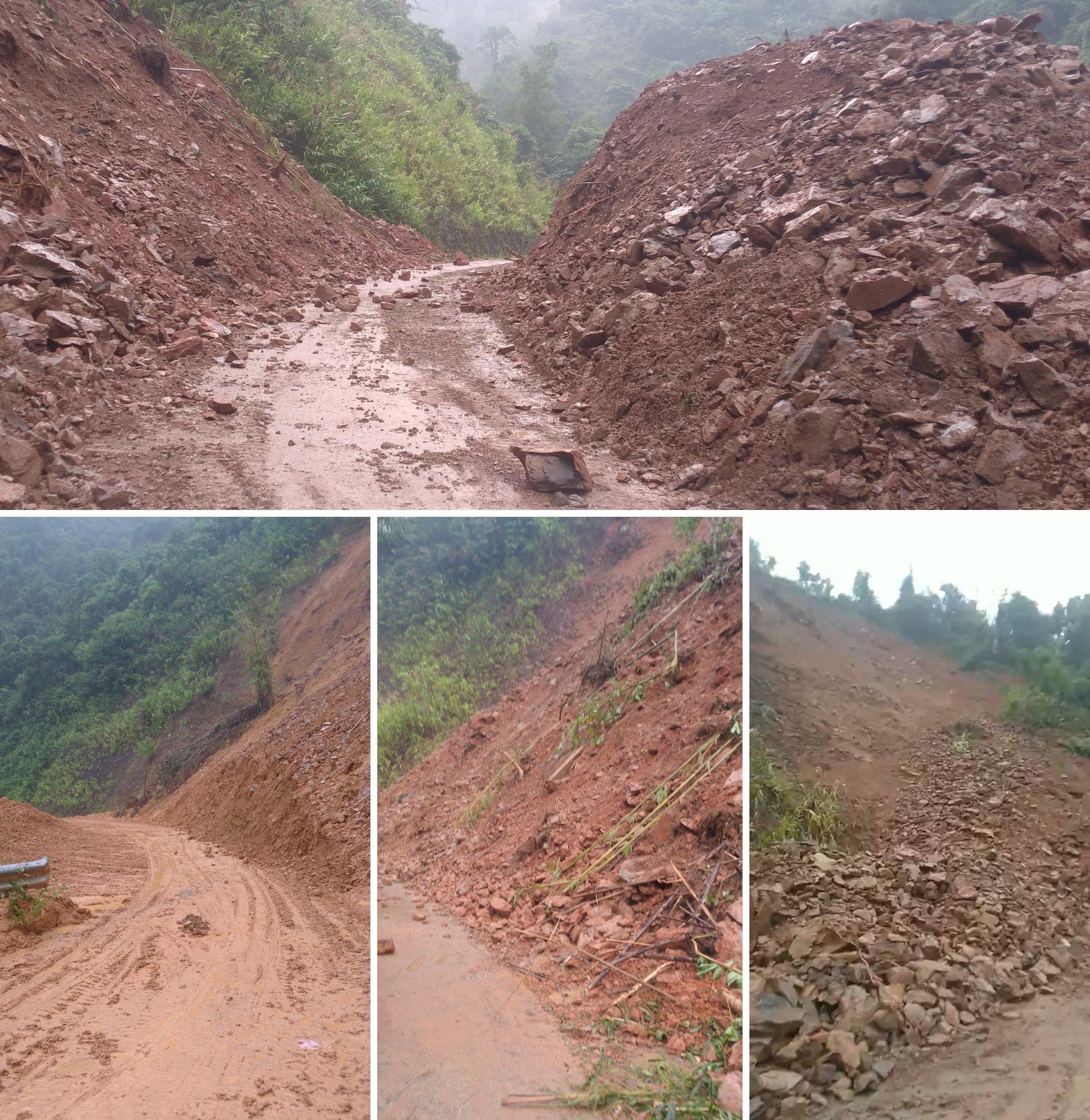
Accordingly, at around 8:00 p.m. on September 28, at Km110+850 on National Highway 7 passing through Boong village, Lang Khe commune (Con Cuong), landslides occurred continuously with large volumes of rock and soil, leading to traffic congestion on this route. Some vehicles got stuck.
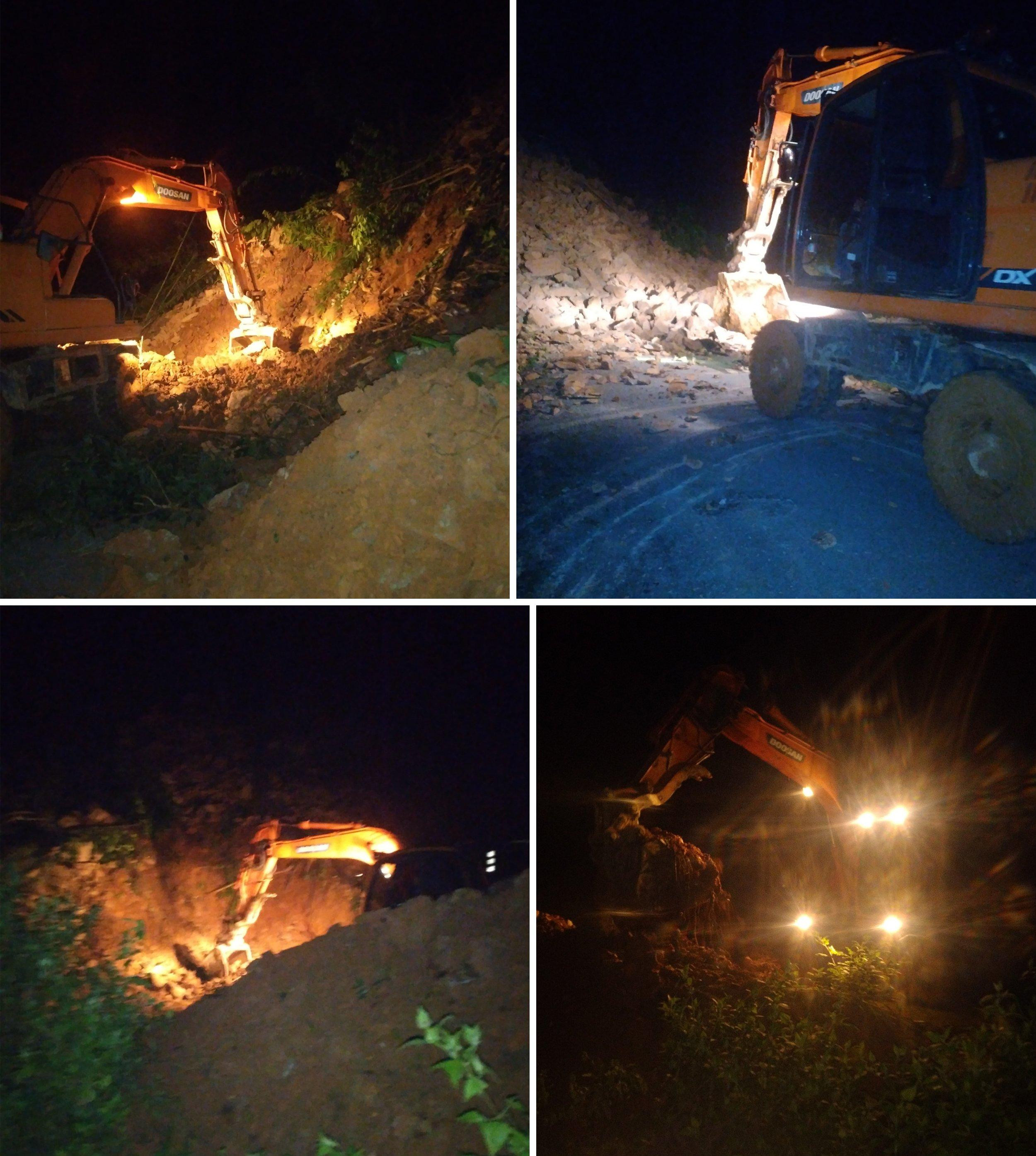
Immediately after the incident, Con Cuong Road Management Department mobilized excavators and human resources to promptly clear the road. However, due to the large volume of earth and rock, the bulldozers could not keep up. Therefore, to ensure the safety of people and property, Con Cuong Road Management Department closed the road from 24 hours last night until 5 am on September 29 to handle the situation.
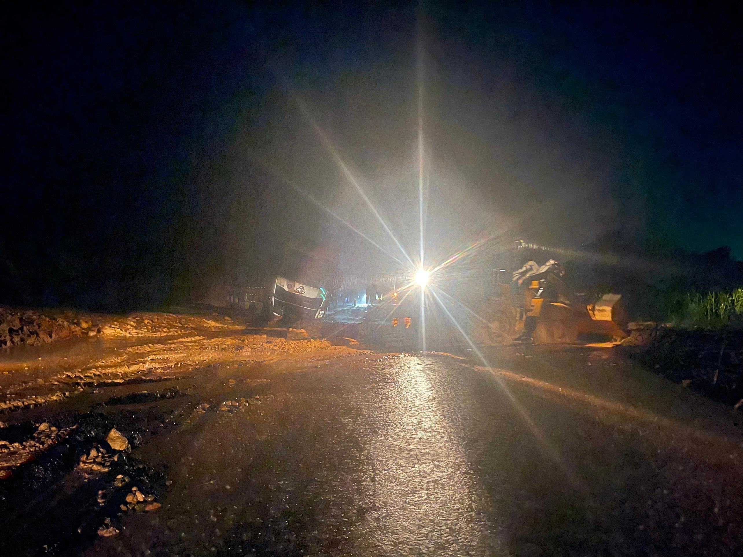 |
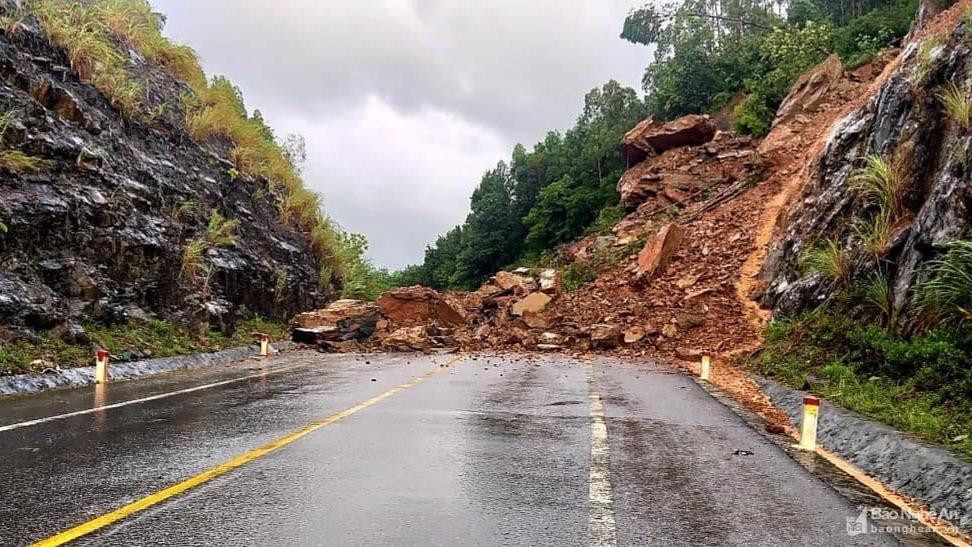
| Overcoming landslides on National Highway 7 through Cho slope. Photo: Ba Hau |
Currently, heavy rain continues to fall in the area, causing landslides to continue. As of 7am this morning, the road is still blocked. To ensure the safety of people and vehicles traveling through Cho slope, the traffic management unit, in addition to being ready to mobilize machinery and human resources to level the road, also coordinates with local authorities to place warning signs and be on duty 24/7 to prevent vehicles from passing when there is a dangerous situation.
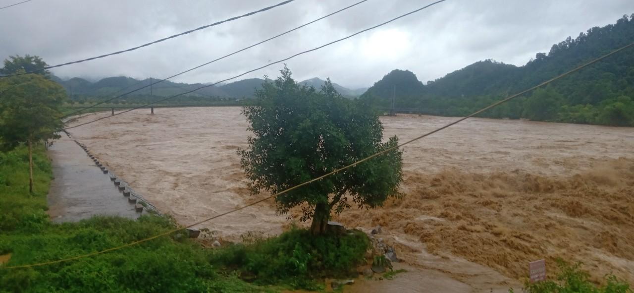 |
| The Giang River continues to rise, threatening many residential roads. Photo: Ba Hau |
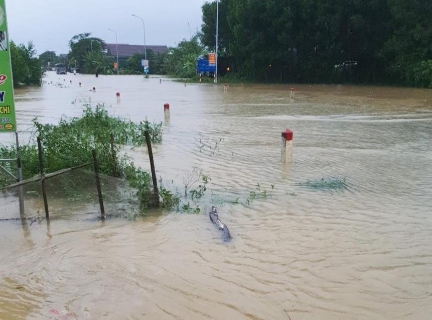
Currently in Con Cuong district, the roads leading to Luc Da, Mon Son, Thach Ngan... and some other places are deeply flooded and partially isolated. Many flooded houses need to be evacuated.
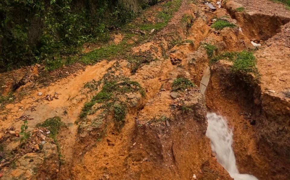 |
Many roads in the district suffered serious landslides. Photo: Ba Hau |
Meanwhile, heavy rain also caused landslides of thousands of cubic meters of soil and rock in Eo Len Nghia Hoan area (Tan Ky district), causing National Highway 48E to be blocked.
At about 4:00 a.m. on September 29, in the Eo Len area bordering Tan Long and Nghia Hoan communes of Tan Ky district, a landslide of thousands of meters occurred.3Soil and rocks caused traffic at km 148 + 100 to km 148 + 170 to be completely blocked, vehicles could not pass.
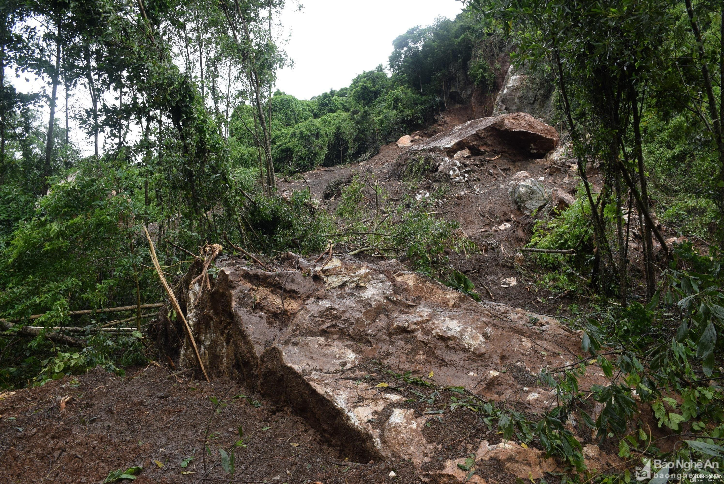 |
Heavy rains caused landslides of thousands of meters.3Soil and rocks at Len Nghia Hoan area (Tan Ky), causing National Highway 48E to be blocked. Photo: Xuan Hoang |
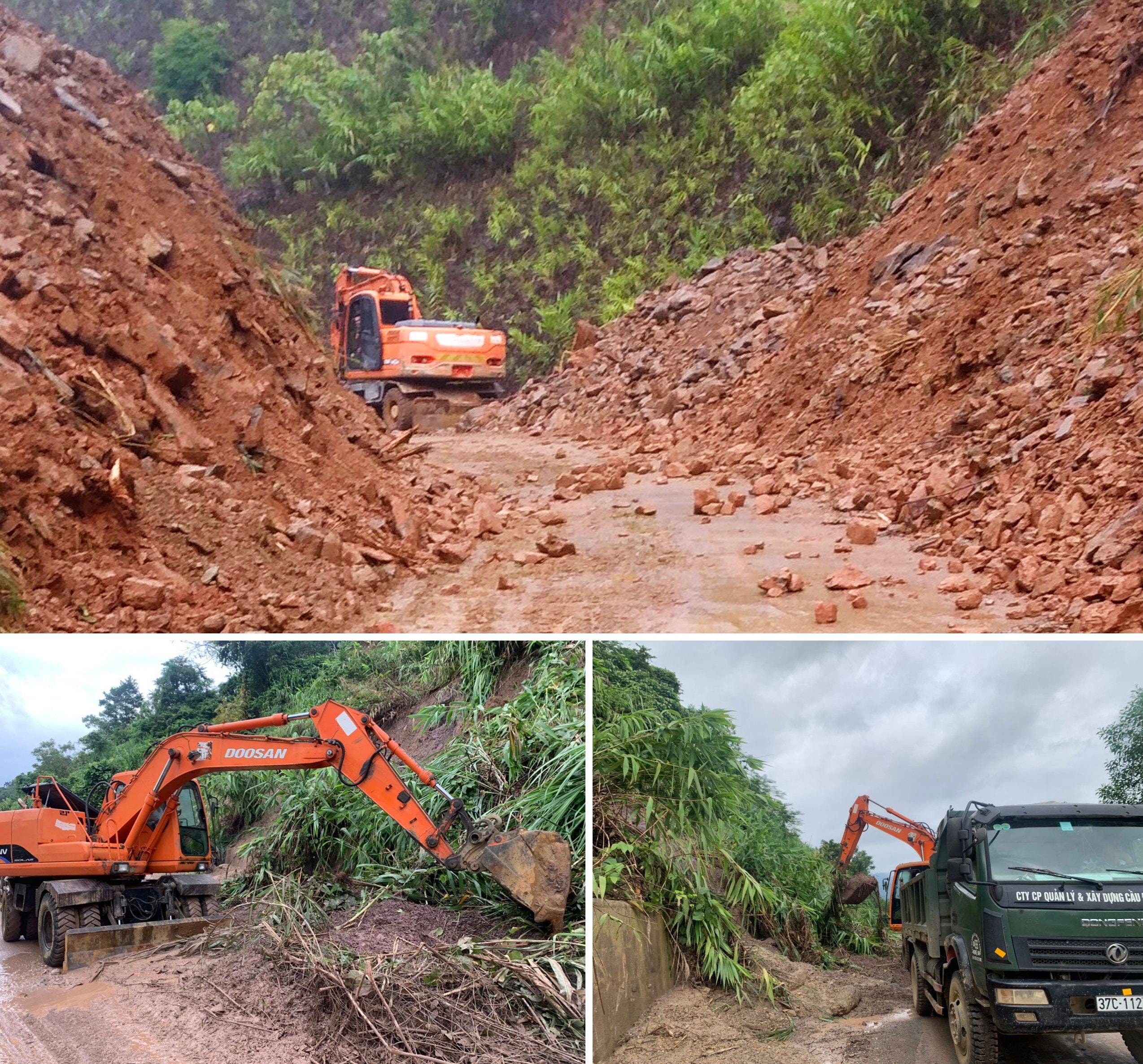
Talking to Nghe An Newspaper, Mr. Pham Hong Son - Vice Chairman of Tan Ky District People's Committee said: The most difficult thing now is that among the dozens of landslides, there is one rock block estimated at about 300m.3The road was blocked and the excavator could not handle it, so the district asked for permission from superiors to use explosives to clear the traffic jam.
| Landslide at Eo Len Nghia Hoan (Tan Ky). Clip: Xuan Hoang |
 |
Authorities mobilized human resources and equipment to overcome the consequences of the landslide. Photo: Xuan Hoang |
At Km 19 National Highway 48D (section through Quynh Vinh commune - Hoang Mai town), the road connecting Hoang Mai town - Thai Hoa town, a landslide blocked the road, vehicles could not circulate, and authorities are blocking and overcoming the consequences.
 |
Km 19 National Highway 48D (section through Quynh Vinh commune - Hoang Mai town), the road connecting Hoang Mai town - Thai Hoa town, was blocked by landslides. Photo: Thanh Yen |
According to information from Nghe An Department of Transport, the impact of storm No. 4 until 9:00 a.m. on September 29, on National Highways and Provincial Roads managed by this Department, there are currently 18 locations where roads are closed (of which National Highways have 11 locations; Provincial Roads have 7 locations).
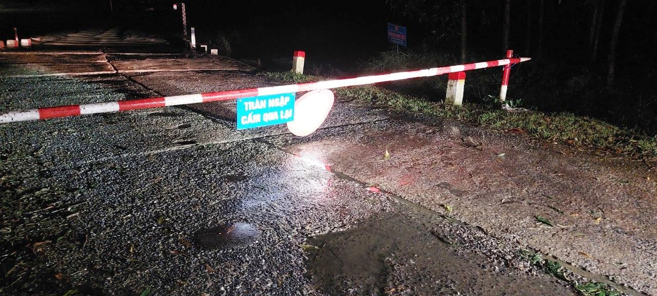
Flooded areas are managed by the management unit in coordination with local authorities to arrange barriers, warning signs, and organize 24/7 guard duty to close roads, prohibit people and vehicles from passing, and ensure safety.
 |
At km 5+100-km5+400 of National Highway 48, passing through Dien Yen commune, Dien Chau district, the entire road was flooded. Photo: Provided by the facility |
Small landslide locations are immediately cleared of soil and rocks to ensure drainage. Large landslide locations are cordoned off and warning signs are placed to ensure traffic safety. Specifically:
- Flooded traffic jams: There are a total of 18 flooded locations. Currently, 18 locations are closed (National Highway: 11 locations; Provincial Road: 7 locations).
- Negative slope and positive slope landslides: Total of 16 locations, including 2 locations
Heavy rain damaged 4 culverts (National Highway: 2 culverts; Provincial Road: 2 culverts).
Currently, some roads in the province are flooded and causing traffic jams. Specifically:
I. National Highway:11 flooded locations are closing roads
1. National Highway QL48:
- Km23+100 (Nghia Thuan Commune, Thai Hoa Town): flooded 0.50m. Unit closed the road and guarded to ensure traffic.
 |
Overflow 59, National Highway 48E flooded, traffic management unit barricaded, with signs to notify people and vehicles. Photo: Provided by the facility |
2. National Highway QL48E:
- Overflow at Km59+950 (Nghia Dan Town, Nghia Dan District): flooded 0.70m. Unit closed the road and guarded to ensure traffic.
- Km61+800 spillway (Nghia Binh commune, Nghia Dan district) is flooded 2.50m. The unit closed the road and stood guard to ensure traffic.
3. National Highway 48B:
- Road section Km17+800-Km17+880, water level 0.4m
- Road section Km13+200-Km13+350: Flooded 0.5m.
4. National Highway 48E: There is 1 flooded location.
Da Han Spillway Km39+400 QL.48E Quynh Thang Commune, Quynh Luu District: Flooded route, road closed at 7:00 p.m. on September 28, 2022.
5. National Highway 15: There are 5 flooded locations:
- At Tran Lang Tra 2 Km207+100 (Nghia Lam Commune, Nghia Dan District): 40 cm of flooding. The management unit has closed the road and sent guards to ensure traffic safety.
- At Tran Nguyen Binh Son Km249+400 (Nghia Binh Commune, Tan Ky District): 40 cm of flooding. The management unit has closed the road and sent guards to ensure traffic safety.
- At Tran Khe Than Km252+600 (Nghia Binh Commune, Tan Ky District): 70 cm flooded. The management unit has closed the road and sent guards to ensure traffic safety.
- At Khe Mit Tran Km258+200 (Nghia Dung Commune, Tan Ky District): 30 cm flooded. The management unit has closed the road and guards are on duty to ensure traffic safety.- At Khe La Tran Km259+500 (Nghia Dung Commune, Tan Ky District): 50 cm flooded. The management unit has closed the road and guards are on duty to ensure traffic safety.
II. Provincial roads:There are 7 flooded locations with roads closed.
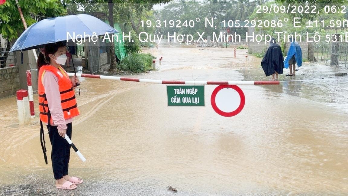
1. Provincial Road 531B:
- Overflow at Km2+250 (Minh Hop commune, Quy Hop district) is 0.40m deep. The unit closed the road and kept watch to ensure traffic.
- Km3+700 spillway (Minh Hop commune, Quy Hop district) flooded 0.40m. The unit closed the road and stood guard to ensure traffic.
 |
| Mountainous areas of the province due to heavy rain caused landslides. Photo: Provided by the facility |
2. Provincial Road 544:
- Overflow at Km25+250 (Chau Phong commune, Quy Chau district) is 0.20m deep. The unit closed the road and kept watch to ensure traffic.
3. Provincial Road 534C
Currently Provincial Road 534C is flooded from Km0+800 with a water level of 1m. Currently the route is completely paralyzed.
4. Provincial Road DT.533:
- Cua Truong Overflow Km2+450 Bao Thanh Commune, Yen Thanh District: Currently flooded 0.35m of the road at 8:00 p.m. on September 28, 2022.
5. Provincial Road DT.538:
- Oil Spill Km27+950 Quynh Tam Commune, Quynh Luu District: Currently 1.0m of road flooded at 10:00 p.m. on September 28, 2022.
6. Provincial Road DT.532:
- Overflow Km16+050 Chau Tien commune, Quy Hop district: Currently flooded 0.35m. The unit closed the road and is on guard to ensure traffic.
On Provincial Road:
Landslides on negative and positive slopes. (National Highway 11 locations, Provincial Road 5 locations)
Unstable landslide sites continue to erode. Traffic management units have set up barriers, ropes and warning signs.
On the National Highway:
1. National Highway 16:
+ Km298+190, left route, negative slope landslide eats deep into the edge of the roadside, current length about 20m.
+ Km317+00 right of way, landslide on positive slope overflowing the road surface, current length about 25m.
+ Km322+400 right of way, landslide on positive slope overflowed the road surface, completely filled the drainage culvert, eroded downstream of the culvert, current length is about 50m. The unit has opened a lane to ensure traffic in step 1.
+ Km402+140, right of way, negative slope landslide eats deep into the edge of the road, the road surface is cracked, current length is about 60m.
 |
Traffic management units arrange staff to be on duty at flooded and impassable points. Photo: Provided by the facility |
2National HighwayNational Highway 48:
-Negative slope landslide at Km98+480 (right) QL48, 15m long, slope >4m deep, close to the edge of the soft guardrail.
- Landslide on positive slope Km103+120 (right): Collapsed up to 2/3 of the road surface, 35m long, continuing to collapse.
3. National Highway 48D:
- At Km0+200 right of route: Current estimated volume of positive slope landslide (length: 35 m, width: 2.5 m, height: 1.5 m);
- At Km19+100 right of way: Landslide on positive slope causes traffic jam;
- At Km20+300 on the left side: Current estimated volume of positive slope landslide (length: 10m, width: 0.4m, height: 0.3m).
 |
Traffic management units mobilized people and vehicles to fix traffic problems on the night of September 28. Photo provided by the facility |
4. National Highway 48E:
- At Km148+00: Landslide caused traffic jam.
- At Km182+320 on the left side: Current estimated volume of negative slope landslide (length: 12m, depth: 2m).
- At Km182+515 right of way: The volume of positive slope landslide caused silting up of the roadside and longitudinal ditch estimated to be 10m long.
On Provincial Road:
1. DT.534C
- Landslide on positive slope Km16+500: Soil overflowed the road surface, filling up a 15m long longitudinal ditch.
- Landslide on negative slope at Km16+450: The unit is continuing to monitor
2. DT 543C
- Landslide on the positive slope at Km43+100 (right) caused traffic congestion, about 34m long. The traffic management unit deployed machinery and equipment to clear a section of the road, ensuring traffic in step 1.
- Landslide on the positive slope at Km50+300 (right) caused traffic congestion, about 50m long. The traffic management unit deployed machinery and equipment to clear a section of the road, ensuring traffic in step 1.
 |
Authorities and local people help people passing through flooded roads. Photo: Provided by the facility |
3. DT 543D:
- Landslide on negative slope at Km104+710 (right) 15m long. Erosion 1m deep into asphalt road surface, subsidence 30cm.
4. Tel.532:
- Landslide on positive slope Km12+950 (left): 2/3 of the road surface has collapsed, 20m long, and is continuing to collapse.
5. Tel.544:
- Landslide on positive slope Km19+250 (right): 2/3 of the road surface has collapsed, 15m long, and is continuing to collapse.
- Landslide on positive slope Km20+550 (left): 2/3 of the road surface, 20m long, collapsed, currently continuing to collapse.
 |
| Traffic management units and local authorities are focusing on ensuring traffic safety on the roads. Photo: Provided by the facility |
Flooded areas are fenced and marked by traffic management units in coordination with local government forces, and 24/7 guards are on duty to close roads, prohibit people and vehicles from passing through, and ensure security and order.


Managing agency: Nghe An Provincial Party Committee
Editor-in-Chief: Tran Minh Ngoc
Electronic newspaper operating license number: 153/GP-BTTTT
Issued by the Ministry of Information and Communications on March 24, 2022


