Nghe An applies digital technology to protect forests
Nghe An has a relatively large area of forest and forest land, high mountainous terrain, complex fragmentation, so the work of forest management, protection and development faces many difficulties. The application of digital technology to protect forests has brought about clear results.
In order to limit deforestation, forest degradation, conserve and enhance forest carbon stocks, and sustainably manage forests to reduce greenhouse gas emissions causing climate change in developing countries, the United Nations has an international initiative called the REDD+ Program.
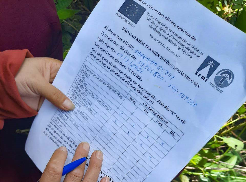
In conjunction with the REDD+ Programme, the European Union has funded the Institute for Sustainable Forest Management and Forest Certification and the Vietnam Centre for Environment and Biological Resources for the Project “Enhancing the participation of grassroots social organizations (CSOs) in monitoring REDD+ programmes in Vietnam”.
The project will be implemented for 4 years (2020-2024) in 18 villages and hamlets of 6 communes: Tam Quang, Tam Dinh, Tam Thai (Tuong Duong) and Na Ngoi, Huu Kiem, Tay Son (Ky Son), with more than 210 members.
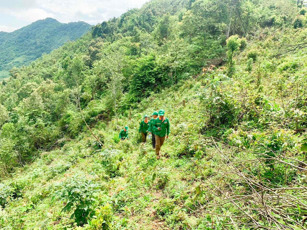
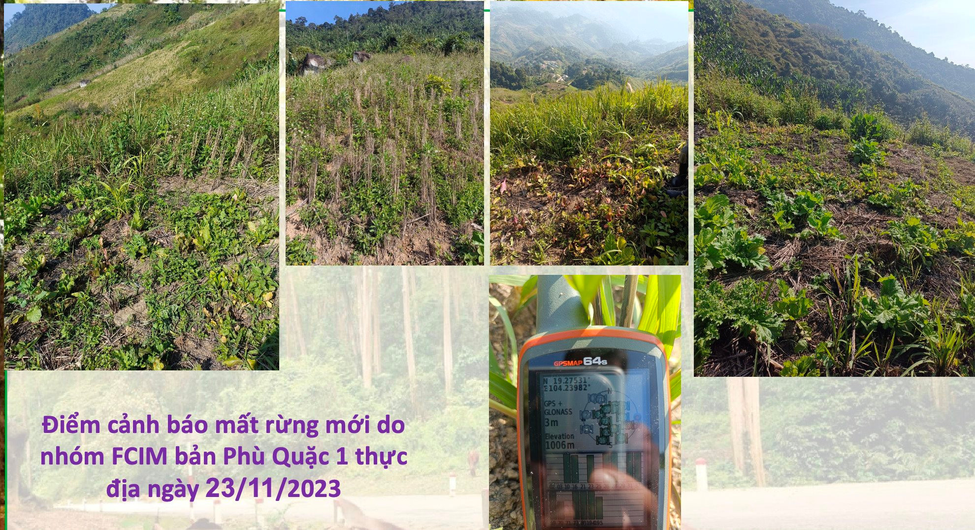
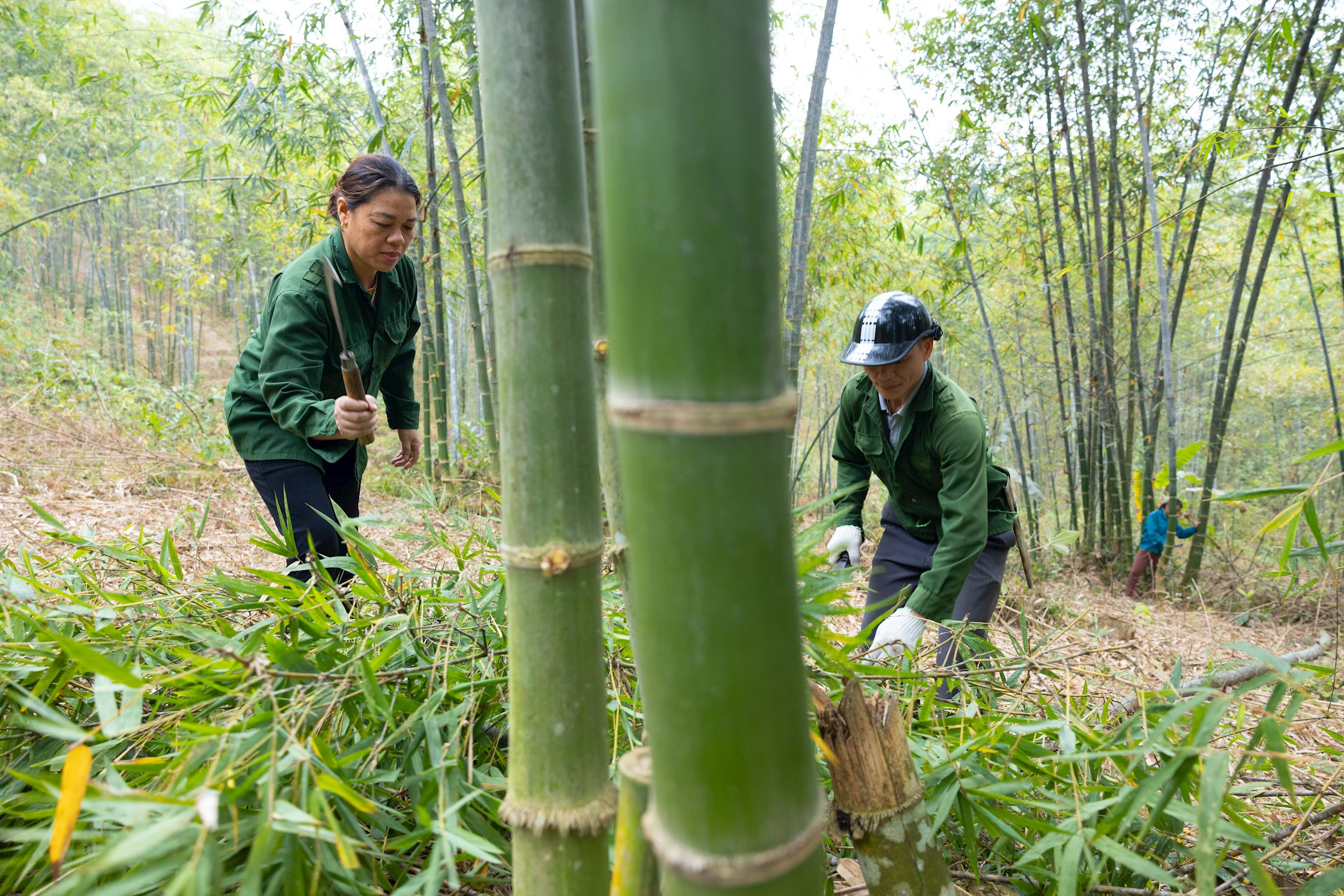
Over the past four years, village FCIM teams, in conjunction with six commune-level FCIM committees, have conducted 545 field visits, identified 577 deforestation sites, and provided feedback to the Terra-i system. FCIM team members are core members of women’s unions, farmers’ unions, veterans’ unions, youth unions, and forest protection patrol teams.
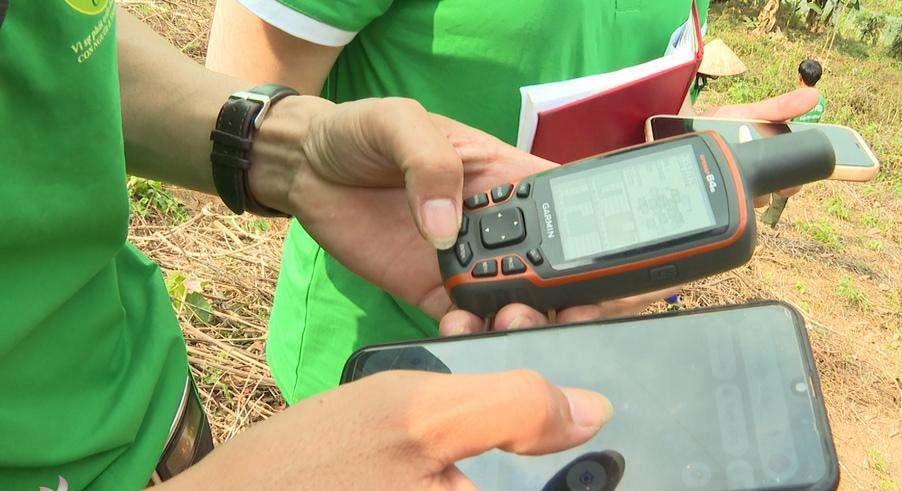
Through the activities of FCIM groups, participants are provided with GPS technology devices, smartphones, and trained in the use of remote sensing technology and the Terra-i system in forest management.
“Since the forest monitoring and protection project was implemented, if just one tree in the forest is cut down or broken, the “eyes of the forest” which are smartphones will immediately detect and report to the system.
From there, members will conduct field inspections and promptly report to local authorities and relevant forces for handling. The support of technology helps to monitor and protect forests more conveniently and effectively, and forest trips are now less difficult," said Mr. Phan Van Manh - Chairman of the Farmers' Association of Ky Son District - representative of the project beneficiary.
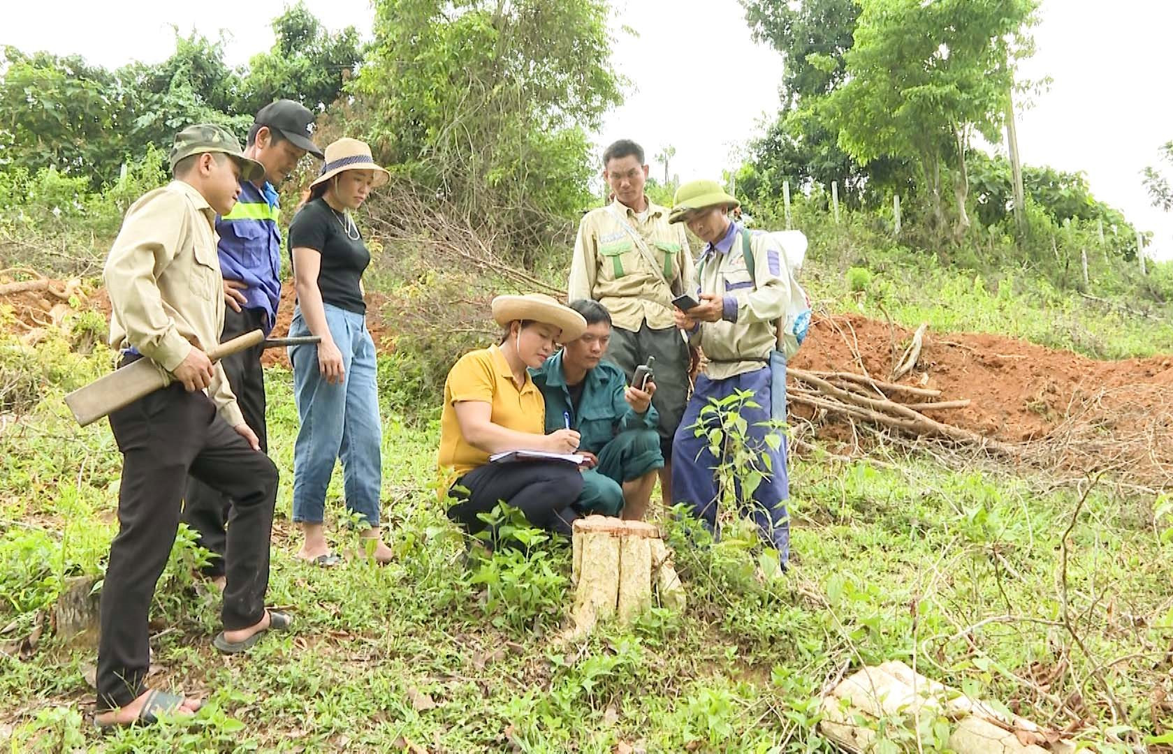
Every month, the FCIM team will conduct a check of the Terra-i system. If any changes in the forest are detected, the team leader will assign specific tasks to members and conduct field investigations. The team will then update the information on the Terra-i system and report to the FCIM committees at the commune and district levels and relevant parties for timely prevention measures.
According to Mr. La Van On - Deputy Head of FCIM Group Na Luong 1, Huu Kiem Commune (Ky Son): "Identifying points with changes in forest trees is easy, so it saves a lot of time, costs and efforts for forest patrol teams, contributing to preventing deforestation in the area. The system also creates conditions for everyone to participate in the process of monitoring the change in the forest status in their village or hamlet."
Speaking more about deforestation control, Mr. Phan Van Manh said: "Sometimes a tree dies, breaks, or is knocked down by a storm, creating a gap compared to the previous data recorded by the machine, the machine will immediately notify the exact location of the detected change, helping the control team to quickly arrive at the correct location to verify."
Previously, the phrase "Remote sensing technology" did not exist in the local language dictionary. Now, through training courses, members are imparted knowledge, instructed on how to use, and "hand-held", so they have mastered the use of equipment and software in forest management and protection.
Mr. Vu Ba Gio - Chairman of the Farmers' Association of Na Ngoi Commune, Deputy Head of the FCIM Project of Na Ngoi Commune said: "Previously, I did not know where the forest areas of the villages I managed were located, how the deforestation progressed, but thanks to this system, I have grasped information about the forest status of my area. The Terra-i system is quite simple to use, can check information about changes in forest trees anywhere, and everyone can access information about changes in forests".
Thanks to the application of remote sensing technology and digital devices in forest management and protection, over the past 4 years, the groups have discovered and recorded 1,626 forest loss warning points of 4,000 hectares; 18 FCIM villages and hamlets in conjunction with 6 FCIM committees at the commune level have conducted 545 field trips, confirmed 577 forest loss points and responded to the Terra-i system, with 488 accurate warning points and 50 additional points discovered.
