North Korean mountain moves more than three meters due to nuclear test
Satellite images show that Mount Mantap, where North Korea conducted its nuclear bomb test, moved about 3.5 meters due to the impact of the explosion.
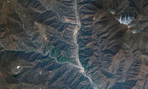
|
Punggye-ri nuclear test site in satellite image. Photo:DigitalGlobe. |
North Korea conducted its latest nuclear test at the Punggye-ri test site on September 3, 2017, and it was the largest test to date, creating a tremor equivalent to a 6.3-magnitude earthquake, according to sensors, Live Science reported. About eight minutes after the test, geologists detected a smaller tremor of 4.1 magnitude, leading to speculation that the nuclear test site inside the mountain had collapsed.
The collapse could render the site unsuitable for future nuclear tests and even increase the risk of radioactive fallout escaping the rock and spreading into the air. The possibility of this phenomenon, known as “tired mountain syndrome,” became even more likely three weeks ago when North Korea announced plans to shut down its main test facility at Mount Mantap, where five of its six nuclear tests took place. In a study published in the journal Geophysical Research Letters, a team of Chinese geologists confirmed that the mountain collapsed after the most recent nuclear test.
In a new report published in the journal Science yesterday, scientists used satellite images to find that Mount Mantap had actually shifted and compressed after the explosion. But the team said the mountain and test site may not have collapsed completely.
Previously, researchers measured nuclear explosions by measuring the ground shaking they caused, using seismic data similar to how earthquakes are measured. But in the new study, an international team of scientists analyzed satellite images taken by Germany's TerraSar-X and Japan's ALOS-2 satellites, and compared the view of Mount Mantap before and after the explosion.
These satellites use synthetic aperture radar, which transmits electromagnetic waves to Earth and measures the reflected light, according to the National Oceanic and Atmospheric Administration (NOAA). The technology can produce high-resolution images even in bad weather and low light conditions because microwaves can penetrate clouds.
Using satellite images, the team calculated that Mount Mantap moved about 3.5 meters and shrank by 0.5 meters. This suggests the collapse of the tunnel inside the mountain, according to Teng Wang, a senior research fellow at the Earth Observatory of Singapore at Nanyang Technological University. "But we cannot conclude whether the entire test site and tunnel have collapsed completely because there is no direct evidence to prove it," said Wang, the study's lead author.
The ground shaking may have resulted from the collapse of a cavity in the rock created by the previous or most recent explosion, according to Douglas Dreger, a professor of earth and planetary sciences at the University of California, Berkeley, and co-author of the study. Wang and Dreger's team estimated the force of the explosion at 120 to 130 kilotons, 10 times the atomic bomb dropped on Hiroshima.