Picturesque winding roads in the Western region of Nghe An
(Baonghean.vn) - The typical highland terrain has left the Western Nghe An region with its winding roads, meandering between the green of the forest and the hazy white of the clouds.
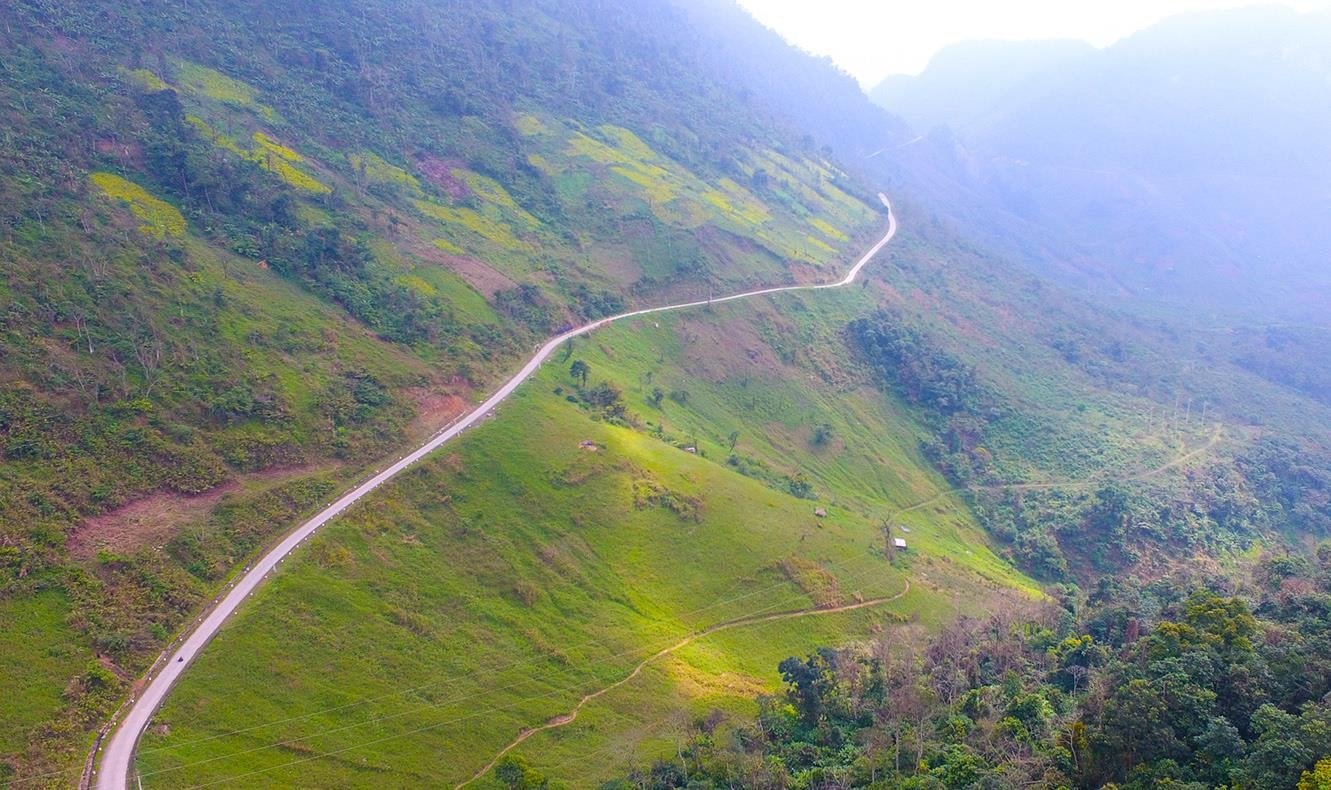 |
| The winding road leads up to Muong Long Heaven Gate, with fields of rapeseed flowers scattered along the mountainside on both sides. Photo: Sach Nguyen |
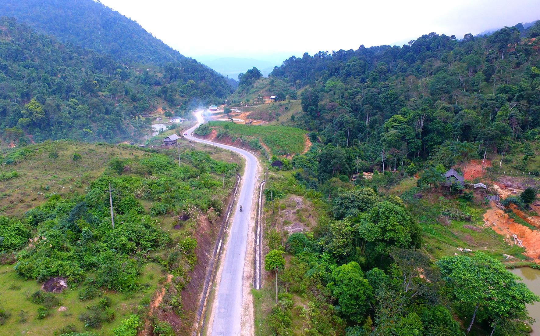 |
| Doc Chuoi is the only vital traffic route connecting Kim Son town - Que Phong district capital to the southwestern communes such as Chau Kim, Tri Le, Nam Nhoong, Chau Thon, Cam Muon, Quang Phong. Photo: Sach Nguyen |
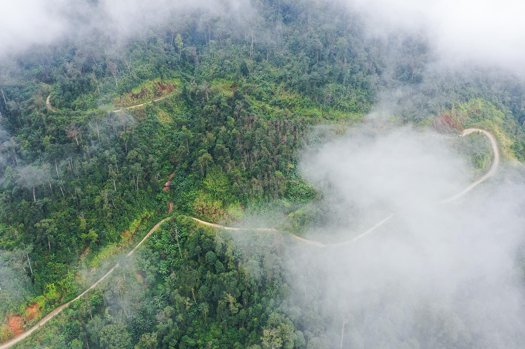 |
| The road to the top of Pu Xai Lai Leng mountain, 2,711m high, is the roof of the majestic Truong Son range located close to the Vietnam - Laos border, in Ky Son district. Photo: Sach Nguyen |
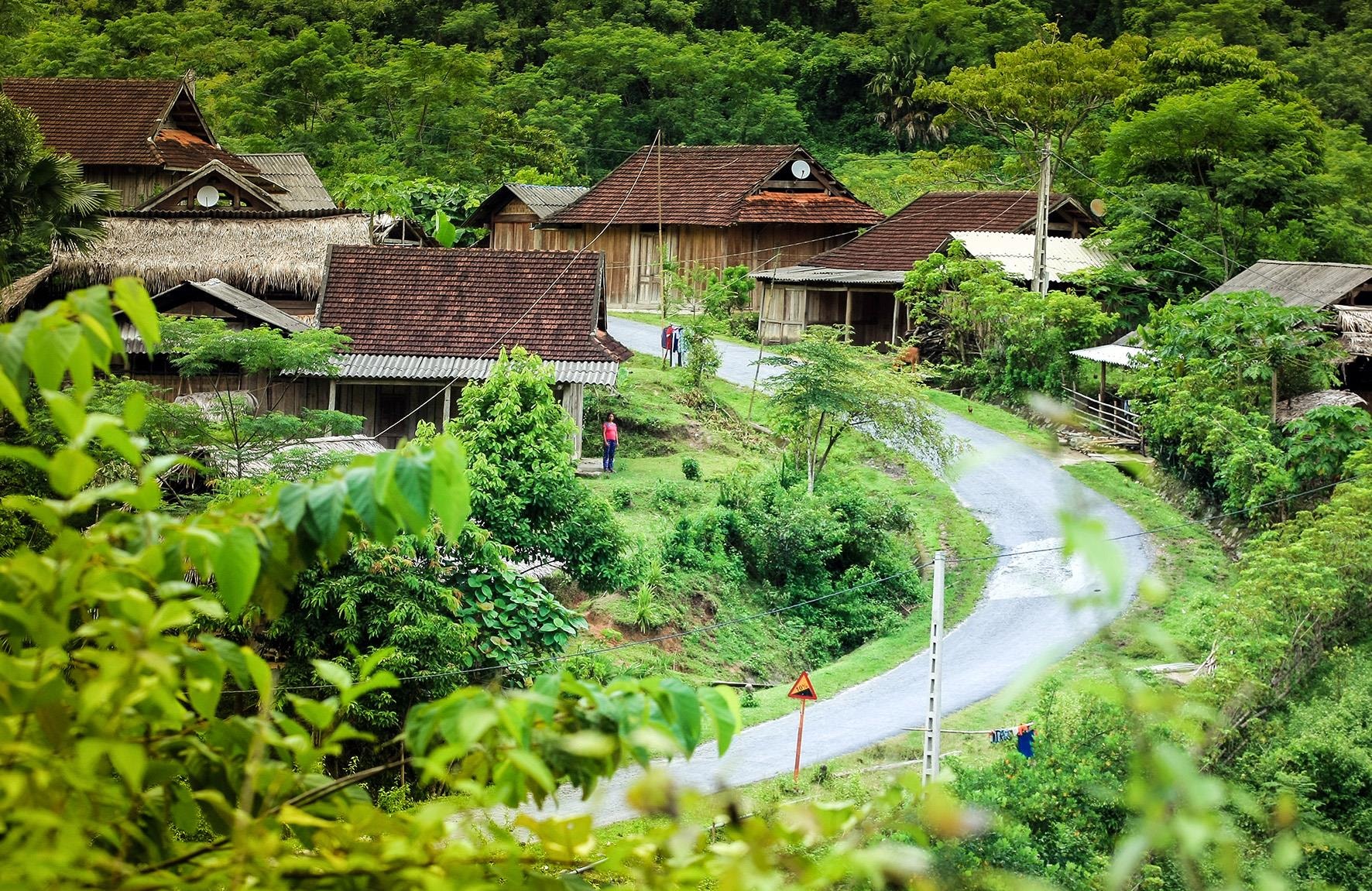 |
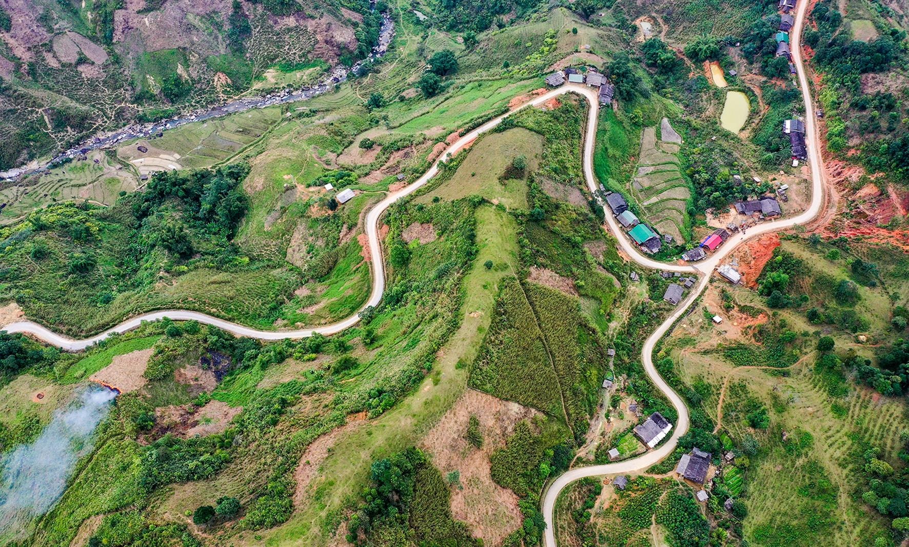
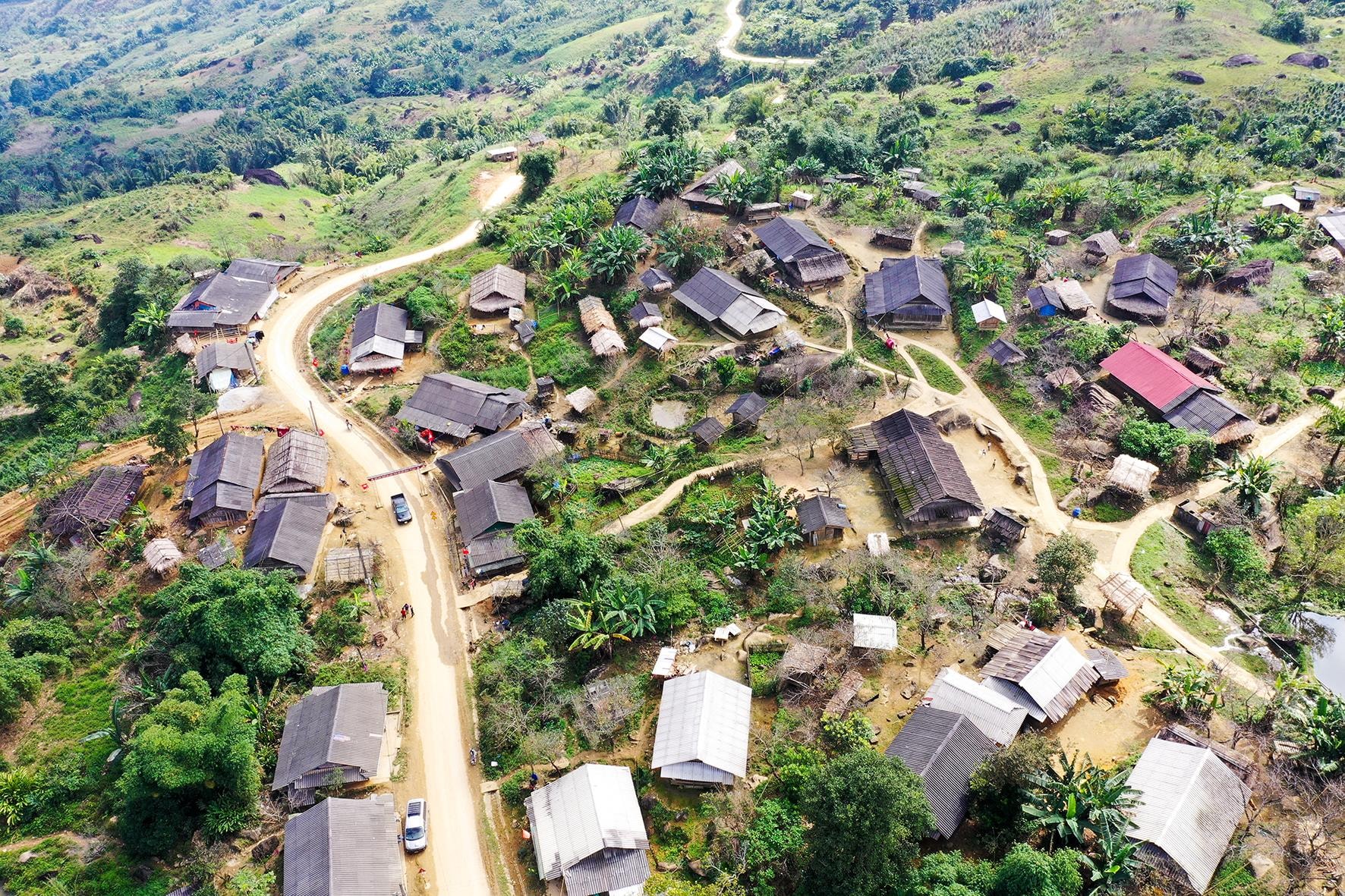
| A village located on the route starting from Khe Kien (Tuong Duong) to Na Ngoi commune (Ky Son). Photo: Sach Nguyen |
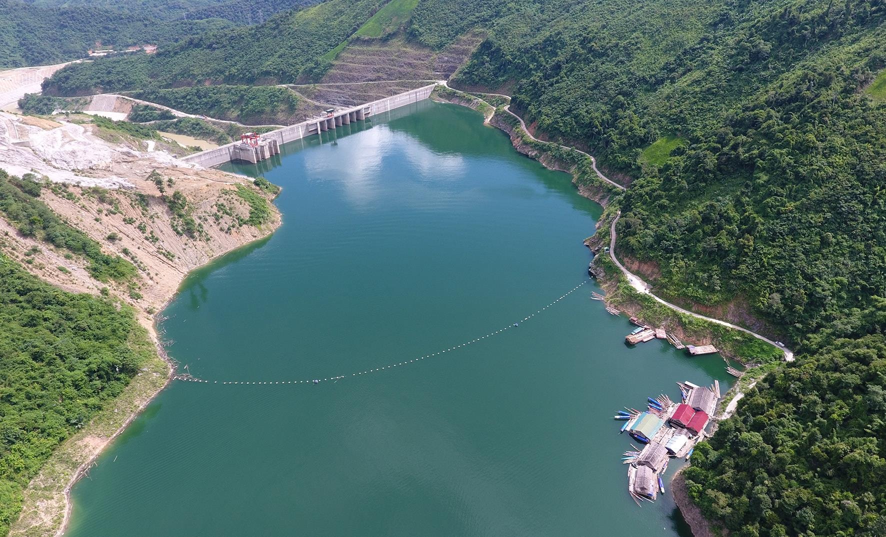 |
| The winding path forms a beautiful curve leading to the upstream wharf of Ban Ve Hydroelectric Dam, Tuong Duong. Photo: Sach Nguyen |
 |
| Na Loi junction is on the Tay Nghe border, the right direction goes to Muong Ai, Muong Tip (Ky Son), the left direction is the branch of Highway 10 leading to the top of Pu Xai Lai Leng mountain. Photo: Sach Nguyen |
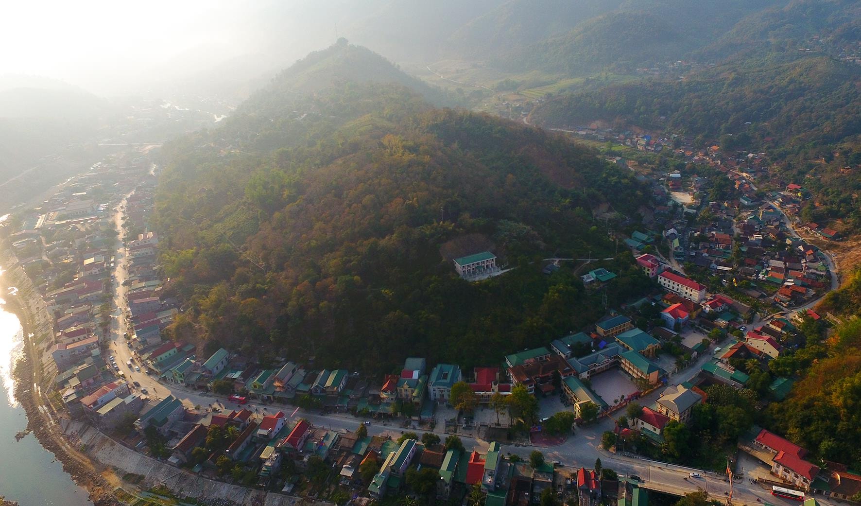 |
| Ky Son district center is surrounded by Highway 7. Photo: Sach Nguyen |
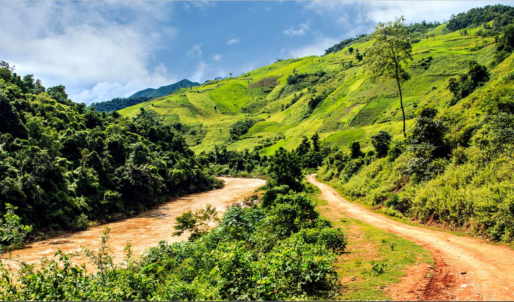 |
| The border route runs along the Nam Mo River in Ta Ca commune, Ky Son. Photo: Sach Nguyen |
 |
| Small winding roads between the undulating roofs of the Mong village of Na Ngoi commune. Photo: Sach Nguyen |