Follow the backpacker to the top of Puxailaileng
(Baonghean.vn) - With an altitude of about 2,720m, Puxailaileng peak in Ky Son district (Nghe An) is considered the "roof of the Northern Truong Son range". Conquering the mountain peak is really arduous but brings excitement, especially for those who love adventure.
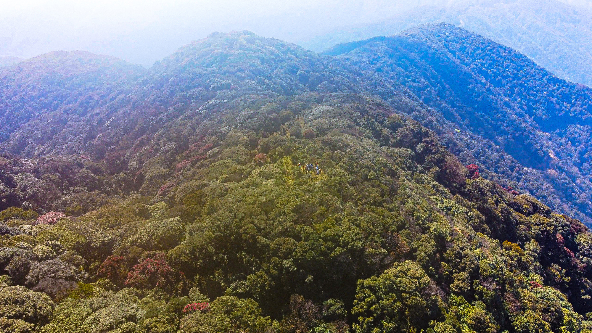 |
| Puxailaileng Peak is located in Nga Ngoi Commune, Ky Son District (Nghe An), near the Vietnam - Laos border. The peak has an altitude of 2,720 m above sea level, the highest in the Northern Truong Son range. Photo: Dinh Tuyen |
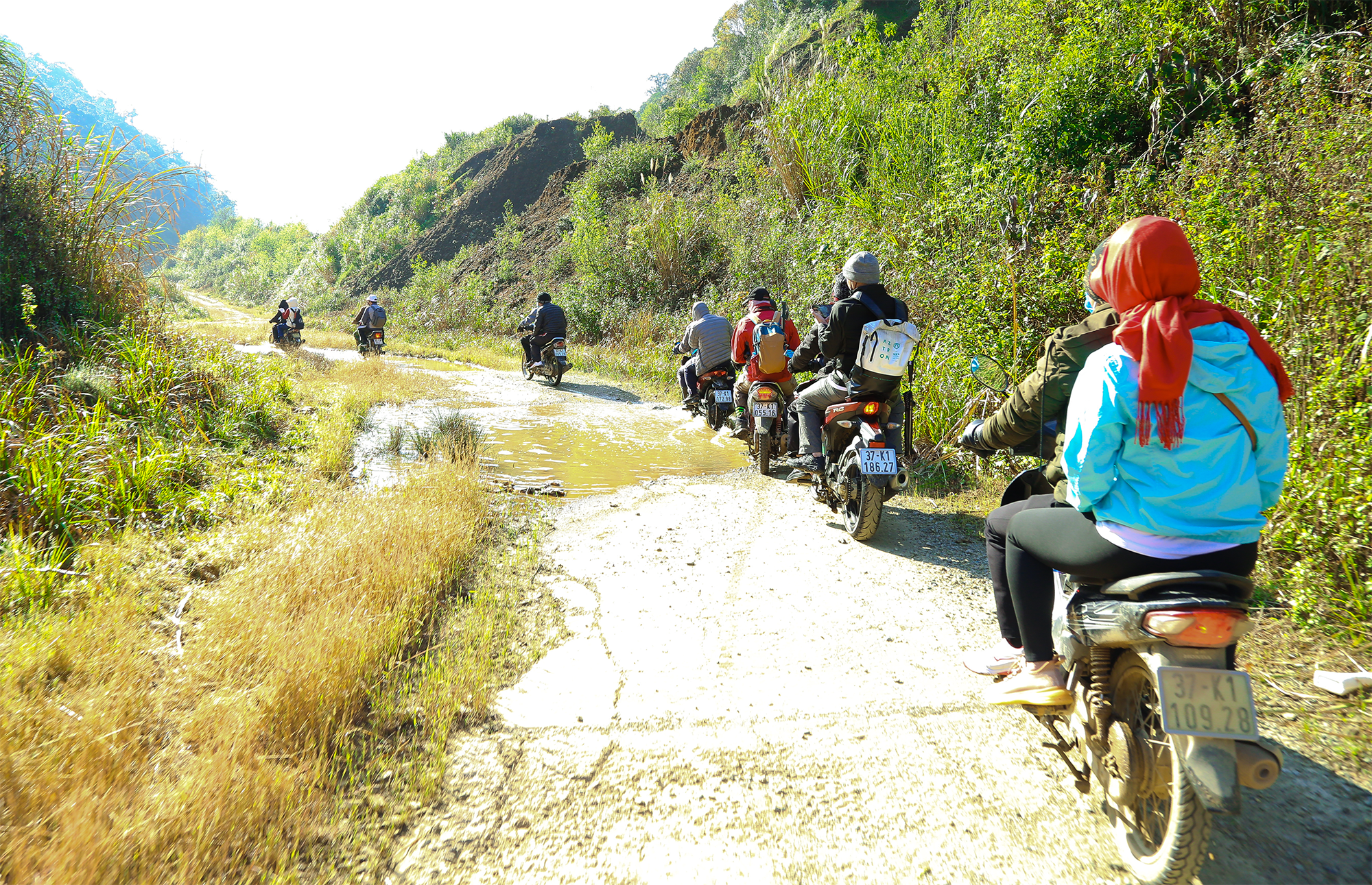 |
| Recently, many tourist groups have come to conquer Puxailaileng peak. From Vinh city, you have to go up National Highway 7A, turn into the center of Na Ngoi commune, then take a pickup truck or motorbike 17km to Buoc Mu Border Guard Station. From Buoc Mu Border Guard Station, tourists will hire locals to carry their motorbikes along the border patrol route. This route has been concreted, but due to the rugged terrain, many sections have been eroded by rain and floods, making travel extremely difficult. Photo: Dinh Tuyen |
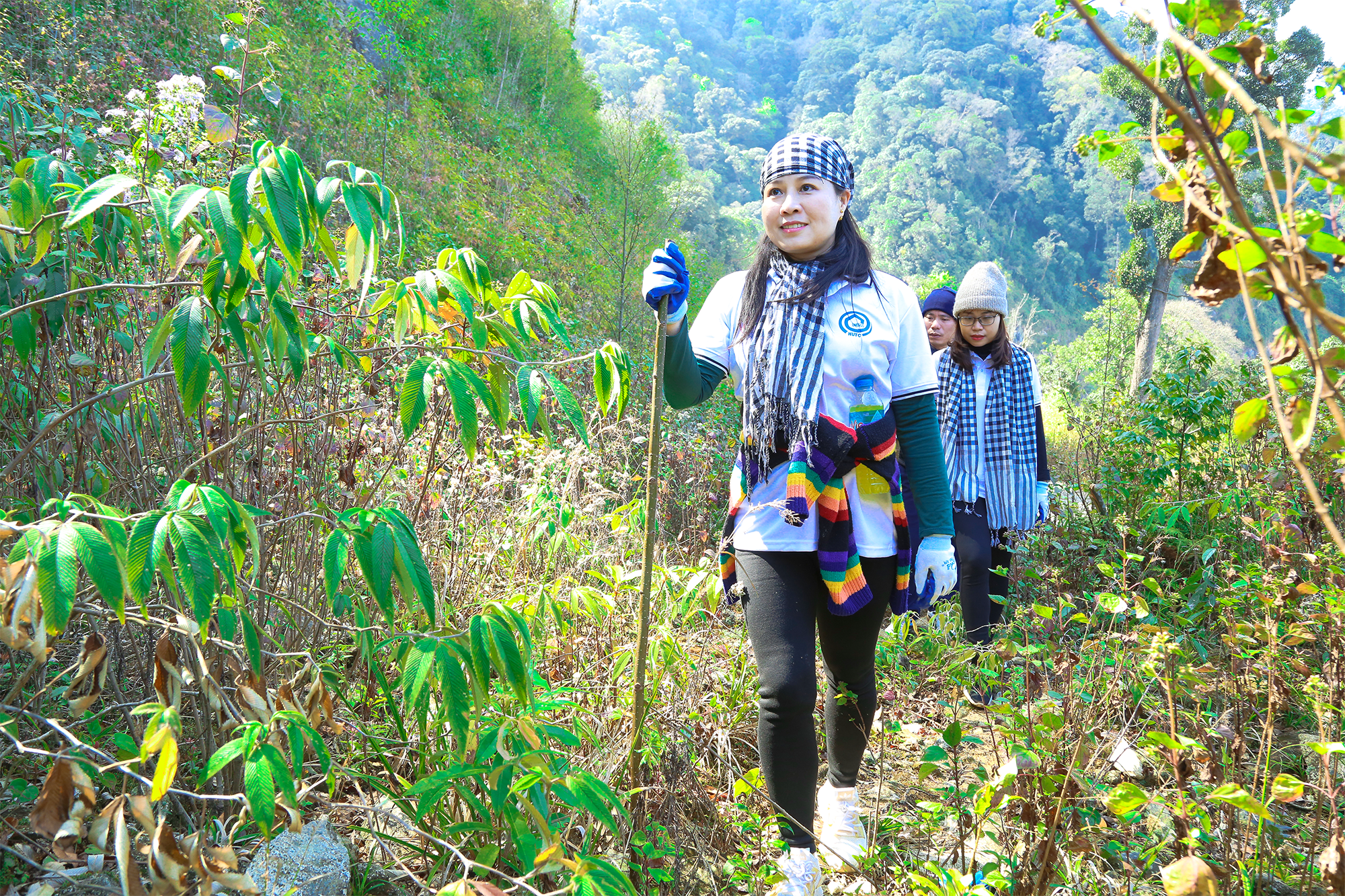 |
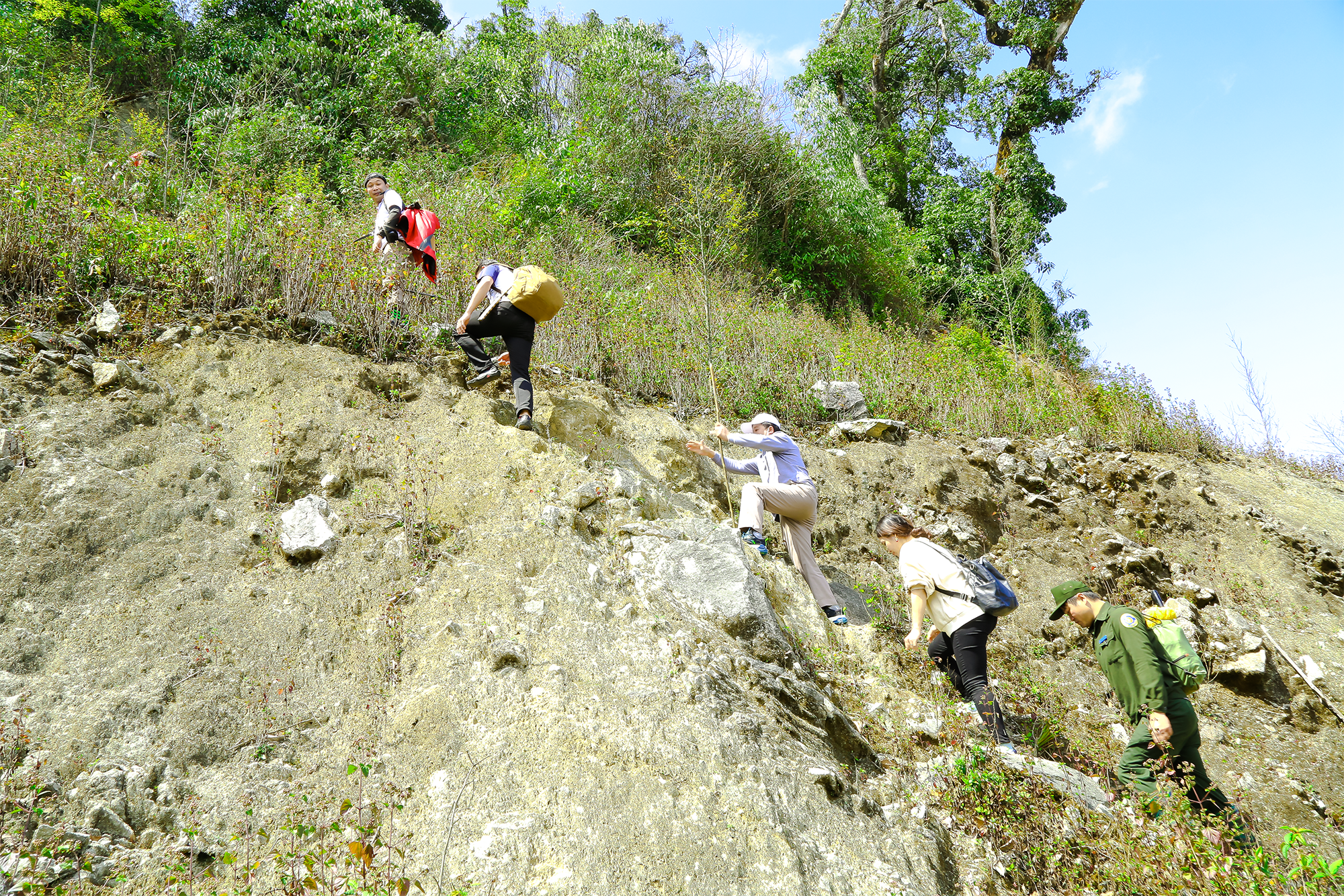
| After traveling more than 10 km, the border patrol road was seriously eroded, motorbikes could no longer travel, the backpackers had to leave their vehicles and continue their journey on foot. Photo: Dinh Tuyen |
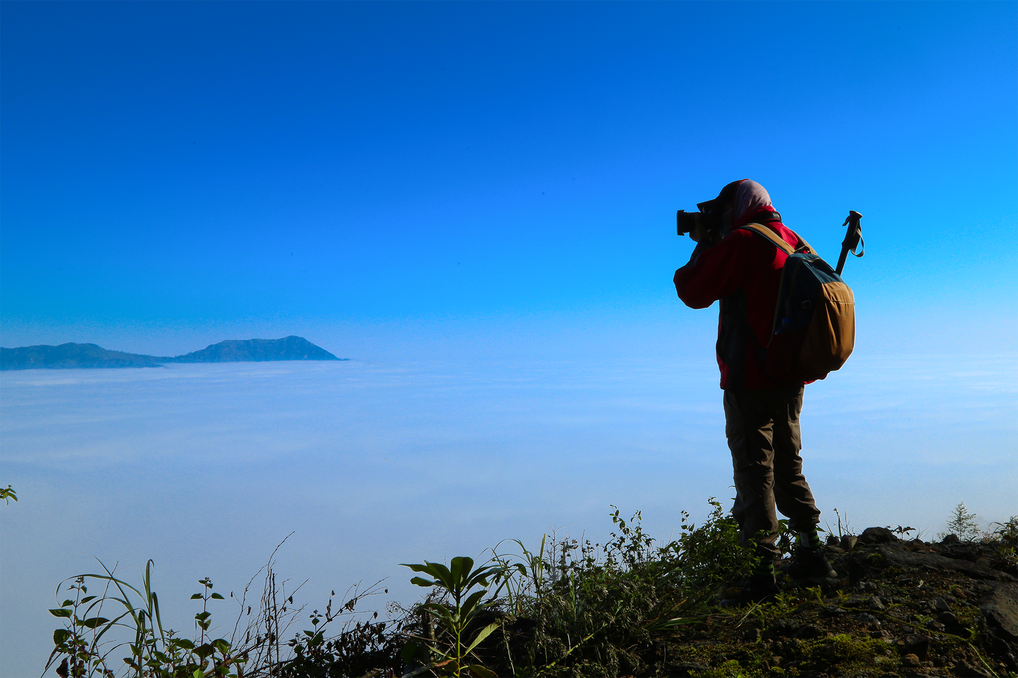 |
| The higher you go, the more beautiful scenery you can see, especially when you can enjoy the "sea of clouds" floating like a fairyland. The backpackers stop, find beautiful locations to check in and record the moments and beautiful scenery of the great western region of Nghe An. Photo: Dinh Tuyen |
 |
| At km18 of the border patrol road, from here to the top of Puxailaileng is not far but the only way is to climb the mountain on foot. Photo: Dinh Tuyen |
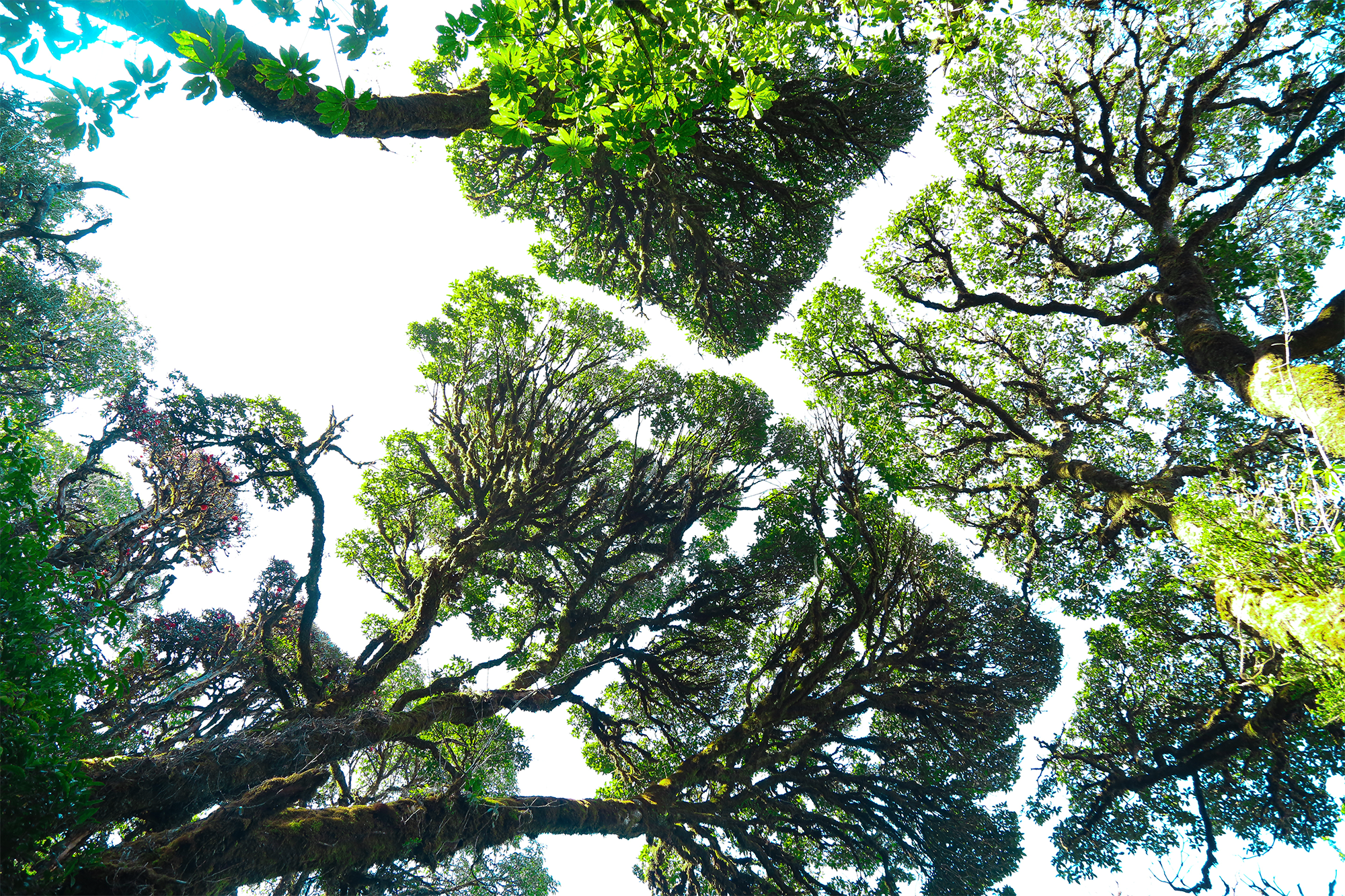 |
| After crossing a high ta-tuy, the backpackers passed through an ancient sa mu forest. The scenery was truly stunning, with towering tree trunks covered in moss, and green leaves intertwined to create a majestic beauty. Photo: Dinh Tuyen |
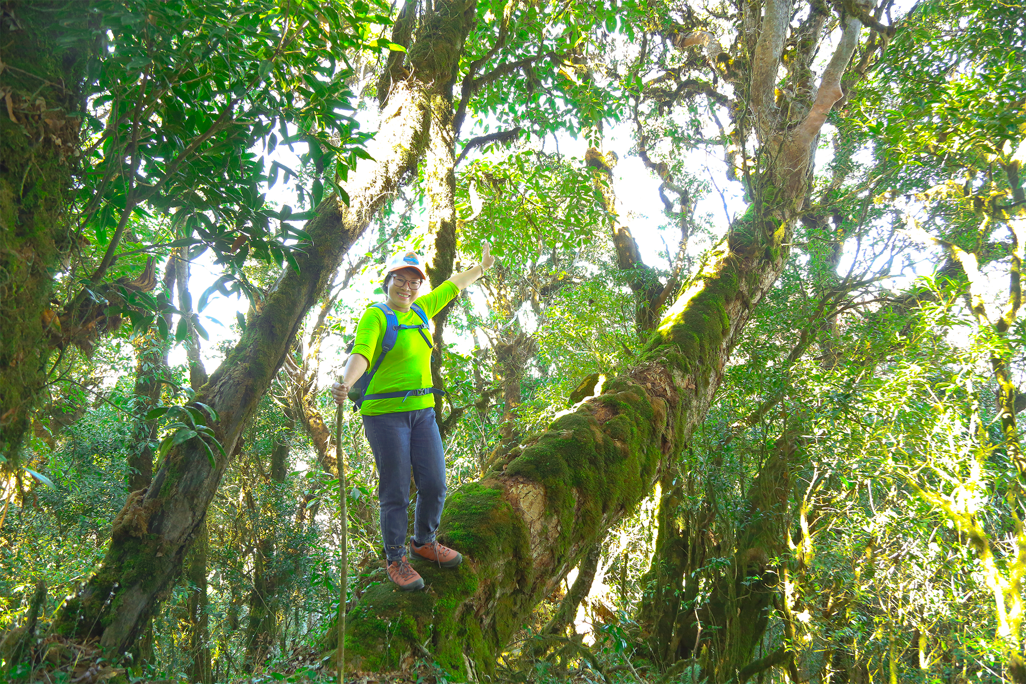 |
| Amidst the beautiful scenery, backpackers take advantage of the opportunity to capture moments that are not easily obtained in the high mountains of the border. Photo: Dinh Tuyen |
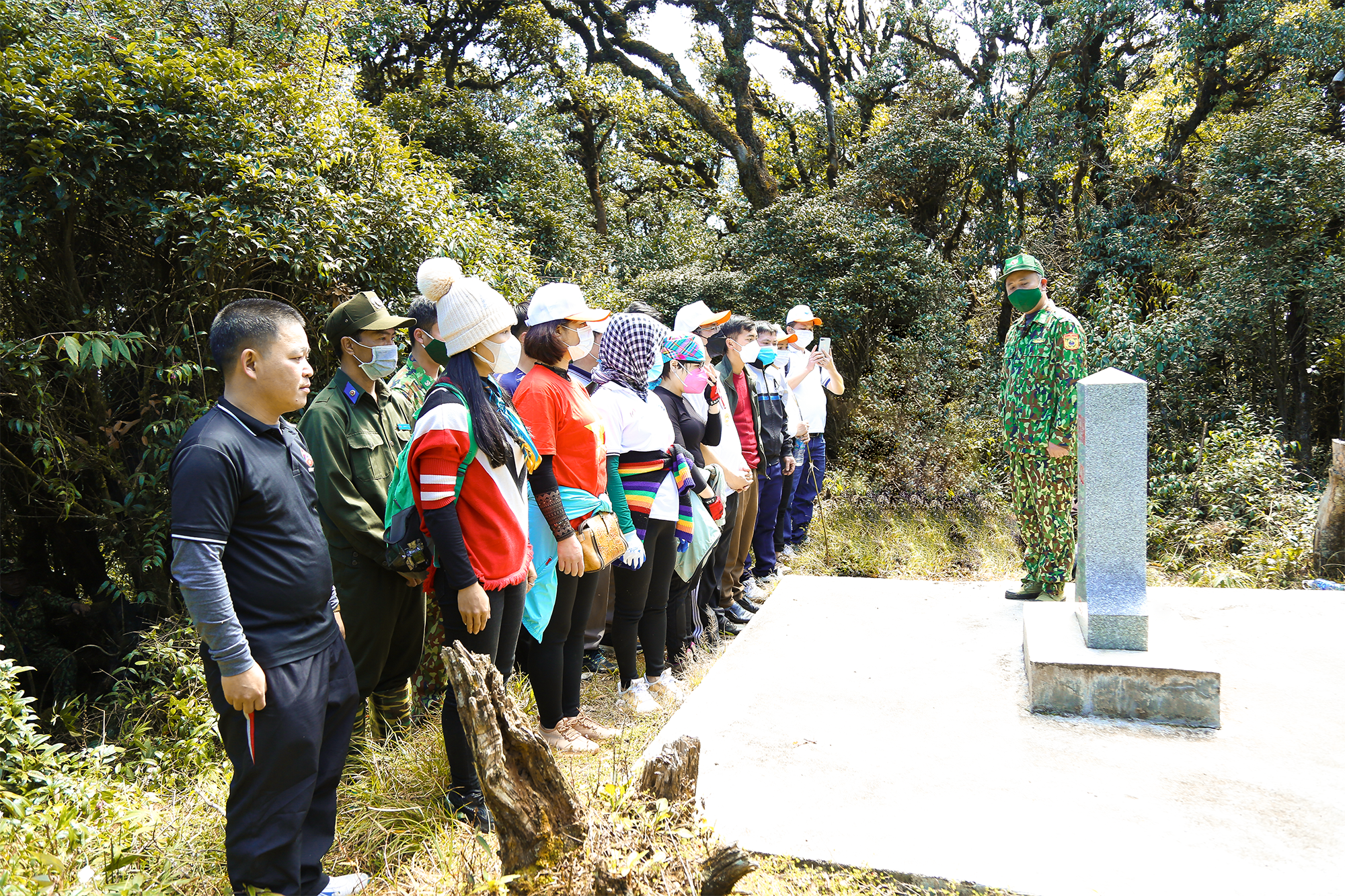 |
| Through the ancient sa mu forest, you will reach landmark 422, the dividing line between Vietnam and Laos. Photo: Dinh Tuyen |
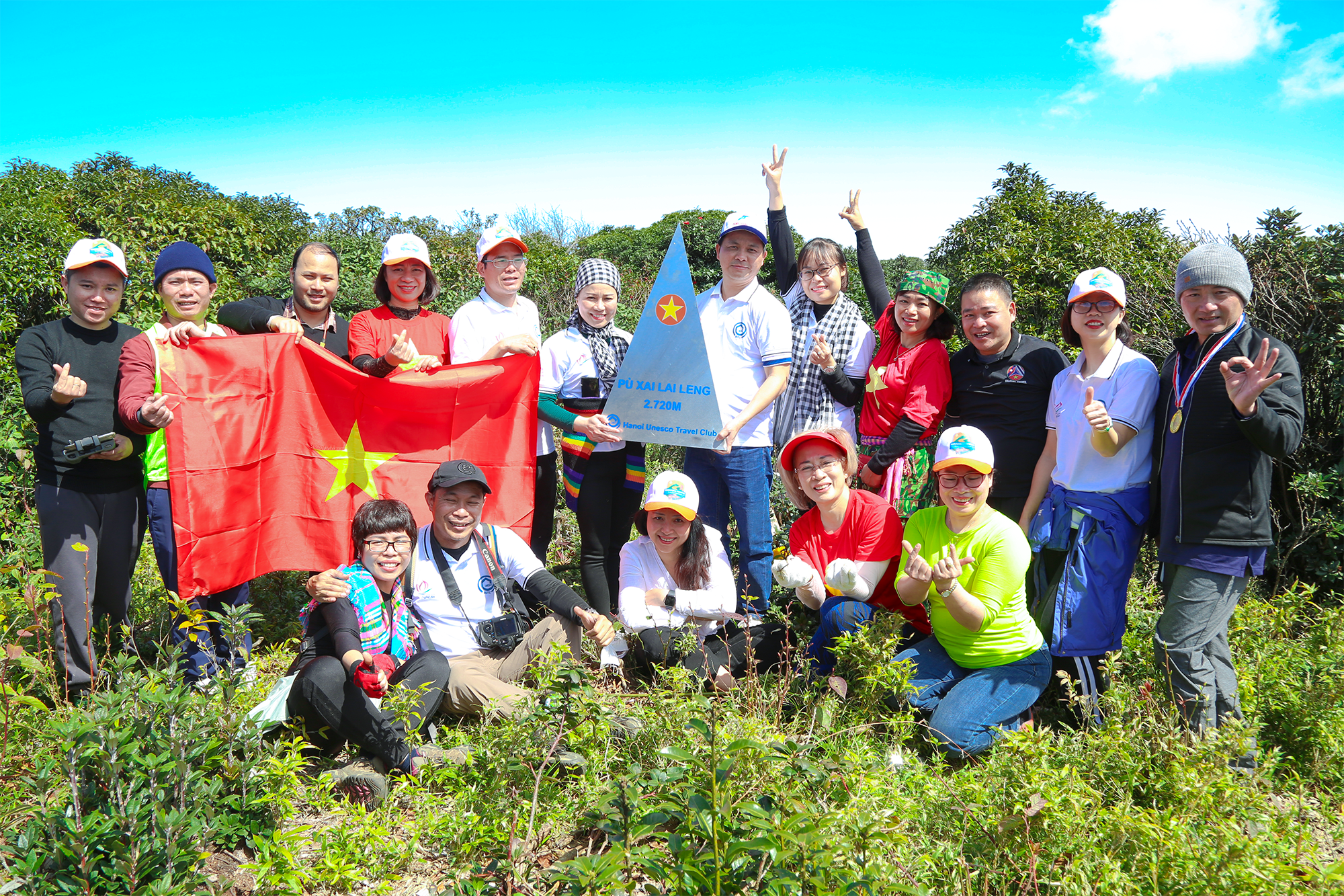 |
| From milestone 422, continue to cross a short distance to reach the top of Puxailaileng. Arriving here, everyone feels excited, proud and happy to conquer the 2,720m peak, the "roof" of the Northern Truong Son range. Photo: Dinh Tuyen |
