Weather October 20: Low pressure area appears offshore, rain in Central region
(Baonghean.vn) - According to the National Center for Hydro-Meteorological Forecasting, this low pressure area is moving westward and is unlikely to strengthen into a tropical depression.
1. Rain in the Central region
According to the forecast, today (October 20), in the coastal areas from Da Nang to Binh Dinh, there will be rain, some places will have moderate rain, heavy rain and thunderstorms (common rainfall 15-30mm/12 hours, some places over 30mm). During the thunderstorm, there is a possibility of tornadoes, lightning, hail and strong gusts of wind.Disaster risk level due to heavy rain: level 1.
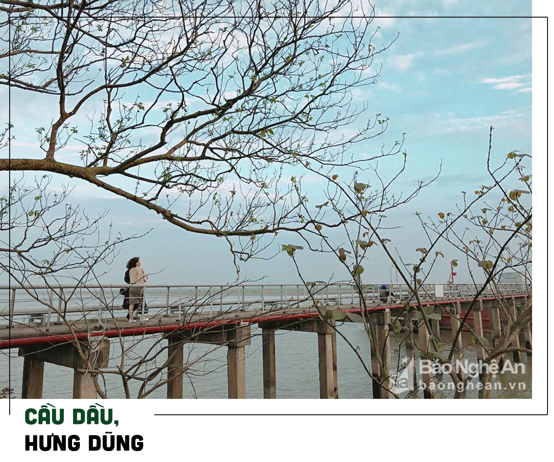 |
| According to forecast, the temperature in the Central region today will decrease by 1-2 degrees compared to yesterday. In photo: Cau Dau (Vinh City). Photo courtesy: Kien Rose |
2. Low pressure area in the sea off the coast of the South
Currently (October 20), rThe low pressure system with an axis at about 7-9 degrees North latitude is active with a low pressure area in the sea off the coast of the South located at 1:00 a.m. at about 8.0-9.0 degrees North latitude; 104.5-105.5 degrees East longitude.
It is forecasted that in the next 24 hours, this low pressure area will move westward, traveling about 15-20km per hour and is unlikely to strengthen into a tropical depression.
Due to the influence of the low pressure circulation with the low pressure trough analyzed above, during today and tonight, in the sea areas of the provinces from Ca Mau to Kien Giang and the Gulf of Thailand, there will be heavy thunderstorms, with the possibility of tornadoes and strong gusts of wind of level 7-8; waves from 1.0-2.0m high; rough seas.
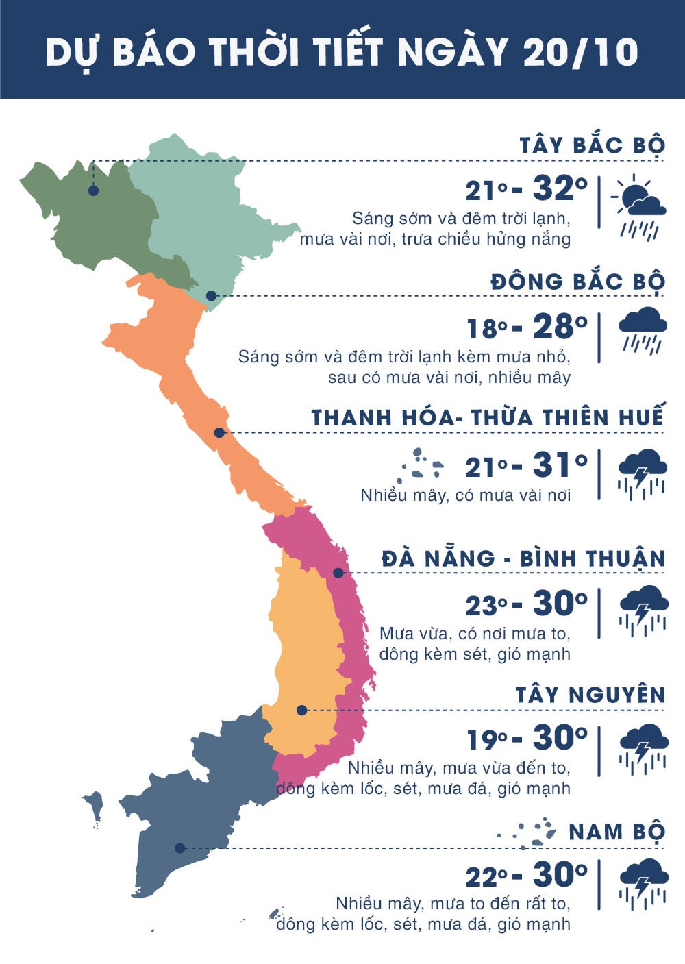 |
| Temperature on October 20 in regions across the country. Photo: news.zing.vn |