Weather October 22: Cold air returns, North and Central regions turn to rain
(Baonghean.vn) - Currently (October 22), the reported cold air mass is still continuing to move and compress the low pressure trough with an axis at about 23-25 degrees North latitude to the South.
According to the National Center for Hydro-Meteorological Forecasting, this evening (October 22), this cold air mass will affect some places in the northern mountainous provinces, and tonight it will affect other places in the North.
 |
| Illustration photo/Source: Internet |
From tonight, the wind will change to the northeast in the mainland of the Northeastern provinces at level 2-3. From tomorrow (October 23), in the Northern provinces, the weather will turn cold at night and early morning with the lowest temperature commonly being 20-23 degrees, in the Northern mountainous areas, some places will have the lowest temperature of 18-20 degrees.
In the Gulf of Tonkin from tonight, the wind will change to the northeast and gradually increase to level 5, sometimes level 6, gusting to level 7; rough sea.
Thunderstorm, tornado, lightning warning:Due to the influence of cold air compressing the low pressure trough, there will be showers and thunderstorms in the mountainous areas of the North; tonight and tomorrow (October 23), thunderstorms will spread to the Northern provinces and Thanh Hoa, especially in the mountainous areas of the Northeast and Viet Bac there will be moderate rain, some places will have heavy rain and thunderstorms. During the thunderstorms there is a possibility of tornadoes, lightning, hail and strong gusts of wind.Disaster risk level due to tornado, lightning, hail: level 1.
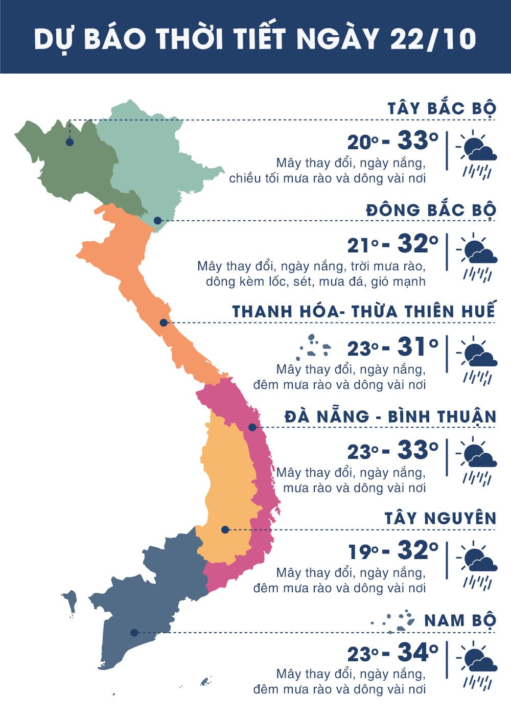 |
| Temperature on October 22 in regions across the country. Photo: news.zing.vn |
.png "Thời tiết Nghệ An ngày 4/8: Nắng nóng gay gắt bao trùm, chiều tối đề phòng dông lốc mạnh")


