Weather on July 3: Nghe An has very heavy rain, beware of tornadoes and lightning during thunderstorms
(Baonghean.vn) - Due to the influence of storm No. 2, today (July 3), in the Southern region of the Northern Delta, the North and Central Central regions, there will be rain, especially in the provinces from Thanh Hoa to Quang Nam, there will be moderate rain, heavy rain, and in some places very heavy rain. During thunderstorms, there is a possibility of tornadoes, lightning and strong gusts of wind.
4:00 a.m. on July 3, the center of the storm is located at about 18.9 degrees North latitude; 110.0 degrees East longitude, in the area east of Hainan Island (China), about 410 km southeast of the mainland of Quang Ninh-Hai Phong provinces. The strongest wind near the storm is level 8 (60-75 km/hour),level 11. Radius of strong wind level 6,level 8 jerkup to about 100 km from the center of the storm.
Forecast for the next 24 hours,The storm is moving in a West-Northwest direction, traveling about 10-15 km per hour and is likely to continue to strengthen. At 4:00 a.m. on July 4, the center of the storm was at about 20.5 degrees North latitude; 107.2 degrees East longitude, in the sea area of Quang Ninh - Ninh Binh provinces. The strongest wind near the center of the storm is level 8 (60-75 km/hour).level 11. Radius of strong wind level 6,level 8 jerkup to about 100 km from the center of the storm.
Dangerous areas in the East Sea in the next 24 hours(strong wind level 6, gust level 8 or higher): North of latitude 18.0 degrees North; West of longitude 111.5 degrees East.Disaster risk level: level 3.
Over the next 24 to 36 hours,The storm is moving in a West-Northwest direction, about 15 km per hour, and is likely to make landfall in the provinces from Quang Ninh to Nam Dinh with strong winds of level 7-8.level 10 jerk,then gradually weakened into a tropical depression, then continued to weaken into a low pressure area over the mountainous and midland areas of the North.
From noon and afternoon today (July 3), in the Gulf of Tonkin area (including the island districts of Bach Long Vi, Co To, Cat Hai, Van Don), the wind will gradually increase to level 6, from tonight it will gradually increase to level 7-8,level 11. The sea is very rough.
Due to the influence of the storm, the western sea area of the North East Sea (including the sea area of Hoang Sa archipelago) today still has strong winds of level 6-7, gusting to level 8. Rough seas.
Strong wind warning on land:On land, provinces from Quang Ninh to Ninh Binh from tonight (July 3) will have strong winds of level 5, sometimes level 6, early morning and on July 4 there will be strong winds of level 6-7, the area near the storm's eye will have strong winds of level 7-8, gusting to level 11.
Rain forecast: Due to the influence of storm No. 2, today (July 3), in the Southern region of the Northern Delta, the North and Central Central regions, there will be rain. In particular, the provinces from Thanh Hoa to Quang Nam will have moderate rain, heavy rain, and in some places very heavy rain and scattered thunderstorms (common rainfall 30-70mm/24 hours, in some places over 100mm/24 hours). During thunderstorms, there is a possibility of tornadoes, lightning and strong gusts of wind.
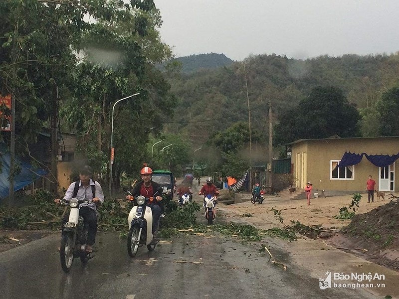 |
| Nghe An has heavy and very heavy rain, with the possibility of tornadoes and lightning. Illustrative photo |
Hanoi area:From this afternoon (July 3), there will be moderate rain, heavy rain and thunderstorms in some places. Thunderstorms may include tornadoes, lightning and strong gusts of wind.
From tonight to July 5, due to the influence of the storm moving towards the mainland, in the provinces of Hoa Binh, Son La, the Northern Delta and North Central, there will be heavy to very heavy rain (common rainfall 100-250mm/period, some places over 300mm/period); from the night of July 3-4, the mountainous areas of the North will have moderate rain, heavy rain, some places very heavy rain (common rainfall 50-150mm/period, some places over 200mm/period).
Flood forecast:On the rivers and streams in the Northern region, from Thanh Hoa to Ha Tinh, there will be a flood with a flood amplitude of 2-5m. The peak flood level on Thao River is likely to reach BĐ1, while the main rivers from Thanh Hoa to Ha Tinh are still below BĐ1.
Flash flood and landslide warning:After a long period of hot weather, the soil has dried up, the soil properties have been broken and forest fires have occurred in the Central region, the surface cover has been reduced, heavy rains over a large area have caused a high risk of flash floods, floods due to blocked waterways, and mud floods. Landslides are at risk in mountainous areas, flooding in low-lying areas in the mountainous provinces of the North, from Thanh Hoa to Quang Binh. Especially in the provinces of Lai Chau, Son La, Hoa Binh, Lao Cai, Yen Bai, Ha Giang, Tuyen Quang, Quang Ninh (mine and waste dump areas) and the provinces from Thanh Hoa to Quang Binh.
Disaster risk level: level 2-3.
Detailed forecast for regions:
Northwest:
Cloudy day, scattered showers and thunderstorms; cloudy afternoon and night, scattered rain, moderate to heavy rain and scattered thunderstorms. Light wind. Thunderstorms may cause tornadoes, lightning, hail and strong gusts of wind. Humidity 66 - 97%.
Lowest temperature from:23 - 26oC
Highest temperature from:31 - 34 degrees, some places above 34oC
Northeast:
Cloudy, rain in the afternoon and at night, some places have moderate rain, heavy rain and thunderstorms; in the plains and coastal areas there will be moderate rain, heavy rain, some places have very heavy rain and scattered thunderstorms. North to northwest wind level 2-3, from tonight in coastal areas the wind will gradually increase to level 5, sometimes level 6, gusting to level 7-8. During thunderstorms there is a possibility of tornadoes, lightning, hail and strong gusts of wind. Humidity from 60 - 99%.
Lowest temperature from:24 - 27oC
Highest temperature from:31 - 34oC
Thanh Hoa to Thua Thien Hue:
Cloudy, moderate to heavy rain, some places with very heavy rain and scattered thunderstorms; especially in the North there will be heavy to very heavy rain. West to southwest wind level 3. During thunderstorms there is a possibility of tornadoes, lightning, hail and strong gusts of wind. Humidity from 68 - 99%.
Lowest temperature from:24 - 27oC
Highest temperature from:27 to 30 degrees, South 29 - 32oC
Da Nang to Binh Thuan:
Cloudy with scattered showers and thunderstorms. Southwesterly winds force 2-3. Thunderstorms may produce tornadoes, lightning, and strong gusts. Humidity 55 - 95%.
Lowest temperature from:26 - 29oC
Highest temperature from:30 - 33oC
Central Highlands:
Cloudy, rain during the day, moderate rain, heavy rain in some places and scattered thunderstorms; scattered showers and thunderstorms at night. Southwest wind level 2-3. During thunderstorms, there is a possibility of tornadoes, lightning and strong gusts of wind. Humidity from 68 - 98%.
Lowest temperature from:20 - 23oC
Highest temperature from:25 - 28oC
Southern region:
Cloudy, rain during the day, moderate rain, heavy rain in some places and scattered thunderstorms; scattered showers and thunderstorms at night. Southwest wind level 2-3. During thunderstorms, there is a possibility of tornadoes, lightning and strong gusts of wind. Humidity from 68 - 98%.
Lowest temperature from:24 - 27oC
Highest temperature from:29 to 32 degrees, some places above 32oC
Hanoi:
Cloudy, moderate rain, heavy rain, very heavy rain and thunderstorms in the afternoon and at night. North to northwest wind level 2-3. During thunderstorms there is a possibility of tornadoes, lightning, hail and strong gusts of wind. Humidity from 60 - 95%.
Lowest temperature from:25 - 28oC
Highest temperature from:31 - 34oC