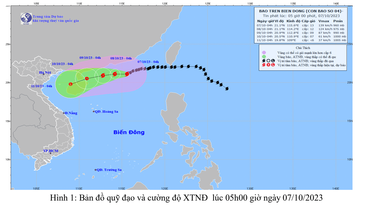
Storm news in the East Sea - storm number 4
(Baonghean.vn) - The strongest wind near the storm center is level 13 (134-149km/h), gusting to level 16, moving slowly to the West at a speed of about 5km/h.
At 4:00 a.m. on October 7, the center of the storm was at about 21.1 degrees North latitude; 115.6 degrees East longitude, about 190 km southeast of Hong Kong (China). The strongest wind near the center of the storm was level 13 (134-149 km/h), gusting to level 16, moving slowly westward at a speed of about 5 km/h.
Storm forecast (in the next 24 to 72 hours):
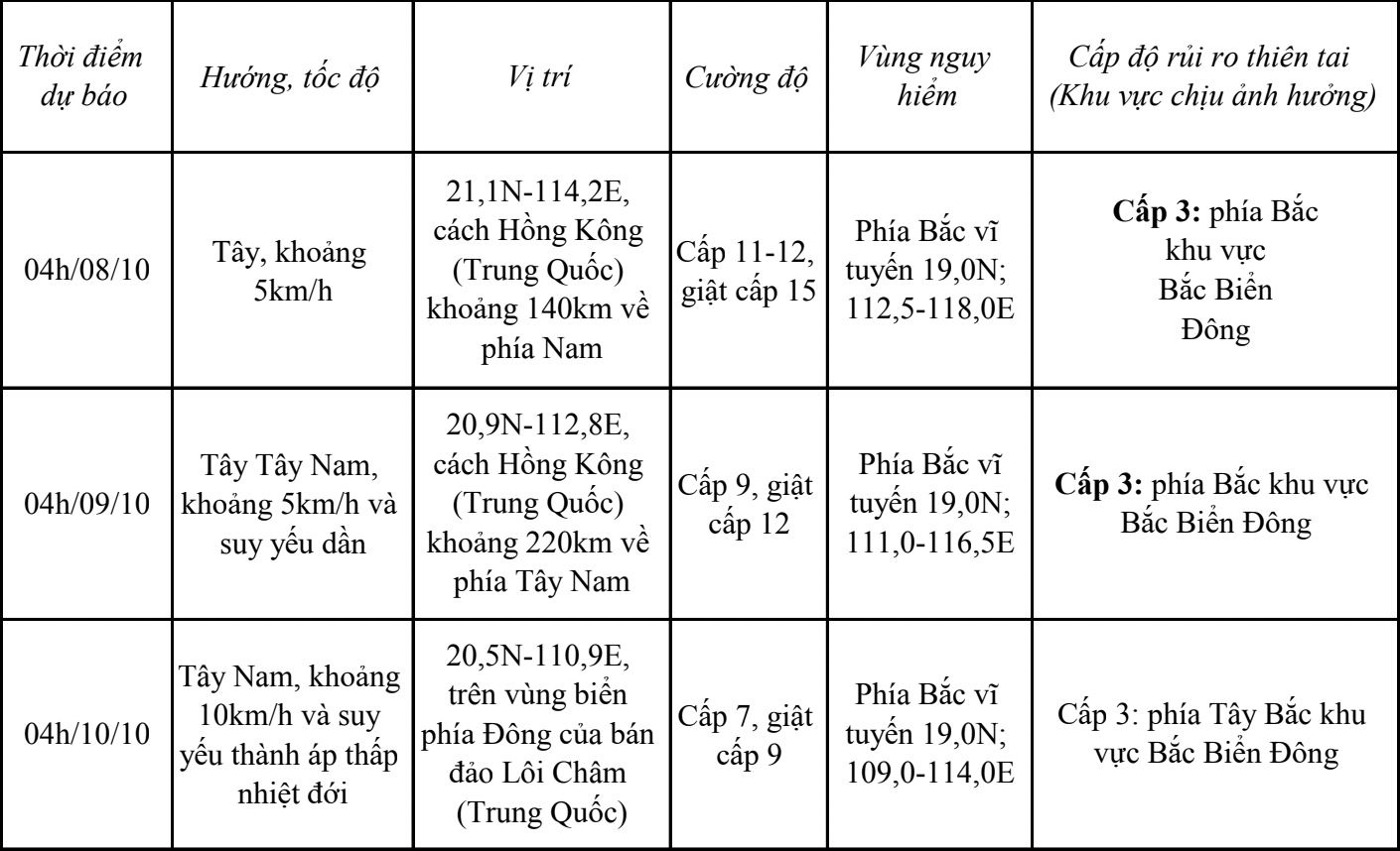
From the next 72 to 96 hours, the tropical depression will move mainly in the West Southwest direction, about 10km per hour and gradually weaken.
In the next 24 to 48 hours, the northern sea area of the North East Sea will have strong winds of level 7-10, the area near the storm center will have strong winds of level 11-13, gusting to level 16; the sea will be very rough. All ships operating in this area will be affected by strong storm winds.
In the North East Sea, waves are 2.0-4.0m high, in the North Sea, waves are 4.0-6.0m high, and near the storm center, waves are 7.0-9.0m high.
FORECASTWEATHER ON LAND IN NGHE AN PROVINCE
(Day and night October 7)
* Coastal plain area
Partly cloudy to cloudy with scattered showers and thunderstorms. East to southeast wind force 3.
- Temperature: 24 – 31 degrees Celsius
- Humidity: 80 – 85%
* Midland and mountainous areas
Partly cloudy to cloudy with scattered showers and thunderstorms, locally moderate to heavy. Light winds.
- Temperature: 22 – 30 degrees Celsius
- Humidity: 75 – 85%
* Vinh city area
Cloudy to cloudy with occasional rain, showers and thunderstorms. East to southeast wind force 2 – 3.
- Temperature: 25 – 33 o C.
- Humidity: 80 – 85%
* Cua Lo and Ngu Island area
Cloudy to cloudy with occasional rain, showers and thunderstorms. East to southeast wind force 2 – 3.
- Temperature: 25 – 33 o C.
- Humidity: 80 – 85%
* Next 48 hours: Continental high pressure continues to strengthen to the south, combined with wind convergence above 1500m in the Northern region, so clouds change to cloudy, with scattered rain, showers and thunderstorms, locally with moderate to heavy rain.
* During thunderstorms there is a possibility of tornadoes, lightning, hail and strong gusts of wind.

