News of exceptionally large floods on the Cau and Thuong rivers.
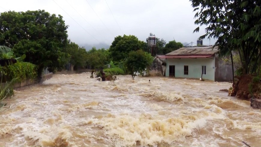
Prolonged heavy rains have caused flooding on the Cau and Thuong river systems, with water levels in many areas exceeding the historical flood levels of 1986, posing a risk of severe flooding in Bac Ninh, Thai Nguyen, and Lang Son provinces.
Flood developments over the past 12 hours: Water levels have exceeded alert level 3.
Over the past 12 hours, the flood situation on rivers in northern Vietnam has become complicated. On the Cau River (Thai Nguyen), the water level at the Gia Bay station has started to decrease slightly, but in the Bac Ninh area, the floodwaters are still rising rapidly.
On the Thuong River (Bac Ninh province), the water level at the Phu Lang Thuong station reached 7.60m at 3:00 AM on October 9th, 1.30m higher than alarm level 3 and exceeding the historical flood peak of 1986. Currently, the water level is changing slowly but remains very high.
On the Trung River (Lang Son province), the water level at the Huu Lung station reached 23.54m, 1m higher than the historical level of 1986. Local authorities along the river are urgently reinforcing embankments and relocating residents from low-lying areas at risk of severe flooding.
24-hour forecast: Floods remain high, reaching new peaks in some areas.
According to forecasts, in the next 12 hours, the flood on the Cau River is likely to peak, with the water level at the Dap Cau station approximately 1.3m above alarm level 3. On the Thuong and Trung rivers, the water level will gradually decrease but will remain above alarm level 3.
Over the next 12 to 24 hours, water levels on the rivers will continue to recede slowly. It is expected that the Gia Bay station (Thai Nguyen) will fall below alert level 1, while the Dap Cau station (Bac Ninh) will remain above alert level 3. On the Thuong and Trung rivers, water levels will continue to remain high, posing significant risks to downstream areas.
In addition, water levels on the Luc Nam River (Bac Ninh) and the Thai Binh River (Hai Phong) are forecast to fluctuate around alarm level 1 to alarm level 2, continuing to put pressure on the dike system in the northern delta and coastal areas.
The risk of flooding and landslides is high in many areas of northern Vietnam.
The meteorological agency warns that widespread flooding may occur in Thai Nguyen, Bac Ninh, and Lang Son provinces over the next 2-3 days, especially in low-lying areas along rivers and urban areas.
In addition to severe flooding, mountainous areas in Northern Vietnam are at risk of landslides, riverbank erosion, and localized dike breaches, threatening the safety of homes and infrastructure. Local authorities need to implement emergency response measures, organize the evacuation of residents from dangerous areas, and inspect the safety of reservoirs and dikes.
Level 3 natural disaster risk: High risk of serious damage.
Severe flooding on the Cau and Thuong rivers is seriously affecting waterway transportation, agricultural production, aquaculture, and people's lives.
Experts warn people not to travel through flooded areas, to proactively cut off electricity in low-lying areas, and to protect property and livestock. Provincial authorities are advised to maintain a 24/7 standby force to promptly handle any incidents.

