Why is the main thoroughfare of Vinh city so frequently flooded?
(Baonghean.vn) - Lenin Boulevard, a continuation of the Soviet Nghe Tinh road, is a major and important route in Vinh City, but it is severely flooded whenever there is heavy rain. There are many explanations for the flooding on this road.
Lenin Boulevard, a continuation of the Soviet Nghe Tinh Boulevard, is a vital arterial road in Vinh City, home to many government offices and experiencing heavy traffic. It also serves as a gateway to the city from the north, particularly connecting Vinh International Airport to the city center. While a two-way road with a wide and open landscape, in recent years, it has frequently experienced severe and prolonged flooding during heavy rains.
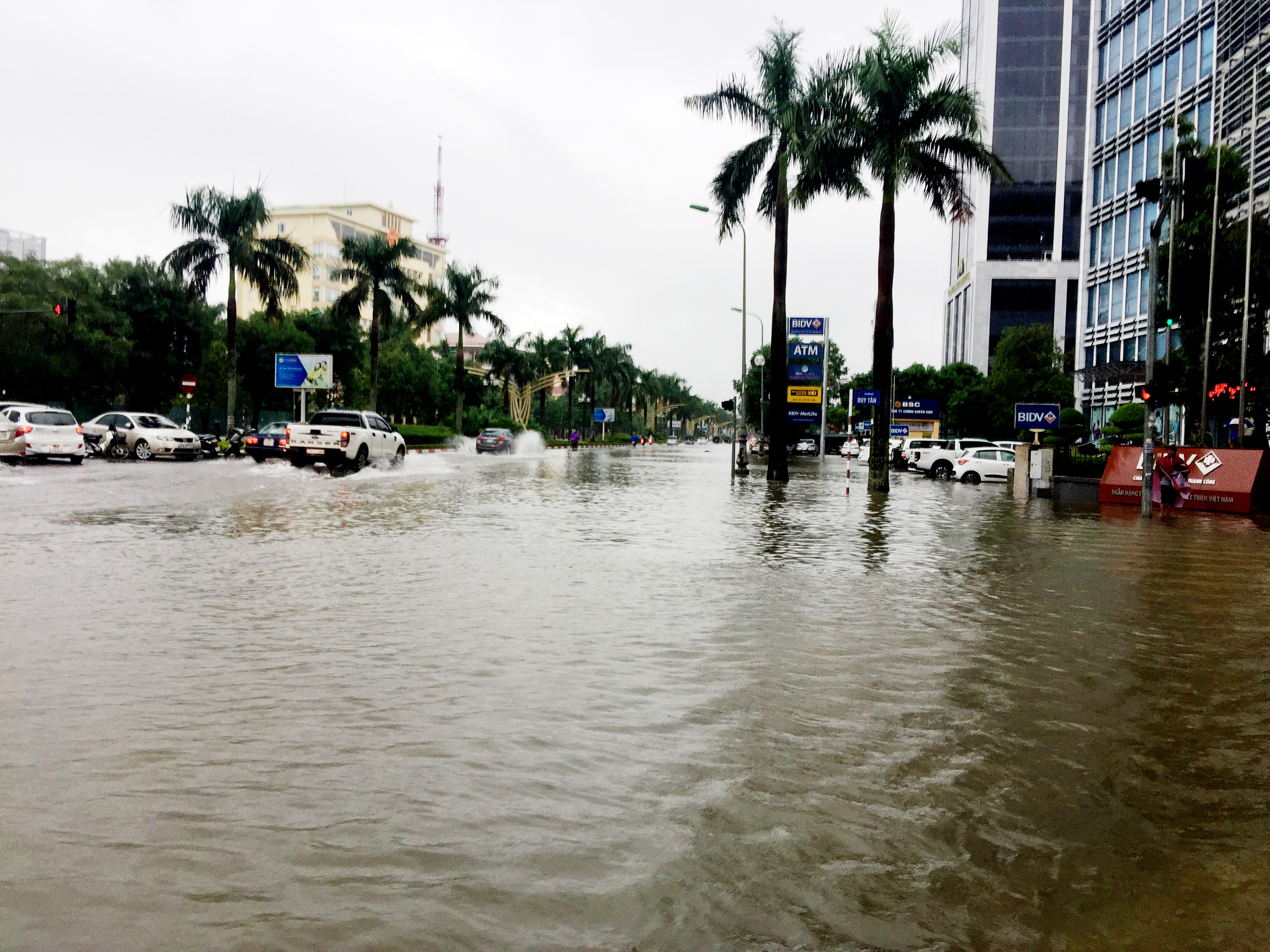 |
| Lenin Street, at the intersection with Duy Tan Street, was flooded with water 0.5-0.7 meters deep. Photo: Nguyen Hai |
Many people are wondering: Why is this road still heavily flooded during heavy rains when the canal crossing it at that time has normal water levels and a steady flow?
According to Mr. Hoang Hong Khanh, representative of Vinh Urban Management Joint Stock Company, the reason why rainwater from Lenin Street connecting to Xo Viet Nghe Tinh Street (and other streets in general) is limited in draining into the North Canal is due to the lack of connection points to the canal (only 15 connection points/4 km including both sides). When the North Canal is renovated, the connections will remain as they are. When heavy rain occurs, the water collection points and drainage ditches become overloaded. The drainage system on both sides of Lenin Street connecting to Xo Viet Nghe Tinh Street is small (1-1.5m) compared to the length from the airport and the width of the road, and therefore does not have enough cross-sectional area to drain all the water during heavy rain in this 'basin'.
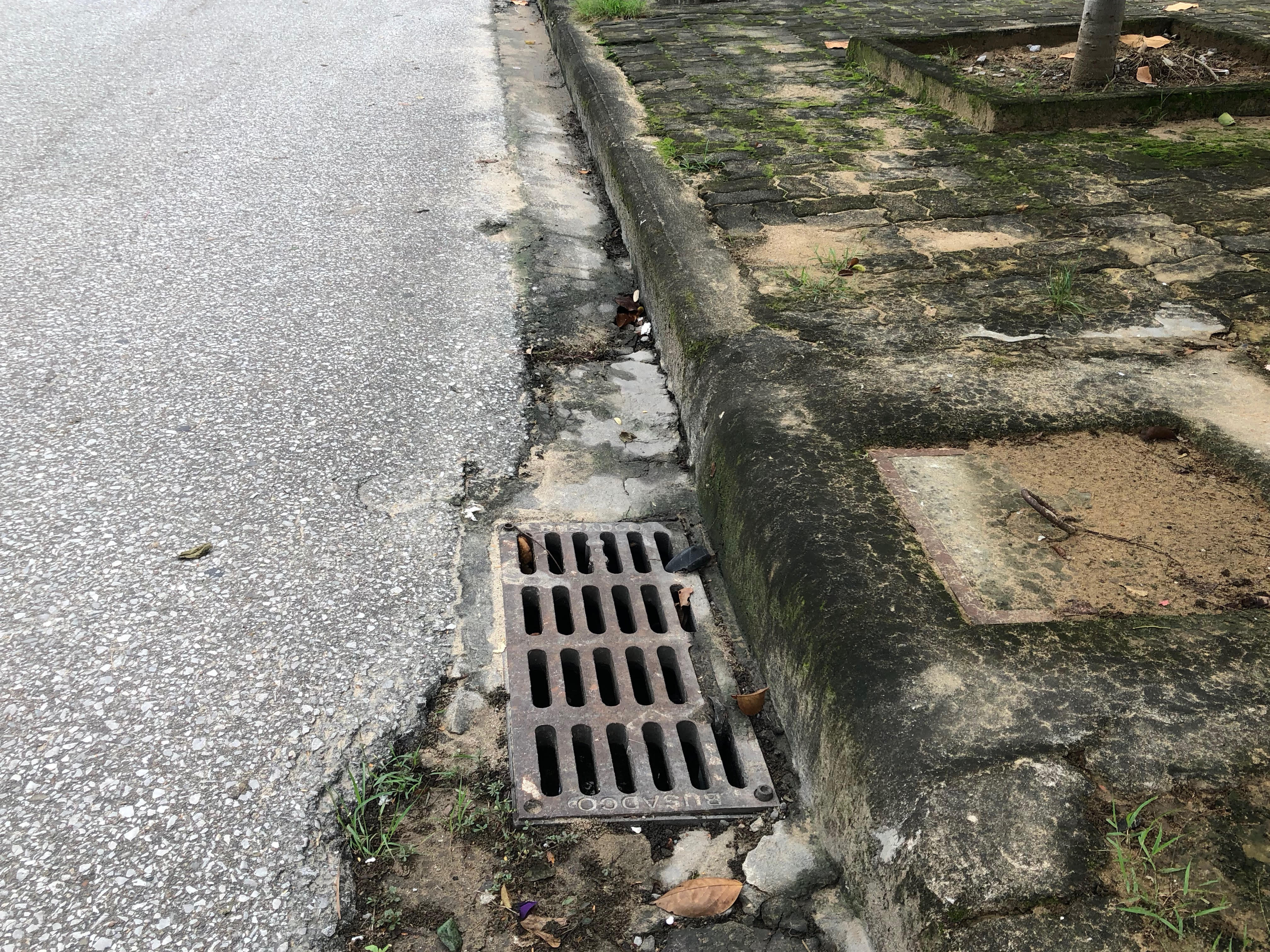 |
| The small drainage holes are insufficient to drain water effectively from Lenin Street during heavy rains. Photo: QA |
According to the Vinh City master plan, there is an 80m wide canal running from the Ke Gai River to Nghi Duc and then into the Rao Dung River, parallel to the 95m road, intended to divert and drain water for the entire Lenin Road connecting to the Soviet Nghe Tinh Road, but for many years there has been no investment for its construction.
Regarding waste in the sewers, Mr. Hoang Hong Khanh stated that there was no blockage. The company had opened all the gates of the trash screens before the rainy season.
To reduce flooding on Lenin Street, which connects to Soviet Nghe Tinh Street, according to Mr. Hoang Hong Khanh, it is necessary to survey and open more connection points to the North Canal and proceed with the construction of the aforementioned 80m canal according to the plan.
Upon investigation, it was found that this 80m canal runs as follows: Starting from the Ke Gai River in Hung Dong commune, it flows from west to east, passing through the wards and communes of Hung Dong, Quan Bau, Ha Huy Tap, Nghi Phu, Hung Loc, and Hung Hoa in Vinh city, then into the Rao Dung River and finally into the Lam River – its end point being in Hung Hoa commune.
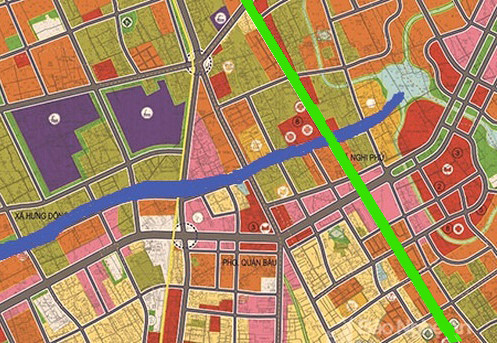 |
| The planned 80m canal (blue line) is expected to drain water from the entire Lenin Street connecting to the Soviet-Nghe Tinh Street (green line) once completed. Photo: Quang An. |

