With a speed of 20km/h, Typhoon No. 12 will make landfall in the South Central provinces.
(Baonghean.vn) - This is an urgent storm warning regarding Typhoon No. 12, as predicted by the Central Meteorological and Hydrological Forecasting Center. The typhoon is continuing to strengthen.
Over the past 6 hours, Typhoon No. 12 has moved in a west-southwest direction at a speed of approximately 20 km per hour and continues to strengthen.
HOhi 04 giNovember 3rdThe storm's center is located at approximately 12.8 degrees North latitude and 114.1 degrees East longitude, about 500km east of the coast of Khanh Hoa and Ninh Thuan provinces. The strongest winds near the storm's center are at level 10 (90-100km/hour).level 13 storm.
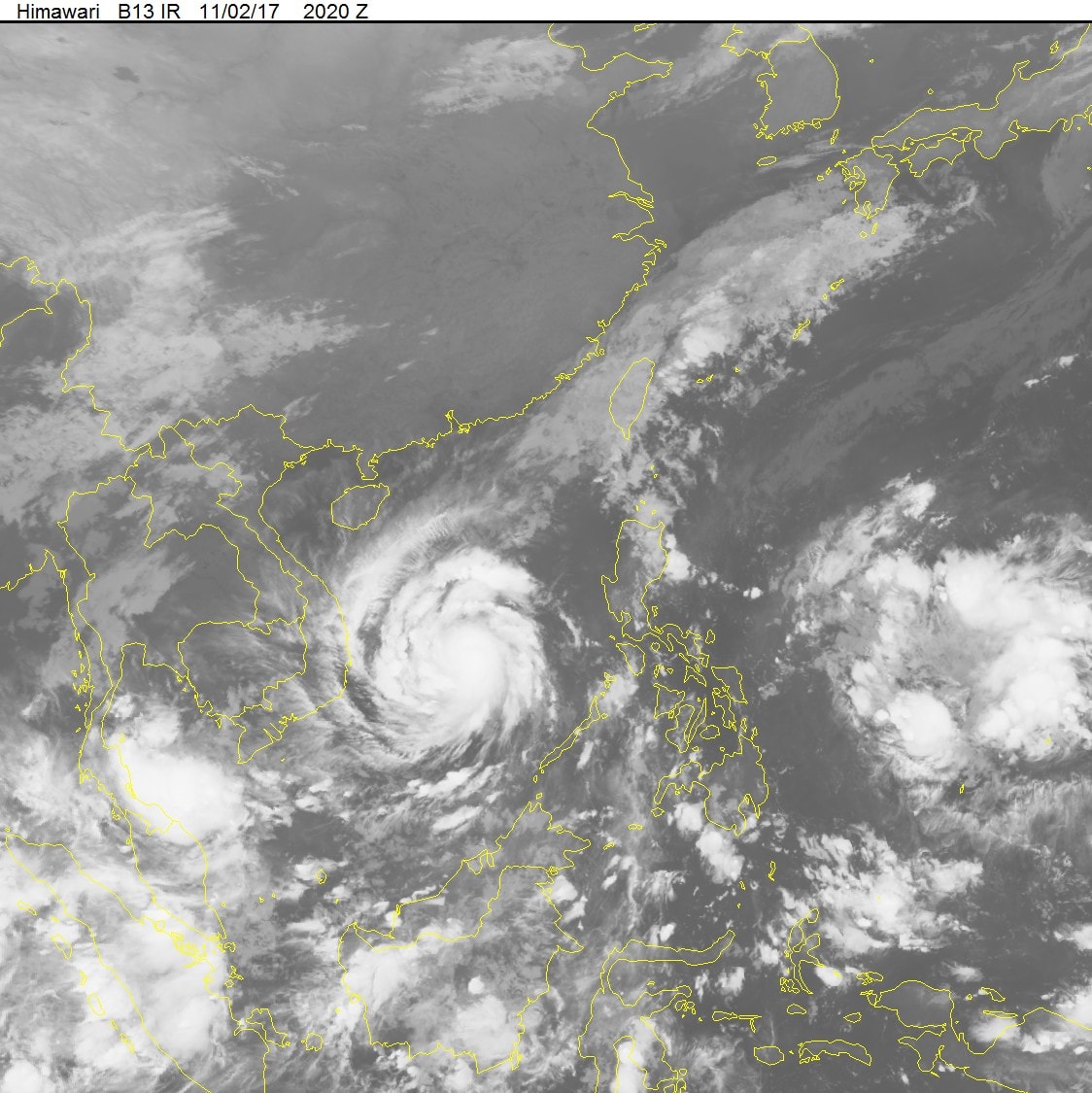 |
| Satellite cloud imagery from the National Center for Hydro-Meteorological Forecasting. |
Dself24-hour newsuhtOhiThe storm is moving in a west-southwest direction at approximately 20 km/h and intensifying. By 04:00 on November 4th, the storm's center was located at approximately 12.2 degrees North latitude and 109.8 degrees East longitude, over the sea off the coast of Khanh Hoa and Ninh Thuan provinces. The strongest winds near the storm's center reached levels 11-12 (100-135 km/h).Level 15 storm.
Due to the influence of the storm, the central area of the East Sea (including the sea area north of the Truong Sa archipelago) is experiencing stormy weather, strong winds of force 7-9, and winds of force 11-12 near the storm's center.level 15The sea was extremely rough.
DselfReport within the next 24 to 36 hours.The storm is moving westward at a speed of 20 km/h, making landfall in the South Central provinces with maximum wind speeds of level 10-11.level 14and gradually weakened into a tropical depression. By 4 PM on November 4th, the center of the tropical depression was located at approximately 12.1 degrees North latitude; 107.1 degrees East longitude, in the border area between Vietnam and Cambodia. The strongest winds near the center of the tropical depression were at level 6-7 (40-60 km/h).level 9 gust.
DselfReport within the next 36 to 48 hours.The tropical depression is moving mainly westward at a speed of about 15 km per hour, moving further inland and gradually dissipating.
Strong winds and high waves at sea:
From this afternoon (November 3rd), the sea area from Quang Ngai to Binh Thuan (including Ly Son and Phu Quy islands) will experience gradually increasing winds of force 6-7, reaching force 8-9 by night, and increasing to force 9-10 near dawn and tomorrow (November 4th), with winds reaching force 11-12 in areas near the storm's path.level 15The sea is extremely rough. Due to the influence of the storm's circulation combined with a strong surge of cold air in the Gulf of Tonkin, the sea areas off the provinces from Quang Tri to Quang Nam are experiencing strong winds of force 6-7.level 9 gustIn the northern South China Sea, there are strong winds of force 7-8.level 10 surgeThe sea is very rough.
Storm surge along the coast of provinces from Phu Yen to Ninh Thuan will be 0.5-1.0m, with waves offshore in the storm's center reaching 5-7m, and 2-4m near the shore.
Strong winds inland:
From early morning on November 4th, strong winds of force 9-11, gusting to force 14, will gradually increase in the coastal areas of Binh Dinh, Phu Yen, Khanh Hoa, and Ninh Thuan provinces. Further inland, winds will be strong at force 7-8, gusting to force 11..Coastal areas of Da Nang, Quang Nam, Quang Ngai, and Binh Thuan provinces will experience strong winds of force 6-7, gusting to force 9.Natural disaster risk level: level 3.
Heavy rain forecast:
From this afternoon and tonight (November 3rd), due to the combined influence of a strong cold front and Typhoon No. 12, very heavy rain is expected in provinces from Quang Tri to Binh Thuan. The heavy rain situation is complex and prolonged, spreading to the North Central region, the Central Highlands, and the Southeastern region.
Chernewspaperũ, lũscan and ssir/ma'amtllivestonet:
From November 4th to 8th, a flood is expected on rivers from Ha Tinh to Binh Thuan, the Central Highlands, and the Dong Nai River. There is a high risk of major flooding in the area from Thua Thien Hue to Khanh Hoa, the northern Central Highlands, and flash floods and landslides in mountainous and riverside areas, as well as widespread and deep flooding in low-lying areas in the aforementioned regions.Level of natural disaster risk: level 3.
Weather forecast for November 3rd from Thanh Hoa to Binh Thuan:
Thanh Hoa to Thua Thien - HueCloudy, with scattered rain; particularly in the South, from the afternoon of November 3rd, there will be rain, with some areas experiencing moderate to heavy rain and scattered thunderstorms. North to Northwest winds at level 2-3. Cold in the early morning and at night. Tornadoes and strong gusts of wind are possible during thunderstorms. Lowest temperature 19-22°C, highest temperature 26-29°C.
Da Nang to Binh ThuanScattered showers and thunderstorms are expected; from the afternoon of November 3rd, there will be rain, moderate rain, with some areas experiencing heavy to very heavy rain and scattered thunderstorms. Northeast to North winds will be at level 2-3. Tornadoes and strong gusts of wind are possible during thunderstorms. The lowest temperature will be 23-26°C, and the highest 27-30°C.
Hoa Le
(Synthetic)
| RELATED NEWS |
|---|

