Selling satellite images produced by Vietnam
This is the information given by Associate Professor Dr. Pham Anh Tuan, Director of the National Satellite Center, at the workshop "Overview of satellite technology and applications" held on the morning of September 10 organized by the National Satellite Center.
According to Associate Professor Dr. Pham Anh Tuan, the Center's roadmap for applying satellite technology is to apply digital imaging systems to forest management by 2013, exploit general images of the marine environment by 2014, research on climate change by 2015, and by 2017 it will be applied to the environment and warning of natural disasters and catastrophes.
The highlight of the Center is to form a roadmap to develop “Made in Vietnam” satellites. Accordingly, the Center has focused on developing both human resources and infrastructure. Currently, there are more than 100 staff trained abroad, who will return to work in Vietnam. Regarding infrastructure development, the Center will build its network across the country, including the Vietnam Space Center in Hoa Lac (Hanoi), the Center for Human Resources Development and Space Technology Transfer (No. 18, Hoang Quoc Viet, Hanoi), Nha Trang Observatory, and the Ho Chi Minh City Space Technology Application Center.
According to the roadmap for developing "made in Vietnam" satellites, after successfully launching the PicoDragon microsatellite (1 kg), Vietnam will continue to launch the NanoDragon satellite (10 kg) in 2016. Two years later, MicroDragon (50 kg) will enter space, followed by LOTUSat-2 (500 kg) in 2020.
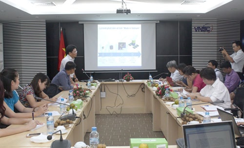 |
| Overview of the workshop |
"LOTUSat-2 is the first satellite produced in Vietnam and will be officially commercialized, meaning that the satellite's images can be sold to countries around the world," said Associate Professor Dr. Pham Anh Tuan. If what is being implemented is correct, Vietnam will be among the leading countries in the region in this field, equivalent to Indonesia and Malaysia. Currently, countries such as Thailand, Laos... have not yet launched any satellites into space. The Philippines only needs to buy foreign images and does not need to manufacture satellites; Singapore mainly follows the commercial direction, not the application. Remote sensing satellites in Vietnam are mainly applied in the fields of resource management, environment, climate change, and disaster prevention and mitigation. The system will ensure earth observation in case of emergency disasters in all weather and climate conditions; build and process satellite data to serve the monitoring and early warning of natural disasters and environmental disasters.
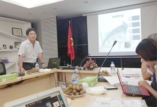 |
| Associate Professor, Dr. Pham Anh Tuan, Director of the National Satellite Center, presented at the workshop. |
According to experts, if you want to take photos of a certain area, you have to order it and then receive it at least two days later. If Vietnam had satellites, everything would be completed within 6 to 12 hours.
The National Satellite Center was established in 2011. Over the past three years, the Center has conducted many studies to apply satellite technology to areas serving socio-economic development, especially resource management, environmental monitoring, natural disasters, such as applied research on forest management in Son La, Hoa Binh and the Central Highlands forest area, or research on landslides in Hoa Binh.
Source: ictnews


