Vietnam's administrative map of 34 new provinces and cities from June 12, 2025
Latest administrative map of Vietnam in 2025: including 28 provinces and 6 centrally run cities.
Today, Vietnam's administrative map officially changed when the Resolution on the arrangement of provincial-level administrative units in 2025 was passed by the National Assembly.
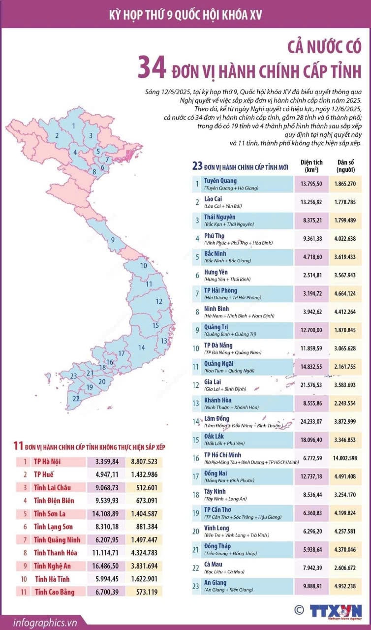
Accordingly, the number of provincial-level units nationwide will be reduced from 63 to 34, with clear adjustments in boundaries, area and population size.
The North has 15 units including 2 centrally-run cities and 13 provinces.
Northeast: Tuyen Quang, Cao Bang, Lang Son, Thai Nguyen, Phu Tho, Quang Ninh
Northwest: Lao Cai, Lai Chau, Dien Bien, Son La,
Red River Delta: Hanoi City, Bac Ninh, Hai Phong, Hung Yen, Ninh Binh
The Central region has 11 units, including 2 centrally-run cities, Da Nang and Hue, and 9 provinces: Thanh Hoa, Nghe An, Ha Tinh, Quang Tri, Quang Ngai, Khanh Hoa, Gia Lai, Dak Lak, Lam Dong.
The South has 8 units, including 2 centrally-run cities, Ho Chi Minh City and Can Tho, and 6 provinces: Dong Nai, Tay Ninh, Dong Thap, An Giang, Vinh Long, and Ca Mau.

, Quốc hội sẽ biểu quyết việc sáp nhập cấp tỉnh")
